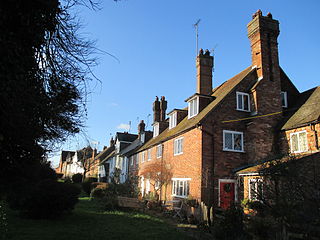
Washington is a village and civil parish in the Horsham District of West Sussex, England. It is located five miles west of Steyning and three miles east of Storrington on the A24 between Horsham and Worthing. The parish covers an area of 1,276 hectares. In the 2001 census 1,930 people lived in 703 households, of whom 820 were economically active. At the 2011 Census the population of the civil parish was 1,867.
Dial Post is a village in the Horsham District of West Sussex, England. The civil parish, where the lowest level political meetings are held, is West Grinstead in the north-east - its biggest settlement is 2 miles (3.2 km) east at Partridge Green. It has a population of around 100 based on the average headcount per inhabited dwelling. In 2001 the population of the civil parish as a whole was 2,934

Pulborough is a town and civil parish in the Horsham district of West Sussex, England, with some 5,000 inhabitants. It is located almost centrally within West Sussex and is 42 miles (68 km) south west of London. It is at the junction of the north–south A29 and the east–west A283 roads.
Felpham is a village and civil parish in the Arun District of West Sussex, England. Although sometimes considered part of the urban area of greater Bognor Regis, it is a village and civil parish in its own right, having an area of 1.645 square miles, (4.26 km),2 with a population of 9,611 people that is still growing. The population at the 2011 Census was 9,746.

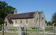
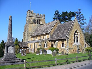
Ashurst is a village and civil parish in the Horsham District of West Sussex, England, about 2 miles (3.2 km) west of Henfield, and 11 miles (18 km) south of Horsham on the B2135 road. The village is about 0.6 miles (0.97 km) west of the River Adur. There is a 12th-century parish church dedicated to St James, where local resident Laurence Olivier's funeral was held, as well as a Church of England primary school and a pub, the Fountain Inn.
Billingshurst is a village and civil parish in the Horsham District of West Sussex, England. The village lies on the A29 road at its crossroads with the A272, 6 miles (10 km) south-west of Horsham and 5.5 miles (9 km) north-east of Pulborough.

Broadbridge Heath is a village and civil parish in the Horsham district of West Sussex, England. It is about two miles (3 km) west from the historic centre of Horsham. The population of Broadbridge Heath has increased considerably in the first two decades of the twenty-first century because of large scale housing development.

Thakeham is a village and civil parish located north of the South Downs in the Horsham District of West Sussex, England. The village is situated approximately 12 miles south-west of Horsham and 11 miles north of the sea-side town of Worthing. Its nearest large village is Storrington. The parish includes the hamlets of Abingworth and Goose Green and has a land area of 1170.6 hectares.

Plaistow is a village and civil parish in the north of the Chichester District of West Sussex, England. There is a village green, a recreation ground, a children's playground, a village pond, a shop, a pub and the Anglican Church.

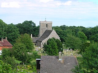
West Grinstead is a village and civil parish in the Horsham District of West Sussex, England. It lies just off the B2135 road four miles (6.3 km) northwest from Henfield. It is within the ancient division of the Rape of Bramber. The western River Adur flows through the village.

Kirdford is a village and civil parish in the Chichester District of West Sussex, England. Its nearest town is Petworth, located 6.5 miles (10.5 km) southwest of the village. The parish has an area of 2,008 acres (813 ha). In the 2001 census 912 people lived in 373 households, of whom 448 were economically active. At the 2011 census the population was 1,063.

Woodmancote is a village and civil parish in the Horsham District of West Sussex, England. The village is 1 mile (1.5 km) southeast of Henfield on the A281 road. It should not be confused with the other West Sussex village of Woodmancote near Chichester.
Rudgwick is a village and civil parish in the Horsham District of West Sussex, England. The village is 6 miles (10 km) west from Horsham on the north side of the A281 road. The parish's northern boundary forms part of the county boundary between Surrey and West Sussex.
Cowfold is a village and civil parish between Billingshurst and Haywards Heath in the Horsham District of West Sussex, England. The village is at the intersection of the A272 and A281 roads. The parish has a land area of 1,926 hectares. In the 2001 census 1,864 people lived in 729 households, of whom 987 were economically active. The population at the 2011 Census had risen to 1,904.
Rusper is a village and civil parish in the Horsham District of West Sussex, England. It lies 4.1 miles (6.6 km) north of the town of Horsham and 4.2 miles (6.8 km) west of Crawley. Rusper is the centre of Rusper Parish which covers most of the northern area between Horsham and Crawley. Rusper is governed by the Horsham District Council based in Horsham. The parish population at the 2001 census was 1,389 people.

Colgate is a small village and civil parish in the Horsham district of West Sussex, England, about four miles (6 km) north east of Horsham.
Itchingfield is a small village and civil parish in the Horsham district of West Sussex, England. It lies on the Barns Green to Broadbridge Heath road 2.7 miles (4.3 km) southwest of Horsham.

Lower Beeding is a village and civil parish in the Horsham District of West Sussex, England. The village lies on the B2110, B2115 and A281 roads 3.5 miles (6 km) southeast from Horsham, and is centred on Holy Trinity Church and The Plough public house, where the B2115 meets the B2110. The parish hamlets are Crabtree to the south of the village, and Ashfold Crossways and Plummer's Plain to the north-east. At Plummer's Plain there is a spring that is the official source of the River Ouse, which eventually reaches the sea at Newhaven.
Shipley is a village and civil parish in the Horsham District of West Sussex, England. It lies just off the A272 road 6 miles north-east of Storrington. The parish includes the village of Coolham and the hamlets of Dragon's Green, Brooks Green and Broomer's Corner.

Slinfold is a village and civil parish in the Horsham District of West Sussex, England.