
Earnley is a village and a civil and ecclesiastical parish in the Chichester District of West Sussex, England. It is located four miles (6.4 km) south-west of Chichester, and lies on the south coast of England. The parish includes the settlements of Almodington and Batchmere.
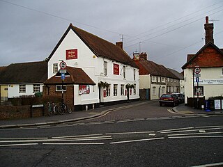
West Tarring or simply Tarring, is a neighbourhood of Worthing, in the borough of Worthing in West Sussex, England. It lies on the A2031 road 1 mile (1.6 km) north-west of the town centre. It is called "West Tarring", or less commonly "Tarring Peverell", to differentiate it from Tarring Neville near Lewes.

Sullington is a village and former civil parish, now in the parish of Storrington and Sullington, in the Horsham district of West Sussex, England. The village lies on the A283 road west of the A24 road, 20 miles (32 km) south of Horsham. In 1961 the parish had a population of 1354. On 1 April 2003 the parish was abolished and merged with Storrington to form "Storrington & Sullington".

Selham is a small village and former civil parish, now in the parish of Graffham, in the Chichester district of West Sussex, England. It lies south of the A272 road 3 miles (4.8 km) east of Midhurst. It is mainly in the parish of Graffham, but partly in that of Lodsworth to the north. In 1931 the parish had a population of 65.
Elsted is a village, Anglican parish and former civil parish, now in the civil parish of Elsted and Treyford, in the Chichester district of West Sussex, England. The village is on the Midhurst to South Harting Road 4.5 miles (7.2 km) west of Midhurst. In 1961 the civil parish had a population of 188. On 1 April 2003 the civil parish was abolished and merged with Treyford to form "Elsted & Treyford".

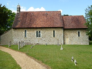
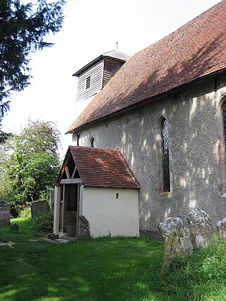
Didling is a small village in West Sussex, England. On 1 April 1933 the parish was abolished and merged with Treyford. The 824 acre village consists of a few buildings and the historic church of St Andrew's, which dates to the 13th century.

Oving is a small village, and civil and ecclesiastical parish in the Chichester District of West Sussex, England. The village lies about 2.5 miles (4.0 km) east of the city of Chichester. The civil parish includes the settlements of Colworth, Drayton, Merston, and Shopwhyke.
East Lavant is one part, which along with Mid Lavant make up the village of Lavant in the Chichester district of West Sussex, England. It lies just east of the A286 road 2.2 miles (3.5 km) north of Chichester. It is in the civil parish of Lavant. East Lavant has a collection of historic cottages and a public house. The manor appears in Domesday as Loventone. In 1851 the parish had a population of 421. On 29 September 1873 the parish was abolished and merged with West Lavant to form "Lavant".
Compton is a village and civil parish in the Chichester district of West Sussex. The village lies on the B2146 road, six miles (9.7 km) southeast of Petersfield, Hampshire and eight miles (13 km) northwest of Chichester. The parish also includes the villages of West Marden and Up Marden.

North Stoke is a village and former civil parish, now in the parish of Amberley, in the Horsham district of West Sussex, England. It is just over 2 miles (3 km) north of Arundel and 0.7 miles (1 km) south of Amberley railway station, and is at the end of a no through road from the station. In 1931 the parish had a population of 70. On 1 April 1933 the parish was abolished and merged with Amberley.

North Marden is a tiny village and former civil parish, now in the parish of Marden, in the Chichester district of West Sussex, England. It is 7.5 miles (12 km) northwest of Chichesteron the spur of the South Downs and on the B2141 road. In 1931 the parish had a population of 12. On 1 April 1933 the parish was abolished to from "Marden".

Egdean is a small village in the civil parish of Petworth, in the Chichester district of West Sussex, England. It lies just off the A283 road 1.7 miles (2.8 km) southeast of Petworth. In 1931 the parish had a population of 82. On 1 April 1933 the parish was abolished and merged with Petworth.

Merston is a small village, an Anglican parish and former civil parish, now in the civil parish of Oving, in the Chichester district of West Sussex, England. It lies just south of the A259 road 2.4 miles (3.9 km) southeast of Chichester.
Up Marden is a small village and former civil parish, now in the parish of Compton, in the Chichester district of West Sussex, England. It is on the South Downs 7 miles (11 km) north-west of Chichester, close to East Marden and North Marden. In 1931 the parish had a population of 266.

Hardham is a small village and former civil parish, now in the parish of Coldwaltham, in the Horsham district of West Sussex, England. It is on the A29 road 1.2 miles (2 km) southwest of Pulborough. In 1931 the parish had a population of 107.
Warminghurst is a village and former civil parish, now in the parish of Thakeham, in the Horsham district of West Sussex, England. It lies on the Ashington to Heath Common road 2.4 miles (3.9 km) northeast of Storrington. In 1931 the parish had a population of 93. On 1 April 1933 the parish was abolished and merged with Ashington.

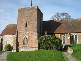
St Catherine of Siena Church is an Anglican parish church in Cocking, a village in the district of Chichester, one of seven local government districts in the English county of West Sussex.

Calthorpe is a small village and former civil parish, now in the parish of Erpingham, in the North Norfolk district, in the county of Norfolk, England. The village is located 0.5 miles (0.80 km) west of the village of Erpingham, 3.4 miles (5.5 km) north of the nearest town of Aylsham and is 15.8 miles (25.4 km) north of the nearest city of Norwich. The nearest railway station is at Gunton for the Bittern Line which runs between Sheringham, Cromer and Norwich and is 7.8 miles (12.6 km) from the village. The nearest airport is Norwich International 14.2 miles (22.9 km) south of the village. In 1931 the parish had a population of 143.

