Sussex is an area within South East England which was historically a kingdom and, later, a county. It includes the ceremonial counties of East Sussex and West Sussex.

West Sussex is a ceremonial county in South East England. It is bordered by Surrey to the north, East Sussex to the east, the English Channel to the south, and Hampshire to the west. The largest settlement is Crawley, and the county town is the city of Chichester.

Haywards Heath is a town in West Sussex, England, 36 miles (58 km) south of London, 14 miles (23 km) north of Brighton, 13 miles (21 km) south of Gatwick Airport and 31 miles (50 km) northeast of the county town, Chichester. Nearby towns include Burgess Hill to the southwest, Horsham to the northwest, Crawley northwest and East Grinstead northeast. With only a relatively small number of jobs available in the immediate vicinity, mostly in the agricultural or service sector, many residents work remotely or commute daily via road or rail to London, Brighton, Crawley or Gatwick Airport.

Chichester is a cathedral city and civil parish in West Sussex, England. It is the only city in West Sussex and is its county town. It was a Roman and Anglo-Saxon settlement and a major market town from those times through Norman and medieval times to the present day. It is the seat of the Church of England Diocese of Chichester and is home to a 12th-century cathedral.

Midhurst is a market town and civil parish in the Chichester District in West Sussex, England. It lies on the River Rother, 20 miles (32 km) inland from the English Channel and 12 miles (19 km) north of Chichester.
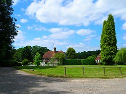
Worth is either a civil parish in the Mid Sussex District of West Sussex, or a distinct but historically related village in Crawley.

The Diocese of Chichester is a Church of England diocese based in Chichester, covering Sussex. It was founded in 681 as the ancient Diocese of Selsey, which was based at Selsey Abbey, until the see was translated to Chichester in 1075. The cathedral is Chichester Cathedral and the diocesan bishop is the Bishop of Chichester. The diocese is in the Province of Canterbury.

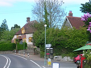
Rogate is a village and civil parish in the Chichester district of West Sussex, England, in the Western Rother valley. The village is on the A272 road 5.6 miles (9.0 km) west of Midhurst and 5 miles (8.0 km) east of Petersfield, Hampshire. The civil parish includes the villages of Rogate and Rake and the hamlets of Haben, Fyning, Hill Brow, Langley, Durford, Wenham, Durleighmarsh and Terwick Common.

Milland is a village and civil parish in the Chichester district of West Sussex, England. It is situated north of the A272 road on the border with Hampshire.
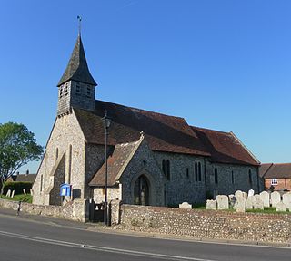
Cocking is a village, parish and civil parish in the Chichester district of West Sussex, England. The village is about three miles (5 km) south of Midhurst on the main A286 road to Chichester.

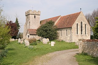
Elsted and Treyford is a civil parish in the Chichester district of West Sussex, west of Midhurst. It contains the settlements of Elsted, Elsted Marsh, Treyford, Didling and Hooksway.

St Richard's Hospital is a medium-sized District General Hospital (DGH) located in Chichester, West Sussex, England. It is now part of University Hospitals Sussex.
Lavant is a civil parish in the Chichester district of West Sussex, England, 2.2 miles (3.5 km) north of Chichester. It includes three villages: Mid Lavant and East Lavant, which are separate Anglican parishes, and the much smaller West Lavant. It takes its name from the River Lavant which flows from East Dean to Chichester.

West Wittering is a village and civil parish situated on the Manhood Peninsula in the Chichester district of West Sussex, England. It lies near the mouth of Chichester Harbour on the B2179 road 6.5 miles (10.5 km) southwest of Chichester close to the border with Hampshire. The sandy beach was described as having excellent water quality in 2017.

West Dean is a village, Anglican parish and civil parish in the District of Chichester in West Sussex, England 5 miles (8 km) north of Chichester on the A286 road just west of Singleton. The parishes include the hamlets of Binderton and Chilgrove.
Donnington is a small village, ecclesiastical parish and civil parish in the Chichester district of West Sussex, England. The village lies on the B2201 road, 2 miles (3.2 km) south of the centre of Chichester, within the Chichester built-up area. The northern part of the parish comprises the Stockbridge area of the City of Chichester.

West Sussex County Council is the upper tier local authority for the non-metropolitan county of West Sussex in England.
Sussex 1 is an English level 9 Rugby Union League. It is made up of teams predominantly from Sussex. Teams play home and away matches from September through to April. The league champions are automatically promoted up to London 3 South East, while the second placed team plays a promotion playoff against the second placed team from Kent 1. Relegated teams drop to Sussex 2 although in recent season there has been no relegation. Only 1st XV sides can be promoted into London 3 South East.