List of United Kingdom locations: Ti

Last updated

The United Kingdom Uk-map.svg
The United Kingdom

This is part of the list of United Kingdom locations: a gazetteer of place names in the United Kingdom showing each place's locality and geographical coordinates.

Ti

LocationLocality Coordinates
(links to map & photo sources)
OS grid
reference
Tibbermore Perth and Kinross 56°23′N3°32′W / 56.39°N 03.54°W / 56.39; -03.54 NO0523
Tibberton Gloucestershire 51°53′N2°21′W / 51.88°N 02.35°W / 51.88; -02.35 SO7621
Tibberton Shropshire 52°46′N2°28′W / 52.77°N 02.47°W / 52.77; -02.47 SJ6820
Tibberton Worcestershire 52°13′N2°08′W / 52.21°N 02.14°W / 52.21; -02.14 SO9057
Tibenham Norfolk 52°27′N1°08′E / 52.45°N 01.13°E / 52.45; 01.13 TM1389
Tibshelf Derbyshire 53°08′N1°21′W / 53.13°N 01.35°W / 53.13; -01.35 SK4360
Tibshelf Wharf Derbyshire 53°08′N1°19′W / 53.14°N 01.32°W / 53.14; -01.32 SK4561
Tibthorpe East Riding of Yorkshire 53°59′N0°32′W / 53.98°N 00.53°W / 53.98; -00.53 SE9655
Ticehurst East Sussex 51°02′N0°24′E / 51.04°N 00.40°E / 51.04; 00.40 TQ6930
Tichborne Hampshire 51°04′N1°11′W / 51.06°N 01.18°W / 51.06; -01.18 SU5730
Tickencote Rutland 52°40′N0°33′W / 52.67°N 00.55°W / 52.67; -00.55 SK9809
Tickenham North Somerset 51°26′N2°48′W / 51.43°N 02.80°W / 51.43; -02.80 ST4471
Tickford End Milton Keynes 52°04′N0°43′W / 52.07°N 00.71°W / 52.07; -00.71 SP8843
Tickhill Doncaster 53°26′N1°07′W / 53.43°N 01.11°W / 53.43; -01.11 SK5993
Tickleback Row Berkshire 51°26′N0°46′W / 51.44°N 00.76°W / 51.44; -00.76 SU8672
Ticklerton Shropshire 52°30′N2°46′W / 52.50°N 02.76°W / 52.50; -02.76 SO4890
Tickmorend Gloucestershire 51°41′N2°14′W / 51.68°N 02.24°W / 51.68; -02.24 ST8398
Ticknall Derbyshire 52°48′N1°29′W / 52.80°N 01.48°W / 52.80; -01.48 SK3523
Tickton East Riding of Yorkshire 53°51′N0°23′W / 53.85°N 00.38°W / 53.85; -00.38 TA0641
Tidbury Green Warwickshire 52°22′N1°52′W / 52.37°N 01.86°W / 52.37; -01.86 SP0975
Tidcombe Wiltshire 51°19′N1°35′W / 51.32°N 01.58°W / 51.32; -01.58 SU2958
Tiddington Oxfordshire 51°44′N1°04′W / 51.73°N 01.06°W / 51.73; -01.06 SP6504
Tiddington Warwickshire 52°11′N1°40′W / 52.19°N 01.67°W / 52.19; -01.67 SP2255
Tidebrook East Sussex 51°02′N0°17′E / 51.03°N 00.29°E / 51.03; 00.29 TQ6129
Tideford Cornwall 50°24′N4°20′W / 50.40°N 04.33°W / 50.40; -04.33 SX3459
Tideford Cross Cornwall 50°25′N4°20′W / 50.42°N 04.33°W / 50.42; -04.33 SX3461
Tidenham Gloucestershire 51°39′N2°39′W / 51.65°N 02.65°W / 51.65; -02.65 ST5595
Tidenham Chase Gloucestershire 51°40′N2°39′W / 51.67°N 02.65°W / 51.67; -02.65 ST5598
Tideswell Derbyshire 53°16′N1°46′W / 53.27°N 01.77°W / 53.27; -01.77 SK1575
Tidmarsh Berkshire 51°28′N1°05′W / 51.46°N 01.09°W / 51.46; -01.09 SU6374
Tidmington Warwickshire 52°02′N1°38′W / 52.04°N 01.63°W / 52.04; -01.63 SP2538
Tidnor Herefordshire 52°02′N2°39′W / 52.04°N 02.65°W / 52.04; -02.65 SO5539
Tidpit Hampshire 50°58′N1°54′W / 50.97°N 01.90°W / 50.97; -01.90 SU0719
Tiers Cross Pembrokeshire 51°44′N5°02′W / 51.74°N 05.04°W / 51.74; -05.04 SM9010
Tiffield Northamptonshire 52°09′N0°59′W / 52.15°N 00.99°W / 52.15; -00.99 SP6951
Tifty Aberdeenshire 57°27′N2°23′W / 57.45°N 02.38°W / 57.45; -02.38 NJ7740
Tigerton Angus 56°46′N2°45′W / 56.76°N 02.75°W / 56.76; -02.75 NO5464
Tigharry Western Isles 57°36′N7°31′W / 57.60°N 07.51°W / 57.60; -07.51 NF7171
Tighnabruaich Argyll and Bute 55°54′N5°14′W / 55.90°N 05.24°W / 55.90; -05.24 NR9773
Tighness Argyll and Bute 56°11′N4°45′W / 56.18°N 04.75°W / 56.18; -04.75 NN2903
Tigley Devon 50°25′N3°46′W / 50.42°N 03.76°W / 50.42; -03.76 SX7560
Tilbrook Cambridgeshire 52°18′N0°26′W / 52.30°N 00.43°W / 52.30; -00.43 TL0769
Tilbury Essex 51°27′N0°21′E / 51.45°N 00.35°E / 51.45; 00.35 TQ6476
Tilbury Green Essex 52°02′N0°32′E / 52.03°N 00.53°E / 52.03; 00.53 TL7440
Tilbury Juxta Clare Essex 52°02′N0°34′E / 52.03°N 00.56°E / 52.03; 00.56 TL7640
Tile Cross Birmingham 52°28′N1°46′W / 52.47°N 01.76°W / 52.47; -01.76 SP1686
Tilegate Green Essex 51°45′N0°10′E / 51.75°N 00.17°E / 51.75; 00.17 TL5008
Tile Hill Coventry 52°23′N1°35′W / 52.39°N 01.58°W / 52.39; -01.58 SP2878
Tilehouse Green Solihull 52°23′N1°45′W / 52.38°N 01.75°W / 52.38; -01.75 SP1776
Tilehurst Berkshire 51°27′N1°03′W / 51.45°N 01.05°W / 51.45; -01.05 SU6673
Tilekiln Green Essex 51°52′N0°12′E / 51.86°N 00.20°E / 51.86; 00.20 TL5221
Tiley Dorset 50°51′N2°28′W / 50.85°N 02.47°W / 50.85; -02.47 ST6706
Tilford Surrey 51°10′N0°45′W / 51.17°N 00.75°W / 51.17; -00.75 SU8743
Tilford Common Surrey 51°10′N0°45′W / 51.17°N 00.75°W / 51.17; -00.75 SU8742
Tilford Reeds Surrey 51°10′N0°46′W / 51.17°N 00.77°W / 51.17; -00.77 SU8643
Tilgate West Sussex 51°06′N0°11′W / 51.10°N 00.18°W / 51.10; -00.18 TQ2735
Tilgate Forest Row West Sussex 51°04′N0°12′W / 51.07°N 00.20°W / 51.07; -00.20 TQ2632
Tilkey Essex 51°52′N0°40′E / 51.87°N 00.67°E / 51.87; 00.67 TL8423
Tilland Cornwall 50°25′N4°22′W / 50.42°N 04.36°W / 50.42; -04.36 SX3261
Tillers' Green Gloucestershire 51°59′N2°27′W / 51.98°N 02.45°W / 51.98; -02.45 SO6932
Tilley Shropshire 52°50′N2°44′W / 52.83°N 02.74°W / 52.83; -02.74 SJ5027
Tilley Green Shropshire 52°50′N2°43′W / 52.83°N 02.72°W / 52.83; -02.72 SJ5127
Tillicoultry Clackmannan 56°09′N3°45′W / 56.15°N 03.75°W / 56.15; -03.75 NS9197
Tillietudlem South Lanarkshire 55°41′N3°55′W / 55.68°N 03.91°W / 55.68; -03.91 NS8045
Tillingham Essex 51°41′N0°52′E / 51.69°N 00.87°E / 51.69; 00.87 TL9903
Tillington Herefordshire 52°06′N2°47′W / 52.10°N 02.78°W / 52.10; -02.78 SO4645
Tillington Staffordshire 52°49′N2°08′W / 52.81°N 02.13°W / 52.81; -02.13 SJ9124
Tillington West Sussex 50°59′N0°38′W / 50.98°N 00.63°W / 50.98; -00.63 SU9621
Tillington Common Herefordshire 52°06′N2°48′W / 52.10°N 02.80°W / 52.10; -02.80 SO4546
Tillislow Devon 50°43′N4°17′W / 50.71°N 04.29°W / 50.71; -04.29 SX3893
Tillworth Devon 50°47′N2°57′W / 50.79°N 02.95°W / 50.79; -02.95 ST3300
Tilly Down Hampshire 51°14′N1°34′W / 51.23°N 01.57°W / 51.23; -01.57 SU3049
Tillydrone City of Aberdeen 57°10′N2°07′W / 57.16°N 02.11°W / 57.16; -02.11 NJ9308
Tillyfourie Aberdeenshire 57°11′N2°35′W / 57.19°N 02.59°W / 57.19; -02.59 NJ6412
Tillyloss Angus 56°40′N3°01′W / 56.67°N 03.01°W / 56.67; -03.01 NO3854
Tilmanstone Kent 51°13′N1°17′E / 51.21°N 01.29°E / 51.21; 01.29 TR3051
Tilney All Saints Norfolk 52°43′N0°18′E / 52.72°N 00.30°E / 52.72; 00.30 TF5617
Tilney cum Islington Norfolk 52°41′N0°19′E / 52.69°N 00.32°E / 52.69; 00.32 TF5713
Tilney Fen End Norfolk 52°40′N0°16′E / 52.67°N 00.27°E / 52.67; 00.27 TF5411
Tilney High End Norfolk 52°43′N0°18′E / 52.72°N 00.30°E / 52.72; 00.30 TF5617
Tilney St Lawrence Norfolk 52°41′N0°16′E / 52.69°N 00.27°E / 52.69; 00.27 TF5413
Tilsdown Gloucestershire 51°41′N2°22′W / 51.68°N 02.37°W / 51.68; -02.37 ST7499
Tilshead Wiltshire 51°13′N1°57′W / 51.22°N 01.95°W / 51.22; -01.95 SU0347
Tilsmore East Sussex 50°58′N0°14′E / 50.96°N 00.23°E / 50.96; 00.23 TQ5721
Tilsop Shropshire 52°20′N2°34′W / 52.34°N 02.57°W / 52.34; -02.57 SO6172
Tilstock Shropshire 52°55′N2°41′W / 52.92°N 02.68°W / 52.92; -02.68 SJ5437
Tilston Cheshire 53°03′N2°49′W / 53.05°N 02.82°W / 53.05; -02.82 SJ4551
Tilstone Bank Cheshire 53°07′N2°39′W / 53.12°N 02.65°W / 53.12; -02.65 SJ5659
Tilstone Fearnall Cheshire 53°08′N2°39′W / 53.13°N 02.65°W / 53.13; -02.65 SJ5660
Tilsworth Bedfordshire 51°54′N0°34′W / 51.90°N 00.57°W / 51.90; -00.57 SP9824
Tilton on the Hill Leicestershire 52°38′N0°54′W / 52.63°N 00.90°W / 52.63; -00.90 SK7405
Tilts Doncaster 53°34′N1°08′W / 53.57°N 01.14°W / 53.57; -01.14 SE5709
Tiltups End Gloucestershire 51°40′N2°14′W / 51.67°N 02.23°W / 51.67; -02.23 ST8497
Tilty Essex 51°55′N0°19′E / 51.91°N 00.31°E / 51.91; 00.31 TL5926
Timberden Bottom Kent 51°20′N0°10′E / 51.33°N 00.16°E / 51.33; 00.16 TQ5162
Timberhonger Worcestershire 52°19′N2°07′W / 52.32°N 02.11°W / 52.32; -02.11 SO9270
Timberland Lincolnshire 53°06′N0°19′W / 53.10°N 00.32°W / 53.10; -00.32 TF1258
Timbersbrook Cheshire 53°09′N2°10′W / 53.15°N 02.16°W / 53.15; -02.16 SJ8962
Timberscombe Somerset 51°10′N3°30′W / 51.16°N 03.50°W / 51.16; -03.50 SS9542
Timble North Yorkshire 53°58′N1°44′W / 53.96°N 01.74°W / 53.96; -01.74 SE1752
Timbold Hill Kent 51°16′N0°43′E / 51.27°N 00.72°E / 51.27; 00.72 TQ9056
Timbrelham Cornwall 50°35′N4°19′W / 50.59°N 04.31°W / 50.59; -04.31 SX3680
Timperley Trafford 53°23′N2°20′W / 53.39°N 02.33°W / 53.39; -02.33 SJ7889
Timsbury Bath and North East Somerset 51°19′N2°29′W / 51.32°N 02.48°W / 51.32; -02.48 ST6658
Timsbury Hampshire 51°01′N1°31′W / 51.01°N 01.51°W / 51.01; -01.51 SU3424
Timsgarry Western Isles 58°11′N7°01′W / 58.19°N 07.02°W / 58.19; -07.02 NB0534
Timworth Suffolk 52°17′N0°43′E / 52.28°N 00.72°E / 52.28; 00.72 TL8669
Timworth Green Suffolk 52°17′N0°43′E / 52.28°N 00.71°E / 52.28; 00.71 TL8569
Tincleton Dorset 50°43′N2°19′W / 50.71°N 02.32°W / 50.71; -02.32 SY7791
Tindale Cumbria 54°55′N2°37′W / 54.92°N 02.61°W / 54.92; -02.61 NY6159
Tindale Crescent Durham 54°38′N1°42′W / 54.63°N 01.70°W / 54.63; -01.70 NZ1927
Tindon End Essex 51°59′N0°20′E / 51.98°N 00.34°E / 51.98; 00.34 TL6134
Tingewick Buckinghamshire 51°59′N1°03′W / 51.98°N 01.05°W / 51.98; -01.05 SP6532
Tingley Leeds 53°44′N1°34′W / 53.73°N 01.57°W / 53.73; -01.57 SE2826
Tingrith Bedfordshire 51°58′N0°32′W / 51.97°N 00.54°W / 51.97; -00.54 TL0032
Tinhay Devon 50°38′N4°16′W / 50.64°N 04.27°W / 50.64; -04.27 SX3985
Tinkers End Buckinghamshire 51°56′N0°53′W / 51.93°N 00.89°W / 51.93; -00.89 SP7627
Tinshill Leeds 53°50′N1°37′W / 53.84°N 01.62°W / 53.84; -01.62 SE2539
Tinsley Sheffield 53°24′N1°25′W / 53.40°N 01.41°W / 53.40; -01.41 SK3990
Tinsley Green West Sussex 51°08′N0°10′W / 51.13°N 00.17°W / 51.13; -00.17 TQ2839
Tintagel Cornwall 50°39′N4°46′W / 50.65°N 04.76°W / 50.65; -04.76 SX0588
Tintagel Head Cornwall 50°40′N4°45′W / 50.66°N 04.75°W / 50.66; -04.75 SX051890
Tintern Monmouthshire 51°41′N2°41′W / 51.69°N 02.69°W / 51.69; -02.69 SO5200
Tintinhull Somerset 50°58′N2°43′W / 50.96°N 02.72°W / 50.96; -02.72 ST4919
Tintwistle Derbyshire 53°28′N1°58′W / 53.47°N 01.97°W / 53.47; -01.97 SK0297
Tinwald Dumfries and Galloway 55°07′N3°34′W / 55.11°N 03.56°W / 55.11; -03.56 NY0081
Tinwell Rutland 52°38′N0°31′W / 52.64°N 00.52°W / 52.64; -00.52 TF0006
Tipner City of Portsmouth 50°49′N1°06′W / 50.82°N 01.10°W / 50.82; -01.10 SU6303
Tippacott Devon 51°12′N3°46′W / 51.20°N 03.77°W / 51.20; -03.77 SS7647
Tipper's Hill Warwickshire 52°29′N1°35′W / 52.48°N 01.58°W / 52.48; -01.58 SP2888
Tipperty Aberdeenshire 57°19′N2°04′W / 57.32°N 02.06°W / 57.32; -02.06 NJ9626
Tipple Cross Devon 50°39′N4°20′W / 50.65°N 04.33°W / 50.65; -04.33 SX3587
Tipps End Norfolk 52°32′N0°13′E / 52.53°N 00.21°E / 52.53; 00.21 TL5095
Tip's Cross Essex 51°40′N0°17′E / 51.67°N 00.28°E / 51.67; 00.28 TL5800
Tipta Skerry Shetland Islands 60°51′N0°53′W / 60.85°N 00.88°W / 60.85; -00.88 HP606194
Tiptoe Hampshire 50°46′N1°38′W / 50.77°N 01.64°W / 50.77; -01.64 SZ2597
Tipton Sandwell 52°31′N2°04′W / 52.52°N 02.07°W / 52.52; -02.07 SO9592
Tipton Green Sandwell 52°31′N2°04′W / 52.52°N 02.07°W / 52.52; -02.07 SO9592
Tipton St John Devon 50°43′N3°17′W / 50.71°N 03.29°W / 50.71; -03.29 SY0991
Tiptree Essex 51°49′N0°44′E / 51.81°N 00.74°E / 51.81; 00.74 TL8916
Tiptree Heath Essex 51°48′N0°43′E / 51.80°N 00.72°E / 51.80; 00.72 TL8815
Tirabad Powys 52°03′N3°38′W / 52.05°N 03.64°W / 52.05; -03.64 SN8741
Tircanol Swansea 51°40′N3°55′W / 51.66°N 03.92°W / 51.66; -03.92 SS6798
Tirdeunaw Swansea 51°39′N3°57′W / 51.65°N 03.95°W / 51.65; -03.95 SS6597
Tiree Argyll and Bute 56°29′N6°55′W / 56.49°N 06.92°W / 56.49; -06.92 NL971440
Tirinie Perth and Kinross 56°47′N3°50′W / 56.78°N 03.83°W / 56.78; -03.83 NN8867
Tirley Gloucestershire 51°57′N2°14′W / 51.95°N 02.24°W / 51.95; -02.24 SO8328
Tirley Knowle Gloucestershire 51°57′N2°16′W / 51.95°N 02.26°W / 51.95; -02.26 SO8229
Tir-Phil Caerphilly 51°43′N3°16′W / 51.71°N 03.26°W / 51.71; -03.26 SO1303
Tirril Cumbria 54°37′N2°46′W / 54.62°N 02.77°W / 54.62; -02.77 NY5026
Tirryside Highland 58°04′N4°26′W / 58.06°N 04.44°W / 58.06; -04.44 NC5611
Tirvister Shetland Islands 60°29′N1°22′W / 60.48°N 01.36°W / 60.48; -01.36 HU3578
Tir-y-berth Caerphilly 51°39′N3°14′W / 51.65°N 03.23°W / 51.65; -03.23 ST1596
Tir-y-dail Carmarthenshire 51°47′N4°00′W / 51.79°N 04.00°W / 51.79; -04.00 SN6213
Tisbury Wiltshire 51°04′N2°05′W / 51.06°N 02.08°W / 51.06; -02.08 ST9429
Tisman's Common West Sussex 51°04′N0°28′W / 51.07°N 00.47°W / 51.07; -00.47 TQ0732
Tissington Derbyshire 53°04′N1°44′W / 53.07°N 01.74°W / 53.07; -01.74 SK1752
Titchberry Devon 51°01′N4°31′W / 51.01°N 04.51°W / 51.01; -04.51 SS2427
Titchfield Hampshire 50°50′N1°14′W / 50.84°N 01.24°W / 50.84; -01.24 SU5305
Titchfield Common Hampshire 50°51′N1°16′W / 50.85°N 01.26°W / 50.85; -01.26 SU5206
Titchfield Park Hampshire 50°52′N1°14′W / 50.86°N 01.24°W / 50.86; -01.24 SU5307
Titchmarsh Northamptonshire 52°23′N0°30′W / 52.39°N 00.50°W / 52.39; -00.50 TL0279
Titchwell Norfolk 52°57′N0°36′E / 52.95°N 00.60°E / 52.95; 00.60 TF7543
Titcomb Berkshire 51°23′N1°28′W / 51.38°N 01.46°W / 51.38; -01.46 SU3765
Tithby Nottinghamshire 52°55′N0°58′W / 52.91°N 00.97°W / 52.91; -00.97 SK6936
Tithebarn Staffordshire 52°58′N1°53′W / 52.96°N 01.89°W / 52.96; -01.89 SK0741
Tithe Barn Hillock St Helens 53°29′N2°40′W / 53.48°N 02.67°W / 53.48; -02.67 SJ5599
Titley Herefordshire 52°14′N2°59′W / 52.23°N 02.98°W / 52.23; -02.98 SO3360
Titlington Northumberland 55°25′N1°51′W / 55.42°N 01.85°W / 55.42; -01.85 NU0915
Titmore Green Hertfordshire 51°55′N0°14′W / 51.91°N 00.24°W / 51.91; -00.24 TL2126
Titsey Surrey 51°16′N0°01′E / 51.26°N 00.01°E / 51.26; 00.01 TQ4054
Titson Cornwall 50°47′N4°29′W / 50.78°N 04.49°W / 50.78; -04.49 SS2401
Tittenhurst Berkshire 51°24′N0°38′W / 51.40°N 00.63°W / 51.40; -00.63 SU9568
Tittensor Staffordshire 52°56′N2°11′W / 52.93°N 02.19°W / 52.93; -02.19 SJ8738
Titterhill Shropshire 52°25′N2°44′W / 52.41°N 02.73°W / 52.41; -02.73 SO5080
Tittle Row Berkshire 51°31′N0°46′W / 51.51°N 00.76°W / 51.51; -00.76 SU8680
Tittleshall Norfolk 52°45′N0°47′E / 52.75°N 00.79°E / 52.75; 00.79 TF8921
Titton Worcestershire 52°19′N2°16′W / 52.31°N 02.26°W / 52.31; -02.26 SO8269
Titty Hill West Sussex 51°01′N0°47′W / 51.01°N 00.78°W / 51.01; -00.78 SU8525
Tiumpan Head Western Isles 58°16′N6°10′W / 58.26°N 06.16°W / 58.26; -06.16 NB558378
Tiverton Cheshire 53°08′N2°40′W / 53.13°N 02.67°W / 53.13; -02.67 SJ5560
Tiverton Devon 50°53′N3°29′W / 50.89°N 03.49°W / 50.89; -03.49 SS9512
Tivetshall St Margaret Norfolk 52°25′N1°10′E / 52.42°N 01.17°E / 52.42; 01.17 TM1686
Tivetshall St Mary Norfolk 52°25′N1°10′E / 52.42°N 01.17°E / 52.42; 01.17 TM1686
Tividale Sandwell 52°30′N2°04′W / 52.50°N 02.06°W / 52.50; -02.06 SO9690
Tivington Somerset 51°11′N3°32′W / 51.19°N 03.53°W / 51.19; -03.53 SS9345
Tivington Knowle Somerset 51°11′N3°32′W / 51.18°N 03.53°W / 51.18; -03.53 SS9344
Tivoli Cumbria 54°34′N3°34′W / 54.56°N 03.56°W / 54.56; -03.56 NX9920
Tivy Dale Barnsley 53°33′N1°35′W / 53.55°N 01.59°W / 53.55; -01.59 SE2707
Tixall Staffordshire 52°47′N2°02′W / 52.79°N 02.04°W / 52.79; -02.04 SJ9722
Tixover Rutland 52°35′N0°34′W / 52.58°N 00.56°W / 52.58; -00.56 SK9700

Related Research Articles

Britain most often refers to:

<span class="mw-page-title-main">Parliament of the United Kingdom</span> Legislative body in the United Kingdom

The Parliament of the United Kingdom of Great Britain and Northern Ireland is the supreme legislative body of the United Kingdom, and may also legislate for the Crown Dependencies and the British Overseas Territories. It meets at the Palace of Westminster in London. Parliament possesses legislative supremacy and thereby holds ultimate power over all other political bodies in the United Kingdom and the Overseas Territories. While Parliament is bicameral, it has three parts: the sovereign (King-in-Parliament), the House of Lords, and the House of Commons. In theory, power is officially vested in the King-in-Parliament. However, the Crown normally acts on the advice of the prime minister, and the powers of the House of Lords are limited to only delaying legislation; thus power is de facto vested in the House of Commons.

<span class="mw-page-title-main">Northern Ireland</span> Part of the United Kingdom

Northern Ireland is a part of the United Kingdom in the north-east of the island of Ireland that is variously described as a country, province or region. Northern Ireland shares an open border to the south and west with the Republic of Ireland. At the 2021 census, its population was 1,903,175, making up around 3% of the UK's population and 27% of the population on the island of Ireland. The Northern Ireland Assembly, established by the Northern Ireland Act 1998, holds responsibility for a range of devolved policy matters, while other areas are reserved for the UK Government. The government of Northern Ireland cooperates with the government of Ireland in several areas under the terms of the Belfast Agreement. The Republic of Ireland also has a consultative role on non-devolved governmental matters through the British–Irish Governmental Conference (BIIG).

<span class="mw-page-title-main">Prime Minister of the United Kingdom</span> Head of government in the United Kingdom

The prime minister of the United Kingdom is the head of government of the United Kingdom. The prime minister advises the sovereign on the exercise of much of the royal prerogative, chairs the Cabinet and selects its ministers. As modern prime ministers hold office by virtue of their ability to command the confidence of the House of Commons, they sit as members of Parliament. The current prime minister is Rishi Sunak of the Conservative Party, who assumed the office on 25 October 2022.

<span class="mw-page-title-main">Primary school</span> School for children

A primary school, elementary school, or grade school is a school for primary education of children who are 4 to 10 years of age. Primary schooling follows preschool and precedes secondary schooling.
<span class="mw-page-title-main">United Kingdom</span> Country in Northwestern Europe

The United Kingdom of Great Britain and Northern Ireland, commonly known as the United Kingdom (UK) or Britain, is a country in Northwestern Europe, off the north-western coast of the continental mainland. It comprises England, Scotland, Wales, and Northern Ireland. It includes the island of Great Britain, the north-eastern part of the island of Ireland, and most of the smaller islands within the British Isles. Northern Ireland shares a land border with the Republic of Ireland; otherwise, the United Kingdom is surrounded by the Atlantic Ocean, the North Sea, the English Channel, the Celtic Sea, and the Irish Sea. The total area of the United Kingdom is 94,354 square miles (244,376 km2), with an estimated population of just over 67 million people in 2021.

The Peerage of Ireland consists of those titles of nobility created by the English monarchs in their capacity as Lord or King of Ireland, or later by monarchs of the United Kingdom of Great Britain and Ireland. It is one of the five divisions of Peerages in the United Kingdom. The creation of such titles came to an end in the 19th century. The ranks of the Irish peerage are duke, marquess, earl, viscount and baron. As of 2016, there were 135 titles in the Peerage of Ireland extant: two dukedoms, ten marquessates, 43 earldoms, 28 viscountcies, and 52 baronies. However, these titles have no official recognition in the Republic of Ireland, with Article 40.2 of the Constitution of Ireland forbidding the state conferring titles of nobility and stating that an Irish citizen may not accept titles of nobility or honour except with the prior approval of the Irish government.
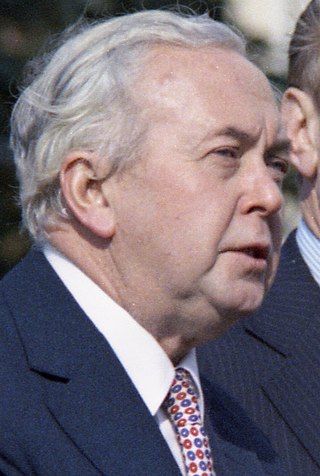
<span class="mw-page-title-main">October 1974 United Kingdom general election</span>

The October 1974 United Kingdom general election took place on Thursday 10 October 1974 to elect 635 members of the British House of Commons. It was the second general election held that year; the first year that two general elections were held in the same year since 1910; and the first time that two general elections were held less than a year apart from each other since the 1923 and 1924 elections, which took place 10 months apart. The election resulted in the Labour Party, led by Prime Minister Harold Wilson, winning a bare majority of three seats. That enabled the remainder of the Labour government to take place, but it saw a gradual loss of its majority.
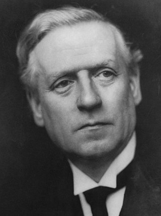
<span class="mw-page-title-main">December 1910 United Kingdom general election</span>

The December 1910 United Kingdom general election was held from 3 to 19 December. It was the last general election to be held over several days and the last to be held before the First World War.

<span class="mw-page-title-main">Lists of places in Wales</span>

These are lists of places in Wales.

<span class="mw-page-title-main">United Kingdom of Portugal, Brazil and the Algarves</span> Pluricontinental monarchy

The United Kingdom of Portugal, Brazil and the Algarves was a pluricontinental monarchy formed by the elevation of the Portuguese colony named State of Brazil to the status of a kingdom and by the simultaneous union of that Kingdom of Brazil with the Kingdom of Portugal and the Kingdom of the Algarves, constituting a single state consisting of three kingdoms.

<span class="mw-page-title-main">UFC 38</span> UFC mixed martial arts event in 2002

UFC 38: Brawl at the Hall was a mixed martial arts event held by the Ultimate Fighting Championship. It took place at the Royal Albert Hall in London, United Kingdom, on July 13, 2002. The event was seen live on pay-per-view in the United States, and was later released on home video.

<span class="mw-page-title-main">Unitary authorities of England</span> Local government in some parts of England

The unitary authorities of England are a type of local authority responsible for all local government services in an area. They combine the functions of a non-metropolitan county council and a non-metropolitan district council, which elsewhere in England provide two tiers of local government.

<span class="mw-page-title-main">Kingdom of Portugal</span> Kingdom in Southwestern Europe (1139–1910)

The Kingdom of Portugal was a monarchy in the western Iberian Peninsula and the predecessor of the modern Portuguese Republic. Existing to various extents between 1139 and 1910, it was also known as the Kingdom of Portugal and the Algarves after 1415, and as the United Kingdom of Portugal, Brazil and the Algarves between 1815 and 1822. The name is also often applied to the Portuguese Empire, the realm's overseas colonies.

<span class="mw-page-title-main">United Kingdom in the Eurovision Song Contest</span>

The United Kingdom has participated in the Eurovision Song Contest 65 times. It first took part in the second contest in 1957 and has entered every year since 1959. Along with Sweden and the Netherlands, the UK is one of only three countries with Eurovision victories in four different decades. It is one of the "Big Five" countries, along with France, Germany, Italy and Spain, that are automatically prequalified for the final each year as they are the biggest financial contributors to the European Broadcasting Union (EBU). The British national broadcaster, the BBC, broadcasts the event and has, on multiple occasions, organised different national selection processes to choose the British entry. The United Kingdom has won the Eurovision Song Contest five times, and has finished as runner-up on a record sixteen occasions. The UK has hosted the contest a record nine times, four times in London and once each in Edinburgh (1972), Brighton (1974), Harrogate (1982), Birmingham (1998), and Liverpool (2023).

<span class="mw-page-title-main">Countries of the United Kingdom</span> Component parts of the UK since 1922

Since 1922, the United Kingdom has been made up of four countries: England, Scotland, Wales and Northern Ireland. The UK Prime Minister's website has used the phrase "countries within a country" to describe the United Kingdom. Some statistical summaries, such as those for the twelve NUTS 1 regions of the UK, refer to Northern Ireland, Scotland, and Wales as "regions". With regard to Northern Ireland, Scotland and Wales particularly, the descriptive name one uses "can be controversial, with the choice often revealing one's political preferences".