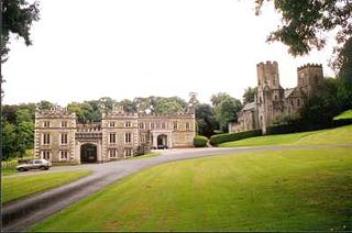
Port Eliot in the parish of St Germans, Cornwall, England, United Kingdom, is the ancestral seat of the Eliot family, whose present head is Albert Eliot, 11th Earl of St Germans.

Red Bay is a fishing village in Labrador, notable as one of the most precious underwater archaeological sites in the Americas. Between 1530 and the early 17th century, it was a major Basque whaling area. Several whaling ships, both large galleons and small chalupas, sunk there, and their discovery led to the designation of Red Bay in 2013 as a UNESCO World Heritage Site.
Bollywood Film Festival is a film festival held annually in Prague, Czech Republic. It was first launched in 2004 and its mission is to present India's Bollywood films to a Czech audience. The song/dance and dramatic storylines which are typical of many Indian films are finding popularity in European culture.

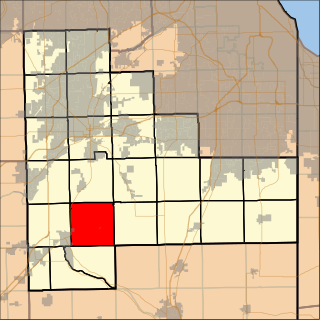
Florence Township is located in Will County, Illinois. As of the 2010 census, its population was 933 and it contained 370 housing units. Florence Township was formed from a portion of Wilmington Township at an unknown date.
Saklıkent is a winter resort in Turkey, 45 kilometres from Antalya and 60 kilometres from Antalya Airport. It is open for skiing from November to May. Because of its proximity to Antalya, one can ski and then one hour later swim in the Mediterranean Sea.

The University of Life Sciences in Poznań is a higher-education institution in Poznań, Poland. It officially gained university status on 11 April 2008. Its previous name was Akademia Rolnicza im. Augusta Cieszkowskiego w Poznaniu, literally "August Cieszkowski Agricultural Academy in Poznań", although it styled itself in English as "The August Cieszkowski Agricultural University of Poznań".

Hatton is a village in Aberdeenshire, Scotland that lies on the A90 road, approximately equidistant from both Ellon and Peterhead.

Willow Point is an unincorporated community in Yolo County, California. It is located on the Sacramento Northern Railroad 1.5 miles (2.4 km) west-northwest of Clarksburg, at an elevation of 0 feet.

Sobienie Kiełczewskie Pierwsze is a village in Otwock County, Gmina Sobienie-Jeziory.The population is near 200. In the village is Voivodship Road 801. It lies approximately 3 kilometres (2 mi) south-east of Sobienie-Jeziory, 23 km (14 mi) south of Otwock, and 41 km (25 mi) south-east of Warsaw.
Chandler Township is a township in Adams County, North Dakota, United States. As of the 2010 census, its population was 13.

Dybówka is a village in the administrative district of Gmina Ozorków, within Zgierz County, Łódź Voivodeship, in central Poland. It lies approximately 5 kilometres (3 mi) north-east of Ozorków, 17 km (11 mi) north of Zgierz, and 26 km (16 mi) north of the regional capital Łódź.

Szczepiatyn is a village in the administrative district of Gmina Ulhówek, within Tomaszów Lubelski County, Lublin Voivodeship, in eastern Poland, close to the border with Ukraine. It lies approximately 4 kilometres (2 mi) south-east of Ulhówek, 29 km (18 mi) east of Tomaszów Lubelski, and 127 km (79 mi) south-east of the regional capital Lublin.

Jakubów is a village in the administrative district of Gmina Imielno, within Jędrzejów County, Świętokrzyskie Voivodeship, in south-central Poland. It lies approximately 3 kilometres (2 mi) north-west of Imielno, 10 km (6 mi) east of Jędrzejów, and 34 km (21 mi) south-west of the regional capital Kielce.

Brzeźno is a village in the administrative district of Gmina Sobków, within Jędrzejów County, Świętokrzyskie Voivodeship, in south-central Poland. It lies approximately 3 kilometres (2 mi) north-west of Sobków, 13 km (8 mi) north-east of Jędrzejów, and 24 km (15 mi) south-west of the regional capital Kielce.

Małomierzyce is a village in the administrative district of Gmina Iłża, within Radom County, Masovian Voivodeship, in east-central Poland. It lies approximately 7 kilometres (4 mi) north-east of Iłża, 26 km (16 mi) south-east of Radom, and 116 km (72 mi) south of Warsaw.

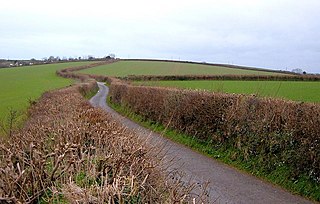
Deviock is a coastal civil parish in south-east Cornwall, England, United Kingdom. It is situated approximately three miles (5 km) west of St Germans and straddles the valley of the River Seaton. The parish includes the settlements of Hessenford, Seaton and Downderry and the population in the 2001 census was 1341, increasing to 1,420 at the 2011 census. The parish occupies an area of 2,108 hectares.

Lisie Kąty is a village in the administrative district of Gmina Paczków, within Nysa County, Opole Voivodeship, in south-western Poland, close to the Czech border.

Meiss is an unincorporated community in El Dorado County, California. It lies at an elevation of 5495 feet.
Drakelow Hillfort, is a small multivallate Iron Age hillfort, located on a promontory at Drakelow at the southern end of Kinver Edge, in the civil parish of Wolverley and Cookley, Worcestershire. The hillfort is a scheduled ancient monument.

Dyken Pond is a 134-acre (54 ha) lake in the towns of Grafton and Berlin in Rensselaer County, New York. The pond gets water primarily from precipitation and outflows westward into the Poesten Kill, a tributary of the Hudson River. It is located in northwest Berlin, south of Grafton Lakes State Park.


