Carnon River

Last updated

Carnon River
Carnon River near Point Mills - geograph.org.uk - 1234714.jpg
Carnon River near Point Mills
Cornwall UK relief location map.jpg
Red pog.svg
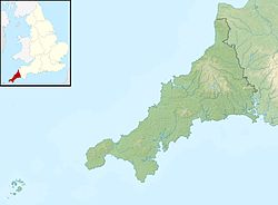
Location within Cornwall
Location
Country England
County Cornwall
Physical characteristics
Source 
  location Chacewater, Cornwall
  coordinates 50°15′45″N5°09′30″W / 50.262394°N 5.158347°W / 50.262394; -5.158347
Mouth Restronguet Creek
  location
Cornwall
  coordinates
50°12′28″N5°04′59″W / 50.2078°N 5.0830°W / 50.2078; -5.0830
Basin features
Tributaries 
  left 50°12′51″N5°05′55″W / 50.214184°N 5.098663°W / 50.214184; -5.098663 , 50°12′51″N5°05′54″W / 50.214208°N 5.098415°W / 50.214208; -5.098415 , 50°12′51″N5°05′54″W / 50.214206°N 5.098334°W / 50.214206; -5.098334 , 50°12′45″N5°05′54″W / 50.212388°N 5.098277°W / 50.212388; -5.098277 , 50°12′20″N5°05′02″W / 50.205645°N 5.083766°W / 50.205645; -5.083766
  right 50°14′14″N5°08′31″W / 50.237319°N 5.141862°W / 50.237319; -5.141862 , 50°13′49″N5°07′35″W / 50.230265°N 5.126254°W / 50.230265; -5.126254 , Trewenda Water 50°12′54″N5°06′04″W / 50.215071°N 5.101136°W / 50.215071; -5.101136 , River Kennall 50°12′25″N5°05′29″W / 50.206988°N 5.091408°W / 50.206988; -5.091408 , Tallack's Creek 50°12′38″N5°04′59″W / 50.210599°N 5.083176°W / 50.210599; -5.083176

The Carnon River (Cornish : Avon Carnon) is a heavily polluted river in Cornwall, England, United Kingdom. [1] It starts in Chacewater. [2] Both Trewedna Water and River Kennall flow into the Carnon before it merges with Tallack's Creek to become Restronguet Creek, which eventually flows into the English Channel at the mouth of Carrick Roads. [3]

Contents

The Nebra sky disc, a gold-decorated bronze disc found in Germany and dated to the Bronze Age, contains both gold and tin from the Carnon valley. [4] [5] There was also an antler pick discovered, along with some other artefacts in 1790. In 2016, the pick was dated to be from the Early Bronze Age. [6]

In 1992, the river was hit by a major pollution incident, when over 45 million litres of contaminated water from the closed Wheal Jane mine was released by the collapse of an adit, colouring the river water red. [7] A treatment works has since been installed at Wheal Jane to intercept the contaminated water and treat it to remove suspended metals and restore a neutral pH. [8]

See also

References

  1. "Case study:Carnon River: Abandoned Metal Mines". Restore. River Restoration Centre. Retrieved 29 January 2018.
  2. "Google Maps". Google Maps. Retrieved 30 January 2018.
  3. "Google Maps". Google Maps. Retrieved 30 January 2018.
  4. Ehser, Anja; Borg, Gregor; Pernicka, Ernst (2011). "Provenance of the gold of the Early Bronze Age Nebra Sky Disk, central Germany: geochemical characterization of natural gold from Cornwall" . European Journal of Mineralogy. 23 (6): 895–910. doi:10.1127/0935-1221/2011/0023-2140 . Retrieved 1 February 2018.
  5. Haustein, M. (2010). "Tin Isotopy—A New Method for Solving Old Questions". Archaeometry. 52 (5): 816–832. doi:10.1111/j.1475-4754.2010.00515.x.
  6. "New Evidence for Bronze AgeTin Mining". www.earlyminesresearchgroup.co.uk. Retrieved 14 January 2024.
  7. Neal, Colin; Whitehead, Paul G.; Jeffery, Hazel; Neal, Margaret (1 February 2005). "The water quality of the River Carnon, west Cornwall, November 1992 to March 1994: the impacts of Wheal Jane discharges". The Science of the Total Environment. 338 (1–2): 23–39. doi:10.1016/j.scitotenv.2004.09.003. ISSN   0048-9697. PMID   15680624.
  8. "Pumping the polluted water from mines - BBC News". BBC Online . Retrieved 1 February 2018.