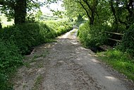
This is a list of farms in Cornwall. Cornwall is a ceremonial county and unitary authority area of England within the United Kingdom.
This is a list of farms in Cornwall. Cornwall is a ceremonial county and unitary authority area of England within the United Kingdom.


The constitutional status of Cornwall has been a matter of debate and dispute. Cornwall is an administrative county of England.
Luxulyan, also spelt Luxullian or Luxulian, is a village and civil parish in mid Cornwall, England, United Kingdom. The village lies four miles (6.5 km) northeast of St Austell and six miles (10 km) south of Bodmin. The population of the parish was 1,371 in the 2001 census. This had risen to 1,381 at the 2011 census.

Goonhilly Downs is a Site of Special Scientific Interest (SSSI) that forms a raised plateau in the central western area of the Lizard peninsula in southern Cornwall, England. It is one of 229 English national nature reserves designated by Natural England with an area of almost 1,270 hectares.

The Helford River is a ria in Cornwall, England, fed by small streams into its many creeks. There are seven creeks on the Helford; from west to east these are Ponsontuel Creek, Mawgan Creek, Polpenwith Creek, Polwheveral Creek, Frenchman's Creek, Port Navas Creek, and Gillan Creek. The best known of these is Frenchman's Creek, made famous by Daphne du Maurier in her novel of the same name. A little further up river is Tremayne Quay, built for a visit by Queen Victoria in the 1840s which she then declined to make, allegedly because it was raining.
Delabole is a large village and civil parish in north Cornwall, England, United Kingdom, which lies approximately two miles (3 km) west of Camelford.

Treverbyn is a civil parish and village in mid-Cornwall, England, United Kingdom, lying north of St Austell.
Feock is a coastal civil parish and village in Cornwall, England, United Kingdom. It is about 5 miles (8.0 km) south of Truro at the head of Carrick Roads on the River Fal. To the south, the parish is bordered by Restronguet Creek and to the east by Carrick Roads and the River Fal. To the north, it is bordered by Kea parish and to the west by Perranarworthal parish.

Lesnewth is a civil parish and village in Cornwall, England, United Kingdom. It is about six miles east of Tintagel Head and two miles east of Boscastle.

Stoke Climsland is a village in the valley of the River Tamar, Cornwall, England, United Kingdom within the civil parish of Stokeclimsland. The population of the parish including Luckett at the 2011 census was 1,703. An electoral ward of the same name also exists. At the same census the population was 3,703.
Belowda is a village in Cornwall, England, UK. The village is just north of the A30 trunk road, about seven miles west-southwest of Bodmin. The village also gives its name to the nearby Belowda Beacon. It is in the civil parish of Roche.

The Isles of Scilly are a small archipelago off the southwestern tip of Cornwall, England, United Kingdom. One of the islands, St Agnes, is over four miles further south than the most southerly point of the British mainland at Lizard Point.

New Downs is a farm near Camborne and St Agnes in Cornwall, England.
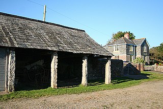
Lower Troswell and Higher Troswell are two farms in the parish of North Petherwin, Cornwall, England, UK.

Wingletang Down is a Site of Special Scientific Interest (SSSI) on the southern side of the island of St Agnes in the Isles of Scilly, England, UK, which is noted for its biological characteristics. All of the land designated as Wingletang Down SSSI is owned by the Duchy of Cornwall. The site is managed by the Isles of Scilly Wildlife Trust and is within the Isles of Scilly Heritage Coast and the Isles of Scilly Area of Outstanding Natural Beauty. It is the only site in Great Britain and Ireland for the small fern, least adder's–tongue. As of 11 September 2009 the SSSI was considered to be in ″unconditional recovering″ condition because European gorse and bramble are at unacceptable levels.
Mulberry Downs Quarry is a disused opencast tin mine in Cornwall, England, UK. Today the site is described as a 'chasm' being a steep or sheer-sided pit 700 foot (210 m) long and up to 100 foot (30 m) deep, and the quarry and immediate surroundings are heavily wooded. The quarry was designated as a Site of Special Scientific Interest (SSSI) in 1973 for its geological interest.
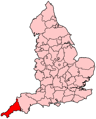
The following outline is provided as an overview of and topical guide to Cornwall: Cornwall – ceremonial county and unitary authority area of England within the United Kingdom. Cornwall is a peninsula bordered to the north and west by the Celtic Sea, to the south by the English Channel, and to the east by the county of Devon, over the River Tamar. Cornwall is also a royal duchy of the United Kingdom. It has an estimated population of half a million and it has its own distinctive history and culture.
Presented below is an alphabetical index of articles related to Cornwall:
This is a list of scheduled monuments in Cornwall, United Kingdom. Monuments are listed by Historic England as part of the National Heritage List for England. For the scope of this list, the Isles of Sicily are included and the ceremonial county boundaries are used.

Arrallas was a manorial settlement recorded in the Domesday book, when in 1086 it had seven households and three ploughlands. It is located in the parish of St Enoder in Cornwall, England. Its name derives from the Cornish language words arghans and lys meaning "silver court", with the lys likely denoting a site of royal importance.
| Unitary authorities | |
|---|---|
| Major settlements (cities in italics) |
|
| Rivers | |
| Topics | |