
Bowithick is a hamlet on the northern edge of Bodmin Moor in Cornwall, England, United Kingdom.

Lanreath is a civil parish and a village in southeast Cornwall, England, United Kingdom. The village is situated five miles (8 km) west-northwest of Looe. The name Lanreath means 'church (Lann) of Raydhogh' and it has been known variously as Lanreythow, Lanrathew, or Lanrethou. The village is mentioned in the Domesday Book as Lanredoch.

Boyton is a civil parish and village in Cornwall, England, United Kingdom. It is situated close to the River Tamar and the border with Devon about six miles (10 km) north of Launceston. According to the 2001 census it had a population of 378.This increased to 457 at the 2011 census.
St Clether is a civil parish and village in Cornwall, England, United Kingdom. The village is situated on the east flank of Bodmin Moor approximately eight miles (13 km) west of Launceston in the valley of the River Inny. The population of the civil parish at the 2011 census was 156.

Pelynt is a civil parish and village in Cornwall, England, United Kingdom. It is 20 miles (32 km) west of Plymouth and four miles (6.5 km) west-northwest of Looe. Pelynt had a population of around 1,124 at the 2001 census which increased to 1,296 at the 2011 census. In addition an electoral ward with the same name exists but extends towards Widegates avoiding Looe at all times. The population at the 2011 for this ward was 4,453.

Polyphant, recorded as Polefant c. 1170, is a village in east Cornwall, England, United Kingdom. It is north of the civil parish of Lewannick, five miles (8 km) west of the town of Launceston near the convergence of the River Inny and Penpont Water.

St Juliot is a civil parish in north-east Cornwall, England, United Kingdom. The parish is entirely rural and the only settlements are the hamlets of Beeny and Tresparrett. The parish population at the 2011 census was 328.

Egloskerry is a village and civil parish in east Cornwall, England, United Kingdom. It is situated approximately five miles (8 km) northwest of Launceston.
Boduel is a hamlet in east Cornwall, England, United Kingdom. It is situated west of Moorswater, one mile (1.6 km) west of Liskeard in the civil parish of Dobwalls.

Lawhitton is a village in the civil parish of Lawhitton Rural, in east Cornwall, England, United Kingdom. The village is situated two miles (3 km) southwest of Launceston and half-a-mile west of Cornwall's border with Devon at the River Tamar.

St Martin-by-Looe is a coastal civil parish in south Cornwall, England, United Kingdom. The parish is immediately east of the town and parish of Looe, seven miles (11 km) south of Liskeard. The parish is in the Liskeard Registration District and the population in the 2001 census was 321, which had increased to 429 at the 2011 census.

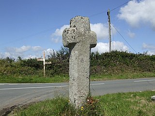
Trewint is a hamlet in the civil parish of Altarnun, east Cornwall, England, UK. Trewint is on the A30 main road west of the village of Altarnun. Trewint Downs, part of Bodmin Moor, are further west.

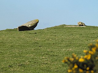
Colliford Lake is a reservoir on Bodmin Moor, Cornwall, England, United Kingdom. Covering more than 900 acres (3.6 km2), it is the largest lake in Cornwall. It is situated south of the A30 trunk road near the village of Bolventor, the approximate centre of the lake being at OS grid reference SX179730. Dozmary Pool outfalls into the lake and the lake's own outfall forms one of the tributaries of the River Fowey.

Gothers is a hamlet near and northeast of St Dennis in mid Cornwall, England.

Idless is a hamlet north of Truro in Cornwall, England. The River Allen rises north of St Allen and flows southwards through the Idless Valley into Truro. It is in the civil parish of Kenwyn
Hendraburnick is a farmstead near Davidstow, Cornwall, England. On Hendraburnick Down is the source of the River Camel.

Holmbush is a village in Cornwall, England that is situated in the suburban area of St Austell. It was a centre for tin and copper mining in the eighteenth and nineteenth centuries, with a few houses to the south of the A390 road. It was developed in the 1970s, with the construction of housing and an industrial estate to the north of the road. Since 1974, the site of Cuddra mine has been developed as Pine Lodge Gardens, an attraction holding over 6,000 varieties of plants, many collected by the owner on plant hunting expeditions.
Lower Croan is a farmstead in Cornwall, England, UK. It is in the parish of Egloshayle and Croan house and Croanford are to the east. Croan House is a manor house of two storeys and seven bays which was built in the 1690s for a prosperous attorney.

Tredaule is a hamlet in Cornwall, England, United Kingdom. It is one mile east of Altarnun.
Catchfrench is a hamlet in Cornwall, England. It is about 1.5 miles (2.4 km) north of Hessenford.

