
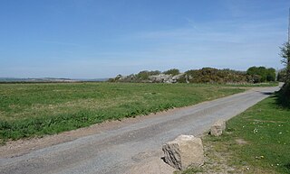
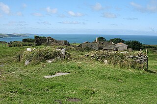
Lower Troswell and Higher Troswell are two farms in the parish of North Petherwin, Cornwall, England, UK. [1]
Lower Troswell and Higher Troswell are two farms in the parish of North Petherwin, Cornwall, England, UK. [1]
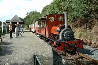
The Launceston Steam Railway is a 1 ft 11+1⁄2 in narrow gauge railway, in Cornwall, England. The railway operates from the town of Launceston to Newmills, where there is a farm park; it is 2+1⁄2 miles (4.0 km) long. The railway is built on the trackbed of the former standard gauge North Cornwall Railway.

The Helford River is a ria in Cornwall, England, fed by small streams into its many creeks. There are seven creeks on the Helford; from west to east these are Ponsontuel Creek, Mawgan Creek, Polpenwith Creek, Polwheveral Creek, Frenchman's Creek, Port Navas Creek, and Gillan Creek. The best known of these is Frenchman's Creek, made famous by Daphne du Maurier in her novel of the same name. A little further up river is Tremayne Quay, built for a visit by Queen Victoria in the 1840s which she then declined to make, allegedly because it was raining.
Kelly Rounds, or Castle Killibury is an Iron Age hill fort in Cornwall, England, United Kingdom. It is situated beside the A39 trunk road approximately two miles east of Wadebridge.

Talland is a hamlet and ecclesiastical parish between Looe and Polperro on the south coast of Cornwall. It is in the civil parish of Polperro and consists of a church, the Old Vicarage and a few houses.
The Rumps is a twin-headland promontory at the north-east corner of Pentire Head in north Cornwall, United Kingdom.

Towan is found in many placenames in Cornwall. However, The Towans usually refers to the three-mile (5 km) stretch of coastal dunes which extends north-east from the estuary of the River Hayle to Gwithian beach with a midpoint near Upton.

Trerulefoot is a village in southeast Cornwall, England, United Kingdom. It is located on the A38 trunk road approximately halfway between the towns of Saltash and Liskeard. Trerulefoot has a farm shop, two cafés and a petrol filling station.

The River Inny is a small river in east Cornwall, United Kingdom. It is a tributary of the River Tamar and is about twenty miles (32 km) long from its source near Davidstow on the eastern flank of Bodmin Moor to its confluence with the Tamar at Inny Foot near Dunterton.

Churchtown Farm is a community nature reserve one mile south of Saltash, Cornwall, England. It is owned and managed by Cornwall Wildlife Trust, and includes diverse habitats such as grassland, estuarine mudflats, wetland, woodland, disused quarries and hedgerows.

Bodrean and Frogmore are farmstead settlements in Cornwall, England, United Kingdom, situated two miles north-northeast of Truro.

The River Ottery is a small river in northeast Cornwall, United Kingdom. The river is about twenty miles (32 km) long from its source southeast of Otterham to its confluence with the River Tamar at Nether Bridge, two miles (3.2 km) northeast of Launceston.

Tremar Coombe is a small hamlet situated in the former Caradon District north of Liskeard in Cornwall. "Tremar" ("Trevargh") means "Mark's farm" in Cornish. It is considered an "industrial settlement" in that it was largely constructed during the mid-nineteenth century to accommodate workers at nearby mines and quarries and their families. The prefix Tre in Cornish stands for farm or homestead, and the word coombe comes from old English cumb, a narrow valley or deep hollow.
Cold Northcott is a hamlet in Cornwall, England, UK. It is on the A395 road two miles southeast of Hallworthy. It is in the civil parish of St Clether.
Dannonchapel is a ruined farm in Cornwall, England. It is about two miles southwest of Delabole. Dannonchapel was a farm in Domesday Book (1086) occupied by one villein and 4 serfs, and held by Blohin from Robert, Count of Mortain. Its value was reduced to 15 shillings.
Halton Barton is a farm in the parish of St Dominic in Cornwall, England.
Haye Farm is a farm in the parish of Callington, Cornwall, England.

Hendra is the name of eight hamlets in Cornwall, England, United Kingdom.

Lanjew is a farm in the parish of Withiel in Cornwall, England.

Launceston North and North Petherwin is an electoral division of Cornwall in the United Kingdom and returns one member to sit on Cornwall Council. The current Councillor is Adam Paynter, an Independent and the council's Deputy Leader.
| Unitary authorities | |
|---|---|
| Major settlements |
|
| Rivers | |
| Topics | |
Coordinates: 50°42′03″N4°28′26″W / 50.7009°N 4.4739°W
| | This article about a location in the former district of North Cornwall, England is a stub. You can help Wikipedia by expanding it. |