List of United Kingdom locations: Woof-Wy

Last updated

The United Kingdom Uk-map.svg
The United Kingdom

This is part of the list of United Kingdom locations: a gazetteer of place names in the United Kingdom showing each place's locality and geographical coordinates.

Contents

Wo (continued)

Woof-Wool

LocationLocality Coordinates
(links to map & photo sources)
OS grid
reference
Woofferton Shropshire 52°18′N2°43′W / 52.30°N 02.72°W / 52.30; -02.72 SO5168
Wookey Somerset 51°12′N2°42′W / 51.20°N 02.70°W / 51.20; -02.70 ST5145
Wookey Hole Somerset 51°13′N2°40′W / 51.22°N 02.67°W / 51.22; -02.67 ST5347
Wool Dorset 50°40′N2°13′W / 50.67°N 02.22°W / 50.67; -02.22 SY8486
Woolacombe Devon 51°10′N4°13′W / 51.16°N 04.21°W / 51.16; -04.21 SS4543
Woolage Green Kent 51°11′N1°11′E / 51.19°N 01.19°E / 51.19; 01.19 TR2349
Woolage Village Kent 51°12′N1°11′E / 51.20°N 01.19°E / 51.20; 01.19 TR2350
Woolaston Gloucestershire 51°41′N2°36′W / 51.68°N 02.60°W / 51.68; -02.60 ST5899
Woolaston Common Gloucestershire 51°42′N2°36′W / 51.70°N 02.60°W / 51.70; -02.60 SO5801
Woolaston Slade Gloucestershire 51°41′N2°37′W / 51.69°N 02.62°W / 51.69; -02.62 SO5700
Woolaston Woodside Gloucestershire 51°41′N2°37′W / 51.69°N 02.62°W / 51.69; -02.62 SO5700
Woolavington Somerset 51°10′N2°56′W / 51.16°N 02.94°W / 51.16; -02.94 ST3441
Woolbeding West Sussex 50°59′N0°46′W / 50.99°N 00.76°W / 50.99; -00.76 SU8722
Wooldale Kirklees 53°34′N1°46′W / 53.56°N 01.77°W / 53.56; -01.77 SE1508
Wooler Northumberland 55°32′N2°01′W / 55.54°N 02.01°W / 55.54; -02.01 NT9928
Wooler Water Northumberland 55°32′N2°01′W / 55.54°N 02.01°W / 55.54; -02.01 NT990279
Woolfall Heath Knowsley 53°25′N2°51′W / 53.42°N 02.85°W / 53.42; -02.85 SJ4392
Woolfardisworthy Devon 50°58′N4°22′W / 50.96°N 04.37°W / 50.96; -04.37 SS3321
Woolfardisworthy Devon 50°51′N3°40′W / 50.85°N 03.67°W / 50.85; -03.67 SS8208
Woolfold Bury 53°35′N2°20′W / 53.59°N 02.33°W / 53.59; -02.33 SD7811
Woolfords Cottages South Lanarkshire 55°47′N3°35′W / 55.79°N 03.59°W / 55.79; -03.59 NT0057
Woolford's Water Dorset 50°50′N2°26′W / 50.84°N 02.44°W / 50.84; -02.44 ST6905
Woolgarston Dorset 50°37′N2°01′W / 50.62°N 02.02°W / 50.62; -02.02 SY9881
Woolgreaves Wakefield 53°38′N1°29′W / 53.63°N 01.48°W / 53.63; -01.48 SE3416
Woolhampton Berkshire 51°23′N1°11′W / 51.39°N 01.18°W / 51.39; -01.18 SU5766
Woolhope Herefordshire 52°01′N2°34′W / 52.01°N 02.56°W / 52.01; -02.56 SO6135
Woolhope Cockshoot Herefordshire 52°02′N2°32′W / 52.03°N 02.54°W / 52.03; -02.54 SO6337
Woolland Dorset 50°51′N2°19′W / 50.85°N 02.32°W / 50.85; -02.32 ST7706
Woollard Bath and North East Somerset 51°22′N2°32′W / 51.37°N 02.53°W / 51.37; -02.53 ST6364
Woollaston Staffordshire 52°44′N2°12′W / 52.73°N 02.20°W / 52.73; -02.20 SJ8615
Woollaton Devon 50°53′N4°10′W / 50.88°N 04.17°W / 50.88; -04.17 SS4712
Woollensbrook Hertfordshire 51°46′N0°02′W / 51.77°N 00.03°W / 51.77; -00.03 TL3610
Woolley Cornwall 50°55′N4°29′W / 50.91°N 04.49°W / 50.91; -04.49 SS2516
Woolley Cambridgeshire 52°21′N0°19′W / 52.35°N 00.31°W / 52.35; -00.31 TL1574
Woolley Wiltshire 51°20′N2°14′W / 51.34°N 02.24°W / 51.34; -02.24 ST8361
Woolley Bath and North East Somerset 51°25′N2°22′W / 51.41°N 02.37°W / 51.41; -02.37 ST7468
Woolley Wakefield 53°37′N1°32′W / 53.61°N 01.53°W / 53.61; -01.53 SE3113
Woolley Derbyshire 53°08′N1°26′W / 53.13°N 01.44°W / 53.13; -01.44 SK3760
Woolley Bridge Tameside 53°27′N2°00′W / 53.45°N 02.00°W / 53.45; -02.00 SK0095
Woolley Green Wiltshire 51°20′N2°14′W / 51.34°N 02.24°W / 51.34; -02.24 ST8361
Woolley Green Berkshire 51°31′N0°46′W / 51.51°N 00.77°W / 51.51; -00.77 SU8580
Woolmere Green Worcestershire 52°15′N2°04′W / 52.25°N 02.06°W / 52.25; -02.06 SO9662
Woolmer Green Hertfordshire 51°50′N0°11′W / 51.84°N 00.18°W / 51.84; -00.18 TL2518
Woolmer Hill Surrey 51°05′N0°45′W / 51.09°N 00.75°W / 51.09; -00.75 SU8733
Woolmersdon Somerset 51°05′N3°01′W / 51.09°N 03.02°W / 51.09; -03.02 ST2833
Woolminstone Somerset 50°52′N2°50′W / 50.86°N 02.83°W / 50.86; -02.83 ST4108
Woolpack Corner Kent 51°06′N0°38′E / 51.10°N 00.64°E / 51.10; 00.64 TQ8537
Woolpit Suffolk 52°13′N0°53′E / 52.22°N 00.88°E / 52.22; 00.88 TL9762
Woolpit Green Suffolk 52°13′N0°53′E / 52.21°N 00.88°E / 52.21; 00.88 TL9761
Woolpit Heath Suffolk 52°13′N0°53′E / 52.21°N 00.89°E / 52.21; 00.89 TL9861
Woolridge Gloucestershire 51°54′N2°17′W / 51.90°N 02.29°W / 51.90; -02.29 SO8023
Woolsbridge Dorset 50°50′N1°52′W / 50.84°N 01.87°W / 50.84; -01.87 SU0905
Woolscott Warwickshire 52°17′N1°17′W / 52.29°N 01.28°W / 52.29; -01.28 SP4967
Woolsery Devon 50°58′N4°22′W / 50.96°N 04.37°W / 50.96; -04.37 SS3321
Woolsgrove Devon 50°48′N3°43′W / 50.80°N 03.71°W / 50.80; -03.71 SS7902
Woolsington Newcastle upon Tyne 55°01′N1°42′W / 55.01°N 01.70°W / 55.01; -01.70 NZ1969
Woolstanwood Cheshire 53°05′N2°29′W / 53.09°N 02.49°W / 53.09; -02.49 SJ6755
Woolstaston Shropshire 52°34′N2°49′W / 52.57°N 02.81°W / 52.57; -02.81 SO4598
Woolsthorpe By Belvoir Leicestershire 52°53′N0°46′W / 52.89°N 00.76°W / 52.89; -00.76 SK8334
Woolsthorpe-by-Colsterworth Lincolnshire 52°48′N0°38′W / 52.80°N 00.63°W / 52.80; -00.63 SK9224
Woolston Somerset 51°02′N2°31′W / 51.04°N 02.51°W / 51.04; -02.51 ST6427
Woolston Somerset 51°08′N3°18′W / 51.14°N 03.30°W / 51.14; -03.30 ST0939
Woolston City of Southampton 50°53′N1°23′W / 50.88°N 01.38°W / 50.88; -01.38 SU4310
Woolston Cornwall 50°29′N4°25′W / 50.48°N 04.41°W / 50.48; -04.41 SX2968
Woolston Devon 50°15′N3°49′W / 50.25°N 03.81°W / 50.25; -03.81 SX7141
Woolston Shropshire 52°28′N2°51′W / 52.47°N 02.85°W / 52.47; -02.85 SO4287
Woolston Cheshire 53°23′N2°32′W / 53.39°N 02.54°W / 53.39; -02.54 SJ6489
Woolston Shropshire 52°48′N3°01′W / 52.80°N 03.01°W / 52.80; -03.01 SJ3224
Woolstone Gloucestershire 51°58′N2°03′W / 51.96°N 02.05°W / 51.96; -02.05 SO9630
Woolstone Milton Keynes 52°02′N0°44′W / 52.03°N 00.73°W / 52.03; -00.73 SP8738
Woolstone Oxfordshire 51°35′N1°35′W / 51.58°N 01.58°W / 51.58; -01.58 SU2987
Woolston Green Devon 50°29′N3°44′W / 50.48°N 03.73°W / 50.48; -03.73 SX7766
Woolton Liverpool 53°22′N2°52′W / 53.36°N 02.87°W / 53.36; -02.87 SJ4286
Woolton Hill Hampshire 51°20′N1°23′W / 51.34°N 01.39°W / 51.34; -01.39 SU4261
Woolvers Hill North Somerset 51°20′N2°53′W / 51.33°N 02.89°W / 51.33; -02.89 ST3860
Woolverstone Suffolk 51°59′N1°10′E / 51.99°N 01.17°E / 51.99; 01.17 TM1838
Woolverton Somerset 51°16′N2°18′W / 51.27°N 02.30°W / 51.27; -02.30 ST7953
Woolwell Devon 50°25′N4°07′W / 50.42°N 04.11°W / 50.42; -04.11 SX5061
Woolwich Greenwich 51°29′N0°03′E / 51.49°N 00.05°E / 51.49; 00.05 TQ4379

Woon-Woot

LocationLocality Coordinates
(links to map & photo sources)
OS grid
reference
Woon Cornwall 50°23′N4°49′W / 50.39°N 04.81°W / 50.39; -04.81 SX0059
Woonton Herefordshire 52°10′N2°57′W / 52.16°N 02.95°W / 52.16; -02.95 SO3552
Woonton Herefordshire 52°15′N2°40′W / 52.25°N 02.67°W / 52.25; -02.67 SO5462
Wooperton Northumberland 55°28′N1°57′W / 55.47°N 01.95°W / 55.47; -01.95 NU0320
Wooplaw Scottish Borders 55°40′N2°49′W / 55.66°N 02.81°W / 55.66; -02.81 NT4942
Woore Shropshire 52°58′N2°24′W / 52.97°N 02.40°W / 52.97; -02.40 SJ7342
Wooth Dorset 50°45′N2°45′W / 50.75°N 02.75°W / 50.75; -02.75 SY4795
Wooton Shropshire 52°29′N2°21′W / 52.49°N 02.35°W / 52.49; -02.35 SO7689
Wooton Shropshire 52°21′N2°38′W / 52.35°N 02.63°W / 52.35; -02.63 SO5773
Wootten Green Suffolk 52°18′N1°16′E / 52.30°N 01.26°E / 52.30; 01.26 TM2372
Wootton Bedfordshire 52°05′N0°32′W / 52.09°N 00.54°W / 52.09; -00.54 TL0045
Wootton Hampshire 50°47′N1°40′W / 50.78°N 01.66°W / 50.78; -01.66 SZ2498
Wootton (Almeley)Herefordshire 52°10′N2°59′W / 52.16°N 02.99°W / 52.16; -02.99 SO3252
Wootton (Dormington)Herefordshire 52°02′N2°35′W / 52.04°N 02.59°W / 52.04; -02.59 SO5939
Wootton Isle of Wight 50°43′N1°14′W / 50.72°N 01.23°W / 50.72; -01.23 SZ5492
Wootton Kent 51°10′N1°10′E / 51.17°N 01.17°E / 51.17; 01.17 TR2246
Wootton North Lincolnshire 53°37′N0°22′W / 53.62°N 00.36°W / 53.62; -00.36 TA0816
Wootton Northamptonshire 52°11′N0°53′W / 52.19°N 00.88°W / 52.19; -00.88 SP7656
Wootton Oxfordshire 51°52′N1°22′W / 51.86°N 01.37°W / 51.86; -01.37 SP4319
Wootton Oxfordshire 51°42′N1°19′W / 51.70°N 01.32°W / 51.70; -01.32 SP4701
Wootton (Oswestry Rural)Shropshire 52°50′N2°59′W / 52.83°N 02.98°W / 52.83; -02.98 SJ3427
Wootton (Onibury)Shropshire 52°23′N2°48′W / 52.39°N 02.80°W / 52.39; -02.80 SO4578
Wootton (East Staffordshire)Staffordshire 53°00′N1°51′W / 53.00°N 01.85°W / 53.00; -01.85 SK1045
Wootton (Stafford)Staffordshire 52°50′N2°16′W / 52.84°N 02.26°W / 52.84; -02.26 SJ8227
Wootton Bourne End Bedfordshire 52°05′N0°34′W / 52.09°N 00.57°W / 52.09; -00.57 SP9845
Wootton Bridge Isle of Wight 50°43′N1°14′W / 50.71°N 01.23°W / 50.71; -01.23 SZ5491
Wootton Broadmead Bedfordshire 52°04′N0°31′W / 52.07°N 00.51°W / 52.07; -00.51 TL0243
Wootton Common Isle of Wight 50°43′N1°15′W / 50.71°N 01.25°W / 50.71; -01.25 SZ5391
Wootton Courtenay Somerset 51°10′N3°32′W / 51.17°N 03.53°W / 51.17; -03.53 SS9343
Wootton Fitzpaine Dorset 50°45′N2°54′W / 50.75°N 02.90°W / 50.75; -02.90 SY3695
Wootton Green Solihull 52°23′N1°40′W / 52.39°N 01.67°W / 52.39; -01.67 SP2278
Wootton Green Bedfordshire 52°04′N0°33′W / 52.07°N 00.55°W / 52.07; -00.55 SP9943
Wootton Rivers Wiltshire 51°22′N1°43′W / 51.36°N 01.72°W / 51.36; -01.72 SU1963
Woottons Staffordshire 52°56′N1°53′W / 52.93°N 01.89°W / 52.93; -01.89 SK0738
Wootton St Lawrence Hampshire 51°16′N1°09′W / 51.27°N 01.15°W / 51.27; -01.15 SU5953
Wootton Wawen Warwickshire 52°16′N1°47′W / 52.26°N 01.78°W / 52.26; -01.78 SP1563

Wor-Wou

LocationLocality Coordinates
(links to map & photo sources)
OS grid
reference
Worbarrow Dorset 50°37′N2°11′W / 50.61°N 02.18°W / 50.61; -02.18 SY8779
Worcester Worcestershire 52°11′N2°13′W / 52.19°N 02.22°W / 52.19; -02.22 SO8555
Worcester Park Surrey 51°22′N0°14′W / 51.37°N 00.24°W / 51.37; -00.24 TQ2265
Wordsley Dudley 52°29′N2°10′W / 52.48°N 02.17°W / 52.48; -02.17 SO8887
Wordwell Suffolk 52°19′N0°40′E / 52.31°N 00.66°E / 52.31; 00.66 TL8272
Worfe Shropshire 52°39′N2°19′W / 52.65°N 02.31°W / 52.65; -02.31 SJ790062
Worfield Shropshire 52°33′N2°22′W / 52.55°N 02.37°W / 52.55; -02.37 SO7595
Worgret Dorset 50°40′N2°08′W / 50.67°N 02.14°W / 50.67; -02.14 SY9086
Workhouse Common Norfolk 52°43′N1°28′E / 52.72°N 01.47°E / 52.72; 01.47 TG3520
Workhouse End Bedfordshire 52°09′N0°23′W / 52.15°N 00.39°W / 52.15; -00.39 TL1052
Workhouse Green Suffolk 51°59′N0°46′E / 51.99°N 00.76°E / 51.99; 00.76 TL9037
Workhouse Hill Essex 51°56′N0°53′E / 51.94°N 00.89°E / 51.94; 00.89 TL9931
Workington Cumbria 54°37′N3°34′W / 54.62°N 03.56°W / 54.62; -03.56 NX9927
Worksop Nottinghamshire 53°18′N1°08′W / 53.30°N 01.13°W / 53.30; -01.13 SK5879
Worlaby North Lincolnshire 53°36′N0°28′W / 53.60°N 00.47°W / 53.60; -00.47 TA0113
Worlaby Lincolnshire 53°16′N0°01′W / 53.26°N 00.01°W / 53.26; -00.01 TF3376
World's End West Sussex 50°57′N0°07′W / 50.95°N 00.12°W / 50.95; -00.12 TQ3219
Worlds End Hampshire 50°54′N1°06′W / 50.90°N 01.10°W / 50.90; -01.10 SU6312
Worlds End Solihull 52°25′N1°47′W / 52.41°N 01.79°W / 52.41; -01.79 SP1480
World's End Suffolk 52°09′N0°54′E / 52.15°N 00.90°E / 52.15; 00.90 TL9955
World's End Buckinghamshire 51°46′N0°46′W / 51.77°N 00.76°W / 51.77; -00.76 SP8509
World's End Enfield 51°38′N0°06′W / 51.64°N 00.10°W / 51.64; -00.10 TQ3196
World's End Berkshire 51°29′N1°19′W / 51.48°N 01.31°W / 51.48; -01.31 SU4876
Worle North Somerset 51°21′N2°56′W / 51.35°N 02.93°W / 51.35; -02.93 ST3562
Worlebury North Somerset 51°21′N2°58′W / 51.35°N 02.96°W / 51.35; -02.96 ST3362
Worleston Cheshire 53°06′N2°31′W / 53.10°N 02.52°W / 53.10; -02.52 SJ6556
Worley Gloucestershire 51°41′N2°14′W / 51.68°N 02.23°W / 51.68; -02.23 ST8499
Worlingham Suffolk 52°26′N1°35′E / 52.44°N 01.58°E / 52.44; 01.58 TM4489
Worlington Devon 51°02′N4°10′W / 51.04°N 04.17°W / 51.04; -04.17 SS4830
Worlington Suffolk 52°19′N0°28′E / 52.32°N 00.47°E / 52.32; 00.47 TL6973
Worlingworth Suffolk 52°16′N1°16′E / 52.26°N 01.26°E / 52.26; 01.26 TM2368
Wormbridge Herefordshire 51°58′N2°50′W / 51.97°N 02.84°W / 51.97; -02.84 SO4231
Wormbridge Common Herefordshire 51°58′N2°50′W / 51.97°N 02.84°W / 51.97; -02.84 SO4231
Wormegay Norfolk 52°40′N0°27′E / 52.67°N 00.45°E / 52.67; 00.45 TF6611
Wormelow Tump Herefordshire 51°58′N2°44′W / 51.96°N 02.74°W / 51.96; -02.74 SO4930
Wormhill Derbyshire 53°16′N1°49′W / 53.26°N 01.82°W / 53.26; -01.82 SK1274
Wormingford Essex 51°56′N0°48′E / 51.94°N 00.80°E / 51.94; 00.80 TL9331
Worminghall Buckinghamshire 51°46′N1°04′W / 51.76°N 01.07°W / 51.76; -01.07 SP6408
Wormington Gloucestershire 52°01′N1°57′W / 52.02°N 01.95°W / 52.02; -01.95 SP0336
Worminster Somerset 51°10′N2°37′W / 51.17°N 02.61°W / 51.17; -02.61 ST5742
Wormit Fife 56°25′N2°59′W / 56.42°N 02.99°W / 56.42; -02.99 NO3926
Wormleighton Warwickshire 52°10′N1°21′W / 52.17°N 01.35°W / 52.17; -01.35 SP4453
Wormley Surrey 51°08′N0°39′W / 51.13°N 00.65°W / 51.13; -00.65 SU9438
Wormley Hertfordshire 51°43′N0°02′W / 51.72°N 00.03°W / 51.72; -00.03 TL3605
Wormleybury Hertfordshire 51°43′N0°02′W / 51.72°N 00.03°W / 51.72; -00.03 TL3605
Wormley West End Hertfordshire 51°43′N0°04′W / 51.72°N 00.07°W / 51.72; -00.07 TL3305
Worms Ash Worcestershire 52°20′N2°05′W / 52.34°N 02.08°W / 52.34; -02.08 SO9472
Wormscleuch Burn Scottish Borders 55°16′N2°38′W / 55.27°N 02.64°W / 55.27; -02.64 NY594983
Worms Head Swansea 51°34′N4°17′W / 51.56°N 04.29°W / 51.56; -04.29 SS410873
Worms Hill Kent 51°07′N0°28′E / 51.12°N 00.47°E / 51.12; 00.47 TQ7339
Wormshill Kent 51°17′N0°41′E / 51.28°N 00.68°E / 51.28; 00.68 TQ8757
Wormsley Herefordshire 52°07′N2°50′W / 52.11°N 02.84°W / 52.11; -02.84 SO4247
Wornish Nook Cheshire 53°11′N2°14′W / 53.18°N 02.24°W / 53.18; -02.24 SJ8465
Worplesdon Surrey 51°16′N0°37′W / 51.26°N 00.61°W / 51.26; -00.61 SU9753
Worrall Sheffield 53°25′N1°32′W / 53.42°N 01.54°W / 53.42; -01.54 SK3092
Worrall Hill Gloucestershire 51°49′N2°35′W / 51.82°N 02.58°W / 51.82; -02.58 SO6014
Worsbrough Barnsley 53°31′N1°28′W / 53.52°N 01.47°W / 53.52; -01.47 SE3503
Worsbrough Bridge Barnsley 53°31′N1°28′W / 53.52°N 01.47°W / 53.52; -01.47 SE3503
Worsbrough Common Barnsley 53°32′N1°29′W / 53.53°N 01.48°W / 53.53; -01.48 SE3404
Worsbrough Dale Barnsley 53°31′N1°27′W / 53.52°N 01.45°W / 53.52; -01.45 SE3603
Worsham Oxfordshire 51°47′N1°35′W / 51.78°N 01.58°W / 51.78; -01.58 SP2910
Worsley Salford 53°30′N2°23′W / 53.50°N 02.39°W / 53.50; -02.39 SD7401
Worsley Hall Wigan 53°32′N2°41′W / 53.54°N 02.68°W / 53.54; -02.68 SD5505
Worsley Mesnes Wigan 53°32′N2°39′W / 53.53°N 02.65°W / 53.53; -02.65 SD5704
Worstead Norfolk 52°47′N1°24′E / 52.78°N 01.40°E / 52.78; 01.40 TG3026
Worsthorne Lancashire 53°47′N2°11′W / 53.78°N 02.19°W / 53.78; -02.19 SD8732
Worston Devon 50°22′N3°59′W / 50.36°N 03.98°W / 50.36; -03.98 SX5953
Worston Lancashire 53°52′N2°22′W / 53.87°N 02.36°W / 53.87; -02.36 SD7642
Worten Kent 51°09′N0°49′E / 51.15°N 00.81°E / 51.15; 00.81 TQ9743
Worth Somerset 51°12′N2°42′W / 51.20°N 02.70°W / 51.20; -02.70 ST5145
Worth West Sussex 51°06′N0°08′W / 51.10°N 00.14°W / 51.10; -00.14 TQ3036
Worth Kent 51°14′N1°20′E / 51.24°N 01.33°E / 51.24; 01.33 TR3355
Worth Abbey West Sussex 51°05′N0°08′W / 51.09°N 00.13°W / 51.09; -00.13 TQ3134
Wortham Suffolk 52°21′N1°03′E / 52.35°N 01.05°E / 52.35; 01.05 TM0877
Worthen Shropshire 52°37′N3°00′W / 52.62°N 03.00°W / 52.62; -03.00 SJ3204
Worthenbury Wrexham 53°00′N2°52′W / 53.00°N 02.86°W / 53.00; -02.86 SJ4246
Worthing West Sussex 50°49′N0°23′W / 50.81°N 00.39°W / 50.81; -00.39 TQ1303
Worthing Norfolk 52°44′N0°56′E / 52.73°N 00.94°E / 52.73; 00.94 TF9919
Worthington Leicestershire 52°46′N1°24′W / 52.77°N 01.40°W / 52.77; -01.40 SK4020
Worth Matravers Dorset 50°35′N2°02′W / 50.59°N 02.04°W / 50.59; -02.04 SY9777
Worthy Somerset 51°13′N3°38′W / 51.21°N 03.64°W / 51.21; -03.64 SS8548
Worthybrook Monmouthshire 51°47′N2°46′W / 51.79°N 02.76°W / 51.79; -02.76 SO4711
Worting Hampshire 51°16′N1°08′W / 51.26°N 01.14°W / 51.26; -01.14 SU6052
Wortley Barnsley 53°29′N1°32′W / 53.48°N 01.54°W / 53.48; -01.54 SK3099
Wortley Gloucestershire 51°37′N2°20′W / 51.61°N 02.34°W / 51.61; -02.34 ST7691
Wortley Leeds 53°47′N1°36′W / 53.78°N 01.60°W / 53.78; -01.60 SE2632
Worton North Yorkshire 54°18′N2°04′W / 54.30°N 02.07°W / 54.30; -02.07 SD9590
Worton Oxfordshire 51°47′N1°20′W / 51.79°N 01.33°W / 51.79; -01.33 SP4611
Worton Wiltshire 51°19′N2°02′W / 51.31°N 02.04°W / 51.31; -02.04 ST9757
Wortwell Norfolk 52°24′N1°20′E / 52.40°N 01.33°E / 52.40; 01.33 TM2784
Wotherton Shropshire 52°35′N3°04′W / 52.59°N 03.06°W / 52.59; -03.06 SJ2800
Wothorpe Northamptonshire 52°38′N0°29′W / 52.63°N 00.49°W / 52.63; -00.49 TF0205
Wotter Devon 50°26′N4°02′W / 50.43°N 04.04°W / 50.43; -04.04 SX5561
Wotton Devon 50°30′N3°41′W / 50.50°N 03.69°W / 50.50; -03.69 SX8069
Wotton Gloucestershire 51°52′N2°14′W / 51.86°N 02.23°W / 51.86; -02.23 SO8418
Wotton Surrey 51°13′N0°23′W / 51.21°N 00.39°W / 51.21; -00.39 TQ1247
Wotton-under-Edge Gloucestershire 51°37′N2°20′W / 51.62°N 02.34°W / 51.62; -02.34 ST7692
Wotton Underwood Buckinghamshire 51°49′N1°01′W / 51.82°N 01.01°W / 51.82; -01.01 SP6815
Woughton on the Green Milton Keynes 52°01′N0°44′W / 52.02°N 00.73°W / 52.02; -00.73 SP8737
Wouldham Kent 51°20′N0°27′E / 51.34°N 00.45°E / 51.34; 00.45 TQ7164
Woundale Shropshire 52°31′N2°20′W / 52.52°N 02.34°W / 52.52; -02.34 SO7792

Wr

LocationLocality Coordinates
(links to map & photo sources)
OS grid
reference
Wrabness Essex 51°56′N1°09′E / 51.93°N 01.15°E / 51.93; 01.15 TM1731
Wrafton Devon 51°05′N4°09′W / 51.09°N 04.15°W / 51.09; -04.15 SS4935
Wragby Lincolnshire 53°17′N0°18′W / 53.28°N 00.30°W / 53.28; -00.30 TF1378
Wragby Wakefield 53°38′N1°23′W / 53.64°N 01.38°W / 53.64; -01.38 SE4117
Wragholme Lincolnshire 53°27′N0°04′E / 53.45°N 00.06°E / 53.45; 00.06 TF3797
Wramplingham Norfolk 52°37′N1°07′E / 52.61°N 01.11°E / 52.61; 01.11 TG1106
Wrangaton Devon 50°23′N3°52′W / 50.39°N 03.87°W / 50.39; -03.87 SX6757
Wrangbrook Wakefield 53°37′N1°16′W / 53.61°N 01.26°W / 53.61; -01.26 SE4913
Wrangle Lincolnshire 53°02′N0°07′E / 53.03°N 00.11°E / 53.03; 00.11 TF4251
Wrangle Bank Lincolnshire 53°03′N0°07′E / 53.05°N 00.11°E / 53.05; 00.11 TF4253
Wrangle Lowgate Lincolnshire 53°02′N0°08′E / 53.03°N 00.13°E / 53.03; 00.13 TF4351
Wrangle Low Ground Lincolnshire 53°02′N0°07′E / 53.04°N 00.11°E / 53.04; 00.11 TF4252
Wrangway Somerset 50°56′N3°15′W / 50.94°N 03.25°W / 50.94; -03.25 ST1217
Wrantage Somerset 50°59′N2°59′W / 50.99°N 02.99°W / 50.99; -02.99 ST3022
Wrawby North Lincolnshire 53°33′N0°28′W / 53.55°N 00.46°W / 53.55; -00.46 TA0208
Wraxall Dorset 50°48′N2°37′W / 50.80°N 02.62°W / 50.80; -02.62 ST5601
Wraxall (near Nailsea)North Somerset 51°26′N2°44′W / 51.43°N 02.73°W / 51.43; -02.73 ST4971
Wraxall (Ditcheat, near Castle Cary)Somerset 51°07′N2°34′W / 51.12°N 02.57°W / 51.12; -02.57 ST6036
Wray Lancashire 54°05′N2°37′W / 54.09°N 02.61°W / 54.09; -02.61 SD6067
Wray Common Surrey 51°14′N0°11′W / 51.23°N 00.19°W / 51.23; -00.19 TQ2650
Wraysbury Berkshire 51°27′N0°34′W / 51.45°N 00.56°W / 51.45; -00.56 TQ0074
Wrayton Lancashire 54°08′N2°35′W / 54.14°N 02.59°W / 54.14; -02.59 SD6172
Wrea Green Lancashire 53°46′N2°55′W / 53.77°N 02.92°W / 53.77; -02.92 SD3931
Wreaks End Cumbria 54°16′N3°11′W / 54.26°N 03.19°W / 54.26; -03.19 SD2286
Wreath Somerset 50°52′N2°56′W / 50.86°N 02.93°W / 50.86; -02.93 ST3408
Wreaths Angus 56°35′N2°59′W / 56.58°N 02.99°W / 56.58; -02.99 NO3944
Wreay (Carlisle)Cumbria 54°49′N2°53′W / 54.82°N 02.88°W / 54.82; -02.88 NY4348
Wreay (Eden)Cumbria 54°35′N2°52′W / 54.59°N 02.86°W / 54.59; -02.86 NY4423
Wrecclesham Surrey 51°11′N0°49′W / 51.18°N 00.82°W / 51.18; -00.82 SU8244
Wrekenton Gateshead 54°55′N1°35′W / 54.92°N 01.58°W / 54.92; -01.58 NZ2759
Wrelton North Yorkshire 54°16′N0°50′W / 54.26°N 00.83°W / 54.26; -00.83 SE7686
Wrenbury Cheshire 53°01′N2°37′W / 53.01°N 02.61°W / 53.01; -02.61 SJ5947
Wreningham Norfolk 52°32′N1°10′E / 52.53°N 01.16°E / 52.53; 01.16 TM1598
Wrentham Suffolk 52°22′N1°39′E / 52.37°N 01.65°E / 52.37; 01.65 TM4982
Wrenthorpe Wakefield 53°41′N1°32′W / 53.69°N 01.53°W / 53.69; -01.53 SE3122
Wrentnall Shropshire 52°37′N2°51′W / 52.62°N 02.85°W / 52.62; -02.85 SJ4203
Wressle East Riding of Yorkshire 53°46′N0°55′W / 53.77°N 00.92°W / 53.77; -00.92 SE7131
Wressle North Lincolnshire 53°34′N0°32′W / 53.56°N 00.53°W / 53.56; -00.53 SE9709
Wrestlingworth Bedfordshire 52°06′N0°10′W / 52.10°N 00.17°W / 52.10; -00.17 TL2547
Wretton Norfolk 52°34′N0°28′E / 52.56°N 00.47°E / 52.56; 00.47 TL6899
Wrexham (Wrecsam) Wrexham 53°02′N3°00′W / 53.04°N 03.00°W / 53.04; -03.00 SJ3350
Wrexham Street Buckinghamshire 51°32′N0°34′W / 51.53°N 00.57°W / 51.53; -00.57 SU9983
Wreyland Devon 50°37′N3°43′W / 50.61°N 03.72°W / 50.61; -03.72 SX7881
Wribbenhall Worcestershire 52°22′N2°18′W / 52.37°N 02.30°W / 52.37; -02.30 SO7975
Wrickton Shropshire 52°28′N2°32′W / 52.46°N 02.53°W / 52.46; -02.53 SO6485
Wrightington Bar Lancashire 53°37′N2°43′W / 53.61°N 02.71°W / 53.61; -02.71 SD5313
Wright's Green Essex 51°50′N0°10′E / 51.83°N 00.17°E / 51.83; 00.17 TL5017
Wrights Green Cheshire 53°21′N2°33′W / 53.35°N 02.55°W / 53.35; -02.55 SJ6384
Wrinehill Staffordshire 53°01′N2°22′W / 53.02°N 02.37°W / 53.02; -02.37 SJ7547
Wringsdown Cornwall 50°39′N4°23′W / 50.65°N 04.39°W / 50.65; -04.39 SX3187
Wrington North Somerset 51°21′N2°46′W / 51.35°N 02.76°W / 51.35; -02.76 ST4762
Wrinkleberry Devon 50°59′N4°24′W / 50.99°N 04.40°W / 50.99; -04.40 SS3124
Writhlington Somerset 51°17′N2°26′W / 51.28°N 02.43°W / 51.28; -02.43 ST7054
Writtle Essex 51°43′N0°25′E / 51.72°N 00.41°E / 51.72; 00.41 TL6706
Wrockwardine Shropshire 52°41′N2°34′W / 52.69°N 02.56°W / 52.69; -02.56 SJ6211
Wrockwardine Wood Shropshire 52°41′N2°26′W / 52.69°N 02.44°W / 52.69; -02.44 SJ7011
Wroot North Lincolnshire 53°31′N0°56′W / 53.51°N 00.93°W / 53.51; -00.93 SE7103
Wrose Bradford 53°49′N1°45′W / 53.82°N 01.75°W / 53.82; -01.75 SE1637
Wrotham Kent 51°18′N0°17′E / 51.30°N 00.29°E / 51.30; 00.29 TQ6059
Wrotham Heath Kent 51°17′N0°20′E / 51.29°N 00.33°E / 51.29; 00.33 TQ6358
Wroughton Swindon 51°31′N1°47′W / 51.51°N 01.79°W / 51.51; -01.79 SU1480
Wroxall Isle of Wight 50°36′N1°13′W / 50.60°N 01.22°W / 50.60; -01.22 SZ5579
Wroxeter Shropshire 52°40′N2°39′W / 52.66°N 02.65°W / 52.66; -02.65 SJ5608
Wroxhall Warwickshire 52°20′N1°40′W / 52.33°N 01.67°W / 52.33; -01.67 SP2271
Wroxham Norfolk 52°42′N1°24′E / 52.70°N 01.40°E / 52.70; 01.40 TG3017
Wroxton Oxfordshire 52°04′N1°24′W / 52.06°N 01.40°W / 52.06; -01.40 SP4141

Wy

LocationLocality Coordinates
(links to map & photo sources)
OS grid
reference
Wyaston Derbyshire 52°58′N1°44′W / 52.97°N 01.73°W / 52.97; -01.73 SK1842
Wyatts Green Essex 51°40′N0°17′E / 51.66°N 00.29°E / 51.66; 00.29 TQ5999
Wybers Wood North East Lincolnshire 53°33′N0°08′W / 53.55°N 00.14°W / 53.55; -00.14 TA2308
Wyberton Lincolnshire 52°57′N0°03′W / 52.95°N 00.05°W / 52.95; -00.05 TF3141
Wyboston Bedfordshire 52°11′N0°18′W / 52.19°N 00.30°W / 52.19; -00.30 TL1656
Wybunbury Cheshire 53°02′N2°28′W / 53.03°N 02.46°W / 53.03; -02.46 SJ6949
Wychbold Worcestershire 52°17′N2°07′W / 52.28°N 02.11°W / 52.28; -02.11 SO9265
Wych Cross East Sussex 51°04′N0°01′E / 51.06°N 00.01°E / 51.06; 00.01 TQ4131
Wychnor Staffordshire 52°44′N1°44′W / 52.74°N 01.74°W / 52.74; -01.74 SK1716
Wychnor Bridges Staffordshire 52°44′N1°44′W / 52.74°N 01.73°W / 52.74; -01.73 SK1816
Wyck Hampshire 51°08′N0°55′W / 51.14°N 00.92°W / 51.14; -00.92 SU7539
Wyck Rissington Gloucestershire 51°53′N1°43′W / 51.88°N 01.72°W / 51.88; -01.72 SP1921
Wycliffe Durham 54°31′N1°50′W / 54.52°N 01.83°W / 54.52; -01.83 NZ1114
Wycoller Lancashire 53°50′N2°06′W / 53.84°N 02.10°W / 53.84; -02.10 SD9339
Wycomb Leicestershire 52°48′N0°51′W / 52.80°N 00.85°W / 52.80; -00.85 SK7724
Wycombe Buckinghamshire 51°37′N0°44′W / 51.61°N 00.73°W / 51.61; -00.73 SU8891
Wyddial Hertfordshire 51°58′N0°01′W / 51.96°N 00.01°W / 51.96; -00.01 TL3731
Wydra North Yorkshire 53°59′N1°41′W / 53.98°N 01.69°W / 53.98; -01.69 SE2054
Wye Buckinghamshire 51°38′N0°45′W / 51.64°N 00.75°W / 51.64; -00.75 SU860947
Wye Derbyshire 53°15′N1°47′W / 53.25°N 01.79°W / 53.25; -01.79 SK140730
Wye Kent 51°10′N0°56′E / 51.17°N 00.93°E / 51.17; 00.93 TR0546
Wye Monmouthshire 51°49′N2°41′W / 51.81°N 02.69°W / 51.81; -02.69 SO522133
Wye Powys 52°12′N3°27′W / 52.20°N 03.45°W / 52.20; -03.45 SO007571
Wyebanks Kent 51°15′N0°46′E / 51.25°N 00.76°E / 51.25; 00.76 TQ9354
Wyegate Green Gloucestershire 51°45′N2°39′W / 51.75°N 02.65°W / 51.75; -02.65 SO5506
Wyesham Monmouthshire 51°48′N2°43′W / 51.80°N 02.71°W / 51.80; -02.71 SO5112
Wyfordby Leicestershire 52°45′N0°50′W / 52.75°N 00.83°W / 52.75; -00.83 SK7918
Wyke Bradford 53°44′N1°46′W / 53.73°N 01.77°W / 53.73; -01.77 SE1526
Wyke Dorset 51°02′N2°18′W / 51.03°N 02.30°W / 51.03; -02.30 ST7926
Wyke Shropshire 52°37′N2°32′W / 52.61°N 02.53°W / 52.61; -02.53 SJ6402
Wyke Surrey 51°15′N0°41′W / 51.25°N 00.68°W / 51.25; -00.68 SU9251
Wyke Champflower Somerset 51°06′N2°29′W / 51.10°N 02.48°W / 51.10; -02.48 ST6634
Wyke Green Devon 50°45′N2°59′W / 50.75°N 02.99°W / 50.75; -02.99 SY3096
Wykeham Lincolnshire 52°49′N0°07′W / 52.81°N 00.11°W / 52.81; -00.11 TF2726
Wykeham Ryedale, North Yorkshire 54°10′N0°45′W / 54.17°N 00.75°W / 54.17; -00.75 SE815752
Wykeham Scarborough, North Yorkshire 54°14′N0°31′W / 54.23°N 00.52°W / 54.23; -00.52 SE9683
Wyken Coventry 52°25′N1°28′W / 52.41°N 01.47°W / 52.41; -01.47 SP3680
Wyken Shropshire 52°32′N2°21′W / 52.54°N 02.35°W / 52.54; -02.35 SO7694
Wyke Regis Dorset 50°35′N2°29′W / 50.59°N 02.48°W / 50.59; -02.48 SY6677
Wykey Shropshire 52°49′N2°54′W / 52.81°N 02.90°W / 52.81; -02.90 SJ3924
Wykin Leicestershire 52°33′N1°25′W / 52.55°N 01.41°W / 52.55; -01.41 SP4095
Wylam Northumberland 54°58′N1°49′W / 54.97°N 01.82°W / 54.97; -01.82 NZ1164
Wylde Herefordshire 52°18′N2°48′W / 52.30°N 02.80°W / 52.30; -02.80 SO4568
Wylde Green Birmingham 52°32′N1°49′W / 52.54°N 01.82°W / 52.54; -01.82 SP1294
Wyllie Caerphilly 51°38′N3°12′W / 51.63°N 03.20°W / 51.63; -03.20 ST1794
Wylye Wiltshire 51°08′N2°00′W / 51.13°N 02.00°W / 51.13; -02.00 ST995377
Wymans Brook Gloucestershire 51°55′N2°05′W / 51.91°N 02.08°W / 51.91; -02.08 SO9424
Wymbush Milton Keynes 52°02′N0°48′W / 52.03°N 00.80°W / 52.03; -00.80 SP8238
Wymering City of Portsmouth 50°51′N1°04′W / 50.85°N 01.07°W / 50.85; -01.07 SU6506
Wymeswold Leicestershire 52°48′N1°07′W / 52.80°N 01.11°W / 52.80; -01.11 SK6023
Wymington Bedfordshire 52°16′N0°36′W / 52.26°N 00.60°W / 52.26; -00.60 SP9564
Wymondham Leicestershire 52°45′N0°44′W / 52.75°N 00.74°W / 52.75; -00.74 SK8518
Wymondham Norfolk 52°34′N1°07′E / 52.56°N 01.11°E / 52.56; 01.11 TG1101
Wymondley Bury Hertfordshire 51°55′N0°14′W / 51.92°N 00.24°W / 51.92; -00.24 TL2127
Wymott Lancashire 53°40′N2°45′W / 53.67°N 02.75°W / 53.67; -02.75 SD5020
Wyndham Bridgend 51°36′N3°32′W / 51.60°N 03.54°W / 51.60; -03.54 SS9391
Wyndham Park The Vale Of Glamorgan 51°28′N3°19′W / 51.47°N 03.32°W / 51.47; -03.32 ST0876
Wynds Point Herefordshire 52°03′N2°21′W / 52.05°N 02.35°W / 52.05; -02.35 SO7640
Wynford Eagle Dorset 50°45′N2°35′W / 50.75°N 02.59°W / 50.75; -02.59 SY5895
Wyng Orkney Islands 58°47′N3°11′W / 58.79°N 03.19°W / 58.79; -03.19 ND3190
Wynn's Green Herefordshire 52°07′N2°35′W / 52.12°N 02.58°W / 52.12; -02.58 SO6047
Wyre Orkney Islands 59°07′N2°58′W / 59.12°N 02.97°W / 59.12; -02.97 HY443263
Wyre Forest Shropshire 52°23′N2°22′W / 52.38°N 02.36°W / 52.38; -02.36 SO750760
Wyre Piddle Worcestershire 52°07′N2°03′W / 52.12°N 02.05°W / 52.12; -02.05 SO9647
Wysall Nottinghamshire 52°50′N1°07′W / 52.83°N 01.11°W / 52.83; -01.11 SK6027
Wyson Herefordshire 52°17′N2°43′W / 52.29°N 02.72°W / 52.29; -02.72 SO5167
Wythall Worcestershire 52°22′N1°53′W / 52.37°N 01.89°W / 52.37; -01.89 SP0775
Wytham Oxfordshire 51°46′N1°19′W / 51.76°N 01.32°W / 51.76; -01.32 SP4708
Wyth Burn Cumbria 54°28′N3°06′W / 54.46°N 03.10°W / 54.46; -03.10 NY283078
Wythenshawe Manchester 53°23′N2°16′W / 53.38°N 02.27°W / 53.38; -02.27 SJ8288
Wythop Mill Cumbria 54°38′N3°17′W / 54.64°N 03.28°W / 54.64; -03.28 NY1729
Wyton Cambridgeshire 52°20′N0°07′W / 52.33°N 00.12°W / 52.33; -00.12 TL2772
Wyton East Riding of Yorkshire 53°47′N0°13′W / 53.78°N 00.22°W / 53.78; -00.22 TA1733
Wyverstone Suffolk 52°16′N0°59′E / 52.26°N 00.98°E / 52.26; 00.98 TM0467
Wyverstone Green Suffolk 52°16′N0°59′E / 52.26°N 00.98°E / 52.26; 00.98 TM0467
Wyverstone Street Suffolk 52°16′N0°58′E / 52.26°N 00.97°E / 52.26; 00.97 TM0367
Wyville Lincolnshire 52°51′N0°41′W / 52.85°N 00.69°W / 52.85; -00.69 SK8829

Related Research Articles

Britain most often refers to:

<span class="mw-page-title-main">England</span> Country in north-west Europe; part of the United Kingdom

England is a country that is part of the United Kingdom. It shares land borders with Wales to its west and Scotland to its north. The Irish Sea lies northwest and the Celtic Sea to the southwest. It is separated from continental Europe by the North Sea to the east and the English Channel to the south. The country covers five-eighths of the island of Great Britain, which lies in the North Atlantic, and includes over 100 smaller islands, such as the Isles of Scilly and the Isle of Wight.

<span class="mw-page-title-main">Parliament of the United Kingdom</span> Legislative body

The Parliament of the United Kingdom is the supreme legislative body of the United Kingdom, the Crown Dependencies and the British Overseas Territories. It meets at the Palace of Westminster, London. It alone possesses legislative supremacy and thereby ultimate power over all other political bodies in the UK and the overseas territories. Parliament is bicameral but has three parts, consisting of the sovereign (King-in-Parliament), the House of Lords, and the House of Commons. In theory, power is officially vested in the King-in-Parliament. However, the Crown normally acts on the advice of the prime minister, and the powers of the House of Lords are limited to only delaying legislation; thus power is de facto vested in the House of Commons.

June is the sixth month of the year in the Julian and Gregorian calendars and is the second of four months to have a length of 30 days, and the third of five months to have a length of less than 31 days. June contains the summer solstice in the Northern Hemisphere, the day with the most daylight hours, and the winter solstice in the Southern Hemisphere, the day with the fewest daylight hours. June in the Northern Hemisphere is the seasonal equivalent to December in the Southern Hemisphere and vice versa. In the Northern Hemisphere, the beginning of the traditional astronomical summer is 21 June. In the Southern Hemisphere, meteorological winter begins on 1 June.

<span class="mw-page-title-main">Northern Ireland</span> Part of the United Kingdom on the island of Ireland

Northern Ireland is a part of the United Kingdom, situated in the north-east of the island of Ireland, that is variously described as a country, province or region. Northern Ireland shares an open border to the south and west with the Republic of Ireland. In 2021, its population was 1,903,100, making up about 27% of Ireland's population and about 3% of the UK's population. The Northern Ireland Assembly, established by the Northern Ireland Act 1998, holds responsibility for a range of devolved policy matters, while other areas are reserved for the UK Government. Northern Ireland cooperates with the Republic of Ireland in several areas.

<span class="mw-page-title-main">Prime Minister of the United Kingdom</span> Head of Government in the United Kingdom

The prime minister of the United Kingdom is the head of government of the United Kingdom. The prime minister advises the sovereign on the exercise of much of the royal prerogative, chairs the Cabinet and selects its ministers. As modern prime ministers hold office by virtue of their ability to command the confidence of the House of Commons, they sit as members of Parliament.

<span class="mw-page-title-main">Primary school</span> School for children

A primary school, junior school, elementary school or grade school is a school for primary education of children who are four to eleven years of age. Primary schooling follows pre-school and precedes secondary schooling.
<span class="mw-page-title-main">United Kingdom</span> Country in north-west Europe

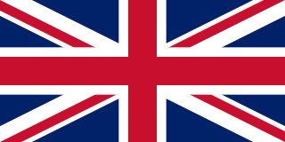
The United Kingdom of Great Britain and Northern Ireland, commonly known as the United Kingdom (UK) or Britain, is a country in Europe, off the north-western coast of the continental mainland. It comprises England, Scotland, Wales and Northern Ireland. The United Kingdom includes the island of Great Britain, the north-eastern part of the island of Ireland, and many smaller islands within the British Isles. Northern Ireland shares a land border with the Republic of Ireland; otherwise, the United Kingdom is surrounded by the Atlantic Ocean, the North Sea, the English Channel, the Celtic Sea and the Irish Sea. The total area of the United Kingdom is 242,495 square kilometres (93,628 sq mi), with an estimated 2020 population of more than 67 million people.

The Peerage of Ireland consists of those titles of nobility created by the English monarchs in their capacity as Lord or King of Ireland, or later by monarchs of the United Kingdom of Great Britain and Ireland. It is one of the five divisions of Peerages in the United Kingdom. The creation of such titles came to an end in the 19th century. The ranks of the Irish peerage are duke, marquess, earl, viscount and baron. As of 2016, there were 135 titles in the Peerage of Ireland extant: two dukedoms, ten marquessates, 43 earldoms, 28 viscountcies, and 52 baronies. The Crown of the United Kingdom of Great Britain and Northern Ireland continues to exercise jurisdiction over the Peerage of Ireland, including those peers whose titles derive from places located in what is now the Republic of Ireland. Article 40.2 of the Constitution of Ireland forbids the state conferring titles of nobility and an Irish citizen may not accept titles of nobility or honour except with the prior approval of the Irish government. This issue has not arisen in respect of the Peerage of Ireland because no creation of titles in it has been made since the constitution came into force.

<span class="mw-page-title-main">December 1910 United Kingdom general election</span>

The December 1910 United Kingdom general election was held from 3 to 19 December. It was the last general election to be held over several days and the last to be held before the First World War.
<span class="mw-page-title-main">Yugoslavia national football team</span> Former mens national association football team representing Yugoslavia

The Yugoslavia national football team represented Yugoslavia in international association football.

<span class="mw-page-title-main">Lists of places in Wales</span>

This is a list of lists of places in Wales.

<span class="mw-page-title-main">United Kingdom of Portugal, Brazil and the Algarves</span> Pluricontinental monarchy

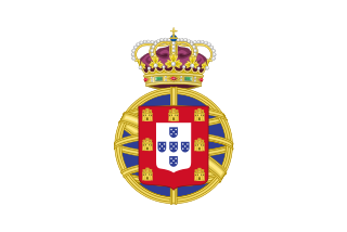
The United Kingdom of Portugal, Brazil and the Algarves was a pluricontinental monarchy formed by the elevation of the Portuguese colony named State of Brazil to the status of a kingdom and by the simultaneous union of that Kingdom of Brazil with the Kingdom of Portugal and the Kingdom of the Algarves, constituting a single state consisting of three kingdoms.

<span class="mw-page-title-main">Kingdom of Portugal</span> Kingdom in Southwestern Europe (1139–1910)

The Kingdom of Portugal was a monarchy in the western Iberian Peninsula and the predecessor of the modern Portuguese Republic. Existing to various extents between 1139 and 1910, it was also known as the Kingdom of Portugal and the Algarves after 1415, and as the United Kingdom of Portugal, Brazil and the Algarves between 1815 and 1822. The name is also often applied to the Portuguese Empire, the realm's overseas colonies.

<span class="mw-page-title-main">United Kingdom in the Eurovision Song Contest</span> Overview of the United Kingdom in Eurovision

The United Kingdom has participated in the Eurovision Song Contest 64 times. It first took part in the second contest in 1957 and has entered every year since 1959. Along with Sweden and the Netherlands, the UK is one of only three countries with Eurovision victories in four different decades. It is one of the "Big Five" countries, along with France, Germany, Italy and Spain, that are automatically prequalified for the final each year as they are the biggest financial contributors to the European Broadcasting Union (EBU). The British national broadcaster, the BBC, broadcasts the event and has, on multiple occasions, organised different national selection processes to choose the British entry. The United Kingdom has won the Eurovision Song Contest five times, and has finished as runner-up on a record sixteen occasions. The UK has hosted the contest a record eight times, four times in London and once each in Edinburgh (1972), Brighton (1974), Harrogate (1982) and Birmingham (1998), and will host the contest for a ninth time in 2023 in Liverpool.

<span class="mw-page-title-main">Countries of the United Kingdom</span> Component parts of the UK since 1922

The United Kingdom of Great Britain and Northern Ireland (UK), since 1922, comprises three constituent provinces and 2 regions: England, Scotland, and Wales, as well as Northern Ireland, a region in its own right. The UK Prime Minister's website has used the phrase "countries within a country" to describe the United Kingdom. Some statistical summaries, such as those for the twelve NUTS 1 regions of the United Kingdom, refer to Northern Ireland, Scotland, and Wales as "regions". With regard to Northern Ireland, Scotland and Wales particularly, the descriptive name one uses "can be controversial, with the choice often revealing one's political preferences".

The World Figure Skating Championships is an annual figure skating competition sanctioned by the International Skating Union in which figure skaters compete for the title of World Champion.