Worton, Wiltshire

Last updated • 2 min readFrom Wikipedia, The Free Encyclopedia

Worton
Worton and Marston Village Hall - geograph.org.uk - 199264.jpg
Village hall of Worton and Marston
Wiltshire UK location map.svg
Red pog.svg
Worton
Location within Wiltshire
Population624 (in 2011) [1]
OS grid reference ST975574
Civil parish
  • Worton
Unitary authority
Ceremonial county
Region
Country England
Sovereign state United Kingdom
Post town Devizes
Postcode district SN10
Dialling code 01380
Police Wiltshire
Fire Dorset and Wiltshire
Ambulance South Western
UK Parliament
Website Parish Council
List of places
UK
England
Wiltshire
51°18′58″N2°02′13″W / 51.316°N 2.037°W / 51.316; -2.037

Worton is a village and civil parish about 3 miles (5 km) southwest of Devizes in Wiltshire. It is near the northern edge of Salisbury Plain in central southern England.

Contents

History

The first recorded mention of Worton was in a document of 1173. [2]

Manor Farmhouse, on the south side of the High Street, began as a timber-framed building in the 16th century then was encased in brick in the 18th. [3] The Grange, nearby to the west, is a 17th-century timber-frame building with later extensions. [4]

Worton (and neighbouring Marston) were tithings of Potterne parish. In 1852, after Christ Church at Worton was consecrated, the tithings became a chapelry of Potterne. [5] Worton and Marston later became separate civil parishes, formalised in 1894. [6]

Geography

The Bulkington Brook forms the southwestern boundary of the parish. The village is elongated, set around its High Street. The hamlet of Cuckold's Green is at the east end of Worton village.

Marston lies just to the south, and Potterne to the east, where the A360 road passes. [7]

Religious sites

Christ Church, Worton Christ Church, Worton- March 2018 (geograph 5709411).jpg
Christ Church, Worton

Christ Church, the Church of England parish church, was built to the south of the village street in 1841 to designs of T.H. Wyatt, to serve both Worton and Marston. Built in ashlar blocks, with an octagonal stone bellcote, the church is Grade II listed. [8] [9] Pevsner described its windows as "oddly tall, slim". [10] The benefice was united with Poulshot in 1931 [11] and today the parish is part of the Wellsprings Benefice, which also covers Potterne, Bulkington and Seend. [12]

There is a small Methodist chapel at Marston. [13] Worton had a larger chapel, built in 1849 to replace an earlier chapel; it closed in the 1990s. [14]

Amenities

The village hall serves Worton and Marston. [15] Worton has a pub, the Rose and Crown, which is a Grade II listed 17th-century building. [16]

Five Lanes Primary School has two sites, with younger children at Potterne and older children at Worton. [17] The school at Worton was built in 1965 and replaced a school which began as a Sunday school in 1844. [18]

Related Research Articles

<span class="mw-page-title-main">Baydon</span> Human settlement in England

Baydon is a village and civil parish in Wiltshire, England about 10 miles (16 km) south-east of Swindon. The eastern boundary of the parish forms part of the county boundary with Berkshire, and the village is about 7 miles (11 km) north-west of the West Berkshire market town of Hungerford.

<span class="mw-page-title-main">Bishops Cannings</span> Human settlement in England

Bishops Cannings is a village and civil parish in the Vale of Pewsey in Wiltshire, England, 3 miles (5 km) north-east of Devizes. The parish includes the village of Coate and the hamlets of Bourton, Horton and Little Horton.

<span class="mw-page-title-main">Bromham, Wiltshire</span> Human settlement in England

Bromham is a village and civil parish in Wiltshire, England. The village is 3+12 miles (6 km) northwest of Devizes and the same distance east of Melksham.
<span class="mw-page-title-main">Easterton</span> Human settlement in England

Easterton is a village and civil parish in Wiltshire, England, 4 miles (6.4 km) south of Devizes. The parish includes the hamlets of Easterton Sands and Eastcott.

<span class="mw-page-title-main">Donhead St Mary</span> Village in Wiltshire, England

Donhead St Mary is a village and civil parish in southwest Wiltshire, England, on the county border with Dorset. The village lies about 2+12 miles (4.0 km) east of the Dorset town of Shaftesbury and stands on high ground above the River Nadder, which rises in the parish.

<span class="mw-page-title-main">West Lavington, Wiltshire</span> Human settlement in England

West Lavington is a village and civil parish in Wiltshire, England, on the north edge of Salisbury Plain, on the A360 road between Devizes and Salisbury, about 5 miles (8 km) south of Devizes. The parish includes the hamlet of Littleton Panell.

<span class="mw-page-title-main">Zeals</span> Human settlement in England

Zeals is a village and civil parish in southwest Wiltshire, England. The village is about 2.2 miles (3.5 km) west of Mere, next to the A303 road towards Wincanton, and adjoins the villages of Bourton, Dorset and Penselwood, Somerset. Its name comes from the Old English sealh meaning a small willow or sallow.
<span class="mw-page-title-main">Atworth</span> Human settlement in England

Atworth is a village and civil parish in west Wiltshire, England. The village is on the A365 road between Melksham and Box, about 2.5 miles (4 km) northwest of Melksham and 4 miles (6 km) northeast of Bradford on Avon. The hamlet of Purlpit lies east of Atworth village, and in the south of the parish are the small village of Great Chalfield and the hamlet of Little Chalfield.

<span class="mw-page-title-main">Wylye</span> Human settlement in England

Wylye is a village and civil parish on the River Wylye in Wiltshire, England. The village is about 9+12 miles (15 km) northwest of Salisbury and a similar distance southeast of Warminster.

<span class="mw-page-title-main">Keevil</span> Human settlement in England

Keevil is a village and civil parish in Wiltshire, England, about 4 miles (6 km) east of the centre of Trowbridge and a similar distance south of Melksham. The village lies on a slope between Great Hinton and Bulkington. Semington Brook forms much of the northeast boundary of the parish.

<span class="mw-page-title-main">Potterne</span> Human settlement in England

Potterne is a village and civil parish in the county of Wiltshire, England. The village is 2 miles (3.2 km) south of Devizes and lies on the A360 which links Devizes to Salisbury. The civil parish includes the hamlet of Potterne Wick.

<span class="mw-page-title-main">Bulkington, Wiltshire</span> Village and civil parish in the county of Wiltshire, England

Bulkington is a village and civil parish in the county of Wiltshire, England. The village is about 4.5 miles (7.2 km) west of Devizes and a similar distance southeast of Melksham.

<span class="mw-page-title-main">Market Lavington</span> Human settlement in England

Market Lavington is a civil parish and large village with a population of about 2,200 on the northern edge of Salisbury Plain in Wiltshire, England, 5 miles (8.0 km) south of the market town of Devizes. The village lies on the B3098 Westbury–Urchfont road which skirts the edge of the Plain. The parish includes the hamlets of Northbrook, Lavington Sands and Fiddington Sands.

<span class="mw-page-title-main">Great Hinton</span> Human settlement in England

Great Hinton is a small village and civil parish about 3 miles (4.8 km) south of Melksham and 3.5 miles (5.6 km) north-east of Trowbridge in Wiltshire, England. The parish includes the hamlets of Bleet and Cold Harbour.
<span class="mw-page-title-main">Seend</span> Human settlement in England

Seend is a village and civil parish about 3 miles (5 km) southeast of the market town of Melksham, Wiltshire, England. It lies about 3.5 miles (6 km) west of Devizes and 5.5 miles (9 km) northeast of the county town of Trowbridge. The parish includes the sub-village of Seend Cleeve and the hamlets of Inmarsh, Martinslade, Seend Head, Sells Green and The Stocks.

<span class="mw-page-title-main">Staverton, Wiltshire</span> Human settlement in England

Staverton is a village and civil parish in the west of the English county of Wiltshire, about 1.75 miles (2.82 km) north of the centre of Trowbridge and 3 miles (4.8 km) east of Bradford on Avon.
<span class="mw-page-title-main">Marston, Wiltshire</span> Human settlement in England

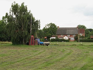
Marston is a small village and civil parish 4 miles (6.4 km) southwest of Devizes in Wiltshire, England. The parish lies south of Worton, away from main roads. Much of the boundary with Worton follows the Bulkington Brook, a tributary of the Semington Brook.

<span class="mw-page-title-main">Charlton-All-Saints</span> Human settlement in England

Charlton-All-Saints is a hamlet in the civil parish of Downton, in South Wiltshire, England. It lies immediately west of the River Avon, about 1.5 mi (2.4 km) north of Downton village and 4 mi (6 km) south-east of the city of Salisbury.
<span class="mw-page-title-main">Marston Meysey</span> Human settlement in England

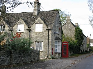
Marston Meysey, pronounced and sometimes also spelt Marston Maisey, is a village and civil parish in Wiltshire, England, lying 3 miles (5 km) northeast of Cricklade on the county boundary with Gloucestershire. The parish includes the hamlet of Marston Hill. Marston Maisey is the spelling for the civil parish, but not for the village on Ordnance Survey maps.

<span class="mw-page-title-main">Poulshot</span> Human settlement in England

Poulshot is a village and civil parish in Wiltshire, England. Its nearest town is Devizes, about 2.5 miles (4 km) to the northeast. The parish includes the hamlet of Townsend.

References

  1. "Wiltshire Community History – Census". Wiltshire Council. Retrieved 11 August 2015.
  2. "Worton". Wiltshire Community History. Wiltshire Council. Retrieved 11 August 2015.
  3. Historic England. "Manof Farmhouse (1243986)". National Heritage List for England . Retrieved 14 March 2021.
  4. Historic England. "The Grange (1272600)". National Heritage List for England. Retrieved 14 March 2021.
  5. "No. 21329". The London Gazette . 18 June 1852. p. 1711.
  6. Chettle, H. F.; Powell, W. R.; Spalding, P. A.; Tillott, P. M. (1953). "Parishes: Potterne". In Pugh, R. B.; Crittall, Elizabeth (eds.). A History of the County of Wiltshire, Volume 7. Victoria County History. University of London. pp. 207–217. Retrieved 14 March 2021 via British History Online.
  7. "Worton, Wiltshire" (Map). Google Maps . Retrieved 4 September 2016.
  8. Historic England. "Christ Church, Worton (1243969)". National Heritage List for England. Retrieved 11 August 2015.
  9. "Christ Church, Worton". Wiltshire Community History. Wiltshire Council. Retrieved 11 August 2015.
  10. Pevsner, Nikolaus; Cherry, Bridget (revision) (1975) [1963]. Wiltshire. The Buildings of England (2nd ed.). Harmondsworth: Penguin Books. p. 599. ISBN   0-14-0710-26-4.
  11. "No. 33720". The London Gazette. 29 May 1931. pp. 3469–3471.
  12. "Christ Church Worton". www.christchurchworton.org.uk. Retrieved 7 December 2018.
  13. "Marston Methodist Chapel" . Retrieved 11 August 2015.
  14. "Wesleyan Methodist Chapel, Worton". Wiltshire Community History. Wiltshire Council. Retrieved 11 August 2015.
  15. "Worton & Marston village hall" . Retrieved 11 August 2015.
  16. Historic England. "The Rose and Crown Inn, Worton (1243971)". National Heritage List for England. Retrieved 11 August 2015.
  17. "Five Lanes CE VC Primary School" . Retrieved 11 August 2015.
  18. "Worton & Marston Primary School". Wiltshire Community History. Wiltshire Council. Retrieved 11 August 2015.

Commons-logo.svg Media related to Worton, Wiltshire at Wikimedia Commons