Wyesham

Last updated

Wyesham
Justin's Hill and Wyesham from the Kymin - geograph.org.uk - 472054.jpg
View of Justin's Hill and Wyesham from the Kymin
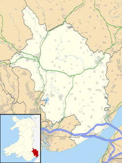
Monmouthshire UK location map.svg
Red pog.svg
Wyesham
Location within Monmouthshire
OS grid reference SO518122
Principal area
Ceremonial county
Country Wales
Sovereign state United Kingdom
Historic county
Post town MONMOUTH
Postcode district NP25
Dialling code 01600
Police Gwent
Fire South Wales
Ambulance Welsh
UK Parliament
Senedd Cymru – Welsh Parliament
List of places
UK
Wales
Monmouthshire
51°48′25″N2°42′00″W / 51.807°N 2.7°W / 51.807; -2.7 Coordinates: 51°48′25″N2°42′00″W / 51.807°N 2.7°W / 51.807; -2.7

Wyesham is a village and electoral ward in Monmouthshire, Wales. It is located less than one mile east of Monmouth, on the opposite side of the River Wye.
Contents

History and amenities

St James' Church, Wyesham St. James' church, Wyesham - geograph.org.uk - 1402517.jpg
St James' Church, Wyesham

Wyesham is effectively a suburb of Monmouth the county town. The Forest of Dean starts uphill from Wyesham and Offa's Dyke Path long distance footpath passes above the village and the Wye Valley Walk runs close by beside the river.

The Roundhouse and Royal Naval Temple which overlooks Monmouth and the Wye Valley at this point on Kymin Hill is located nearby.

Representation

Wyesham is a community electoral ward to Monmouth Town Council, electing four town councillors. [1] The ward stretches north from Wyesham village, bounded to the west and the north by the River Wye and to the east by the Gloucestershire border.

Wyesham is also an electoral division of Monmouthshire County Council, coterminous with the community ward, electing a county councillor. [2] The 2004, 2008 and 2012 elections were won by Conservative councillor Elizabeth Hackett-Pain. [3]

See also

Related Research Articles

Monmouth Town in Monmouthshire, Wales

Monmouth is both the historic county town of Monmouthshire in Wales and a community. Situated where the River Monnow joins the River Wye, 2 miles (3.2 km) from the Wales–England border. Monmouth is 30 miles (48 km) northeast of Cardiff, and 113 miles (182 km) west of London. It is within the Monmouthshire local authority, and the parliamentary constituency of Monmouth. The population in the 2011 census was 10,508, rising from 8,877 in 2001.

Chepstow Human settlement in Wales

Chepstow is a town and community in Monmouthshire, Wales, adjoining the border with Gloucestershire, England. It is located on the tidal River Wye, about 2 miles (3.2 km) above its confluence with the River Severn, and adjoining the western end of the Severn Bridge. It is the easternmost settlement in Wales, situated 16 miles (26 km) east of Newport, 28 miles (45 km) east-northeast of Cardiff, 18 miles (29 km) northwest of Bristol and 110 miles (180 km) west of London.

Monmouthshire County

Monmouthshire is a principal area with the style of 'county' in South East Wales. The name derives from the historic county of Monmouthshire of which it covers the eastern 60%. The largest town is Abergavenny. Other towns and large villages are Caldicot, Chepstow, Monmouth, Magor and Usk. It borders Torfaen, Newport and Blaenau Gwent to the west; Herefordshire and Gloucestershire to the east; and Powys to the north.

Laura Anne Jones

Laura Anne Jones is a Conservative politician who has been the Member of the Senedd (MS) for the South Wales East electoral region since July 2020, having previously held the same seat as an Assembly Member (AM) in the National Assembly for Wales between 2003 and 2007. Since 2017, Jones has also served as a county councillor for the Wyesham ward in Monmouthshire County Council.

Monmouthshire County Council

Monmouthshire County Council is the governing body for the Monmouthshire principal area – one of the unitary authorities of Wales.

Govilon Human settlement in Wales

Govilon is a small Welsh village located between Llanfoist and Gilwern near Abergavenny in north Monmouthshire. It is part of the community of Llanfoist Fawr. the population was 1,447 in 2011.

Mitchel Troy Human settlement in Wales

Mitchel Troy is a village and community in Monmouthshire, south east Wales, in the United Kingdom. It is located 3 miles south west of the county town of Monmouth, just off the A40 road leading towards Raglan. Settlements within the community include Tregare, Dingestow, Cwmcarvan and Wonastow.

Wye Valley Railway Disused railway in England and Wales

The Wye Valley Railway was a standard gauge railway that ran for nearly 15 miles (24 km) along the Lower Wye Valley between the towns of Chepstow and Monmouth, crossing several times between Wales and England. Opened on 1 November 1876, it was leased to, and worked by, the Great Western Railway (GWR), before being fully absorbed by the GWR in 1905.

Llangeinor is a small village located in the Garw Valley around 5 miles north of Bridgend in Bridgend County Borough, Wales. The ward population taken at the 2011 census was 1,243. The entire village is now protected as part of a conservation area.

Cyfarthfa Human settlement in Wales

Cyfarthfa is a community and electoral ward in the west of the town of Merthyr Tydfil in Merthyr Tydfil County Borough, Wales.

Overmonnow Place in Monmouthshire, Wales

Overmonnow is that part of the town of Monmouth, in Wales, which is located to the west of the River Monnow and the Monnow Bridge. It developed as a suburb of the town in the Middle Ages, when it was protected by a defensive ditch, the Clawdd-du or "Black Dyke", the remains of which are now protected as an ancient monument. In later centuries the area became known as "Little Monmouth" or "Cappers' Town". Development of the area has continued, particularly since the mid-twentieth century, and the area is now a ward of Monmouthshire County Council.

Monmouth Town Council

Monmouth Town Council is the town council of the traditional county town of Monmouth, south-east Wales. The Council comprises 16 members, who are elected every five years. The Mayor is the titular head of the council. The council has its offices in the Shire Hall, a Grade I listed building owned by Monmouthshire County Council.

Trellech United Community/Electoral ward in Wales

Trellech United is a community and electoral ward in the county of Monmouthshire, Wales. It lies south of the county town of Monmouth next to the Wales-England border.

Castle (Abergavenny ward) Electoral ward in Wales

Castle is an electoral ward in Abergavenny, Monmouthshire. The ward elects councillors to Abergavenny Town Council and Monmouthshire County Council.

Llanwenarth Ultra Electoral ward in Wales

Llanwenarth Ultra is an electoral ward near Abergavenny, Monmouthshire. The ward elects councillors to Llanfoist Fawr Community Council and Monmouthshire County Council.

Drybridge (Monmouth ward) Electoral ward in Wales

Drybridge is an electoral ward in the town of Monmouth, Monmouthshire, Wales. The ward elects councillors to Monmouth Town Council and Monmouthshire County Council.

Caldicot Castle (electoral ward) Electoral ward in Wales

Caldicot Castle is an electoral ward in the town of Caldicot, Monmouthshire, Wales. The ward elects councillors to Caldicot Town Council and Monmouthshire County Council.

Severn (Caldicot ward) Electoral ward in Wales

Severn is the name of an electoral ward in the town of Caldicot, Monmouthshire, Wales. The ward elects councillors to Caldicot Town Council and Monmouthshire County Council.

St Marys (Chepstow ward) Electoral ward in Wales

St Mary's is the name of an electoral ward in the town of Chepstow, Monmouthshire, Wales. The ward elects councillors to Chepstow Town Council and Monmouthshire County Council.

West End (Caldicot ward) Electoral ward in Wales

West End is an electoral ward in the town of Caldicot, Monmouthshire, Wales. The ward elects councillors to Caldicot Town Council and Monmouthshire County Council.

References

  1. Councillors, Monmouth Town Council. Retrieved 6 January 2019.
  2. The County of Monmouthshire (Electoral Changes) Order 2002. legislation.gov.uk. Statutory Instruments. 6 December 2002. Retrieved 6 January 2019.
  3. "Monmouthshire County Council Election Results 1995-2012" (PDF). The Elections Centre. Retrieved 6 January 2019.