Symonds Yat is a village in the Wye Valley and a popular tourist destination, straddling the River Wye in the English county of Herefordshire, close to the Gloucestershire border. It is within a few miles of Monmouthshire and the Welsh border.

The River Wye is the fourth-longest river in the UK, stretching some 250 kilometres from its source on Plynlimon in mid Wales to the Severn estuary. For much of its length the river forms part of the border between England and Wales. The Wye Valley is designated an Area of Outstanding Natural Beauty. The Wye is important for nature conservation and recreation, but is severely impacted by pollution.

Chepstow is a town and community in Monmouthshire, Wales, adjoining the border with Gloucestershire, England. It is located on the tidal River Wye, about 2 miles (3.2 km) above its confluence with the River Severn, and adjoining the western end of the Severn Bridge. It is the easternmost settlement in Wales, situated 16 miles (26 km) east of Newport, 28 miles (45 km) east-northeast of Cardiff, 18 miles (29 km) northwest of Bristol and 110 miles (180 km) west of London.

The A470 is a trunk road in Wales. It is the country's longest road at 186 miles (299 km) and links the capital Cardiff on the south coast to Llandudno on the north coast. There have been considerable road improvements in the last two decades. While previously one had to navigate the narrow roads of Llanidloes and Dolgellau, both these market towns are now bypassed due to extensive road modernisation. The 26 miles (42 km) from Cardiff Bay to Merthyr Tydfil are mainly direct and good quality dual carriageway, but most of the route from north of Merthyr to Llandudno is single carriageway that has seen improvement in the last 20 to 30 years.
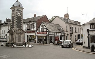
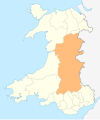
Rhayader is both a market town and a community and an electoral ward in Powys, Wales, within the historic county of Radnorshire. The town is 20 miles (32 km) from the source of the River Wye on Plynlimon, the highest point of the Cambrian Mountains, and is located at the junction of the A470 road and the A44 road 13 miles (21 km) north of Builth Wells and 30 miles (48 km) east of Aberystwyth.

The Celtic Trail is a network of dedicated cycle routes in the National Cycle Network, crossing West, South and Mid Wales, and covering 377 miles in total. It is divided into east and west sections. The west section links Pembroke and Fishguard on the west coast to Swansea, and the east section covers the area from Swansea to Chepstow, Abergavenny and Hay-on-Wye in the east. It is largely traffic free but sections along the route are still being upgraded and improved. In some places there is a choice of a low-level route, or a high-level route for mountain bikes.
Kerne Bridge is a hamlet in south Herefordshire, England, about 3.5 miles (6 km) south of the market town of Ross-on-Wye on the B4234 Ross-on-Wye to Coleford road. Situated on the left bank of the River Wye, it takes its modern name from the nineteenth century bridge over the river. It was once a significant stop on the now disused and abandoned Monmouth to Ross-on-Wye railway, and is now known for a popular canoe-launching site. It marks the northern start of the Upper Wye Gorge and is situated in the heart of the Wye Valley Area of Outstanding Natural Beauty.
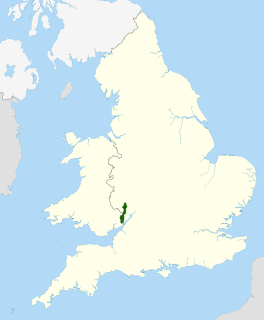
The Wye Valley Area of Outstanding Natural Beauty is an internationally important protected landscape straddling the border between England and Wales.

The A466, also known as the Wye Valley Road, is a road from Hereford, England to Chepstow, Wales via Monmouth, Tintern and the Wye Valley.

National Cycle Route 8 is a route of the National Cycle Network, running from Cardiff to Holyhead. The route passes through the heart of Wales, and is also known by its Welsh name Lôn Las Cymru. It is largely north–south from Holyhead to Cardiff or Chepstow, and in total measures some 400 km (250 mi) in length. Some of its route follows the trackbed of former railway lines, such as Lôn Las Menai, Lôn Eifion, the Mawddach Trail and the Taff Trail; in other places, the route is on public highways.

The Wye Valley Railway was a standard gauge railway that ran for nearly 15 miles (24 km) along the Lower Wye Valley between the towns of Chepstow and Monmouth, crossing several times between Wales and England. Opened on 1 November 1876, it was leased to, and worked by, the Great Western Railway (GWR), before being fully absorbed by the GWR in 1905.

The Mid-Wales Railway was conceived as a trunk route through Wales connecting industrial areas in north west England with sea ports in south west Wales. The company was prevented from reaching its goal by competing proposals in Parliament, and it was only able to build a line between Llanidloes and a junction with the Brecon and Merthyr Railway 5 miles (8 km) east of Brecon. The line was 70 miles (110 km) long and opened in 1864. The company found it impossible to raise the share subscription, but the contractor partnership of Davies and Savin agreed to build the line and take shares in payment,
The Ross and Monmouth Railway was a standard gauge railway of 13 miles (21 km) which ran between Ross-on-Wye, in Herefordshire, England and Monmouth, Wales.
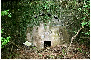
Symonds Yat railway station is a disused railway station on the Ross and Monmouth Railway constructed on the banks of the River Wye in Symonds Yat East.
The Wye Tour was an excursion past and through a series of scenic buildings, natural phenomena, and factories located along the River Wye. It was a popular destination for British travellers from 1782 to around 1850, and reached its peak popularity during the Napoleonic Wars, when travel to Continental Europe was not an option.
The Royal George Hotel is a hotel in Tintern located 5 miles (8.0 km) to the north of Chepstow, Monmouthshire, Wales. It is situated beside the A466 road, across the road from the River Wye, on the corner of an unclassified road to Devauden and Trellech. It is a Grade II listed building.