The route
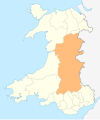
The route follows some of the course of the River Usk and runs from a start point at Caerleon, not far upstream from the rivermouth at Uskmouth, south of Newport, up the river valley, with interesting detours, to Brecon in the north.
It passes from Roman Caerleon uphill, climbing the Wentwood ridge, to descend into gentle dairy pastureland , visiting the riverside towns of Usk and Abergavenny, where it enters the Brecon Beacons National Park, follows the towpath of the Monmouthshire and Brecon Canal, bypassing Crickhowell where it climbs again providing views of the Black Mountains falling back to the canal towpath again. Just after Llangynidr it climbs again towards Talybont Reservoir with fine views of the highest part of the Brecon Beacons on the way. Passing below the reservoir the route climbs towards Talybont Forest rejoining the canal at Pencelli. The route ends at Brecon.
The route is waymarked using a symbol of an otter's head, an animal that any walker may well see on the river. A guidebook for the route is available from bookshops.
More adventurous walkers can follow further up the River Usk towards its source in the Carmarthenshire Fans below Fan Brycheiniog in the far west of the National Park.

The River Usk rises on the northern slopes of the Black Mountain, Wales, in the westernmost part of the Brecon Beacons National Park. Initially forming the boundary between Carmarthenshire and Powys, it flows north into Usk Reservoir, then east by Sennybridge to Brecon before turning southeast to flow by Talybont-on-Usk, Crickhowell and Abergavenny after which it takes a more southerly course.

The Taff Trail is a popular walking and cycle path that runs for 55 miles (89 km) between Cardiff Bay and Brecon in Wales. It is so named because it follows the course of the River Taff. Along much of its length, it follows the National Cycle Network Route 8 that continues to Holyhead, and is substantially off-road.

Pen y Fan is the highest peak in South Wales, situated in Brecon Beacons National Park. At 886 metres (2,907 ft) above sea-level, it is also the highest British peak south of Cadair Idris in Snowdonia. It is the highest point of the historic county of Brecknockshire. The twin summits of Pen y Fan and Corn Du at 873 metres (2,864 ft) were formerly referred to as Cadair Arthur or 'Arthur's Seat'.

Bwlch is a small village and an electoral ward in the community of Cwmdu and District, Powys, south Wales. The settlement is strung out along the A40 road which crosses a low col above the Usk Valley at this point on its route between Brecon and Crickhowell.

The Monarch's Way is a 625-mile (1,006 km) long-distance footpath in England that approximates the escape route taken by King Charles II in 1651 after being defeated in the Battle of Worcester. It runs from Worcester via Bristol and Yeovil to Shoreham, West Sussex.

Blorenge, also called The Blorenge, is a prominent hill overlooking the valley of the River Usk near Abergavenny, Monmouthshire, southeast Wales. It is situated in the southeastern corner of the Brecon Beacons National Park. The summit plateau reaches a height of 1,841 feet (561 m).

The Monmouthshire and Brecon Canal is a small network of canals in South Wales. For most of its currently (2018) navigable 35-mile (56 km) length it runs through the Brecon Beacons National Park, and its present rural character and tranquillity belies its original purpose as an industrial corridor for coal and iron, which were brought to the canal by a network of tramways and/or railroads, many of which were built and owned by the canal company.
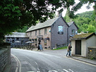
Talybont-on-Usk is a village and community in Powys, Wales, in the historic county of Brecknockshire. It lies on both the Caerfanell river and the Monmouthshire and Brecon Canal, about 1 mile (1.6 km) from the River Usk. In 2001, it had a population of 743, reducing to 719 at the 2011 census. The community includes the settlements of Llansantffraed, Scethrog, Aber Village, and Pencelli.

The Lea Valley Walk is a 50-mile (80 km) long-distance path located between Leagrave, the source of the River Lea near Luton, and the Thames, at Limehouse Basin, Limehouse, east London. From its source much of the walk is rural. At Hertford the path follows the towpath of the River Lee Navigation, and it becomes increasingly urbanised as it approaches London. The walk was opened in 1993 and is waymarked throughout using a swan logo.

The Marches Way is a partially waymarked long-distance footpath in the United Kingdom. It runs for 351 kilometres (218 mi) through the Welsh–English borderlands, traditionally known as the Welsh Marches, and links the cities of Chester in the north and Cardiff in the south.

The Beacons Way is a waymarked long distance footpath in the Brecon Beacons National Park, Wales. It is a linear route which runs for 99 miles (159 km) east to west through the National Park, and passes many of the most important landmarks and mountain peaks in the mountain range. It also includes a few of the towns in the park as well as popular attractions such as Carreg Cennen Castle near Llandeilo at the western end of the path.

Tor y Foel is a hill in the Brecon Beacons National Park in the county of Powys in Wales. It is located on the eastern flank of Talybont Reservoir, and the summit at 551m is marked by a small cairn. It gives excellent panoramic views over the valley of the River Usk, across to the Black Mountains and west to the Brecon Beacons.

Waun Lefrith is a top of Picws Du and is also the westernmost of the Carmarthen Fans, a group of peaks within the Black Mountain of the Brecon Beacons National Park. It lies within Carmarthenshire, Wales. The summit plateau of the mountain reaches a height of 2221 feet above sea level. Picws Du and Fan Foel are the other, higher summits of the Carmarthen Fans. The glacial lake of Llyn y Fan Fach dominates the panorama to the north of the peak. Beyond the lake to the north lies the Usk Reservoir and then the Cambrian Mountains on the horizon. Swansea Bay and the Bristol Channel are visible to the south across the undulating dip slope of the mountain. The Towy (Tywi) valley lies to the west, with Llandovery and Llandeilo as important market towns nearest to the hills.

Picws Du is the second highest peak of the Carmarthen Fans in the Carmarthenshire section of the Black Mountain in the west of the Brecon Beacons National Park in south Wales. The highest peak is Fan Foel immediately next along the ridge and it is a subsidiary summit of Fan Brycheiniog. Picws Du falls within Fforest Fawr Geopark and its prominent summit is marked by a large Bronze Age round barrow at a height of 2457 feet above sea level. Waun Lefrith is the other, lower summit of the Bannau Sir Gâr / Carmarthen Fans situated to the west. The peak overlooks the glacial lake of Llyn y Fan Fach in the cwm below. As the peak sits on the edge of the escarpment on a ridge which juts out into the valley below, the views from the summit are panoramic and extensive. The views to the north are especially impressive when the weather is clear, looking towards the Cambrian Mountains, Mynydd Epynt and Brecon. Swansea and the Bristol Channel can just be seen on the horizon to the south, across the gently falling dip slope. Pen y Fan and Corn Du are distinctive landmarks seen directly to the east across Fforest Fawr.

Aber Village or Aber Clydach is a hamlet within the Brecon Beacons National Park in Powys, Wales. It is centred on the minor road which runs south from Talybont-on-Usk up the Caerfanell valley known as Glyn Collwn across the Brecon Beacons to Pontsticill and Merthyr Tydfil. Aber Clydach lies within the community of Talybont-on-Usk about 1.5 km to the south of the village of Talybont and 0.5 km to the north of the dam of Talybont Reservoir.

Torpantau railway station is a station in the Welsh county of Brecknockshire, and the northern terminus of the narrow gauge Brecon Mountain Railway.

Glyn Tarell is a valley and a community in the county of Powys, Wales, and the historic county of Brecknockshire. It is in the Brecon Beacons National Park and at the northern edge of the Brecon Beacons mountains.

The Monmouthshire Way is a circular long-distance footpath of 116 miles that explores the historic county of Monmouth. Short sections of the route trespass into the neighbouring counties of Gloucester, Hereford and Brecon. It was designed by the South Wales Long Distance Walkers Association and is currently not waymarked.