The A44 is a major road in the United Kingdom that runs from Oxford in southern England to Aberystwyth in west Wales.

The River Teme rises in Mid Wales, south of Newtown, and flows southeast roughly forming the border between England and Wales for several miles through Knighton before entering England in the vicinity of Bucknell and continuing east to Ludlow in Shropshire. From there, it flows to the north of Tenbury Wells on the Shropshire/Worcestershire border on its way to join the River Severn south of Worcester. The whole of the River Teme was designated as an SSSI by English Nature in 1996.

The A49 is an A road in western England, which traverses the Welsh Marches region. It runs north from Ross-on-Wye in Herefordshire via Hereford, Leominster, Ludlow, Shrewsbury and Whitchurch, then continues through central Cheshire to Warrington and Wigan before terminating at its junction with the A6 road just south of Bamber Bridge, near the junction of the M6, M65 and M61 motorways.
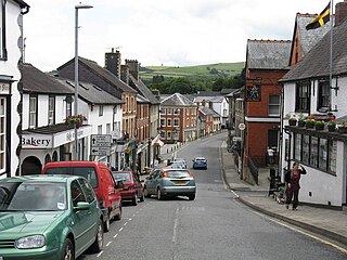
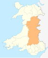
Knighton is a market town and community on the River Teme, straddling the border between Powys, Wales and Shropshire, England. It lies in the traditional county of Radnorshire. Originally an Anglo-Saxon settlement, Knighton is located on Offa's Dyke, the ancient earthwork that divided the two countries. It later became a Norman defensive border town.

The River Clun runs mostly through Shropshire, England and joins the River Teme at Leintwardine, Herefordshire. The Clun Valley is part of the Shropshire Hills AONB.

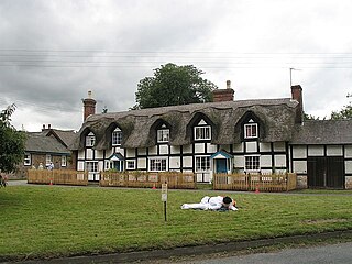
Clungunford is a village and civil parish in south Shropshire, England, located near the border with Herefordshire.

The Shropshire Hills is a designated Area of Outstanding Natural Beauty (AONB) in Shropshire, England. It is located in the south of the county, extending to its border with Wales. Designated in 1958, the area encompasses 802 square kilometres (310 sq mi) of land primarily in south-west Shropshire, taking its name from the upland region of the Shropshire Hills. The A49 road and Welsh Marches Railway Line bisect the area north–south, passing through or near Shrewsbury, Church Stretton, Craven Arms and Ludlow.

Leintwardine is a small to mid-size village and civil parish in north Herefordshire, England, close to the border with Shropshire.

Known as the Hagley Road in Birmingham, the A456 is a main road in England running between Central Birmingham and Woofferton, Shropshire, south of Ludlow. Some sections of the route, for example Edgbaston near Bearwood, are also the route of the Elan Aqueduct which carries Birmingham's water supply from the Elan Valley.

The A4117 is a single-carriageway 'A road' in western England, largely in Shropshire, which passes through part of the Wyre Forest and Clee Hills.

The Shropshire Hills are a dissected upland area and one of the natural regions of England. They lie wholly within the county of Shropshire and encompass several distinctive and well-known landmarks, such as the Long Mynd, Wenlock Edge, The Wrekin and the Clees.
Ashford Bowdler is a small village and civil parish in south Shropshire, England, near the county border with Herefordshire.

Bromfield is a village and civil parish in Shropshire, England.

Buckton and Coxall is a civil parish in north Herefordshire, England.
Walford, Letton and Newton is a civil parish in north Herefordshire, England, and approximately 20 miles (30 km) north-northwest from the city and county town of Hereford, and 2 miles (3 km) east from the border with Wales.
Ludford is a small village and civil parish in south Shropshire, England. The parish is situated adjacent to the market town of Ludlow and was, until 1895, partly in Herefordshire.
Brampton Bryan is a small village and civil parish situated in north Herefordshire, England close to the Shropshire and Welsh borders.
Heartsease is a small settlement or hamlet in Powys, Wales. It is close to the border with England and lies near the junction of the two counties of Herefordshire and Shropshire.
National Cycle Network Route 44, part of the National Cycle Network, connects Shrewsbury, Shropshire with Cinderford, Gloucestershire. The part of the route from Shrewsbury to Bromfield is signed - the remainder of the route is currently unsigned.

Broadward is a dispersed hamlet in south Shropshire, England, situated by the border with Herefordshire. It is in the civil parish of Clungunford, a village approximately 2 miles (3.2 km) to the north.