The M1 motorway connects London to Leeds, where it joins the A1(M) near Aberford, to connect to Newcastle. It was the first inter-urban motorway to be completed in the UK; the first motorway in the country was the Preston Bypass, which later became part of the M6.

The A41 is a trunk road between London and Birkenhead, England. Now in parts replaced by motorways, it passes through or near Watford, Kings Langley, Hemel Hempstead, Aylesbury, Bicester, Solihull, Birmingham, West Bromwich, Wolverhampton, Newport, Whitchurch, Chester and Ellesmere Port.

The M40 motorway links London, Oxford, and Birmingham in England, a distance of approximately 89 miles (143 km).

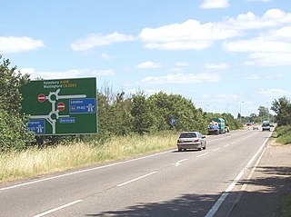
The A5, the London-Holyhead trunk road, is a major road in England and Wales. It runs for about 243 miles (391 km) from London to the Irish Sea at the ferry port of Holyhead. In many parts the route follows that of the Roman Iter II route which later took the Anglo-Saxon name Watling Street.

The A6 is one of the main north–south roads in England. It runs from Luton in Bedfordshire to Carlisle in Cumbria, although it formerly started at a junction with the A1 at Barnet. It is the fourth longest numbered road in Britain; only the A1, A38 and A30 are longer.

The A38, parts of which are known as Devon Expressway, Bristol Road and Gloucester Road, is a major A-class trunk road in England.

Stoke Hammond is a village and also a civil parish situated in the north of the unitary authority area of Buckinghamshire, England, about two and a half miles south of Fenny Stratford.
The A45 is a major road in England. It runs east from Birmingham past the National Exhibition Centre and the M42, then bypasses Coventry and Rugby, where it briefly merges with the M45 until it continues to Daventry. It then heads to Northampton and Wellingborough before running north of Rushden and Higham Ferrers and terminating at its junction with the A14 in Thrapston.

The A52 is a major road in the East Midlands, England. It runs east from a junction with the A53 at Newcastle-under-Lyme near Stoke-on-Trent via Ashbourne, Derby, Stapleford, Nottingham, West Bridgford, Bingham, Grantham, Boston and Skegness to the east Lincolnshire coast at Mablethorpe. It is approximately 147 miles (237 km) long.

The A1081 is a road in the south of England. It starts at Luton Airport in Bedfordshire and runs to High Barnet in Greater London via Harpenden, St Albans and London Colney, a distance of around 20.5 miles (33.0 km). For most of its length, the A1081 follows the route of the original A6.

Leighton Buzzard railway station serves the towns of Leighton Buzzard and Linslade in the county of Bedfordshire and nearby areas of Buckinghamshire. Actually situated in Linslade, the station is 40 miles (64 km) north west of London Euston and is served by London Northwestern Railway services on the West Coast Main Line. Until the 1960s the station was the start of a branch to Dunstable and Luton, with a junction just north of the present station. The station has four platforms. Platforms 1 & 2 serve the fast lines and are used by Avanti West Coast services running non-stop to/from London Euston. Platforms 3 & 4 are served by slower London Northwestern railway services to/from London Euston.

The A43 is a primary route in the English Midlands and northern South East England, that runs from the M40 motorway near Ardley in Oxfordshire to Stamford in Lincolnshire. Through Northamptonshire it bypasses the towns of Northampton, Kettering and Corby which are the three principal destinations on the A43 route. The A43 also links to the M1 motorway.
The A428 road is a major road in central and eastern England. It runs between the cities of Coventry and Cambridge by way of the county towns of Northampton and Bedford. Together with the A421,, the eastern section of the A428 forms the route between Cambridge and Oxford. The A428 was formerly part of the main route from Birmingham to Felixstowe before the A14 was fully opened in 1993.

The A421 is an important road for east/west journeys across south central England. Together with the A428, the A43 and A34, it forms the route from Cambridge through Milton Keynes to Oxford. The section between the A1 and the A5 is a national primary route.
The A509 is a short A-class road for north–south journeys in south central England, forming the route from Kettering in Northamptonshire to the A5 in Milton Keynes, via M1 J14.

The A422 is an "A" road for east–west journeys in south central England, connecting the county towns of Bedford and Worcester by way of Milton Keynes, Buckingham, Banbury and Stratford-upon-Avon. For most of its length, it is a narrow single carriageway.
The A418 road is a main trunk road in Buckinghamshire and Oxfordshire, England. It begins at a roundabout with the A4146 just north of Ascott, near Leighton Buzzard. It then runs south as a single carriageway through Wing to Aylesbury. This stretch is proposed for a dual carriageway bypass. After diving through Aylesbury the road runs past Aylesbury College before heading out into Stone. From there it runs past Haddenham to the M40 near Thame. The road has been rerouted in two locations so that it no longer runs through Hulcott and Haddenham.

The A505 is a road in the East of England. It follows part of the route of the Icknield Way and the corresponding Icknield Way Path and runs from Leighton Buzzard in Bedfordshire to the A11 Abington Interchange North in Cambridgeshire.

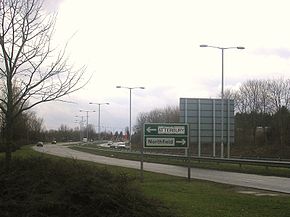
The Milton Keynes grid road system is a network of predominantly national speed limit, fully landscaped routes that form the top layer of the street hierarchy for both private and public transport in Milton Keynes, Buckinghamshire. The system is unique in the United Kingdom for its innovative use of street hierarchy principles: the grid roads run in between districts rather than through them. This arrangement permits higher speed limits due to the absence of buildings close to the roads – although more recently some have been limited in part to 40 mph (64 km/h). The grid road system also serves an important purpose of discouraging through-traffic from travelling through neighborhoods and thus reduces traffic noise and pollution in pedestrian areas. Motor traffic is segregated from pedestrian and leisure cycling traffic, which uses the alternative Milton Keynes redway system. Almost all grid junctions are roundabouts, and the absence of traffic lights enables free and efficient movement of traffic.

Transport in Buckinghamshire has been shaped by its position within the United Kingdom. Most routes between the UK's two largest cities, London and Birmingham, pass through this county. The county's growing industry first brought canals to the area, then railways and then motorways.