
The M40 motorway links London, Oxford, and Birmingham in England, a distance of approximately 89 miles (143 km).

Harrow is a large town in Greater London, England, and serves as the principal settlement of the London Borough of Harrow. Lying about 9.5 miles (15.3 km) north-west of Charing Cross and 5.4 miles (8.7 km) south of Watford, the entire town including its localities had a population of 149,246 at the 2011 census, whereas the wider borough had a population of 250,149.
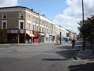
West Harrow is a locality directly to the west/southwest of Harrow town in the London Borough of Harrow, in the county of Greater London and historically in the county of Middlesex.
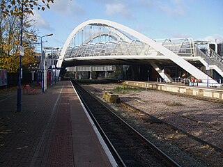
Wembley Stadium railway station is a Network Rail station in Wembley, Greater London, on the Chiltern Main Line. It is the nearest station to Wembley Stadium, and is located a quarter of a mile south west of the sports venue.

Northolt Park railway station is a National Rail station in Northolt, Greater London. It is in Cadogan Close and spans the boundary between the London Borough of Harrow and the London Borough of Ealing, with a footbridge connecting the north side to the south side. South Harrow Tube Station on the Piccadilly line is 0.7 miles (1.1 km) by foot from Northolt Park Station. Northolt Underground station on the Central line is less than 1 mile (1.6 km) away and is accessible by the 140 and SL9 buses from Northolt Road.

The A308(M) is a motorway in Berkshire, England. It is 0.6 miles (0.97 km) long. It forms part of the Maidenhead bypass and runs from the M4 at junction 8/9 to the A308 south of Maidenhead town centre. The A308(M) is one of Britain's shortest motorways, and is generally considered to be the second shortest, after the A635(M) on the Mancunian Way.

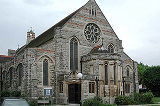
Harrow on the Hill is a locality and historic village in the borough of Harrow in Greater London, England. The name refers to Harrow Hill, 408 feet (124 m), and is located some half a mile south of the modern town of Harrow. The village dates back to early medieval times, built around the 11th-century St Mary's Church, and is the location of Harrow, St Dominic's and John Lyon schools.
Kenton Road is a main road in the London Borough of Harrow and the London Borough of Brent. It lies in the areas of Harrow and Kenton.
South Harrow is the southern part of the town of Harrow, located south-west of Harrow-on-the-Hill in the London Borough of Harrow. Its development originally spread south and west from the hamlet of Roxeth in the urbanisation process and easier access from Central London by rail. Six roads now converge at Roxeth hamlet centre at the bottom of Roxeth Hill. Its areas include, in the west, the area of Shaftesbury Circus/Avenue and in the south a shopping area, South Harrow tube station and the high street, Northolt Road.

The A219, is a road in West London, England, which connects the A404 Harrow Road in Harlesden to the A24 in South Wimbledon. Running from North to South, it starts near Willesden Junction station, crosses the Grand Union Canal and runs through Shepherd's Bush, Hammersmith and Fulham, crossing the River Thames at Putney Bridge. It continues through Putney and passes Wimbledon Common, and goes through Wimbledon to terminate just after South Wimbledon Underground station at the A24.

Sudbury is a suburb in the London Borough of Brent, located in northwest London, United Kingdom. The suburb forms the western part of Wembley and is centred around 0.6 miles (1 km) west of Wembley Central railway station.
Roxeth was a hamlet in the ancient Harrow on the Hill parish, which now forms part of the London Borough of Harrow in Greater London, England.

The Harrow Road is an ancient route in North West London which runs from Paddington in a northwesterly direction towards Harrow. It is also the name given to the immediate surrounding area of Queens Park and Kensal Green, straddling the NW10, W10, W2 and W9 postcodes. With minor deviations in the 19th and 20th centuries, the route remains otherwise unaltered.
The A404 is a road in the United Kingdom that starts at Paddington in London and terminates near Maidenhead in Berkshire. It is 44.6 miles (71.8 km) long.

The A404 autoroute is a motorway in France. The road connects A40 with Oyonnax and was completed in November 1997.

The Magic Roundabout in High Wycombe, Buckinghamshire, England, is similar to the roundabouts with the same name in Hemel Hempstead and other places. It is located on the junction of the A40 and A404 roads. The junction is the second meeting point of the two roads; they interchange at the start of the A404 in Marylebone, London, with the A40 forming the Westway. The two roads follow different routes to reach Wycombe, the A40 coming via Beaconsfield and the A404 via North London and Amersham. From the roundabout, the A40 continues towards Oxford, Cheltenham, Gloucester and South Wales, whilst the A404 goes south to Marlow and Maidenhead.

Handy Cross roundabout is a major road interchange at Handy Cross, High Wycombe, Buckinghamshire; the junction for High Wycombe, the M40 motorway and the A404 dual-carriageway. It is the terminus of the A4010 which runs to Aylesbury.
Sudbury Hill is an area of the London Borough of Harrow in northwest London, England. It forms part of the HA1 postcode and Harrow post town.
Pinner Green is a small area of Pinner, in the north-west of the London Borough of Harrow, 13.2 miles north-west of Charing Cross. It is a suburban area mostly occupied by family houses and flats, with a small parade of independent shops, a Tesco supermarket and a modern Shell forecourt.

