St Albans is a cathedral city in Hertfordshire, England, east of Hemel Hempstead and west of Hatfield, 20 miles (32 km) north-west of London, 8 miles (13 km) south-west of Welwyn Garden City and 11 miles (18 km) south-east of Luton. St Albans was the first major town on the old Roman road of Watling Street for travellers heading north and became the city of Verulamium. It is within the London commuter belt and the Greater London Built-up Area.

The M1 motorway connects London to Leeds, where it joins the A1(M) near Aberford, to connect to Newcastle. It was the first inter-urban motorway to be completed in the UK; the first motorway in the country was the Preston Bypass, which later became part of the M6.

The A41 is a trunk road between London and Birkenhead, England. Now in parts replaced by motorways, it passes through or near Watford, Kings Langley, Hemel Hempstead, Aylesbury, Bicester, Solihull, Birmingham, West Bromwich, Wolverhampton, Newport, Whitchurch, Chester and Ellesmere Port.
The A1, also known as the Great North Road, is the longest numbered road in the United Kingdom, at 410 miles (660 km). It connects London, the capital of England, with Edinburgh, the capital of Scotland. The numbering system for A-roads, devised in the early 1920s, was based around patterns of roads radiating from two hubs at London and Edinburgh. The first number in the system, A1, was given to the most important part of that system: the road from London to Edinburgh, joining the two central points of the system and linking the UK's (then) two mainland capital cities. It passes through or near north London, Hatfield, Welwyn Garden City, Stevenage, Baldock, Letchworth Garden City, Biggleswade, Eaton Socon, Buckden, Peterborough, Stamford, Grantham, Newark-on-Trent, Retford, Doncaster, Pontefract, York, Wetherby, Ripon, Darlington, Durham, Gateshead, Newcastle upon Tyne, Morpeth, Alnwick and Berwick-upon-Tweed.

The M40 motorway links London, Oxford, and Birmingham in England, a distance of approximately 89 miles (143 km).

The M180 is a 25.5-mile-long (41 km) motorway in eastern England, starting at junction 5 on the M18 motorway in Hatfield, within the Metropolitan Borough of Doncaster, South Yorkshire, and terminating at Barnetby, Lincolnshire, some 10 miles (16 km) from the port of Immingham and 14 miles (23 km) from the port of Grimsby. The A180 road continues to the east for Grimsby, Cleethorpes and Immingham. Scunthorpe, Lincoln, Hull, Brigg, Bawtry and the Isle of Axholme can be accessed using the motorway. Humberside Airport, the now-closed Doncaster Sheffield Airport, and the Killingholme, Humber and Lindsey oil refineries are close to the motorway. The road forms part of the unsigned Euroroute E22 and is the main route along the south bank of the Humber Estuary.

St Albans, also known as the City and District of St Albans, is a local government district with city status in Hertfordshire, England. Its council is based in St Albans, the largest settlement in the district. The district also includes the town of Harpenden and several villages. The district borders North Hertfordshire, Welwyn Hatfield, Hertsmere, Watford, Three Rivers, Dacorum, and Central Bedfordshire.

London Colney is a village and civil parish in Hertfordshire, England. It is located to the north of London, close to Junction 22 of the M25 motorway.

The A414 is a major road in England, which connects the towns of Hemel Hempstead in Hertfordshire and Maldon in Essex. The road commences at the A41, at a junction west of Hemel, and travels through the town to junction 8 of the M1 motorway at Buncefield. From there, it runs parallel to the M1 until junction 7, heading south of St Albans and east through Hatfield and Hertford. The road then crosses the A10 and into Essex; it travels through Harlow, Chipping Ongar and Chelmsford, before terminating at Maldon.

The M10 was a motorway in Hertfordshire, England, running for approximately 3 miles (4.5 km) southeast from the M1 motorway at junction 7 near Hemel Hempstead to the A414 North Orbital Road at Park Street Roundabout, just south of St Albans. Opened in 1959, it was reclassified as part of the A414 in 2009 having only been a spur motorway for about 50 years.

The A1081 is a road in the south of England. It starts at Luton Airport in Bedfordshire and runs to High Barnet in Greater London via Harpenden, St Albans and London Colney, a distance of around 20.5 miles (33.0 km). For most of its length, the A1081 follows the route of the original A6.
St Stephen is a civil parish in the St Albans City and District in Hertfordshire, England. It is located approximately 17 miles (27 km) north-northwest of central London, straddling the M25 motorway and immediately adjacent to the southern boundary of St Albans. St Stephen is a partly urbanised parish with multiple centres of activity and open land that forms part of the Metropolitan Green Belt. The local council is St Stephen Parish Council. The parish covers Bricket Wood, Chiswell Green, Frogmore, Colney Street, How Wood and Park Street. It is an ancient parish, and sections of it were transferred to St Albans progressively up to 1935. At the 2011 census it had a population of 13,865.

The A18 is a road in England that links Doncaster in South Yorkshire with Ludborough in Lincolnshire, via Scunthorpe and Grimsby. Much of its route has been superseded by the M180 motorway.

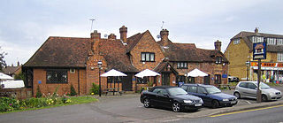
Park Street is a small village in Hertfordshire, England. It is on the southern outskirts of St Albans, around 2 miles (3.2 km) south of the city centre, and is separated from the rest of the city's contiguous built-up area by a buffer to the north.

The A525 is a major route from Rhyl in Wales to Newcastle-under-Lyme in England. The route passes near Denbigh, through Ruthin, through Wrexham and near Whitchurch.
Chiswell Green is a village, on the southern outskirts of St Albans, in the parish of St Stephen and district of the City of St Albans in Hertfordshire. It has a population of approximately 2,800.

The A4008 is a local road in south east England.

Napsbury Park is a residential development in Hertfordshire, England. It is located to the north of London, at Junction 22 of the M25 motorway and Junction 6 of the M1 motorway. It is protected by a Conservation Area.
Leavesden is a residential and commercial area in the northern part of Watford, England. It lies within the M25 Motorway. On its eastern side it is bounded by the M1 Motorway. Leavesden is split into two councils which are Watford Borough Council and Three Rivers District Council. Leavesden Green is an adjoining residential community which lies partly in Three Rivers and partly in the Borough of Watford.
National Cycle Route 61 is part of the National Cycle Network managed by the charity Sustrans. It runs for 34 miles from Maidenhead (Berkshire) to Rye House (Hertfordshire) via Uxbridge, Watford, St Albans, Hatfield, Welwyn Garden City and Hertford in the United Kingdom.