The River Usk rises on the northern slopes of the Black Mountain, Wales, in the westernmost part of the Brecon Beacons National Park. Initially forming the boundary between Carmarthenshire and Powys, it flows north into Usk Reservoir, then east by Sennybridge to Brecon before turning southeast to flow by Talybont-on-Usk, Crickhowell and Abergavenny after which it takes a more southerly course.

The M4, originally the London-South Wales Motorway, is a motorway in the United Kingdom running from west London to southwest Wales. The English section to the Severn Bridge was constructed between 1961 and 1971; the Welsh element was largely complete by 1980, though a non-motorway section around Briton Ferry bridge remained until 1993. On the opening of the Second Severn Crossing in 1996, the M4 was rerouted over it.

The A40 is a trunk road which runs between London and Goodwick (Fishguard), Wales, and officially called The London to Fishguard Trunk Road (A40) in all legal documents and Acts. Much of its length within England has been superseded by motorways, such as the M40, and has lost its trunk road status, though it retains it west of Gloucester, including its length within Wales. It is approximately 260 miles (420 km) long. The eastern section from Denham, Buckinghamshire to Wheatley, Oxfordshire is better served by the M40 and its former function of linking London with Cheltenham and Gloucester has been taken by the M4, A419 and A417 via Swindon.

The A48 is a trunk road in Great Britain running from the A40 at Highnam, 3 miles (4.8 km) west of Gloucester, England, to the A40 at Carmarthen, Wales. Before the Severn Bridge opened on 8 September 1966, it was a major route between England and South Wales. For most of its route, it runs almost parallel to the M4 motorway. During times of high winds at the Severn Bridge, the A48 is used as part of the diversion route and is still marked as a Holiday Route.

The A465 is a trunk road that runs from Bromyard in Herefordshire, England to Llandarcy near Swansea in South Wales. The western half is known officially as the Neath to Abergavenny Trunk Road, but the section from Abergavenny to the Vale of Neath is more commonly referred to as the Heads of the Valleys Road because it links the northern heads of the South Wales Valleys. Approximately following the southern boundary of the Brecon Beacons National Park, the Ordnance Survey Pathfinder guide describes it as the unofficial border between rural and industrial South Wales. The A465 provides an alternative route between England and the counties in South West Wales and to the ferries to Ireland.

The A449 is a major road in the United Kingdom. It runs north from junction 24 of the A48 road at Newport in South Wales to Stafford in Staffordshire.

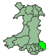
New Inn - - is a village and community directly south east of Pontypool, within the County Borough of Torfaen in Wales, within the historic boundaries of Monmouthshire. It had a population of 5,986 at the 2011 Census.

Pontypool and New Inn railway station is situated to the south east of Pontypool town centre between the town and the suburb of New Inn, Wales. The station was formerly called Pontypool Road until renamed just Pontypool in 1972 and then to the present name in 1994.
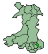
Little Mill is a village in Monmouthshire, south east Wales, United Kingdom, in the community and ward of Goetre Fawr. It has a population of about 600.

The M4 motorway Usk bridge, officially St. Julians Bridge, carries the M4 motorway across the River Usk in the city of Newport, Wales.

Crindau is a Victorian inner-city area just north of the city centre in Newport in south-east Wales. It lies within the Shaftesbury electoral district (ward) and community (parish).

The A4232, which is also known either as the Peripheral Distributor Road (PDR) (Welsh: Ffordd Ddosbarthu Ymylol) or the Cardiff Link Road (Welsh: Ffordd Gyswllt Caerdydd), is a distributor road in Cardiff, the capital of Wales.
The Pontypool, Caerleon & Newport Railway was promoted independently to relieve congestion on the heavily worked Eastern Valley Line of the Monmouthshire Railway and Canal Company. The Great Western Railway put up half the capital, making it in effect a GWR subsidiary. It opened in 1874, and most long-distance passenger and goods traffic, especially the heavy mineral traffic, transferred to it. It amalgamated with the GWR in 1876.

The A4060, also known as the East of Abercynon to East of Dowlais Trunk Road, is a trunk road in Wales.
Newport Mill Street railway station was one of four stations in central Newport, Wales.
The Newport, Abergavenny and Hereford Railway was a railway company formed to connect the places in its name. When it sought Parliamentary authorisation, it was denied the southern section, and obliged to use the Monmouthshire Railway between Pontypool and Newport.

The Coleford, Monmouth, Usk & Pontypool Railway (CMU&PR) was a standard gauge railway of 16 miles (26 km) which ran from Monmouth to Little Mill, near Pontypool in Monmouthshire, Wales. It was intended to convey the mineral products of the Forest of Dean to the ironworks of South Wales, by connecting to the Newport, Abergavenny and Hereford Railway at Little Mill Junction. The NAHR made the onward connection over its Taff Vale Extension line. The CMU&PR intended to acquire the Monmouth Railway, actually a horse-operated plateway, and convert it to locomotive operation.
Usk (GWR) railway station is a disused railway station in the town of Usk, Monmouthshire, Wales. The station is now barely recognisable with the remains of the platforms beneath undergrowth, but the trackbed, the adjacent Usk Tunnel and road and river bridges remain extant and can be walked.

Little Mill Junction was a station on the former Coleford, Monmouth, Usk and Pontypool Railway, located between the main Newport, Abergavenny and Hereford Railway line and the branch to Usk. It served the village of Little Mill, Monmouthshire.