A4148 | ||||
---|---|---|---|---|
Walsall Ring Road | ||||
Route information | ||||
Length | 5.3 mi [1] (8.5 km) | |||
Major junctions | ||||
Orbital around Walsall, West Midlands | ||||
Location | ||||
Country | United Kingdom | |||
Road network | ||||
|
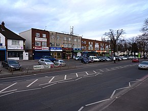
The A4148 is an A-class road in the town of Walsall, West Midlands, England. It serves as the town's ring road, as it encircles the town centre, and no road inside it has a number. Major junctions occur where it meets the A34, A454 and A461.
Rather than a purpose-built ring road, such as the nearby A4150 Wolverhampton Inner Ring Road, the A4148 consists of existing streets marked as a ring road. Since 2006, Walsall Council has implemented a number of roadwork projects in an attempt to improve traffic flow. [2] This included eliminating the large roundabout near the Arboretum which was replaced by traffic lights.
The A34 is a major road in England. It runs from the A33 and M3 at Winchester in Hampshire, to the A6 and A6042 in Salford, close to Manchester City Centre. It forms a large part of the major trunk route from Southampton, via Oxford, to Birmingham, The Potteries and Manchester. For most of its length, it forms part of the former Winchester–Preston Trunk Road. Improvements to the section of road forming the Newbury Bypass around Newbury were the scene of significant direct action environmental protests in the 1990s. It is 151 miles (243 km) long.
The M57 motorway, also known as the Liverpool Outer Ring Road, is a motorway in England. Designed as a ring road for Liverpool, it is 10 miles (16 km) long between Tarbock Green and Switch lsland, and links various towns east of the city, as well as the M62 and M58 motorways.
Wednesfield is a town and historic village in the City of Wolverhampton, West Midlands, England, It is 2 miles (3.2 km) east-northeast of Wolverhampton city centre and about 10 miles (16 km) from Birmingham and is part of the West Midlands conurbation. It was historically within the county of Staffordshire.
The A426 road is a road in England which runs from the city of Leicester to the market town of Southam in Warwickshire via the towns of Lutterworth and Rugby.
Leamore is a suburb of Walsall in the extreme north of the town on the border with Bloxwich. It is a mix of private and council housing built since the late 19th century. The most significant homes in the area are several multi-storey blocks of council flats, which were built in the 1960s.
Moxley is a suburb of Darlaston in the Metropolitan Borough of Walsall, West Midlands County, England. It was first developed during the early part of the 19th century when a handful of terraced houses were built to accommodate locals working in factories and mines and the area was created in 1845 out of land from Darlaston, Bilston and Wednesbury.
Walsall railway station is the principal railway station of Walsall, West Midlands, England and situated in the heart of the town. It is operated by West Midlands Trains, with services provided by West Midlands Railway and from 2019, London Northwestern Railway operate a service from Rugeley to London Euston that calls at the station. The main entrance is situated inside the Saddlers Shopping Centre.
Known as the Hagley Road in Birmingham, the A456 is a main road in England running between Central Birmingham and Woofferton, Shropshire, south of Ludlow. Some sections of the route, for example Edgbaston near Bearwood, are also the route of the Elan Aqueduct which carries Birmingham's water supply from the Elan Valley.
The A454 is a major road in central England. It runs 28.9 miles (46.5 km) from Bridgnorth to Sutton Coldfield and is an important primary route linking Wolverhampton and Walsall with the M6 motorway.
The A563 is the designation for the ring road of Leicester, England. It forms a near-complete circuit except for a gap of around 2.2 miles (3.5 km) in the east of the city. An indirect route linking the gap involves the (A47) A6030, and A6. The A563 was formerly referred to as the Outer Ring.
Queensway is the name of a number of roads in central Birmingham, especially those that formed the A4400 Inner Ring Road. The name most often refers to the Great Charles Street Queensway tunnel, part of the A38.
Bentley is an area in the Metropolitan Borough of Walsall located around Junction 10 of the M6 Motorway. It is also a rural village of houses towards its eastern sides. It shares borders with the areas of Willenhall, Beechdale, Ashmore Park, Pleck, Darlaston and Alumwell.
Coal Pool is a housing estate in Walsall, West Midlands, England. Most of the homes in area were built by the local council during the 1930s, with a smaller development taking place in the late 1940s which marked the resumption of council house building in the borough after World War II.
The R136 road is a regional road in Ireland, located in the southwest of Dublin. Named the Outer Ring Road, the route, which is dual carriageway, runs from the N4 at Lucan to the N81 at Tallaght, bypassing west of Clondalkin and crossing the N7 near Citywest. It was built as part of the planning for the new town of Adamstown.
Palfrey is a neighbourhood in the Metropolitan Borough of Walsall, in the West Midlands. It covers 3.68 sq km, which accounts for 3.5% of the area of the Walsall borough.
Highgate is a small village located within the Walsall Ring Road. The village was constructed in the Victorian era for the wealthy, and has developed a reputation as one of the most expensive neighbourhoods in Walsall for house prices.
The A491 is an A road in Zone 4 of the Great Britain numbering scheme.
Newtown, also referred to as Aston New Town, is an inner city area of Birmingham, England, just to the north of the city centre.
The A448 is a main road in England running between Studley in Warwickshire and Kidderminster in Worcestershire.
Walsall Leather Museum is located in Walsall, in the West Midlands in England, and was opened in 1988, in a Victorian factory building renovated by Walsall Council. It tells the story of the leather trade in Walsall, charting the town's rise from a small market town into an international saddle-making centre.
Coordinates: 52°35′19″N1°58′57″W / 52.5885°N 1.9826°W