
The M42 motorway runs north east from Bromsgrove in Worcestershire to just south west of Ashby-de-la-Zouch in Leicestershire, passing Redditch, Solihull, the National Exhibition Centre (NEC) and Tamworth on the way, serving the east of the Birmingham metropolitan area. The section between the M40 and junction 4 of the M6 forms – though unsigned as such – a part of Euroroute E05. Northwards beyond junction 11, the route is continued as the A42; the junctions on this section, 12–14, are numbered like a continuation of the motorway, but the road has non-motorway status from here.

The M69 is a 15.7-mile (25.3 km) dual three lane dual carriageway motorway in Leicestershire and Warwickshire, England. It runs between junction 21 of the M1 near Leicester and junction 2 of the M6 near Coventry. It opened in 1977.

Watford Gap is a low-lying area between two hills, close to the village of Watford, Northamptonshire, England. Engineers from Roman times onwards have found it to be an ideal route for connecting the Midlands with South East England. The A5 road, the West Coast Main Line railway, the M1 motorway and a branch of the Grand Union Canal traverse in parallel a space about 400 metres (1,300 ft) wide. It has been written and spoken of as marking the divide between Northern England and Southern England.
The A15 is a major road in England. It runs north from Peterborough via Market Deeping, Bourne, Sleaford and Lincoln along a variety of ancient, Roman, and Turnpike alignments before it is interrupted at its junction with the M180 near Scawby. The road restarts 10 miles (16 km) east, and then continues north past Barton-upon-Humber, crossing the Humber on the Humber Bridge before terminating at Hessle near Kingston upon Hull.

The A55, also known as the North Wales Expressway, is a major road in Wales and England, connecting Cheshire and North Wales. The vast majority of its length from Chester to Holyhead is a dual carriageway primary route, with the exception of the Britannia Bridge over the Menai Strait and several short sections where there are gaps in between the two carriageways. All junctions are grade separated apart from a roundabout east of Penmaenmawr and another nearby in Llanfairfechan. Initially, the road ran from Chester to Bangor. In 2001, it was extended across Anglesey to the ferry port of Holyhead parallel to the A5. The road improvements have been part funded with European money, under the Trans-European Networks programme, as the route is designated part of Euroroute E22.

The R148 road is one of Ireland's regional roads which was classified following the opening of a by-passed national primary road.

The A449 is a major road in the United Kingdom. It runs north from junction 24 of the A48 road at Newport in South Wales to Stafford in Staffordshire.

The A4117 is a single-carriageway 'A road' in western England, largely in Shropshire, which passes through part of the Wyre Forest and Clee Hills.

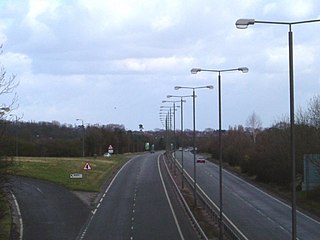
The M54 is a 23-mile (37 km) east-west motorway in the counties of Shropshire and Staffordshire, England. It is also referred to as the Telford motorway, after the road's primary westbound destination, the town of Telford. It cost £65 million to construct, and is two-lane dual carriageway for the majority of its length, with sections of three-lane.

The A475 road in Wales links Newcastle Emlyn in Carmarthenshire with Lampeter in Ceredigion; a distance of 19 miles (31 km).
The A516 road is a road in Derbyshire that runs from the A50 Junction 5, to the A601 in Derby. The road is used mostly for traffic flowing from the A50 to the A38.

Bronwydd is a village and community in the county of Carmarthenshire, Wales, situated about three miles north of Carmarthen in the valley of the River Gwili. Bronwydd community comprises the village of Bronwydd Arms, a couple of nearby hamlets and a number of working farms in the surrounding area. In Census 2011, it had a population of 564.
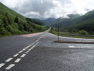
The A815 is a major road located in Argyll and Bute, Scotland. It runs for about 37 miles (60 km) from the A83, near Cairndow, in the north to Toward in the south. It passes beside three lochs, while its final stretch is along the Firth of Clyde.

The A6121 is a short cross-country road in the counties of Lincolnshire and Rutland, England. It forms the principal route between Bourne and Stamford and the A1 in Lincolnshire, continuing on through Ketton in Rutland to its junction with the A47 at Morcott. Its south-western end is at 52°35.5860′N0°38.0820′W and its north-eastern end is at 52°45.9120′N0°24.0660′W. The road has increased in importance with the rapid expansion of housing in this part of South Kesteven.
Pentrecwrt is a village in north Carmarthenshire, Wales on the A486 road halfway between Carmarthen and New Quay.

Devonport Kings Road railway station was the London and South Western Railway station in Devonport, Devon, England. It opened in 1876 and closed in 1964. For the first 14 years it was a terminal station with trains to London departing eastwards, but from 1890 it became a through station with trains to London departing westwards.

The A4214 is a ring-road around Llanelli in Carmarthenshire, west Wales.

Ffostrasol is a small village in the south of Ceredigion, Wales. It is located on the A486 between Synod Inn and Llandysul, and it forms part of the parish of Troedyraur. The village lies on a rural crossroad connecting it with the nearby village of Plwmp to the north, Synod Inn to the north east, Newcastle Emlyn to the south west, and Llandysul to the south east.
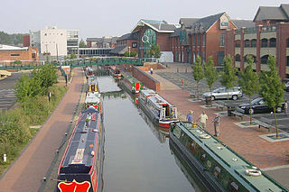
Castle Quay Shopping Centre is a shopping centre in the town of Banbury, North Oxfordshire, England.
Great Yarmouth Corporation Tramways served the town of Great Yarmouth in Norfolk, England from 19 June 1902 until 14 December 1933.

