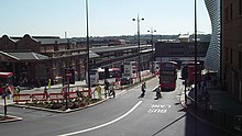
The A41 is a trunk road between London and Birkenhead, England. Now in parts replaced by motorways, it passes through or near Watford, Kings Langley, Hemel Hempstead, Aylesbury, Bicester, Solihull, Birmingham, West Bromwich, Wolverhampton, Newport, Whitchurch, Chester and Ellesmere Port.

The A38, parts of which are known as Devon Expressway, Bristol Road and Gloucester Road, is a major A-class trunk road in England.

The A38(M), commonly known as the Aston Expressway, is a motorway in Birmingham, England. It is 2 miles (3.2 km) long and was opened on 24 May 1972. It connects the M6 motorway to Aston and Central Birmingham and forms part of the much longer A38 route.

The Big City Plan is a major development plan for the city centre of Birmingham, England.

The A4540 is a ring road in Birmingham, England, also known as the Middle Ring Road, or the Middleway. It runs around the centre of the city at a distance of approximately 1 mile (1.6 km). The ring road was planned and designed by Herbert Manzoni. It is now simply known as the Ring Road due to the removal of the old Inner Ring Road.

Known as the Hagley Road in Birmingham, the A456 is a main road in England running between Central Birmingham and Woofferton, Shropshire, south of Ludlow. Some sections of the route, for example Edgbaston near Bearwood, are also the route of the Elan Aqueduct which carries Birmingham's water supply from the Elan Valley.

The A4150 Wolverhampton Inner Ring Road is a ring road that encircles the city centre of Wolverhampton in the West Midlands, England. The circumference of the road is around 2.1 miles (3.4 km). Technically, the route is listed as an "Inner Ring Road", although only a tiny section of the "Outer Ring Road" was ever constructed with only one of the two designed carriageways built. A second carriageway was built in 2017 along a short stretch between Patshull Avenue and Stafford Road. The section of outer ring road is called Wobaston Road and locally classified by Wolverhampton City Council as U119.

The A594 Central Ring is Leicester's central distributor road network.

The A453 road was formerly the main trunk road connecting the English cities of Nottingham and Birmingham. However, the middle section of this mainly single-carriageway road has largely been downgraded to B roads or unclassified roads following the construction of the parallel M42-A42 link around 1990. The M42 was originally meant to pass further north than it does, and to join the M1 at Sandiacre in Derbyshire. The M42/A42 does not enter Derbyshire, but instead joins the M1 closer to the A453 junction at Kegworth. The A42 shadows the former A453 from Appleby Magna to Castle Donington. The road historically connected the East Midlands with the West Midlands.

Masshouse is a development site in the Eastside area of Birmingham, England. Its name derives from a Roman Catholic Church built in 1687. Buildings were cleared to make way for the inner city ring road and car parking in the 1960s. Birmingham City Council wished to expand the city centre eastwards and an elevated road junction, Masshouse Circus was demolished in 2002 to facilitate redevelopment.

A subway, also known as an underpass, is a grade-separated pedestrian crossing running underneath a road or railway in order to entirely separate pedestrians and cyclists from motor or train traffic.
Martineau Galleries is a proposed mixed-use development for Birmingham, England which was shelved in 2009 but re-approved in 2020. It was to connect the Eastside to the city centre core, a major retail area.

Old Square is a public square and road junction in the Core area of Birmingham City Centre, England.

Snowhill is a mixed-use development in the Colmore business district, known historically as Snow Hill, in Central Birmingham, England. The area, between Snow Hill Queensway and Birmingham Snow Hill station, is being redeveloped by the Ballymore Group. The £500 million phased scheme has been partly completed on the site of a former surface car park adjacent to the railway station and West Midlands Metro terminus.

Birmingham city centre, also known as Central Birmingham, is the central business district of Birmingham, England. The area was historically in Warwickshire. Following the removal of the Inner Ring Road, the city centre is now defined as being the area within the Middle Ring Road. The city centre is undergoing massive redevelopment with the Big City Plan, which means there are now nine emerging districts and the city centre is approximately five times bigger.
Sir Herbert John Baptista Manzoni CBE MICE was a British civil engineer known for holding the position of City Engineer and Surveyor of Birmingham from 1935 until 1963. This position put him in charge of all municipal works and his influence on the city, especially following World War II, completely changed the image of Birmingham.

The A4053 Coventry ring road is a 2.25-mile (3.62 km) ring road in Coventry, England, which forms a complete dual-carriageway loop around the city centre. The road encompasses the old and new Coventry Cathedrals, the city's shopping areas and much of Coventry University. With the exception of one roundabout at junction 1, the ring road's nine junctions are entirely grade separated and closely spaced, with weaving sections between them, some as short as 300 yards (270 m), giving the road a reputation for being difficult to navigate. The junctions include connections with three other A roads: the A4114, A4600 and A429.

Paradise, formerly named Paradise Circus, is the name given to an area of approximately 7 hectares in Birmingham city centre between Chamberlain and Centenary Squares. The area has been part of the civic centre of Birmingham, England since the 19th century when it contained buildings such as the Town Hall, Mason Science College, Birmingham and Midland Institute buildings and Central Library. The site was redeveloped from 1960 to 1975 into the present Paradise Circus based within a roundabout on the Inner Ring Road system containing a new Central Library and School of Music. From 2015, Argent Group will redevelop the area into new mixed use buildings and public squares.

Ringway Centre is a Grade B locally listed building located on Smallbrook Queensway in the city centre of Birmingham, England. The six-storey, 230 metres (750 ft) long building was designed by architect James Roberts as part of the Inner Ring Road scheme in the 1950s and is notable for its gentle sweeping curved frontal elevation.

Road building was central to planning policy for much of the 20th century in Bristol, England. The planned road network evolved over time but at its core was a network of concentric ring roads and high-capacity radial roads.


