The M4, originally the London-South Wales Motorway, is a motorway in the United Kingdom running from west London to southwest Wales. The English section to the Severn Bridge was constructed between 1961 and 1971; the Welsh element was largely complete by 1980, though a non-motorway section around Briton Ferry bridge remained until 1993. On the opening of the Second Severn Crossing in 1996, the M4 was rerouted over it.
The A1, also known as the Great North Road, is the longest numbered road in the United Kingdom, at 410 miles (660 km). It connects London, the capital of England, with Edinburgh, the capital of Scotland. The numbering system for A-roads, devised in the early 1920s, was based around patterns of roads radiating from two hubs at London and Edinburgh. The first number in the system, A1, was given to the most important part of that system: the road from London to Edinburgh, joining the two central points of the system and linking the UK's (then) two mainland capital cities. It passes through or near north London, Hatfield, Welwyn Garden City, Stevenage, Baldock, Letchworth Garden City, Biggleswade, Eaton Socon, Buckden, Peterborough, Stamford, Grantham, Newark-on-Trent, Retford, Doncaster, Pontefract, York, Wetherby, Ripon, Darlington, Durham, Gateshead, Newcastle upon Tyne, Morpeth, Alnwick and Berwick-upon-Tweed.

The M40 motorway links London, Oxford, and Birmingham in England, a distance of approximately 89 miles (143 km).

The A40 is a trunk road which runs between London and Goodwick (Fishguard), Wales, and officially called The London to Fishguard Trunk Road (A40) in all legal documents and Acts. Much of its length within England has been superseded by motorways, such as the M40, and has lost its trunk road status, though it retains it west of Gloucester, including its length within Wales. It is approximately 260 miles (420 km) long. The eastern section from Denham, Buckinghamshire to Wheatley, Oxfordshire is better served by the M40 and its former function of linking London with Cheltenham and Gloucester has been taken by the M4, A419 and A417 via Swindon.
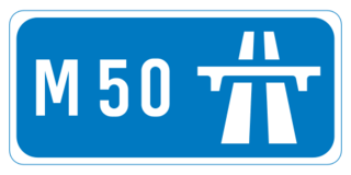
The M50 motorway is a C-shaped orbital motorway in Dublin and the busiest motorway in Ireland. The current route was built in various sections over the course of 27 years, from 1983 to 2010. It begins at Dublin Port, running northward through the Dublin Port Tunnel and along a portion of the Airport Motorway. It then turns west at its junction with the M1, circling the northern, western and southern suburbs of Dublin, before merging with the M11 at Shankill in South East Dublin. The road forms part of European route E01.

The A38, parts of which are known as Devon Expressway, Bristol Road and Gloucester Road, is a major A-class trunk road in England.

The A57 is a major road in England. It runs east from Liverpool to Lincoln via Warrington, Salford and Manchester, and then through the Pennines over the Snake Pass (between the high moorlands of Bleaklow and Kinder Scout), around the Ladybower Reservoir, through Sheffield and past Worksop. Between Liverpool and Glossop, the road has largely been superseded by the M62, M602 and M67 motorways. Within Manchester a short stretch becomes the Mancunian Way, designated A57(M).
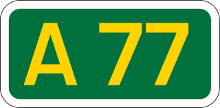
The A77 road is a major road in Scotland. It runs in a southwesterly direction from the city of Glasgow, past the towns of Giffnock, Newton Mearns, Kilmarnock, Prestwick, Ayr, Girvan and Stranraer to the village of Portpatrick on the Irish Sea. It passes through the council areas of Glasgow City, East Renfrewshire, East Ayrshire, South Ayrshire and Dumfries and Galloway.

The A46 is a major A road in England. It starts east of Bath, Somerset and ends in Cleethorpes, Lincolnshire, but it does not form a continuous route. Large portions of the old road have been lost, bypassed, or replaced by motorway development. Between Leicester and Lincoln the road follows the course of the Roman Fosse Way, but between Bath and Leicester, two cities also linked by the Fosse Way, it follows a more westerly course.
The A21 is a trunk road in Southern England, one of several which connect London and various commuter towns to the south coast. It provides a link to Hastings, East Sussex and parts of Kent. Half of the distance covered is over gently undulating terrain, with some hills and bends. Often traffic is slow-moving, particularly on weekdays on the short single carriageway stretches; and in summer with holiday traffic. Because of this, people have described the A21 as "a joke" and businesspeople have been reported to "hate coming down the A21". There have been many proposals to upgrade parts of the A21 in response to this.

The A31 is a major trunk road in southern England that runs from Guildford in Surrey to Bere Regis in Dorset. Its most well known section is the Hog's Back, a hilly ridge forming part of the North Downs, in the Surrey stretch between Guildford and Farnham.

The A48 is a trunk road in Great Britain running from the A40 at Highnam, 3 miles (4.8 km) west of Gloucester, England, to the A40 at Carmarthen, Wales. Before the Severn Bridge opened on 8 September 1966, it was a major route between England and South Wales. For most of its route, it runs almost parallel to the M4 motorway. During times of high winds at the Severn Bridge, the A48 is used as part of the diversion route and is still marked as a Holiday Route.
The A45 is a major road in England. It runs east from Birmingham past the National Exhibition Centre and the M42, then bypasses Coventry and Rugby, where it briefly merges with the M45 until it continues to Daventry. It then heads to Northampton and Wellingborough before running north of Rushden and Higham Ferrers and terminating at its junction with the A14 in Thrapston.

The A417 is a main road in England, running from Streatley, Berkshire to Hope under Dinmore, Herefordshire. It is best known for its section between Cirencester and Gloucester where it has primary status and forms part of the link between the major settlements of Swindon and Gloucester.

The A453 road was formerly the main trunk road connecting the English cities of Nottingham and Birmingham. However, the middle section of this mainly single-carriageway road has largely been downgraded to B roads or unclassified roads following the construction of the parallel M42-A42 link around 1990. The M42 was originally meant to pass further north than it does, and to join the M1 at Sandiacre in Derbyshire. The M42/A42 does not enter Derbyshire, but instead joins the M1 closer to the A453 junction at Kegworth. The A42 shadows the former A453 from Appleby Magna to Castle Donington. The road historically connected the East Midlands with the West Midlands.

The A505 is a road in the East of England. It follows part of the route of the Icknield Way and the corresponding Icknield Way Path and runs from Leighton Buzzard in Bedfordshire to the A11 Abington Interchange North in Cambridgeshire.

The A556 is a road in England which extends from the village of Delamere in Cheshire West and Chester to the Bowdon Interchange in Cheshire East, bordering Greater Manchester. The road contains a mixture of single and dual carriageway sections and forms a large part of the route between Manchester and Chester. It also acts as a major access route to Chester/North Wales to the west and to Manchester to the east for the conurbation of towns and villages around the Dane Valley centering on Winsford and Northwich. The central part, which forms the Northwich Bypass between Davenham and Lostock Gralam, suffers because of the amount of commuter traffic from this area. The part of the route between the M6 motorway Junction 19 and the M56 motorway Junction 7 is a major route into Manchester and has been recently upgraded to a four-lane dual carriageway.

The A4119 links Tonypandy with Cardiff in South Wales.

The A726 road in Scotland is a major route with several distinct sections with different characteristics and names; owing to its stages of construction, since 2005 it has two separate parts, the first running between Strathaven in South Lanarkshire and Junction 5 of the M77 motorway south of Newton Mearns in East Renfrewshire via East Kilbride, and the other running between Junction 3 of the M77 and the M898 motorway near the Erskine Bridge, via Paisley and Junction 29 of the M8 motorway near Glasgow International Airport.

The B4265 road is a main road in the Vale of Glamorgan, southeastern Wales, running in a northwesterly direction along near the coast. It links Cardiff Airport to Bridgend, lasting for 15.9 miles (25.6 km). The road begins at the roundabout near the airport and the village of Penmark at 51°24′21″N3°20′39″W as a continuation of the A4226 road leading from Barry. Passing the junction turnoff to Gileston and St Athan, at Llantwit Major, the B4270 road branches off to the northwest to Llandow Industrial Estate. The road then moves progressively in northwesterly direction until St Brides Major, where the B4524 road to the south connects it to Southerndown and Ogmore-by-Sea. At St Brides Major, the road shifts to a northerly direction, where it passes Ewenny and Ogmore village leading to Bridgend, where it joins the A48 road and finally A473 road at 51°30′7″N3°34′34″W.