Drope

Last updated

Drope
Dwellings in the village of Drope - geograph.org.uk - 421750.jpg
Vale of Glamorgan UK location map.svg
Red pog.svg
Drope
Location within the Vale of Glamorgan
OS grid reference ST108758
Community
Principal area
Ceremonial county
Country Wales
Sovereign state United Kingdom
Postcode district CF
Police South Wales
Fire South Wales
Ambulance Welsh
UK Parliament
Senedd Cymru – Welsh Parliament
List of places
UK
Wales
Vale of Glamorgan
51°28′29″N3°17′11″W / 51.474722°N 3.286389°W / 51.474722; -3.286389 Coordinates: 51°28′29″N3°17′11″W / 51.474722°N 3.286389°W / 51.474722; -3.286389

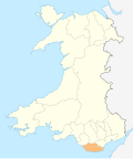
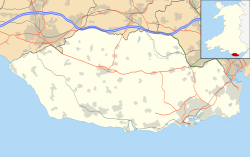
Drope is a hamlet in the valley of the River Ely in Vale of Glamorgan, southeast Wales, just beyond the territorial border of western Cardiff. It lies immediately east from Michaelston-super-Ely, west of Ely, Cardiff and southeast of St Georges-super Ely and is accessed via a bridge along Drope Road across the A4232 road to the north of Culverhouse Cross. Drope was designated a special conservation area in March 1973 by the former Glamorgan County Council due to its architectural heritage. [1]
Landmarks

Ty Llwyd Farm and lane, Drope Ty Llwyd Farm and lane - Drope - geograph.org.uk - 1733497.jpg
Ty Llwyd Farm and lane, Drope

The farms of Drope, Ty Llwyd and Ty Uchaf and The Old Rectory in Drope have been identified as buildings which make a positive contribution to the special architectural or historic interest of the conservation area. [1] The Old Rectory dates to the early Victorian period and set in landscaped gardens, it features a slate roof under local limestone walls. [1] To the south is Coedarhydyglyn.

Related Research Articles

<span class="mw-page-title-main">Vale of Glamorgan</span> County borough in Wales

The Vale of Glamorgan, often referred to as The Vale, is a county borough in the south-east of Wales. It borders Bridgend County Borough to the west, Cardiff to the east, Rhondda Cynon Taf to the north, and the Bristol Channel to the south. With an economy based largely on agriculture and chemicals, it is the southernmost unitary authority in Wales. Attractions include Barry Island Pleasure Park, the Barry Tourist Railway, Medieval wall paintings in St Cadoc's Church, Llancarfan, Porthkerry Park, St Donat's Castle, Cosmeston Lakes Country Park and Cosmeston Medieval Village. The largest town is Barry. Other towns include Penarth, Llantwit Major, and Cowbridge. There are many villages in the county borough.

<span class="mw-page-title-main">Glamorgan</span> Historic county of Wales

Glamorgan, or sometimes Glamorganshire, is one of the thirteen historic counties of Wales and a former administrative county of Wales. Originally an early medieval petty kingdom of varying boundaries known in Welsh as the Kingdom of Morgannwg, which was then invaded and taken over by the Normans as the Lordship of Glamorgan. The area that became known as Glamorgan was both a rural, pastoral area, and a conflict point between the Norman lords and the Welsh princes. It was defined by a large concentration of castles.

<span class="mw-page-title-main">Llantwit Major</span> Human settlement in Wales

Llantwit Major is a town and community in Wales on the Bristol Channel coast. It is one of four towns in the Vale of Glamorgan, with the third largest population after Barry and Penarth, and ahead of Cowbridge. It is 4+12 miles (7.2 km) from Cowbridge, 9 miles (14 km) from Bridgend, 10 miles (16 km) from Barry, and 15 miles (24 km) from Cardiff. It had a population of 9,486 in 2011.

<span class="mw-page-title-main">St Mellons</span> Human settlement in Wales

St Mellons is a district and suburb of southeastern Cardiff, the capital city of Wales. Prior to 1996 St Mellons was the name given to the community largely north of Newport Road (B4487) which included the old St Mellons village. After 1996 the old community was divided and renamed as Old St Mellons and Pontprennau, with the newer, much larger area of modern housing and business parks to the south of Newport Road retaining the St Mellons name. Historically in Monmouthshire, St Mellons became part of South Glamorgan and Cardiff in 1974.

<span class="mw-page-title-main">Colwinston</span> Human settlement in Wales

Colwinston is both a village and a community in the Vale of Glamorgan, Wales, approximately 4 miles (6.4 km) southeast of the centre of Bridgend and 21 miles (34 km) west of the centre of Cardiff. The village is located within 12 mile (0.80 km) of the A48. The population in 2005 was approximately 400 but with recent building development, the population is now estimated at over 600 people.

<span class="mw-page-title-main">Peterston-super-Ely</span> Human settlement in Wales

Peterston-super-Ely is a village and community situated on the River Ely in the county borough of the Vale of Glamorgan, Wales. The community population at the 2011 census was 874. The community includes the hamlet of Gwern-y-Steeple.

<span class="mw-page-title-main">Ely, Cardiff</span> Human settlement in Wales

Ely is a district and community in Cardiff, Wales. It is to the north of Cowbridge Road West. Caerau defines the boundary to the south as does River Ely to the east and in part to the north.

<span class="mw-page-title-main">St Athan</span> Human settlement in Wales

St Athan is a village and community in the Vale of Glamorgan in South Wales. The village and its parish church are dedicated to Saint Tathan. The church dates to the 13th–14th century, though an earlier church was dated to the Norman period. The village and the adjacent dormitory village of Eglwys Brewis are known primarily for the MOD St Athan RAF base. There are two pubs in the village, as well as a football team at St Athan Football Club and the St Athan Golf Club. The community includes West Aberthaw.

<span class="mw-page-title-main">Palmerstown, Vale of Glamorgan</span> District of Barry in Wales

Palmerstown is a south-eastern suburb of Barry in the Vale of Glamorgan south-west of Dinas Powys and 7 miles south-west of Cardiff in Wales. It is immediately north of chemical and plastics industries such as Dow Chemicals, and Barry No.2 dock and the Atlantic Trading Estate lie south-east of No.2 dock. Its south end is separated from the A4055 Cardiff-Barry main road via Palmerston Road, (sic) a tee junction with the A4055 and access to the original part of Palmerstown's housing is via a narrow railway bridge over the Barry-Cardiff railway line and lies north-west of the former Biglis Junction which was a short distance from the so-called "Palmerston Bridge" which separates Palmerston Road from Dobbins Road.

<span class="mw-page-title-main">Aberthaw</span> Human settlement in Wales

Aberthaw is an area containing the villages of East Aberthaw and West Aberthaw, on the coast of South Wales about 5 miles (8 km) west of Barry. It is home to Aberthaw Cement Works, Aberthaw Lime Works, and Aberthaw Power Station, a coal power station that is linked to the South Wales Valleys via the Vale of Glamorgan Railway. The area is historically within the parish of Penmark in the Vale of Glamorgan. The two villages of West and East Aberthaw are separated by the River Thaw. The village of East Aberthaw, near Rhoose, has a 13th-century pub. The village Baptist Chapel and Mission Room, no longer exist as such and have been converted for other uses.

<span class="mw-page-title-main">Caerau, Cardiff</span> Human settlement in Wales

Caerau[ˈkai̯r.ai] is a community in the west of Cardiff, capital city of Wales. Often considered part of Wenvoe by gully, Heol Trelai is the main road or avenue, lined with large trees. Dominated mostly by private housing, it has the Western Leisure Centre, supermarkets, schools and churches.

<span class="mw-page-title-main">River Ely</span> River in South Wales flowing from Tonyrefail to Cardiff

The River Ely is in South Wales flowing generally southeast, from Tonyrefail to Cardiff.

<span class="mw-page-title-main">St Hilary, Vale of Glamorgan</span> Human settlement in Wales

St Hilary is a village in the Vale of Glamorgan, Wales. It is located just south of the A48, about a mile southeast of the market town of Cowbridge. The village has a population of about 260, in approximately 80 houses. Notable landmarks in the vicinity include The Bush Inn, the Church of St Hilary, the Old Beaupre Castle, New Beaupre, Coed Hills and St. Hilary mast.

<span class="mw-page-title-main">Coedarhydyglyn</span> Building in Vale of Glamorgan, Wales

Coedarhydyglyn or Coedriglan, formerly Old Coedarhydyglyn, is a private Grade I listed neo-classical regency villa and estate on the western rim of Cardiff, less than half a mile from Culverhouse Cross, southeast Wales. It is accessed via the A48 road between Cardiff and St. Nicholas at the top of "The Tumble" hill leading up from Culverhouse Cross and Coedarhydyglyn Lane which leads to Drope to the north. The estate lies between the villages of St Georges-super-Ely and Downs just inside the boundary of the Vale of Glamorgan.

The Vale of Glamorgan has 740 listed buildings of which 4% are Grade I listed, 10% Grade II* listed and remainder Grade II listed.

<span class="mw-page-title-main">Grade II* listed buildings in the Vale of Glamorgan</span>

In the United Kingdom, the term listed building refers to a building or other structure officially designated as being of special architectural, historical, or cultural significance; Grade II* structures are those considered to be "particularly important buildings of more than special interest". Listing was begun by a provision in the Town and Country Planning Act 1947. Once listed, strict limitations are imposed on the modifications allowed to a building's structure or fittings. In Wales, the authority for listing under the Planning Act 1990 rests with Cadw.

<span class="mw-page-title-main">St Georges super Ely</span> Human settlement in Wales

St Georges super Ely, also known as St Georges, is a small village and community in the western outskirts of Cardiff, in the Vale of Glamorgan, South Wales. Lying to the northwest of Culverhouse Cross, between Peterston-super-Ely and Michaelston-super-Ely, it contains a medieval church and ruined manor house dated to the fifteenth century. The community includes the settlements of Drope, Downs and Sant-y-Nyll.

David Montgomery Vaughan (c.1810–c.1892) was a Welsh architect, surveyor, land agent and diarist.

References

  1. 1 2 3 "Appraisal and Management Plan". Vale of Glamorgan Council . Retrieved 28 June 2011.