Llansannor

Last updated

Llansannor
Parkland at Llansannor Court - geograph.org.uk - 923965.jpg
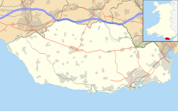
Vale of Glamorgan UK location map.svg
Red pog.svg
Llansannor
Location within the Vale of Glamorgan
OS grid reference SS994775
Principal area
Ceremonial county
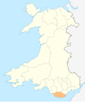
Country Wales
Sovereign state United Kingdom
Postcode district CF
Police South Wales
Fire South Wales
Ambulance Welsh
UK Parliament
Senedd Cymru – Welsh Parliament
List of places
UK
Wales
Vale of Glamorgan
51°29′16″N3°27′02″W / 51.4879°N 3.4506°W / 51.4879; -3.4506 Coordinates: 51°29′16″N3°27′02″W / 51.4879°N 3.4506°W / 51.4879; -3.4506

Llansannor (Welsh : Llansanwyr) is a small hamlet in the Vale of Glamorgan, Wales, United Kingdom.

Contents

It has a population of roughly 200 people. It contains a parish church, a pub (the City Inn, now closed), a primary school and a village hall, which has recently been rebuilt thanks to the efforts of the parishioners.

Llansannor is traditionally a parish, until the last century comprising little more than a collection of farms spread out across Llansannor Hill (Mynydd y Fforest) and now incorporating the present hamlet of City and a collection of houses built in the grounds of Llansannor Court between the 1970s and 90's. Present day farms in the parish include Church Farm, Gelli Goll Farm and Windmill Farm. While agriculture remains important to the character of the area, many residents of the village are retirees or commute to work in nearby Cardiff.

The Valeways Millennium Heritage Trail passes through the parish, and the source of the River Thaw is nearby.

Famous residents include JPR Williams, former Welsh rugby fullback.

Population Statistics

Population density (people / sq mi)0.9
Gender split (females / male)1.03
Average commute 12.89 miles
Average age42
Home ownership16.9%
Student population2.6%
People in good health73%

[1]

Related Research Articles

Bodelwyddan Human settlement in Wales

Bodelwyddan is a town, electoral ward and community in Denbighshire, Wales, approximately 5 miles (8 km) South of Rhyl. The Parish includes several smaller hamlets such as Marli and Pengwern.

Llanfynydd Village in Carmarthenshire, Wales

Llanfynydd is a village, parish and community in Carmarthenshire, Wales. The community population at the 2011 census was 499. It lies some 10 miles north-east of the county town, Carmarthen. Bordering it are the communities of Llansawel, Talley, Manordeilo and Salem, Llangathen, Llanegwad and Llanfihangel Rhos-y-Corn, all in Carmarthenshire.

St Illtyd Human settlement in Wales

St Illtyd is a hamlet near Aberbeeg, in southeast Wales, within the historic boundaries of Monmouthshire. It is situated on the mountain road between Pontypool and Abertillery in Blaenau Gwent. It rests at about 1200 feet above sea level. The Royal Mail postcode is NP13 2AY.

Little Meadle is a hamlet in Buckinghamshire, England. It is part of the civil parish of Longwick-cum-Ilmer and is located between the hamlets of Owlswick and Meadle. It is approximately 5 miles (8.0 km) from Aylesbury and 20 miles (32 km) from Oxford. In addition to the Farm House it consists of a collection of houses built over the past 60 years, and it gained an official name with the Royal Mail in 2004, as well as being mapped with the Ordnance Survey 2006. The term Little Meadle is a relatively new one it has no historical meaning in itself, except that it is close to the village of Meadle and is a small hamlet that was previously known only by the name of the road in which it is situated Stockwell Lane.

Llanmartin

Llanmartin is a village and parish in the city of Newport, Wales.

Llansilin

Llansilin is a village and local government community in Montgomeryshire, Powys, Wales, 5 miles (8 km) west of Oswestry. The community, which includes Llansilin village, a large rural area and the hamlets of Moelfre and Rhiwlas as well as the remote parish of Llangadwaladr, had a population of 648 at the 2001 census, increasing to 698 at the 2011 Census. There is also an electoral ward including the nearby village of Llanrhaeadr-ym-Mochnant with a population of 2,295.

Langstone, Newport Human settlement in Wales

Langstone is an electoral ward and smaller village and community of the city of Newport, Wales. The area is governed by the Newport City Council. The community had a population of 3,279 in 2011.

Offley Human settlement in England

Offley is a civil parish in the English county of Hertfordshire, between Hitchin and Luton. The main village is Great Offley, and the parish also contains the nearby hamlets of Little Offley and The Flints. In the south-west of the parish, near Luton, there are the hamlets of Cockernhoe, Mangrove Green and Tea Green, and also the Putteridge Bury estate; these have LU2 postcodes and 01582 telephone numbers.

Carew, Pembrokeshire Human settlement in Wales

Carew is a village, parish and community on an inlet of Milford Haven in the former Hundred of Narberth, Pembrokeshire, West Wales, 4 miles (6.4 km) east of Pembroke. The eastern part of the parish is in the Pembrokeshire Coast National Park.

Trabboch

Trabboch is a hamlet in East Ayrshire, Scotland. Built as a miners village in the 1880s, it was owned and leased by Wm. Baird & Co., Ltd. and at one time had 94 dwellings. The miners rows stood, until demolition in 1969, on the Stair and Littlemill road, about two miles south of Stair, in that parish. The name is locally pronounced 'Traaboch'.

Balgriffin is a part-rural suburb of Dublin, Ireland, centred on a hamlet. It lies within southern Fingal in the traditional County Dublin and it is partly in the jurisdiction of Dublin City Council and partly that of Fingal County Council.

Tidebrook is a hamlet within the parish of Wadhurst in East Sussex, England. It is located between the villages of Mayfield and Wadhurst. The brook for which the hamlet is named rises in the valley and forms one of the sources of the River Rother which meets the sea at Rye.

Nolton and Roch Human settlement in Wales

Nolton and Roch is a community in the Hundred of Roose, Pembrokeshire, Wales. The community consists essentially of the villages of Nolton and Roch and a number of hamlets including Cuffern and Druidston. The western part of the community is in the Pembrokeshire Coast National Park. Its population (2001) was 746, increasing to 825 at the 2011 census.

Llangynog, Carmarthenshire Small settlement in Carmarthenshire, Wales

Llangynog is a small rural community located in Carmarthenshire, Wales the main settlement of which was once called ‘Ebenezer’village. It is bordered by the communities of: Newchurch and Merthyr; Carmarthen; Llangain; Llansteffan; Laugharne Township; and St Clears, all being in Carmarthenshire. The population at the 2011 census was 492.

Ambleston Human settlement in Wales

Ambleston is a village, parish, and community in Pembrokeshire, Wales, lying seven miles (11 km) north-north-east of Haverfordwest. The parish includes the hamlets of Wallis and Woodstock.

Brawdy Human settlement in Wales

Brawdy is a village and community in Pembrokeshire, Wales.

Cilrhedyn Human settlement in Wales

Cilrhedyn is a hamlet and parish in the counties of Carmarthenshire and Pembrokeshire, Wales, in the hill country to the south of the Teifi valley. The Afon Cych divides it into two unequal parts: West Cilrhedyn, Pembrokeshire and East Cilrhedyn, Carmarthenshire. The parish church is in West Cilrhedyn.

Rowlestone Human settlement in England

Rowlestone is a village and civil parish in the county of Herefordshire in England. It is a rural area with agriculture the main source of employment, and had only 87 residents in 2004, increasing to 180 at the 2011 Census. , The area was historically Welsh-speaking. Two Welsh bibles from Rowlestone, formerly stored in the Rowlestone vicarage and damaged by fire, are kept in the Herefordshire County archives.

St Brides Major (community) Human settlement in Wales

St Brides Major is a community on the western edge of the Vale of Glamorgan, South Wales. Its largest settlement is the village of St Brides Major, and also includes the villages of Ogmore-by-Sea and Southerndown, and the hamlets of Ogmore Village, Castle-upon-Alun, Heol-y-Mynydd, Norton and Pont-yr-Brown It is notable for coastal geology and scenery, limestone downlands and fossilised primitive mammals, sea cliffs and beaches, two Iron Age hillforts, three medieval castle sites,, two stepping stone river crossings and a clapper bridge. Three long distance paths cross the community. It is the western limit of the Vale of Glamorgan Heritage Coast, and has a visitor centre and tourist facilities.

References

  1. "Source of population statistics".