The Bulwarks, Porthkerry

Last updated
The Bulwarks, Porthkerry
Airport Approach Lights at The Bulwarks - geograph.org.uk - 1366764.jpg
Approach lights for Cardiff Airport runway 30 in the north section of the Bulwarks fort
Vale of Glamorgan UK relief location map.jpg
Archaeological site icon (red).svg
Shown within Vale of Glamorgan
Alternative nameThe Bulwarks, Porthceri
Location Rhoose, Vale of Glamorgan
RegionWales
Coordinates 51°23′19″N3°19′17″W / 51.388595°N 3.321514°W / 51.388595; -3.321514 Coordinates: 51°23′19″N3°19′17″W / 51.388595°N 3.321514°W / 51.388595; -3.321514
Type Promontory fort
Length230 metres (750 ft)
Width120 to 250 metres (390 to 820 ft)
Area4.1 hectares (10 acres)
History
FoundedIron Age
Site notes
ConditionOvergrown
Public accessYes
DesignationNPRN 93015; ST 082664

The Bulwarks, Porthkerry is a promontory fort in Rhoose, Vale of Glamorgan, on the southern coast of Wales overlooking the Bristol Channel. It probably dates to the Iron Age and continued to be occupied during the Roman period in Britain. The ramparts and ditches along the west side are well preserved, but the fortifications are heavily overgrown.

Contents

Location

The Iron Age fortification is one of several along the southern coast of Wales. [1] The site was a strategically important position overlooking the Bristol Channel. [2] The fort is on the end of a spur that faces west and overlooked the Porthkerry creek, now silted up. The natural slopes are very steep on the south east and north, but the ground is almost level towards the west. The south side is now bounded by the edge of the cliff along the shore, but probably there was originally a fortification along this side, since eroded away. [3] The ramparts enclose an area of about 4 hectares (9.9 acres). [1] The fort is accessible via the Porthkerry caravan park. [2]

Fortification

The Bulwarks enclosure is trapezoidal in shape. At present it is about 230 metres (750 ft) from north to south, 250 metres (820 ft) along the north side and 120 metres (390 ft) along the south side. [3] The cliff bounding the fort today has a recession rate of 24.2 centimetres (9.5 in) annually. [4] Erosion along the south side has probably removed a strip about 120 metres (390 ft) wide and 1 hectare (2.5 acres) in area. [3]

The defence consisted of three close-set banks separated by ditches. On the west the banks and ditches are well-preserved and about 50 metres (160 ft) wide in total. On the other two sides only terraces remain where the defences once ran. The fort appears to have had just one entrance in the middle of the west side, at a slightly oblique angle to the rampart line, with gaps in the ramparts and causeways across the ditches. The interior is almost level and about 60 metres (200 ft) above O.D. [3]

History

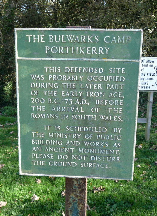
Limited excavations indicate that the Bulwarks fort was occupied from the Iron Age into the Roman era. [5] The camp was probably first occupied around 200 BC to 75 AD, before the Romans arrived in South Wales. [6] Of the pottery remains from the military and then civilian occupation of the site, 26.7% is South-East Dorset Black Burnished Category I Pottery. [7]

In 1968 F. L. Davies excavated the site for the Department of the Environment. He found traces of three rectangular buildings just inside the innermost west rampart. [3] Of these successive timber buildings, the earliest may have been pre-Roman. [8] The second was occupied from the late first century AD to the mid second century AD, then burned down. [8] After this the site was covered in a layer of Lias limestone rubble, then a third rectangular building was erected, 10 feet (3.0 m) wide and at least 30 feet (9.1 m) long, with a porch and doorway in the south west corner. The third building seems to have been occupied until the late third century or the fourth century AD. [8]

The defensive walls are now covered in thick vegetation. [3] The fort is scheduled as an ancient monument by the Ministry of Public Building and Works. [6]

Notes

    1. 1 2 Porthkerry – The Bulwarks – Vale of Glamorgan, p. 36.
    2. 1 2 Loveluck-Edwards.
    3. 1 2 3 4 5 6 Royal Commission on the Ancient and Historical Monuments of Wales 1976, p. 41.
    4. Trenhaile 1972, p. 141.
    5. Cunliffe 1991, p. 268.
    6. 1 2 The Bulwarks Camp Portkerry – Ministry.
    7. Allen & Fulford 1996, p. 246.
    8. 1 2 3 Wilson & Wright 1969, p. 200.

    Sources

    Related Research Articles

    Uffington Castle

    Uffington Castle is an early Iron Age univallate hillfort in Oxfordshire, England. It covers about 32,000 square metres and is surrounded by two earth banks separated by a ditch with an entrance in the western end. A second entrance in the eastern end was apparently blocked up a few centuries after it was built. The original defensive ditch was V-shaped with a small box rampart in front and a larger one behind it. Timber posts stood on the ramparts. Later the ditch was deepened and the extra material dumped on top of the ramparts to increase their size. A parapet wall of sarsen stones lined the top of the innermost rampart. It is very close to the Uffington White Horse on White Horse Hill.

    Barry, Vale of Glamorgan Settlement in the Vale of Glamorgan, Wales

    Barry is a town in the Vale of Glamorgan, Wales, on the north coast of the Bristol Channel approximately 9 miles (14 km) south-southwest of Cardiff. Barry is a seaside resort, with attractions including several beaches and the resurrected Barry Island Pleasure Park. According to Office for National Statistics 2016 estimate data, the population of Barry was 54,673.

    Porthkerry Human settlement in Wales

    The hamlet of Porthkerry lies on the Bristol Channel coast of South Wales within the community of Rhoose between that village and the town of Barry to the east. It is very close to the end of the runway of Cardiff International Airport. To the east of the hamlet is Porthkerry Country Park which occupies the valley leading down to the coast.

    Castleshaw Roman Fort

    Castleshaw Roman fort was a castellum in the Roman province of Britannia. Although there is no evidence to substantiate the claim, it has been suggested that Castleshaw Roman fort is the site of Rigodunum, a Brigantian settlement. The remains of the fort are located on Castle Hill on the eastern side of Castleshaw Valley at the foot of Standedge but overlooking the valley. The hill is on the edge of Castleshaw in Greater Manchester. The fort was constructed in c. AD 79, but fell out of use at some time during the 90s. It was replaced by a smaller fortlet, built in c. 105, around which a civilian settlement grew. It may have served as a logistical and administrative centre, although it was abandoned in the 120s.

    Maiden Castle, Cheshire

    Maiden Castle is an Iron Age hill fort, one of many fortified hill-top settlements constructed across Britain during the Iron Age, but one of only seven in the county of Cheshire in northern England. The hill fort was probably occupied from its construction in 600 BC until the Roman conquest of Britain in the 1st century AD. At this time the Cornovii tribe are recorded to have occupied parts of the surrounding area but, because they left no distinctive pottery or metalworking, their occupation has not been verified. Since then it has been quarried and used for military exercises. It is protected as a Scheduled Ancient Monument, and is owned by the National Trust. The hill fort is open to visitors, but unrestricted access to the site has resulted in it being classified as "at high risk" from erosion.

    Penydarren Human settlement in Wales

    Penydarren is a community and electoral ward in Merthyr Tydfil County Borough in Wales.

    Buckland Rings

    Buckland Rings is the site of an Iron Age hill fort in the town of Lymington, Hampshire. Today, the mounds and dykes around the outside which once constituted its defences are still clearly visible, although the outer bank lies under the road on the west side, and on the south-east it is nearly ploughed-out. Excavations of the inner and middle ramparts in 1935 revealed that they were of wall-and-fill construction, retained at the front by upright timber beams and walls of cut and laid turf. The entrance, which lies on the east side, was also excavated revealing a long entrance passage and the postholes for a pair of stout gateposts. The site was bought by Hampshire County Council in 1989 to ensure its preservation, and it is open to the public from the A337 road onto which part of it faces.

    Blewburton Hill Hillfort in Oxfordshire, England

    Blewburton Hill is the site of an Iron Age hillfort located in Oxfordshire, in the southeast of England. It was a univallate hillfort. The area is mostly farmland with some small areas of wooded copse to the south and the northeast. The hill fort may have been occupied from the 4th century BC to the 1st century BC, and replaced a small settlement surrounded by a stockade, which is estimated to have been built in the 5th or 6th century BC.

    Scratchbury Camp Hillfort in Wiltshire

    Scratchbury Camp is the site of an Iron Age univallate hillfort on Scratchbury Hill, overlooking the Wylye valley about 1km northeast of the village of Norton Bavant in Wiltshire, England. The fort covers an area of 37 acres (15 ha) and occupies the summit of the hill on the edge of Salisbury Plain, with its four-sided shape largely following the natural contours of the hill.

    Chiselbury

    Chiselbury is the site of an Iron Age univallate hillfort located in Wiltshire. The hillfort is sub-circular in plan, and encloses an area of approximately 10.5 acres (460,000 sq ft). It is defined by an earthen rampart up to 3.6 metres (12 ft) in height and an external ditch, up to a maximum of 1.6 metres (5.2 ft) in depth. A gap in the southeastern side of the rampart, and a corresponding causeway across the ditch, is thought to be the original entrance and is associated with a small 'D' shaped embanked enclosure, which is apparently visible on aerial photographs. Although the enclosure has subsequently been degraded by ploughing, it is still apparent as a series of low earthworks.

    Cholesbury Camp

    Cholesbury Camp is a large and well-preserved Iron Age hill fort on the northern edge of the village of Cholesbury in Buckinghamshire, England. It is roughly oval-shaped and covers an area, including ramparts, of 15 acres (6.1 ha), and measures approximately 310 m (1,020 ft) north-east to south-west by 230 m (750 ft) north-west to south-east. The interior is a fairly level plateau which has been in agricultural use since the medieval period. The hill fort is now a scheduled ancient monument.

    Caerau Hillfort

    Caerau Hillfort is a large triangular multivallate Iron Age hillfort, built on a previously occupied Neolithic site, occupying the western tip of an extensive ridge-top plateau in the western suburbs of Caerau and Ely, Cardiff, Wales. It is the largest Iron Age site of its type in south Wales and also one of the largest in Great Britain. The old parish church, St Mary's, and a small ringwork, almost certainly a medieval castle site probably contemporary with the church, stand within the hillfort on the north-eastern side.

    Promontory forts of Cornwall

    Cornish promontory forts, commonly known in Cornwall as cliff castles, are coastal equivalents of the hill forts and Cornish "rounds" found on Cornish hilltops and slopes. Similar coastal forts are found on the north–west European seaboard, in Normandy, Brittany and around the coastlines of the British Isles, especially in Wales, Scotland and Ireland. Many are known in southwest England, particularly in Cornwall and its neighbouring county, Devon. Two have been identified immediately west of Cornwall, in the Isles of Scilly.

    Crosskirk Broch

    Crosskirk Broch was a fortification near the present day hamlet of Crosskirk near Thurso, Caithness, Scotland. After thorough archaeological exploration it was destroyed in 1972 since the site had become unsafe due to sea erosion. The site was unusual in having a broch, a large circular fortification, built within an older promontory fortification with a ring wall and blockhouse.

    Castle Rings, Wiltshire

    Castle Rings is a univallate hill fort in the parish of Donhead St Mary in Wiltshire in England. The fort is a Scheduled Ancient Monument, with a list entry identification number of 1005698. Castle Rings has been dated to the Iron Age and is situated at an altitude of 228 metres (748 ft) upon Upper Greensand sandstone beds. The main bulk of the fort enclosure lies within the boundaries of Donhead St Mary parish but some of the outlying earthworks are situated in the neighbouring Sedgehill and Semley parish. In the mid-1980s a metal detectorist unearthed a hoard of stater coins of the Durotriges tribe within the hill fort.

    Bigbury Camp

    Bigbury Camp is a univallate hill fort in the parish of Harbledown and Rough Common in Kent in England. The fort is a Scheduled Ancient Monument, with a list entry identification number of 1005169. Bigbury Camp is the only confirmed Iron Age hill fort in east Kent. It is managed by Kent Wildlife Trust.

    Porthkerry Viaduct

    Porthkerry Viaduct is a railway viaduct near Barry in the Vale of Glamorgan, Wales.

    Castell Caer Seion

    Castell Caer Seion is an Iron Age hillfort situated at the top of Conwy Mountain, in Conwy County, North Wales. It is unusual for the fact that the main fort contains a smaller, more heavily defended fort, complete with its own distinct defences and entrance, with no obvious means of access between the two. The construction date of the original fort is still unknown, but recent excavations have revealed evidence of occupation as early as the 6th century BC, whilst the smaller fort can be dated with reasonable certainty to around the 4th century BC. Whilst the forts were constructed in different periods, archaeologists have uncovered evidence of concurrent occupation, seemingly up until around the 2nd century BC. The larger fort contained around 50 roundhouses during its lifetime, whereas examinations of the smaller fort have turned up no more than six. The site was traditionally associated with Maelgwyn Gwynedd, but there is no evidence pointing to a 6th-century occupation. The fort and wider area beyond its boundaries have been said to retain significant archaeological potential, and are protected by law as a scheduled ancient monument.

    Moel Arthur

    Moel Arthur is an Iron Age hillfort in Flintshire, Wales, at the boundary with Denbighshire, about 5 miles (8.0 km) east of Denbigh.

    Maiden Bower hillfort

    Maiden Bower is an Iron Age hillfort near Dunstable in Bedfordshire, England. The site, which also has traces of a Neolithic causewayed enclosure, is a scheduled monument.