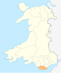
Lidmore | |
---|---|
Lidmore Farm | |
Location within the Vale of Glamorgan | |
Principal area | |
Ceremonial county | |
Country | Wales |
Sovereign state | United Kingdom |
Post town | BARRY |
Postcode district | CF62 |
Police | South Wales |
Fire | South Wales |
Ambulance | Welsh |
UK Parliament | |
Senedd Cymru – Welsh Parliament | |
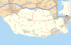
Lidmore or Lydmore is a small hamlet and farm in the Vale of Glamorgan. It is located just off the A4226 road, to the northwest of Highlight Park in Barry, Vale of Glamorgan and in close proximity to Brynhill Golf Club. To the north is Great Hamston and Dyffryn and the hamlet is accessed through another hamlet called Northcliff from the main road. [1] To the southwest is Lidmore Wood and the Welsh Hawking Centre.
The main landmark is the Lidmore Farm, an early 18th-century Grade II listed building. [2] It is a "two-storey, whitewashed rubble stone farmhouse" with a "Welsh slate roof with four corniced brick ridges and end stacks. There are two wings, the narrower downhill and set back at each elevation. The main frontage faces the garden and this has a three-window range of sashes to the left main unit: two to the left (plus one smaller to ground floor) and one to the right of a gabled porch which is of rock-faced stone with brick dressings, including moulded brick cambered arch, flag floor and boarded door." [3] Refurbished in the 19th century, Lidmore Farmhouse became a listed building on 10 October 2002. [3]
Several of the former farm buildings along the lane near the farmhouse which were shown on the Tithe Map of 1842 have been converted into expensive houses, the largest of which is a sprawling stone bungalow. [3] The land to southeast of the farm formerly belonged to Highlight Farm before it was purchased by Brynhill Golf Club in the mid-1990s.
The Vale of Glamorgan, often referred to as The Vale, is a county borough in Wales, bordering Bridgend, Cardiff, and Rhondda Cynon Taf. With an economy based largely on agriculture and chemicals, it is the southernmost unitary authority in Wales. Attractions include Barry Island Pleasure Park, the Barry Tourist Railway, Medieval wall paintings in St Cadoc's Church, Llancarfan, Porthkerry Park, St Donat's Castle, Cosmeston Lakes Country Park and Cosmeston Medieval Village.
Llantwit Major is a town and community in Wales. Situated on the Bristol Channel coast, it is one of four towns in the Vale of Glamorgan, with the third largest population after Barry and Penarth, and ahead of Cowbridge. Llantwit Major is 4+1⁄2 miles (7.2 km) from Cowbridge, 9 miles (14 km) from Bridgend, 10 miles (16 km) from Barry, and 15 miles (24 km) from Cardiff. The community had a population of 9,486 in 2011.
Sully is a village in the community of Sully and Lavernock, in the Vale of Glamorgan, Wales lying on the northern coast of the Bristol Channel, midway between the towns of Penarth and Barry and 7 miles southwest of the Welsh capital city of Cardiff.
Pingewood is a hamlet in the civil parish of Burghfield, to the south of Reading, in the English county of Berkshire. It lies to the Southwest of Burghfield Bridge The name Pingewood derives from the old Celtic word 'pen' meaning head, peak, tip or end. The 'ge' is a contraction of the Celtic word for wood, 'coed'. When the Saxons moved into the area in the 5th century, they did not understand the meaning and added their own descriptive word 'wood' on the end.
Low Walworth is a hamlet in County Durham, England, 1.5 miles (2.4 km) to the north−west of the edge of Darlington. It consists of Low Walworth Hall, Low Walworth Farm and their respective cottages, flats and outbuildings. Several of these buildings are listed, and date from the 17th to the 19th century. Attached to one of the late-18th-century farm buildings is a gin gang, or building from which a horse powered a threshing machine by walking in a circle. The hall has accommodated at least one High Sheriff of Durham.
St Athan is a village and community in the Vale of Glamorgan in South Wales. The village and its parish church are dedicated to Saint Tathan. The church dates to the 13th–14th century, though an earlier church was dated to the Norman period. The village and the adjacent dormitory village of Eglwys Brewis are known primarily for the MOD St Athan RAF base. There is one pub in the village, as well as a football team at St Athan Football Club and the St Athan Golf Club. The community includes West Aberthaw.
Dinas Powys is a large village and a community in the Vale of Glamorgan in South Wales which takes its name from the ancient Welsh for stronghold (Dinas), and pagus (Powys), the Latin word for an outlying or rural settlement. The literal meaning, therefore, being, "Settlement Stronghold", referring to Dinas Powys hillfort, which dates from the Iron Age. The village is 5.6 miles (9.0 km) south-west of the centre of Cardiff and conveniently situated on the A4055 Cardiff to Barry main road, almost merging with Penarth. It is generally regarded as a pleasant dormitory village for Cardiff's commerce and industry commuters since the city has expanded with widespread development around the Cardiff Bay area.
The hamlet of Porthkerry lies on the Bristol Channel coast of South Wales within the community of Rhoose between that village and the town of Barry to the east. It is very close to the end of the runway of Cardiff International Airport. To the east of the hamlet is Porthkerry Country Park which occupies the valley leading down to the coast.
Woodborough is a small village and civil parish in the Vale of Pewsey, Wiltshire, England, about 3.5 miles (5.6 km) west of Pewsey.
Hatherton is a hamlet and civil parish in the unitary authority of Cheshire East and the ceremonial county of Cheshire, England. The hamlet is located on the B5071 at SJ687474, 2+3⁄4 miles (4.4 km) to the north east of Audlem and 3+3⁄4 miles (6.0 km) to the south east of Nantwich. The civil parish has an area of 673 hectares and also includes the small settlements of Birchall Moss, Broomlands and part of Artlebrook, with a total population of 360 in 2011. Nearby villages include Hankelow, Stapeley, Walgherton, Wybunbury, Blakenhall and Buerton. The A529 runs through the parish and the River Weaver forms the western boundary.
Great Hinton is a small village and civil parish about 3 miles (4.8 km) south of Melksham and 3.5 miles (5.6 km) north-east of Trowbridge in Wiltshire, England. The parish includes the hamlets of Bleet and Cold Harbour.
Blackstone is a hamlet in the civil parish of Woodmancote and the Horsham district of West Sussex, England. Blackstone is significant for its listed 17th- and 18th-century houses and cottages.
Clawdd Coch is a hamlet in the Vale of Glamorgan. It lies to the northeast of Tredodridge in the parish of Pendoylan. It is located near the edge of the Vale of Glamorgan Golf Club and Hensol Castle.
Goldsland is a small hamlet and farm in the Vale of Glamorgan in south Wales. It is located near the boundary of the Wenvoe Castle Golf Club in the parish of Wenvoe. It lies to the east of Dyffryn and south of St Lythans and the road leading from the west passes through the farms of Old and New Wallace. Goldsland Brook flows through here. A sub-manor was reportedly held at Goldsland by a Mathew of Llandaff under the manor of Wenvoe in 1583.
Great Brynhill is a small hamlet and farm in the Vale of Glamorgan in south Wales. It consists little more than a few farms including the Little Brynhill Farm and Thorn Falcon Farm and the Great Brynhill Farm. It is located in the historical parish of Merthyr Dyfan and near Colcot now northern districts of the town of Barry. It is accessed via a lane from Port Road but can also be accessed from Dyffryn along the lane to the New Wallace Farm and Goldsland which lie just to the northeast.
Great Hamston is a small hamlet and farm in the Vale of Glamorgan in south Wales. It is located about 4.2 miles (6.8 km) north of the town centre of Barry, about 600 metres to the south of the main village of Dyffryn, even nearer to Lower Dyffryn, west along the lane from Goldsland, and just north of Lidmore and North Cliff Farm. It lies off the A4226 road. The River Waycock flows through the hamlet and the Goldsland Brook joins this stream from the east just to the northeast of Great Hamston. The Hamston Pond Cottage is let out to tourists. Just to the north is the Aqua farm, Dyffryn Springs, which is a noted commercial fishing spot for trout in the county and the hamlet also contains an allotment. Great Hamston Farm has a distinctive white tower which can be viewed on Bing Maps Birdseye view. The lane to Goldsland and Wenvoe to the east contains the Old Wallace Farm and the New Wallace Farm.
Flemingston is a small village in the Vale of Glamorgan in south Wales. It is located 8.5 miles (13.7 km) northwest by road from the town centre of Barry. It contains the Church of St. Michael the Archangel, the ruins of Flemingston Court, and Flemingston Manor or Grange, all of which are listed buildings. Historically, the parish of Flemingston was a sub-manor of Aberthaw or St Athan.
Eglwys Brewis is a village in the Vale of Glamorgan in south Wales. It is located just to the north of the village of St Athan, south of Flemingston and northeast of Llantwit Major. Greenlands and St Mary Church lie to the north by road from Eglwys Brewis. The village consists primarily of residential estates which were originally built in the mid-20th century for service families stationed at nearby RAF St Athan. The estates are regularly used by driving instructors in the Vale of Glamorgan. Nant y Stepsau flows in the vicinity.
St Georges super Ely, also known as St Georges, is a small village and community in the western outskirts of Cardiff, in the Vale of Glamorgan, South Wales. Lying to the northwest of Culverhouse Cross, between Peterston-super-Ely and Michaelston-super-Ely, it contains a medieval church and ruined manor house dated to the fifteenth century.
Todenham is a village and civil parish in the Cotswold district of Gloucestershire, England. The village is significant for its Grade I listed 14th-century parish church.