Aberthin

Last updated

Aberthin
Aberthin1.jpg
Aberthin
Vale of Glamorgan UK location map.svg
Red pog.svg
Aberthin
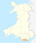
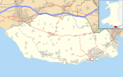
Location within the Vale of Glamorgan
OS grid reference ST008752
Community
Principal area
Preserved county
Country Wales
Sovereign state United Kingdom
Post town Cowbridge
Postcode district CF71
Police South Wales
Fire South Wales
Ambulance Welsh
UK Parliament
Senedd Cymru – Welsh Parliament
List of places
UK
Wales
Vale of Glamorgan
51°28′01″N3°25′46″W / 51.46704°N 3.42948°W / 51.46704; -3.42948

Aberthin is a small village, just outside Cowbridge in the Vale of Glamorgan, South Wales, on the north side of a shallow valley, less than a mile northeast of Cowbridge across the A48 road. [1] Cowbridge Comprehensive School lies just to the southwest of the village. About 250 metres to the south is an old quarry, with a "faulted strip of grey oolite". [2] Aberthin is also the name of a brook, the River Aberthin. [3] The village was served by the Aberthin Platform railway station between 1905 and 1920, now a field to the west of Aberthin.
Contents

Etymology

Thomas Morgan recorded an early belief that the village had been a place of druidic sacrifices, and that the name derived from the word Abertha (sacrifice). However, this derivation is now considered a folk etymology. [4] As the Nant y Berthyn's confluence (or "Aber" in Welsh) with the River Thaw located just to the west of the village's centre, the name is most likely a contraction of "Aber-Nant-y-Berthyn".

Notable landmarks

Aberthin2.jpg
Aberthin3.jpg

It has no shops, but does have two pubs, a village hall which when built in 1749 was created as Wales's second purpose-built Calvinistic Methodist meeting house, [5] and a notable tree in the middle of the roundabout. The Methodist church and village was visited in 1746 by Howell Harries and it was at the church where Peter Williams gave a speech in which he was disowned by the Methodists. [6] Houses in the area include Llansannor Court and Great House, Aberthin. [1]

Culture

The village hall committee organises many events throughout the year, such as a duck race (where plastic yellow ducks are raced down the stream), a free bonfire and fireworks display (held on the Downs overlooking the village), quiz nights, amateur dramatics, barn dances, and an annual Village Day, which has a barbecue, live music and a dog show.

Related Research Articles

<span class="mw-page-title-main">Vale of Glamorgan</span> County borough in Wales

The Vale of Glamorgan, often referred to as The Vale, is a county borough in the south-east of Wales. It borders Bridgend County Borough to the west, Cardiff to the east, Rhondda Cynon Taf to the north, and the Bristol Channel to the south. With an economy based largely on agriculture and chemicals, it is the southernmost unitary authority in Wales. Attractions include Barry Island Pleasure Park, the Barry Tourist Railway, Medieval wall paintings in St Cadoc's Church, Llancarfan, Porthkerry Park, St Donat's Castle, Cosmeston Lakes Country Park and Cosmeston Medieval Village. The largest town is Barry. Other towns include Penarth, Llantwit Major, and Cowbridge. There are many villages in the county borough.

<span class="mw-page-title-main">Glamorgan</span> Historic county of Wales

Glamorgan, or sometimes Glamorganshire, is one of the thirteen historic counties of Wales and a former administrative county of Wales. Originally an early medieval petty kingdom of varying boundaries known in Welsh as the Kingdom of Morgannwg, which was then invaded and taken over by the Normans as the Lordship of Glamorgan. The area that became known as Glamorgan was both a rural, pastoral area, and a conflict point between the Norman lords and the Welsh princes. It was defined by a large concentration of castles.

<span class="mw-page-title-main">Cowbridge</span> Human settlement in Wales

Cowbridge is a market town in the Vale of Glamorgan, Wales, approximately 12 miles (19 km) west of the centre of Cardiff.

<span class="mw-page-title-main">Colwinston</span> Human settlement in Wales

Colwinston is both a village and a community in the Vale of Glamorgan, Wales, approximately 4 miles (6.4 km) southeast of the centre of Bridgend and 21 miles (34 km) west of the centre of Cardiff. The village is located within 12 mile (0.80 km) of the A48. The population in 2005 was approximately 400 but with recent building development, the population is now estimated at over 600 people.

<span class="mw-page-title-main">Baglan, Neath Port Talbot</span> Village in West Glamorgan, Wales

Baglan is a village in Wales, adjoining Port Talbot, named after Saint Baglan. It is also a community and ward in the Neath Port Talbot county borough. In 2001, the population was 6,654. rising to 6,819 in 2011.

<span class="mw-page-title-main">Abernant, Rhondda Cynon Taf</span> Human settlement in Wales

Abernant is a small village north-east of the town of Aberdare, Rhondda Cynon Taf, Wales. Like many in the South Wales Valleys, it was once a coal-mining village.

<span class="mw-page-title-main">Pyle</span> Human settlement in Wales

Pyle is a village and community in Bridgend county borough, Wales. This large village is served by the A48 road, and lies less than one mile from Junction 37 of the M4 motorway, and is therefore only a half-hour journey from the capital city of Wales, Cardiff. The nearest town is the seaside resort of Porthcawl. Within the Community, to the northeast of Pyle, is the adjoining settlement of Kenfig Hill, North Cornelly also adjoins Pyle and the built-up area had a population of 13,701 in 2011.

<span class="mw-page-title-main">Bonvilston</span> Human settlement in Wales

Bonvilston is a village in the Vale of Glamorgan, Wales. The village is situated on the A48 about four miles east of Cowbridge and near the Welsh capital city of Cardiff. The population in 2011 was 392.

<span class="mw-page-title-main">Aberthaw</span> Human settlement in Wales

Aberthaw is an area containing the villages of East Aberthaw and West Aberthaw, on the coast of South Wales about 5 miles (8 km) west of Barry. It is home to Aberthaw Cement Works, Aberthaw Lime Works, and Aberthaw Power Station, a decommissioned coal power station that was linked to the South Wales Valleys via the Vale of Glamorgan Railway. The area is historically within the parish of Penmark in the Vale of Glamorgan. The two villages of West and East Aberthaw are separated by the River Thaw. The village of East Aberthaw, near Rhoose, has a 13th-century pub. The village Baptist Chapel and Mission Room no longer exist as such and have been converted for other uses.

<span class="mw-page-title-main">Cowbridge with Llanblethian</span> Human settlement in Wales

Cowbridge with Llanblethian is a community in the Vale of Glamorgan, Wales, which incorporates Llanblethian and the town of Cowbridge. It also covers the village of Aberthin to the northeast of Cowbridge. The population was 4,063 in 2011.

<span class="mw-page-title-main">Llanblethian</span> Human settlement in Wales

Llanblethian is a village in the Vale of Glamorgan in Wales which sits upon the River Thaw. It makes up part of the community of Cowbridge with Llanblethian, which consists of the village itself, the larger market town of Cowbridge and Aberthin.

<span class="mw-page-title-main">John Prichard</span> British architect (1817–1886)

John Prichard was a Welsh architect in the neo-Gothic style. As diocesan architect of Llandaff, he was involved in the building or restoration of many churches in south Wales.

<span class="mw-page-title-main">Afon Clun</span> River in Wales

The Afon Clun is a 14-mile (23 km) long tributary of the River Ely, in the counties of Cardiff and Rhondda Cynon Taf, Wales. Its bedrock is predominantly of sandstone. Beginning on the western slope of The Garth the river is fast-flowing, in clear shallow water with a hard substrate, flowing to the south of Llantrisant and generally west to its confluence with the River Ely at Pontyclun, falling 715 feet (218 m) over its course.

<span class="mw-page-title-main">Ynysboeth</span> Human settlement in Wales

Ynysboeth is a local community within the Mountain Ash (Aberpennar) postal district of the Cynon Valley in the County Borough of Rhondda Cynon Taf, South East Wales.

<span class="mw-page-title-main">River Thaw</span> River in United Kingdom, Wales

The River Thaw is a river in the Vale of Glamorgan, south Wales. At 20 kilometres/12.4 miles, it is the longest river entirely in the Vale of Glamorgan.

<span class="mw-page-title-main">Flemingston</span> Human settlement in Wales

Flemingston is a small village in the Vale of Glamorgan in south Wales. It is located 8.5 miles (13.7 km) northwest by road from the town centre of Barry. It contains the Church of St. Michael the Archangel, the ruins of Flemingston Court, and Flemingston Manor or Grange, all of which are listed buildings. Historically, the parish of Flemingston was a sub-manor of Aberthaw or St Athan.

A bibliography of books related to the Vale of Glamorgan, south Wales.

<span class="mw-page-title-main">Llanilid</span> Human settlement in Wales

Llanilid is a small settlement of in the county borough of Rhondda Cynon Taf, Wales. It is in the historic county of Glamorgan. Llanilid is part of the community of Llanharan along with the villages of Bryncae, Brynna, Ynysmaerdy, Peterston-super-Montem and Llanharan itself.

<span class="mw-page-title-main">Welsh St Donats</span> Human settlement in Wales

Welsh St Donats is a village and a community in The Vale of Glamorgan, Wales. Consisting of 1207 hectares of mainly rural land, it is located north east of Cowbridge. The population of the community was 534 in the 2011 census. Welsh St Donats includes the villages of Maendy, Prisk and Tair Onen. A mile to the east from the village lies the Hensol Forest, while the remains of Talyfan Castle are to the north.

References

  1. 1 2 Royal Commission on Ancient and Historical Monuments in Wales (1981). An Inventory of the Ancient Monuments in Glamorgan: The Iron Age and the Roman. H.M.S.D. ISBN   9780117007543.
  2. Geological Survey of Great Britain (1927). The Geology of the South Wales Coal-field ...: The country around Bridgend (Sheets 261, 262 of the map), by Aubrey Strahan and T. C. Cantrill, with parts by H. B. Woodward and R. H. Tiddeman. 1904. Printed for H.M. Stationery off., by Wyman and sons, limited.
  3. Willett, Mark (1825). The Stranger in Monmouthsire, and South Wales; or, Illustrative sketches of the history, antiquities, and scenery, of South Wales, and its borders. p. 354.
  4. Morgan, Thomas (1912). The Place-Names of Wales. Dalcassian Publishing Company. p. 163. Retrieved 8 September 2021.
  5. The Welsh Academy Encyclopaedia of Wales. John Davies, Nigel Jenkins, Menna Baines and Peredur Lynch (2008) pg500 ISBN   978-0-7083-1953-6
  6. Davies, D. Elwyn (1982). "They thought for themselves": a brief look at the story of Unitarianism and the liberal tradition in Wales and beyond its borders. Gomer Press. p. 71. ISBN   9780850889161.