Sutton, Vale of Glamorgan

Last updated

Sutton
Springfield Nurseries, Llandow - geograph.org.uk - 1770634.jpg
Springfield Nurseries
Vale of Glamorgan UK location map.svg
Red pog.svg
Sutton
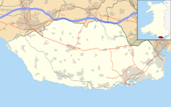
Location within the Vale of Glamorgan
Principal area
Ceremonial county
Country Wales
Sovereign state United Kingdom
Historic county
Post town COWBRIDGE
Postcode district CF71
Police South Wales
Fire South Wales
Ambulance Welsh
UK Parliament
Senedd Cymru – Welsh Parliament
List of places
UK
Wales
Vale of Glamorgan
51°26′22″N3°31′07″W / 51.4395°N 3.5187°W / 51.4395; -3.5187 Coordinates: 51°26′22″N3°31′07″W / 51.4395°N 3.5187°W / 51.4395; -3.5187

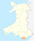
Sutton is a small hamlet in the Vale of Glamorgan, just south of Llandow.

Contents

History

Sutton was once home to the Turbervill family, and Edward Turbervill once had his seat at Sutton. [1] A Bronze Age barrow has been unearthed in Sutton. [2] [3] In 1940, Sir Cyril Fox was said to have found "a primary burial of a typical Beaker man, crouched in a large pit cut into the subsoil, with a Beaker of debased 'B1' type and barbed and tanged flint arrow-heads." [4]

Notable landmarks

It contains three listed buildings, Sutton Farmhouse which is Grade II* listed and the "Long Range of Outbuildings to Northwest of Sutton Farmhouse" and "Small Outbuilding immediately to West of Sutton Farmhouse" which are Grade II listed. [5] Nearby is Llandow Industrial Estate and Springfield Nurseries, a major supplier of pot Chrysanthemums to the UK market.

A 5 bedroom mansion in Sutton named The Granary was valued at £730,000 as of August 2011, making it amongst the most expensive properties in the county. [6]

Related Research Articles

Vale of Glamorgan county borough

The Vale of Glamorgan, often referred to as The Vale, is a county borough in Wales, bordering Bridgend, Cardiff, and Rhondda Cynon Taf. With an economy based largely on agriculture and chemicals, it is the southernmost unitary authority in Wales. Attractions include Barry Island Pleasure Park, the Barry Tourist Railway, Medieval wall paintings in St Cadoc's Church, Llancarfan, Porthkerry Park, St Donat's Castle, Cosmeston Lakes Country Park and Cosmeston Medieval Village.

Glamorgan Historic county of Wales

Glamorgan, or sometimes Glamorganshire, is one of the thirteen historic counties of Wales and a former administrative county of Wales. Originally an early medieval petty kingdom of varying boundaries known as Glywysing. Then taken over by the Normans as a lordship. The area that became known as Glamorgan was both a rural, pastoral area, and a conflict point between the Norman lords and the Welsh princes. It was defined by a large concentration of castles.

Ewenny Priory Former monastery in Wales

Ewenny Priory, in Ewenny in the Vale of Glamorgan, Wales, was a monastery of the Benedictine order, founded in the 12th century.

Ewenny Human settlement in Wales

Ewenny is a village and community (parish) on the River Ewenny in the Vale of Glamorgan, Wales.

Colwinston Human settlement in Wales

Colwinston is both a village and a community in the Vale of Glamorgan, Wales, approximately 4 miles (6.4 km) southeast of the centre of Bridgend and 21 miles (34 km) west of the centre of Cardiff. The village is located within 12 mile (0.80 km) of the A48. The population in 2005 was approximately 400 but with recent building development, the population is now estimated at over 600 people.

St Athan Human settlement in Wales

St Athan is a village and community in the Vale of Glamorgan in South Wales. The village and its parish church are dedicated to Saint Tathan. The church dates to the 13th–14th century, though an earlier church was dated to the Norman period. The village and the adjacent dormitory village of Eglwys Brewis are known primarily for the MOD St Athan RAF base. There is one pub in the village, as well as a football team at St Athan Football Club and the St Athan Golf Club. The community includes West Aberthaw.

Bishops Sutton Human settlement in England

Bishops Sutton or Bishop's Sutton is a village and civil parish one mile (1.6 km) east of the market town of Alresford in the City of Winchester district of Hampshire, England. According to the 2001 census it had a population of 419, increasing to 463 at the 2011 Census.

Ruscombe Human settlement in England

Ruscombe is a village and civil parish, east of Twyford in the Borough of Wokingham in Berkshire, England.

Llandow Human settlement in Wales

Llandow is a village and community in the Vale of Glamorgan, Wales. The community population taken at the 2011 census was 726. The village is located 15 miles (24 km) south west of Cardiff. The community includes the villages of Sigingstone and Llysworney.

Mellor Hall

Mellor Hall is a country house in Mellor, Greater Manchester, England, 0.4 miles (0.64 km) north of the Devonshire Arms off Longhurst Lane.

Coedarhydyglyn

Coedarhydyglyn or Coedriglan, formerly Old Coedarhydyglyn, is a private Grade I listed neo-classical regency villa and estate on the western rim of Cardiff, less than half a mile from Culverhouse Cross, southeast Wales. It is accessed via the A48 road between Cardiff and St. Nicholas at the top of "The Tumble" hill leading up from Culverhouse Cross and Coedarhydyglyn Lane which leads to Drope to the north. The estate lies between the villages of St Georges-super-Ely and Downs just inside the boundary of the Vale of Glamorgan.

The Vale of Glamorgan has 740 listed buildings of which 4% are Grade I listed, 10% Grade II* listed and remainder Grade II listed.

Tytherington, Wiltshire Human settlement in England

Tytherington is a small village in Wiltshire, in the southwest of England. It lies on the south side of the Wylye valley, about 3+12 miles (6 km) southeast of the town of Warminster and 1 mile (1.6 km) southwest of the larger village of Heytesbury. Most of the village is now part of the civil parish of Heytesbury although a few houses in the west are within the parish of Sutton Veny.

Llanrothal Human settlement in England

Llanrothal is a small village and historical parish in Herefordshire, England in the Monnow Valley, on the border with Monmouthshire, Wales. The River Monnow flows near here along the border. The village is located 5 miles by road northwest of Monmouth. It contains a 12th-century church, St John the Baptist's which stands in a remote position close to the England–Wales border overlooking the river.

Flemingston Human settlement in Wales

Flemingston is a small village in the Vale of Glamorgan in south Wales. It is located 8.5 miles (13.7 km) northwest by road from the town centre of Barry. It contains the Church of St. Michael the Archangel, the ruins of Flemingston Court, and Flemingston Manor or Grange, all of which are listed buildings. Historically, the parish of Flemingston was a sub-manor of Aberthaw or St Athan.

Great Manson Farm, Monmouth

Great Manson Farm is a property on the northern outskirts of Monmouth, Monmouthshire, Wales, in the Buckholt area. It is in the Manson Lane neighbourhood, within the electoral division of Dixton with Osbaston. During the course of the nineteenth and twentieth centuries, members of the Clarke, Goode, Clark, Dampier, and Morgan families resided at Great Manson Farm, at which time the reported size of the farm varied from 170 to 200 acres. The property is remarkable for the presence of three grade II listed buildings, including a barn with medieval origins.

Grade I listed buildings in the Vale of Glamorgan

There are 33 Grade I listed buildings in the Vale of Glamorgan all of which are churches and priory buildings, castles, country or manor houses and associated structures such as churchyard crosses and a dovecote.

St Georges super Ely Human settlement in Wales

St Georges super Ely, also known as St Georges, is a small village and community in the western outskirts of Cardiff, in the Vale of Glamorgan, South Wales. Lying to the northwest of Culverhouse Cross, between Peterston-super-Ely and Michaelston-super-Ely, it contains a medieval church and ruined manor house dated to the fifteenth century.

Nash Manor is a Grade I listed building in Llandow, near Cowbridge in the Vale of Glamorgan, south Wales. It became a Grade I listed building on 16 December 1952.

Blaengavenny Farmhouse, Llanvihangel Crucorney

Blaengavenny Farmhouse, Llanvihangel Crucorney, Monmouthshire is a farmhouse of late medieval origins. It is a Grade II listed building. Its adjacent barn and granary have separate Grade II listings.

References

  1. A List of the names and residences of the High Sheriffs of the County of Glamorgan: from 1541 to 1966. George Williams. 1966. p. 84. Retrieved 20 August 2011.
  2. The bulletin of the Board of Celtic Studies. Oxford University Press. 1968. p. 283. Retrieved 20 August 2011.
  3. National Museum of Wales (1939). Annual report. The Museum. Retrieved 20 August 2011.
  4. Foster, Idris Llewelyn; Daniel, Glyn Edmund (1965). Prehistoric and early Wales. Routledge and K. Paul. p. 83. Retrieved 20 August 2011.
  5. "Listed Buildings" (PDF). www.valeofglamorgan.gov.uk. Retrieved 20 August 2011.
  6. "The Granary". Zoopla . Retrieved 20 August 2010.