Fonmon

Last updated

Fonmon
Village Pond, Fonmon, Vale of Glamorgan. - geograph.org.uk - 374957.jpg
Village pond, Fonmon
Vale of Glamorgan UK location map.svg
Red pog.svg
Fonmon
Location within the Vale of Glamorgan
Principal area
Preserved county
Country Wales
Sovereign state United Kingdom
Postcode district CF
Police South Wales
Fire South Wales
Ambulance Welsh
UK Parliament
Senedd Cymru – Welsh Parliament
List of places
UK
Wales
Vale of Glamorgan
51°23′59″N3°22′11″W / 51.399779°N 3.369596°W / 51.399779; -3.369596

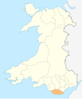
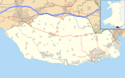
Fonmon (Welsh : Ffwl-y-mwn) is a hamlet in the Vale of Glamorgan in south Wales. It lies just off the B4265 road to the northwest of Font-y-Gary and Rhoose on the western side of Cardiff Airport. The hamlet is best known for its central duck pond and Fonmon Castle, a historical house located on the otherside of the B4265 road to the north. The largest house in the hamlet is called The Gables, accessed off a drive on the left approaching Fonmon from the north. A number of the houses in the area are thatched roofed.
Contents

Castle

Fonmon Castle is one of the few medieval castles which are still lived in as a home. Since it was built by the St. John family c.1200, it has only changed hands once. [1] Oliver St John of Fonmon was one of the legendary Twelve Knights of Glamorgan who effected the Norman conquest of Glamorgan. The St John family is today represented by the Viscounts Bolingbroke. The castle is still in use as a private residence. The present owners, the Boothby baronets, are descendants of Colonel Philip Jones, who bought the house in 1654. [2] In 1762 the castle was renovated by Thomas Paty of Bristol for its owner at the time, Robert Jones. [3] The ceilings and library were designed by Thomas Stocking in the Rococo style and extensive gardens were added. [3]

In 2022, archaeologists have discovered around 70 ancient graves on the grounds of Fonmon Castle, near the runway of Cardiff Airport. The graves are believed be dated to the 6th or 7th Century. [4]

Related Research Articles

<span class="mw-page-title-main">Vale of Glamorgan</span> County borough in Wales

The Vale of Glamorgan, often referred to as The Vale, is a county borough in the south-east of Wales. It borders Bridgend County Borough to the west, Cardiff to the east, Rhondda Cynon Taf to the north, and the Bristol Channel to the south. With an economy based largely on agriculture and chemicals, it is the southernmost unitary authority in Wales. Attractions include Barry Island Pleasure Park, the Barry Tourist Railway, Medieval wall paintings in St Cadoc's Church, Llancarfan, Porthkerry Park, St Donat's Castle, Cosmeston Lakes Country Park and Cosmeston Medieval Village. The largest town is Barry. Other towns include Penarth, Llantwit Major, and Cowbridge. There are many villages in the county borough.

<span class="mw-page-title-main">Glamorgan</span> Historic county of Wales

Until 1974, Glamorgan, or sometimes Glamorganshire, was an administrative county in the south of Wales, and later classed as one of the thirteen historic counties of Wales. Originally an early medieval petty kingdom of varying boundaries known in Welsh as Morgannwg, which was then invaded and taken over by the Normans as the Lordship of Glamorgan. The area that became known as Glamorgan was both a rural, pastoral area, and a conflict point between the Norman lords and the Welsh princes. It was defined by a large concentration of castles.

<span class="mw-page-title-main">Cardiff Castle</span> Grade I listed castle in Cardiff, Wales

Cardiff Castle is a medieval castle and Victorian Gothic revival mansion located in the city centre of Cardiff, Wales. The original motte and bailey castle was built in the late 11th century by Norman invaders on top of a 3rd-century Roman fort. The castle was commissioned either by William the Conqueror or by Robert Fitzhamon, and formed the heart of the medieval town of Cardiff and the Marcher Lord territory of Glamorgan. In the 12th century the castle began to be rebuilt in stone, probably by Robert of Gloucester, with a shell keep and substantial defensive walls being erected. Further work was conducted by the 6th Earl of Gloucester in the second half of the 13th century. Cardiff Castle was repeatedly involved in the conflicts between the Anglo-Normans and the Welsh, being attacked several times in the 12th century, and stormed in 1404 during the revolt of Owain Glyndŵr.

<span class="mw-page-title-main">Llantwit Major</span> Human settlement in Wales

Llantwit Major is a town and community in Wales on the Bristol Channel coast. It is one of four towns in the Vale of Glamorgan, with the third largest population after Barry and Penarth, and ahead of Cowbridge. It is 4+12 miles (7.2 km) from Cowbridge, 9 miles (14 km) from Bridgend, 10 miles (16 km) from Barry, and 15 miles (24 km) from Cardiff. It had a population of 9,530 in 2021.

<span class="mw-page-title-main">Barry, Vale of Glamorgan</span> Town in the Vale of Glamorgan, Wales

Barry is a town and community in the Vale of Glamorgan, Wales. It is on the north coast of the Bristol Channel approximately 9 miles (14 km) south-southwest of Cardiff. Barry is a seaside resort, with attractions including several beaches and the resurrected Barry Island Pleasure Park. According to Office for National Statistics 2016 estimate data, the population of Barry was 54,673.

<span class="mw-page-title-main">Baglan, Neath Port Talbot</span> Village in West Glamorgan, Wales

Baglan is a village in Wales, adjoining Port Talbot, named after Saint Baglan. It is also a community and ward in the Neath Port Talbot county borough. In 2001, the population was 6,654. rising to 6,819 in 2011.

<span class="mw-page-title-main">Dinas Powys</span> Human settlement in Wales

Dinas Powys is a small town and community in the Vale of Glamorgan, South Wales. Its name means "fort of the provincial place" and refers to the Iron Age hillfort which overlooks the village. Dinas Powys is 5.6 miles (9.0 km) south-west of the centre of Cardiff and is situated on the A4055 road from Cardiff to Barry, making it a popular dormitory village for city commuters. It neighbours the larger town of Penarth.

<span class="mw-page-title-main">Porthkerry</span> Hamlet in the Vale of Glamorgan, Wales

The hamlet of Porthkerry lies on the Bristol Channel coast of South Wales within the community of Rhoose between that village and the town of Barry to the east. It is very close to the end of the runway of Cardiff International Airport. To the east of the hamlet is Porthkerry Country Park which occupies the valley leading down to the coast.

<span class="mw-page-title-main">Aberthaw</span> Human settlement in Wales

Aberthaw is an area containing the villages of East Aberthaw and West Aberthaw, on the coast of South Wales about 5 miles (8 km) west of Barry. It is home to Aberthaw Cement Works, Aberthaw Lime Works, and Aberthaw Power Station, a decommissioned coal power station that was linked to the South Wales Valleys via the Vale of Glamorgan Railway. The area is historically within the parish of Penmark in the Vale of Glamorgan. The two villages of West and East Aberthaw are separated by the River Thaw. The village of East Aberthaw, near Rhoose, has a 13th-century pub. The village Baptist Chapel and Mission Room no longer exist as such and have been converted for other uses.

<span class="mw-page-title-main">St Fagans Castle</span> Grade I listed Elizabethan castle

St Fagans Castle is an Elizabethan mansion in St Fagans, Cardiff, Wales, dating from the late 16th century. The house and remaining medieval fortifications are Grade I listed. The grounds of St Fagans Castle now contain St Fagans National Museum of History. The castle estate is designated Grade I on the Cadw/ICOMOS Register of Parks and Gardens of Special Historic Interest in Wales.

<span class="mw-page-title-main">Fonmon Castle</span>

Fonmon Castle is a fortified medieval castle near the village of Fonmon in the Vale of Glamorgan and a Grade I listed building. The castle's gardens are designated Grade II on the Cadw/ICOMOS Register of Parks and Gardens of Special Historic Interest in Wales. With its origins rooted in the 12th century it is today seen as a great architectural rarity, as it is one of few buildings that was drastically remodelled in the 18th century, but not Gothicized. The castle is believed to have remained under the ownership of just two families throughout its history; from Norman times, it was owned by the St Johns, and from 1656, by the descendants of Colonel Philip Jones.

<span class="mw-page-title-main">Philip Jones of Fonmon</span> Welsh military leader and politician

Colonel Philip Jones was a Welsh military leader and politician who sat in the House of Commons between 1650 and 1656. He rose to the rank of Colonel in the service of the Parliamentary Army under Fairfax during the English Civil War. As Governor of Swansea he successfully held the town against the Royalist forces.

This page is a list of High Sheriffs of Glamorgan. Sheriffs of Glamorgan served under and were answerable to the independent Lords of Glamorgan until that lordship was merged into the crown. This is in contrast to sheriffs of the English shires who were from the earliest times officers of the crown. Sheriffs in the modern sense, appointed and answerable to the crown, were instituted in the county of Glamorgan in 1541.

<span class="mw-page-title-main">Clemenstone</span> Human settlement in Wales

Clemenstone or Clemenston is a hamlet located in the western part of the Vale of Glamorgan, southeast Wales, southeast of Bridgend. Historically part of Glamorgan, it contains the Clemenstone Estate and House, long-time seat of the Curre family, and a Sports Academy. Clemenstone Meadows are a Site of Special Scientific Interest (SSSI).

The Vale of Glamorgan has 740 listed buildings of which 4% are Grade I listed, 10% Grade II* listed and remainder Grade II listed.

<span class="mw-page-title-main">Wrinstone</span> Building in Vale of Glamorgan, Wales

Wrinstone or Wrinston is a medieval hamlet, just east of Wenvoe, Vale of Glamorgan, south Wales. The Wrinstone estate was variously also known as Wrenston, Wrencheston or Wrenchester. The Barry Railway line ran past the hamlet and entered the Wenvoe Tunnel just to the north near Wenvoe Quarry. It closed after a fire in 1963.

A bibliography of books related to the Vale of Glamorgan, south Wales.

<span class="mw-page-title-main">Llanilid</span> Human settlement in Wales

Llanilid is a small settlement of in the county borough of Rhondda Cynon Taf, Wales. It is in the historic county of Glamorgan. Llanilid is part of the community of Llanharan along with the villages of Bryncae, Brynna, Ynysmaerdy, Peterston-super-Montem and Llanharan itself.

<span class="mw-page-title-main">Tythegston</span> Human settlement in Wales

Tythegston is a conservation area village located close to Cardiff and Swansea on the south coast of Bridgend, Wales. It is home to Tythegston Court, a Grade II listed manor house at the centre of the 1,200 acre Tythegston Estate which is designated at Grade II on the Cadw/ICOMOS Register of Parks and Gardens of Special Historic Interest in Wales. The estate has been owned by the Knight family for some 350 years and operates as a farming and property enterprise, with an industrial estate, as well as hosting green energy and food production. The seaside town of Porthcawl, with its numerous beaches is within 3 miles, as is Bridgend inter-city rail station. The village covers an area of 2,871 acres (1,162 ha). It is part of the community of Merthyr Mawr.

<span class="mw-page-title-main">Perth-hir House</span> House in Rockfield, Monmouthshire

Perth-hir House, Rockfield, Monmouthshire, Wales, was a major residence of the Herbert family. It stood at a bend of the River Monnow, to the north-west of the village. At its height in the 16th century, the mansion, entered by two drawbridges over a moat, comprised a great hall and a number of secondary structures. Subsequently in the ownership of the Powells, and then the Lorimers, the house became a centre of Catholic recusancy following the English Reformation. By the 19th century, the house had declined to the status of a farmhouse and it was largely demolished in around 1830. Its ruins, and the site which contains considerable remnants of a Tudor garden, are a scheduled monument.

References

  1. Spurgeon, Clifford (April 2000). An inventory of the ancient monuments in Glamorgan. Royal Commission on Ancient and Historical Monuments in Wales, H.M.S.O. pp. 147–50. ISBN   978-1-871184-22-8.
  2. Williams, William Retlaw (1895). The parliamentary history of the principality of Wales, from the earliesr times to the present day, 1541-1895: comprising lists of the representatives, chronologically arranged under counties, with biographical and genealogical notices of the members, together with particulars of the various contested elections, double returns and petitions. Priv. print. for the author by E. Davis and Bell. p.  97 . Retrieved 19 April 2012.
  3. 1 2 Newman, John (1995). Glamorgan: (Mid Glamorgan, South Glamorgan and West Glamorgan). Yale University Press. p. 350. ISBN   978-0-14-071056-4.
  4. "Mysterious medieval cemetery unearthed in Wales". 3 January 2024. Retrieved 25 January 2024.