Gwern-y-Steeple

Last updated

Gwern-y-Steeple
Cottages - Gwern-y-Steeple - geograph.org.uk - 1276189.jpg
Cottages along main road
Vale of Glamorgan UK location map.svg
Red pog.svg
Gwern-y-Steeple
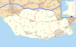
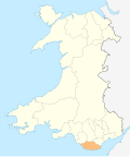
Location within the Vale of Glamorgan
OS grid reference ST077756
Community
Principal area
Preserved county
Country Wales
Sovereign state United Kingdom
Post town Barry
Postcode district CF62
Police South Wales
Fire South Wales
Ambulance Welsh
UK Parliament
Senedd Cymru – Welsh Parliament
List of places
UK
Wales
Vale of Glamorgan
51°28′17″N3°19′46″W / 51.471389°N 3.329444°W / 51.471389; -3.329444

Gwern-y-steeple is a hamlet in the Vale of Glamorgan, Wales. It lies north of the A48 road and north-west St. Nicholas (to which it is linked by Chapel Lane) on the road south-west of Peterston-Super-Ely. Cottrell Park Golf Club lies to the south. Gwern-y-steeple is part of the village of Peterston-Super-Ely and lies within the catchment area of both Peterson-Super-Ely Church in Wales Primary School and Pendoylan Primary School. The local member of Parliament is Conservative Alun Cairns and is part of the Vale of Glamorgan county council. The local county councillor is Rhodri Traherne.

The village of St. Nicholas once extended as far north as Gwern-y-steeple, with Croes-y-Parc Chapel, originally being within the St. Nicholas boundary. [1]
Notable people

Related Research Articles

<span class="mw-page-title-main">Vale of Glamorgan</span> County borough in Wales

The Vale of Glamorgan, often referred to as The Vale, is a county borough in the south-east of Wales. It borders Bridgend County Borough to the west, Cardiff to the east, Rhondda Cynon Taf to the north, and the Bristol Channel to the south. With an economy based largely on agriculture and chemicals, it is the southernmost unitary authority in Wales. Attractions include Barry Island Pleasure Park, the Barry Tourist Railway, Medieval wall paintings in St Cadoc's Church, Llancarfan, Porthkerry Park, St Donat's Castle, Cosmeston Lakes Country Park and Cosmeston Medieval Village. The largest town is Barry. Other towns include Penarth, Llantwit Major, and Cowbridge. There are many villages in the county borough.

<span class="mw-page-title-main">Colwinston</span> Human settlement in Wales

Colwinston is both a village and a community in the Vale of Glamorgan, Wales, approximately 4 miles (6.4 km) southeast of the centre of Bridgend and 21 miles (34 km) west of the centre of Cardiff. The village is located within 12 mile (0.80 km) of the A48. The population in 2005 was approximately 400 but with recent building development, the population is now estimated at over 600 people.

<span class="mw-page-title-main">Barry, Vale of Glamorgan</span> Town in the Vale of Glamorgan, Wales

Barry is a town in the Vale of Glamorgan, Wales, on the north coast of the Bristol Channel approximately 9 miles (14 km) south-southwest of Cardiff. Barry is a seaside resort, with attractions including several beaches and the resurrected Barry Island Pleasure Park. According to Office for National Statistics 2016 estimate data, the population of Barry was 54,673.

<span class="mw-page-title-main">Ynyshir</span> Village and community in Rhondda, Wales

Ynyshir is a village and community located in the Rhondda Valley, within Rhondda Cynon Taf, South Wales. The name of the village means "long island" in Welsh and takes its name from a farm in the area, falling within the historic parishes of Ystradyfodwg and Llanwynno (Llanwonno). The community of Ynyshir lies between the small adjoining village of Wattstown and the larger town of neighbouring Porth.

<span class="mw-page-title-main">Peterston-super-Ely</span> Human settlement in Wales

Peterston-super-Ely is a village and community situated on the River Ely in the county borough of the Vale of Glamorgan, Wales. The community population at the 2011 census was 874. The community includes the hamlet of Gwern-y-Steeple.

<span class="mw-page-title-main">St Athan</span> Human settlement in Wales

St Athan is a village and community in the Vale of Glamorgan in South Wales. The village and its parish church are dedicated to Saint Tathan. The church dates to the 13th–14th century, though an earlier church was dated to the Norman period. The village and the adjacent dormitory village of Eglwys Brewis are known primarily for the MOD St Athan RAF base. There are two pubs in the village, as well as a football team at St Athan Football Club and the St Athan Golf Club. The community includes West Aberthaw.

<span class="mw-page-title-main">Clydach, Swansea</span> Village in Swansea, Wales

Clydach is both a village and a community in Swansea, Wales, within the Clydach ward and the Llangyfelach parish. It is located 6 miles (9.7 km) northeast of Swansea city centre. In 2011, the population was 7,503. Welsh is the first language of 24 per cent of the population and both Welsh and English language schools are available. The village lies close to the M4 motorway which can be accessed via the bypass or old road via Ynystawe. The community includes part of the village of Glais.

<span class="mw-page-title-main">St Brides Major</span> Human settlement in Wales

St. Brides Major is a village within the community also called St Brides Major in the Vale of Glamorgan in Wales.

<span class="mw-page-title-main">River Ely</span> River in South Wales flowing from Tonyrefail to Cardiff

The River Ely is in South Wales flowing generally southeast, from Tonyrefail to Cardiff.

<span class="mw-page-title-main">A4226 road</span> Road in the Vale of Glamorgan

The A4226 is a main road linking Bonvilston to Barry and Cardiff International Airport (CIA) in the Vale of Glamorgan, Wales.

<span class="mw-page-title-main">St. Nicholas, Vale of Glamorgan</span> Human settlement in Wales

St. Nicholas is a small village in the Vale of Glamorgan, South Wales. It lies 2 miles west of the capital city, Cardiff and 7 miles from its city centre. St. Nicholas is the highest elevation village in the Vale of Glamorgan. The population was 417 in 2011. It is in the community of St Nicholas and Bonvilston.

<span class="mw-page-title-main">St Lythans</span> Human settlement in Wales

St Lythans is an affluent hamlet and former parish in the Vale of Glamorgan, southeast Wales, just outside western Cardiff. It lies southwest of Culverhouse Cross, west of Wenvoe and southwest of Twyn-yr-Odyn and is also connected by road from Dyffryn and the Five Mile Lane in the west. It is one of the wealthiest communities in the Vale of Glamorgan, containing some notable mansions and cottages, valued on average at over £500,000 as of 2011. The megalithic St Lythans burial chamber, over 6000 years old, lies 1 km to the west of the village and the hamlet also contains the St.Lythans Parish Church or Church of St Bleddian, a Grade II* listed building.

<span class="mw-page-title-main">Ynysboeth</span> Human settlement in Wales

Ynysboeth is a local community within the Mountain Ash (Aberpennar) postal district of the Cynon Valley in the County Borough of Rhondda Cynon Taf, South East Wales.

<span class="mw-page-title-main">Eglwys Brewis</span> Human settlement in Wales

Eglwys Brewis is a village in the Vale of Glamorgan in south Wales. It is located just to the north of the village of St Athan, south of Flemingston and northeast of Llantwit Major. Greenlands and St Mary Church lie to the north by road from Eglwys Brewis. The village consists primarily of residential estates which were originally built in the mid-20th century for service families stationed at nearby RAF St Athan. The estates are regularly used by driving instructors in the Vale of Glamorgan. Nant y Stepsau flows in the vicinity.

<span class="mw-page-title-main">Welsh St Donats</span> Human settlement in Wales

Welsh St Donats is a village and a community in The Vale of Glamorgan, Wales. Consisting of 1207 hectares of mainly rural land, it is located north east of Cowbridge. The population of the community was 534 in the 2011 census. Welsh St Donats includes the villages of Maendy, Prisk and Tair Onen. A mile to the east from the village lies the Hensol Forest, while the remains of Talyfan Castle are to the north.

<span class="mw-page-title-main">St Georges super Ely</span> Human settlement in Wales

St Georges super Ely, also known as St Georges, is a small village and community in the western outskirts of Cardiff, in the Vale of Glamorgan, South Wales. Lying to the northwest of Culverhouse Cross, between Peterston-super-Ely and Michaelston-super-Ely, it contains a medieval church and ruined manor house dated to the fifteenth century. The community includes the settlements of Drope, Downs and Sant-y-Nyll.

<span class="mw-page-title-main">St. Brides-super-Ely</span> Human settlement in Wales

St. Brides-super-Ely is a village and district of the community of Peterston-super-Ely, within the Vale of Glamorgan, South Wales. It is located near the western border of the Welsh Capital City of Cardiff, to the west of the A4232, and north of the River Ely.

<span class="mw-page-title-main">Peterston-super-Ely (electoral ward)</span> Electoral ward in Wales

Peterston-super-Ely is the name of an electoral ward in the Vale of Glamorgan, Wales, which covers its namesake village of Peterston-super-Ely and the neighbouring communities of Pendoylan and Welsh St Donats. The ward elects a county councillor to the Vale of Glamorgan Council.

References

  1. "St Nicholas, Glamorgan". www.genuki.org.uk. Retrieved 31 August 2023.
  2. Godden, Geoffrey A. (1991). Encyclopaedia of British pottery and porcelain marks. Barrie and Jenkins. ISBN   978-0-257-65782-0.

Genuki