

Gileston Manor is a manor and country house located in the small village of Gileston near St Athan, Vale of Glamorgan, Wales.
Gileston Manor is a manor and country house located in the small village of Gileston near St Athan, Vale of Glamorgan, Wales.
The house contains remnants of a late medieval building, but the exterior and some of the internal fittings date from the 18th century. [1] The building is square in plan and has two main storeys, as well as an attic and cellars. A wide staircase occupies the middle of the house while the front bedrooms are lined with 18th-century wall panelling. [1] The west wing is the oldest part of the building, with roof trussess suggesting it dates to the early 1500s. The exterior south (front) façade is a later remodelling of the early 1700s, with a symmetrical arrangement of windows and a hipped roof. [1] The house has a large 18th-century walled garden and summer house.
The manor is believed to have been held by a family with the surname Jule or Giles, until the last male heir died in 1673. The house was then passed on to two female heiresses and subsequently, during the 18th century, was occupied by a succession of village clerics. [1] For example, in 1771 the Bishop of Llandaff recorded that the village population consisted of a farmer, his wife, son and servants, an old man and an old woman, while the rector and his family was also the squire and occupants of the manor house. [2]
The manor house became a Grade II* listed building in 1952. [3]
In 2009, the house and grounds were reported to be on sale with an asking price of £2.5 million. [4]

The Vale of Glamorgan, locally referred to as The Vale, is a county borough in the south-east of Wales. It borders Bridgend County Borough to the west, Cardiff to the east, Rhondda Cynon Taf to the north, and the Bristol Channel to the south. With an economy based largely on agriculture and chemicals, it is the southernmost unitary authority in Wales. Attractions include Barry Island Pleasure Park, the Barry Tourist Railway, Medieval wall paintings in St Cadoc's Church, Llancarfan, Porthkerry Park, St Donat's Castle, Cosmeston Lakes Country Park and Cosmeston Medieval Village. The largest town is Barry. Other towns include Penarth, Llantwit Major, and Cowbridge. There are many villages in the county borough.

Llantwit Major is a town and community in Wales on the Bristol Channel coast. It is one of four towns in the Vale of Glamorgan, with the third largest population after Barry and Penarth, and ahead of Cowbridge. It is 4+1⁄2 miles (7.2 km) from Cowbridge, 9 miles (14 km) from Bridgend, 10 miles (16 km) from Barry, and 15 miles (24 km) from Cardiff. It had a population of 9,530 in 2021.

Merthyr Mawr is a village and community in Bridgend, Wales. The village is about 2+1⁄2 miles from the centre of Bridgend town. The population of the community at the 2011 census was 267. The community occupies the area west of the Ewenny River, between Bridgend and Porthcawl. It takes in the settlement of Tythegston and a stretch of coastal sand dunes known as Merthyr Mawr Warren. It is in the historic county of Glamorgan.

St Athan is a village and community in the Vale of Glamorgan in South Wales. The village and its parish church are dedicated to Saint Tathan. The church dates to the 13th–14th century, though an earlier church was dated to the Norman period. The village and the adjacent dormitory village of Eglwys Brewis are known primarily for the MOD St Athan RAF base. There are two pubs in the village, as well as a football team at St Athan Football Club and the St Athan Golf Club. The community includes West Aberthaw.

Gileston is a small Welsh village near West Aberthaw in the Vale of Glamorgan on the coast of South Wales.

Aberthaw is an area containing the villages of East Aberthaw and West Aberthaw, on the coast of South Wales about 5 miles (8 km) west of Barry. It is home to Aberthaw Cement Works, Aberthaw Lime Works, and Aberthaw Power Station, a decommissioned coal power station that was linked to the South Wales Valleys via the Vale of Glamorgan Railway. The area is historically within the parish of Penmark in the Vale of Glamorgan. The two villages of West and East Aberthaw are separated by the River Thaw. The village of East Aberthaw, near Rhoose, has a 13th-century pub. The village Baptist Chapel and Mission Room no longer exist as such and have been converted for other uses.

Old Beaupre Castle is a ruined medieval fortified manor house located in the community of Llanfair, outside Cowbridge in Wales. It is known in historic documents under the names Beawpire, Bewerpere, Bewpyr and Y Bewpur. It is a Grade I listed building and is under the care of Cadw. It can be visited free of charge all year round by members of the public. The gardens are designated Grade II on the Cadw/ICOMOS Register of Parks and Gardens of Special Historic Interest in Wales.
The Vale of Glamorgan has 740 listed buildings of which 4% are Grade I listed, 10% Grade II* listed and remainder Grade II listed.

Whitecross Street is a historic street in the town centre of Monmouth, Monmouthshire, Wales. It was in existence by the 15th century, and appears as Whit crose on the 1610 map of the town by cartographer John Speed. It runs in an east-west direction, between Church Street and St James Square. It has been suggested that the street takes its name from a plague cross. Whitecross Street is lined with numerous listed buildings.

Flemingston is a small village in the Vale of Glamorgan in south Wales. It is located 8.5 miles (13.7 km) northwest by road from the town centre of Barry. It contains the Church of St. Michael the Archangel, the ruins of Flemingston Court, and Flemingston Manor or Grange, all of which are listed buildings. Historically, the parish of Flemingston was a sub-manor of Aberthaw or St Athan.

St James Square is a historic square in the town centre of Monmouth, Monmouthshire, Wales. It is located at the eastern end of Whitecross Street, within the medieval town walls. The area features the Monmouth War Memorial and the controversial, historic Indian Bean Tree. In addition, in 2010, the square was the site of discovery of the first Mesolithic artefacts in Monmouth. St James Square is lined with numerous listed buildings. It is also home to the Monmouth Catalpa Tree.

Wrinstone or Wrinston is a medieval hamlet, just east of Wenvoe, Vale of Glamorgan, south Wales. The Wrinstone estate was variously also known as Wrenston, Wrencheston or Wrenchester. The Barry Railway line ran past the hamlet and entered the Wenvoe Tunnel just to the north near Wenvoe Quarry. It closed after a fire in 1963.

There are 33 Grade I listed buildings in the Vale of Glamorgan all of which are churches and priory buildings, castles, country or manor houses and associated structures such as churchyard crosses and a dovecote.

St Brides Major is a community on the western edge of the Vale of Glamorgan, South Wales. Its largest settlement is the village of St Brides Major, and also includes the villages of Ogmore-by-Sea and Southerndown, and the hamlets of Ogmore Village, Castle-upon-Alun, Heol-y-Mynydd, Norton and Pont-yr-Brown It is notable for coastal geology and scenery, limestone downlands and fossilised primitive mammals, sea cliffs and beaches, two Iron Age hillforts, three medieval castle sites,, two stepping stone river crossings and a clapper bridge. Three long distance paths cross the community. It is the western limit of the Vale of Glamorgan Heritage Coast, and has a visitor centre and tourist facilities.
St Athan Road railway station served the village of St Athan in the Vale of Glamorgan in South Wales.

Gileston railway station served the village of Gileston in South Wales.

St David's Church, Laleston is a Grade I listed church in Laleston, Bridgend County Borough, southern Wales. It is listed Grade 1 as a medieval church with its fabric, including timber roofs, mainly intact, and having group value with the churchyard cross and Cliff Cottage.

Holy Trinity Church is a Grade I-listed church in Marcross, a village in the Vale of Glamorgan, south Wales. It received its status as a Grade I-listed building on 22 February 1963.

Llansannor Court is a Grade I listed building in Llansannor, near Cowbridge in the Vale of Glamorgan, south Wales. It became a Grade I listed building on 16 December 1952. It is believed to have been built during the Elizabethan era.
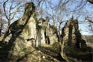
East Orchard Castle is a ruined building near St Athan in the Vale of Glamorgan, Wales, whose remains date mainly from the 14th century.
