Penllyn, Vale of Glamorgan

Last updated

Penllyn
Vale of Glamorgan UK location map.svg
Red pog.svg
Penllyn
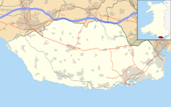
Location within the Vale of Glamorgan
Population1,506 (2011) [1]
OS grid reference SS973761
Community
  • Penllyn
Principal area
Preserved county
Country Wales
Sovereign state United Kingdom
Post town Cowbridge
Postcode district CF71
Dialling code 01446
Police South Wales
Fire South Wales
Ambulance Welsh
UK Parliament
Senedd Cymru – Welsh Parliament
List of places
UK
Wales
Vale of Glamorgan
51°28′31″N3°28′48″W / 51.475228°N 3.480110°W / 51.475228; -3.480110

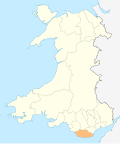
Penllyn (Welsh : Pen-llin) is a village and community in the Vale of Glamorgan, Wales. It is located north west of the market town of Cowbridge. As a community it contains the settlements of Llansannor, Pentre Meyrick, Trerhyngyll, Ystradowen and Penllyn itself. [2]

Penllyn is home to Penllyn Castle, a 12th-century fortification which, although ruinous, is now adjoined by a castellated mansion originally built in the late 16th century.

The smaller hamlet of Graig Penllyn, about 1.3 miles (2.1 km) north of the main village, is notable for its pub the Barley Mow. [3] [4]

The Barley Mow, Graig Penllyn The Barley Mow at Graig Penllyn - geograph.org.uk - 923306.jpg
The Barley Mow, Graig Penllyn

Notes

  1. "Community population 2011" . Retrieved 9 April 2015.
  2. Davies, John; Jenkins, Nigel; Menna, Baines; Lynch, Peredur I., eds. (2008). The Welsh Academy Encyclopaedia of Wales. Cardiff: University of Wales Press. p. 492. ISBN   978-0-7083-1953-6.
  3. "The Barley Mow Inn, a pub in Cowbridge, South Wales". cowbridgeguide.co.uk. Retrieved 30 September 2016.
  4. "Barley Mow, Craig Penllyn". whatpub.com. Retrieved 30 September 2016.

Related Research Articles

<span class="mw-page-title-main">Vale of Glamorgan</span> County borough in Wales

The Vale of Glamorgan, locally referred to as The Vale, is a county borough in the south-east of Wales. It borders Bridgend County Borough to the west, Cardiff to the east, Rhondda Cynon Taf to the north, and the Bristol Channel to the south. With an economy based largely on agriculture and chemicals, it is the southernmost unitary authority in Wales. Attractions include Barry Island Pleasure Park, the Barry Tourist Railway, Medieval wall paintings in St Cadoc's Church, Llancarfan, Porthkerry Park, St Donat's Castle, Cosmeston Lakes Country Park and Cosmeston Medieval Village. The largest town is Barry. Other towns include Penarth, Llantwit Major, and Cowbridge. There are many villages in the county borough.

<span class="mw-page-title-main">Cowbridge</span> Human settlement in Wales

Cowbridge is a market town in the Vale of Glamorgan, Wales, approximately 12 miles (19 km) west of the centre of Cardiff.

<span class="mw-page-title-main">Merionethshire</span> Historic county of Wales

Until 1974, Merionethshire or Merioneth was an administrative county in the north-west of Wales, later classed as one of the thirteen historic counties of Wales.

<span class="mw-page-title-main">Colwinston</span> Village and community in Wales

Colwinston is both a village and a community in the Vale of Glamorgan, Wales, approximately 4 miles (6.4 km) southeast of the centre of Bridgend and 21 miles (34 km) west of the centre of Cardiff. The village is located within 12 mile (0.80 km) of the A48. The population in 2005 was approximately 400 but with recent building development, the population is now estimated at over 600 people.

<span class="mw-page-title-main">Aberthin</span> Human settlement in Wales

Aberthin is a small village, just outside Cowbridge in the Vale of Glamorgan, South Wales, on the north side of a shallow valley, less than a mile northeast of Cowbridge across the A48 road. Cowbridge Comprehensive School lies just to the southwest of the village. About 250 metres to the south is an old quarry, with a "faulted strip of grey oolite". Aberthin is also the name of a brook, the River Aberthin. The village was served by the Aberthin Platform railway station between 1905 and 1920, now a field to the west of Aberthin.

<span class="mw-page-title-main">Ely, Cardiff</span> District and community of Cardiff, Wales

Ely is a district and community in Cardiff, Wales. It is to the north of Cowbridge Road West. Caerau defines the boundary to the south as does River Ely to the east and in part to the north.

<span class="mw-page-title-main">Canton, Cardiff</span> District and community in Cardiff, Wales

Canton is an inner-city district and community in the west of Cardiff, capital of Wales, lying 2 miles (3.2 km) west of the city's civic centre. It is located adjacent to Pontcanna. Canton is one of the most ethnically diverse of Cardiff's suburbs, with a significant Pakistani and Indian population. The total population of Canton increased to 14,304 at the 2011 census. It is also the most Welsh-speaking district of central Cardiff, with 19.1% of the population speaking Welsh.

<span class="mw-page-title-main">Bonvilston</span> Human settlement in Wales

Bonvilston is a village in the Vale of Glamorgan, Wales. The village is situated on the A48 about four miles east of Cowbridge and near the Welsh capital city of Cardiff. The population in 2011 was 392.

<span class="mw-page-title-main">Mynytho</span> Human settlement in Wales

Mynytho is a small village in the parish of Llanengan near the southern coast of the Llŷn Peninsula in northwestern Wales. It consists of a few houses and some farmland. There are also several campsites on the outskirts of the village. The population was 536 as of the 2011 UK census with over a third born in England.

<span class="mw-page-title-main">Ystradowen</span> Village in Vale of Glamorgan, Wales

Ystradowen is a small village twelve miles west of Cardiff, located in Penllyn community in the Vale of Glamorgan in south Wales; its nearest town is Cowbridge which is about three miles to the south.

<span class="mw-page-title-main">Kirk Ireton</span> Village in Derbyshire, England

Kirk Ireton is a village and civil parish in Derbyshire, England, 4 miles (6.4 km) southwest of Wirksworth on a hillside near Carsington Water, 700 feet (210 m) above sea level. The population at the 2011 Census was 518. Ireton is a corruption of the Saxon hyre-tun, meaning "Irishman's enclosure"; Kirk was added after the Norman invasion and the building of the church. The village dates back to at least the Bronze Age.

<span class="mw-page-title-main">St Nicholas, Vale of Glamorgan</span> Village in Wales

St Nicholas is a village situated in the Vale of Glamorgan, Wales. It lies 2 miles west of Cardiff and 6 miles east of Cowbridge. According to the 2021 census, the village had a population of 654 residents. St Nicholas forms part of the larger community of St Nicholas and Bonvilston.

<span class="mw-page-title-main">The Gatehouse, Monmouth</span> Public House (since 1812) in Monmouth, Wales

The Gatehouse, also known as The Gate House, is a public house located next to Monnow Bridge in Monmouth, Wales. The pub was known as the Barley Mow until it changed its name in 1993. It is the only public house in Monmouth located beside a river. The pub has a restaurant area, seated balcony and a function room.

<span class="mw-page-title-main">Eglwys Brewis</span> Human settlement in Wales

Eglwys Brewis is a village in the Vale of Glamorgan in south Wales. It is located just to the north of the village of St Athan, south of Flemingston and northeast of Llantwit Major. Greenlands and St Mary Church lie to the north by road from Eglwys Brewis. The village consists primarily of residential estates which were originally built in the mid-20th century for service families stationed at nearby RAF St Athan. The estates are regularly used by driving instructors in the Vale of Glamorgan. Nant y Stepsau flows in the vicinity.

<span class="mw-page-title-main">St Mary Hill</span> Human settlement in Wales

St Mary Hill is a settlement in the Vale of Glamorgan, Wales. It is located approximately 4 miles (6.4 km) north west of the market town of Cowbridge. It is part of the community of Llangan along with Treoes and the village of Llangan itself.

<span class="mw-page-title-main">Church of the Holy Cross, Cowbridge</span> Church in Wales

The Church of the Holy Cross is a medieval church in Cowbridge in the Vale of Glamorgan, south Wales. Initially a chapel of ease to Church of St John the Baptist, Llanblethian of Cowbridge as a medieval market town. Believed to have been built in the 13th century, the church has an unusual tower design. It has undergone several restorations including one by John Prichard in 1850–52. The Church of the Holy Cross was listed as a Grade I building on 12 May 1963.

<span class="mw-page-title-main">Llansannor Court</span> Grade I listed building in Vale of Glamorgan.

Llansannor Court is a Grade I listed building in Llansannor, near Cowbridge in the Vale of Glamorgan, south Wales. It became a Grade I listed building on 16 December 1952. It is believed to have been built during the Elizabethan era.

<span class="mw-page-title-main">St Senwyr's Church</span> Church in Llansannor, Vale of Glamorgan, Wales

St Senwyr's Church is a Grade I listed church in Llansannor, in the Vale of Glamorgan, south Wales. It became a Grade I listed building on 22 February 1963.

<span class="mw-page-title-main">Cowbridge (electoral ward)</span> Electoral ward in Wales

Cowbridge is the name of an electoral ward in the Vale of Glamorgan, Wales, which covers its namesake town of Cowbridge as well as the neighbouring villages of Llanblethian and Aberthin and the communities of Llanfair and Penllyn. The ward elects three county councillors to the Vale of Glamorgan Council.