St Georges super Ely

Last updated

St Georges super Ely
St. George's Church, St George's - geograph.org.uk - 421746.jpg
St. George's Church
Vale of Glamorgan UK location map.svg
Red pog.svg
St Georges super Ely
Location within the Vale of Glamorgan
Population417 
Principal area
Preserved county
Country Wales
Sovereign state United Kingdom
Postcode district CF
Police South Wales
Fire South Wales
Ambulance Welsh
UK Parliament
Senedd Cymru – Welsh Parliament
List of places
UK
Wales
Vale of Glamorgan
51°28′58″N3°17′55″W / 51.482706°N 3.298547°W / 51.482706; -3.298547

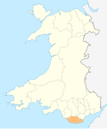
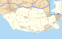
St Georges super Ely, also known as St Georges (Welsh : Sain Siorys), is a small village and community in the western outskirts of Cardiff, in the Vale of Glamorgan, South Wales. Lying to the northwest of Culverhouse Cross, between Peterston-super-Ely and Michaelston-super-Ely, it contains a medieval church and ruined manor house dated to the fifteenth century. The community includes the settlements of St Brides-super-Ely, Drope, Downs and Sant-y-Nyll.
Contents

History

In the 1870s, John Montgomery Traherne of the wealthy Traherne family was the vicar of St Georges. [1]

Geography

The bridge that passes over the A4232 to St Georges super Ely Bridge carrying the A4232 over St Georges road. - geograph.org.uk - 421748.jpg
The bridge that passes over the A4232 to St Georges super Ely

St Georges super Ely lies to the northwest of Culverhouse Cross, beyond Coedarhydyglyn, and to the east of Peterston-super-Ely. It can also be accessed by road from Michaelston-super-Ely, across the A4232 road. The Cardiff-Bridgend railway and River Ely pass through the village. [2]

Landmarks

Level crossing in the village along the Cardiff to Bridgend railway Level Crossing at St. George's - geograph.org.uk - 563025.jpg
Level crossing in the village along the Cardiff to Bridgend railway

The village contains a church, dedicated to Saint George, which dates to the fourteenth century. It is Grade II* listed. [3] Built in the form of a Greek or St. George's cross, it is described by Geoffrey R. Orrin as "one of the smallest cruciform churches in the diocese if not in Wales". [4]

At nearby Castle Farm is the Grade I listed Castle Farmhouse, [5] overlooking the River Ely. The medieval manor house, which was known as St George's Castle. was built by the Malefant family in the 15th century, replacing an earlier hall belonging to the Sullys. The upper chamber is now one room; it was once split into a hall and a solar. [6] The nineteenth century mansion, Coedarhydyglyn, lies to the south of the village.

Related Research Articles

<span class="mw-page-title-main">Vale of Glamorgan</span> County borough in Wales

The Vale of Glamorgan, locally referred to as The Vale, is a county borough in the south-east of Wales. It borders Bridgend County Borough to the west, Cardiff to the east, Rhondda Cynon Taf to the north, and the Bristol Channel to the south. With an economy based largely on agriculture and chemicals, it is the southernmost unitary authority in Wales. Attractions include Barry Island Pleasure Park, the Barry Tourist Railway, Medieval wall paintings in St Cadoc's Church, Llancarfan, Porthkerry Park, St Donat's Castle, Cosmeston Lakes Country Park and Cosmeston Medieval Village. The largest town is Barry. Other towns include Penarth, Llantwit Major, and Cowbridge. There are many villages in the county borough.

<span class="mw-page-title-main">Michaelston-super-Ely</span> Village in Cardiff, Wales

Michaelston-super-Ely is a village, to the west of the city of Cardiff, Wales.

<span class="mw-page-title-main">Peterston-super-Ely</span> Human settlement in Wales

Peterston-super-Ely is a village and community situated on the River Ely in the county borough of the Vale of Glamorgan, Wales. The community population at the 2011 census was 874. The community includes the hamlet of Gwern-y-Steeple.

<span class="mw-page-title-main">Dinas Powys</span> Human settlement in Wales

Dinas Powys is a town and community in the Vale of Glamorgan, South Wales. Its name means "fort of the provincial place" and refers to the Iron Age hillfort which overlooks the village. Dinas Powys is 5.6 miles (9.0 km) south-west of the centre of Cardiff and is situated on the A4055 road from Cardiff to Barry, making it a popular dormitory village for city commuters. It neighbours the larger town of Penarth.

<span class="mw-page-title-main">Culverhouse Cross</span> Area in Cardiff / Vale of Glamorgan, UK

Culverhouse Cross is a district straddling the boundary between Cardiff and the Vale of Glamorgan, Wales, in the community of Wenvoe.

<span class="mw-page-title-main">River Ely</span> River in South Wales flowing from Tonyrefail to Cardiff

The River Ely is in South Wales flowing generally southeast, from Tonyrefail to Cardiff.

<span class="mw-page-title-main">Michaelston-le-Pit</span> Human settlement in Wales

Michaelston-le-Pit is a village in the Vale of Glamorgan, just to the west of the city of Cardiff, Wales. It is part of the Michaelston-le-Pit and Leckwith community. The community population taken at the 2011 census was 309.

<span class="mw-page-title-main">St Hilary, Vale of Glamorgan</span> Human settlement in Wales

St Hilary is a village in the Vale of Glamorgan, Wales. It is located just south of the A48, about a mile southeast of the market town of Cowbridge. The village has a population of about 260, in approximately 80 houses. Notable landmarks in the vicinity include The Bush Inn, the Church of St Hilary, the Old Beaupre Castle, New Beaupre, Coed Hills and St. Hilary mast.

Sir Cennydd George Traherne was a notable Welsh landowner.

<span class="mw-page-title-main">St Lythans</span> Human settlement in Wales

St Lythans is an affluent hamlet and former parish in the Vale of Glamorgan, southeast Wales, just outside western Cardiff. It lies southwest of Culverhouse Cross, west of Wenvoe and southwest of Twyn-yr-Odyn and is also connected by road from Dyffryn and the Five Mile Lane in the west. It is one of the wealthiest communities in the Vale of Glamorgan, containing some notable mansions and cottages, valued on average at over £500,000 as of 2011. The megalithic St Lythans burial chamber, over 6000 years old, lies 1 km to the west of the village and the hamlet also contains the St.Lythans Parish Church or Church of St Bleddian, a Grade II* listed building.

<span class="mw-page-title-main">Gwern-y-Steeple</span> Human settlement in Wales

Gwern-y-steeple is a hamlet in the Vale of Glamorgan, Wales. It lies north of the A48 road and north-west St. Nicholas on the road south-west of Peterston-Super-Ely. Cottrell Park Golf Club lies to the south. Gwern-y-steeple is part of the village of Peterston-Super-Ely and lies within the catchment area of both Peterson-Super-Ely Church in Wales Primary School and Pendoylan Primary School. The local member of Parliament is Conservative Alun Cairns and is part of the Vale of Glamorgan county council. The local county councillor is Rhodri Traherne.

<span class="mw-page-title-main">Drope</span> Human settlement in Wales

Drope is a hamlet in the valley of the River Ely in Vale of Glamorgan, southeast Wales, just beyond the territorial border of western Cardiff. It lies immediately east from Michaelston-super-Ely, west of Ely, Cardiff and southeast of St Georges-super Ely and is accessed via a bridge along Drope Road across the A4232 road to the north of Culverhouse Cross. Drope was designated a special conservation area in March 1973 by the former Glamorgan County Council due to its architectural heritage.

<span class="mw-page-title-main">Coedarhydyglyn</span>

Coedarhydyglyn or Coedriglan, formerly Old Coedarhydyglyn, is a private Grade I listed neo-classical regency villa and estate on the western rim of Cardiff, less than half a mile from Culverhouse Cross, southeast Wales. It is accessed via the A48 road between Cardiff and St. Nicholas at the top of "The Tumble" hill leading up from Culverhouse Cross and Coedarhydyglyn Lane which leads to Drope to the north. The estate lies between the villages of St Georges-super-Ely and Downs just inside the boundary of the Vale of Glamorgan.

John Montgomery Traherne, FRS, FSA, FGS, FLS was a Welsh Anglican priest, antiquarian, magistrate and Deputy Lieutenant of County of Glamorgan. His best known work is Historical Notices of Sir Matthew Craddock of Swansea.

<span class="mw-page-title-main">Downs, Vale of Glamorgan</span> Human settlement in Wales

Downs is a hamlet in the Vale of Glamorgan near the county border with the City of Cardiff. It lies just off the A48 road along a road called Grant's Field, just west of Culverhouse Cross and just south of the historical estate of Coedarhydyglyn. The village of St. Nicholas, Vale of Glamorgan lies to the west. The Traherne Arms lies along the main road near the village and, being near the top of The Tumble hill above Culverhouse Cross, has panoramic views of the Welsh capital of Cardiff.

<span class="mw-page-title-main">Flemingston</span> Human settlement in Wales

Flemingston is a small village in the Vale of Glamorgan in south Wales. It is located 8.5 miles (13.7 km) northwest by road from the town centre of Barry. It contains the Church of St. Michael the Archangel, the ruins of Flemingston Court, and Flemingston Manor or Grange, all of which are listed buildings. Historically, the parish of Flemingston was a sub-manor of Aberthaw or St Athan.

<span class="mw-page-title-main">Wrinstone</span>

Wrinstone or Wrinston is a medieval hamlet, just east of Wenvoe, Vale of Glamorgan, south Wales. The Wrinstone estate was variously also known as Wrenston, Wrencheston or Wrenchester. The Barry Railway line ran past the hamlet and entered the Wenvoe Tunnel just to the north near Wenvoe Quarry. It closed after a fire in 1963.

David Montgomery Vaughan (c.1810–c.1892) was a Welsh architect, surveyor, land agent and diarist.

<span class="mw-page-title-main">Peterston-super-Ely (electoral ward)</span> Electoral ward in Wales

Peterston-super-Ely is the name of an electoral ward in the Vale of Glamorgan, Wales, which covers its namesake village of Peterston-super-Ely and the neighbouring communities of Pendoylan and Welsh St Donats. The ward elects a county councillor to the Vale of Glamorgan Council.

References

  1. Nicholas, Thomas (1874). The History and Antiquities of Glamorganshire and Its Families: With Numerous Illustrations on Wood from Photographs, of Castles, Abbeys, Mansions &c. Longmans, Green & Company. p.  185.
  2. "St Georges super Ely" (Map). Google Maps . Retrieved 23 March 2016.
  3. "Church of St George, St Georges-super-Ely". British Listed Buildings. Retrieved 23 March 2016.
  4. Orrin, Geoffrey R. (1988). Medieval Churches of the Vale of Glamorgan. D. Brown. p. 365. ISBN   978-0-905928-80-7.
  5. "Castle Farmhouse, St Georges-super-Ely". British Listed Buildings. Retrieved 24 March 2016.
  6. Pettifer, Adrian (2000). Welsh Castles: A Guide by Counties. Boydell & Brewer. p. 108. ISBN   978-0-85115-778-8.