Saint Hilary's own connection with Wales arose from confused accounts that he ordainedSaint Cybi as a bishop, although the two were separated by two centuries.[8][9]Baring-Gould suggests this may have arisen from a confusion with Saint Elian, who was a relative of Cybi's.[10]
The village also contains an Iron Age roundhouse and formerly contained the St Hilary school, the smallest in the county with just 10 pupils recorded in 1678.[2] The village school closed in 1910; children in the village now generally go to the school in St. Mary Church.
Listed buildings
Listed buildings in St Hilary and Old Beaupre
The following are the listed buildings in St Hilary and Old Beaupre. The listings are graded:
There are two notable country houses.[14] Among the most conspicuous is the now ruined Grade I listedOld Beaupre Castle, which stands to the south on the site of one of the palaces of the royal house of Sitsyllt, the progenitors of the family of the Cecils, Marquesses of Salisbury and Exeter; it is supposed to have been one of the most ancient in the vale. It is situated in a meadow about 1 mile (1.6km) from the village. Originally called Beau Pre (pronounced 'Bewper'), on which spot the present mansion, now in a ruinous condition, was built about the year 1600. A notable feature is the ornamental porch attached to the principal front of the building, which is considered one of the earliest specimens of the Grecian style of architecture introduced into this country, and was erected at the expense of Richard Bassett, Esq.[11] It consists of three stages of columns of which the lowest is of the Doric, the middle of the Tuscan, and the upper of the Corinthian order. Te capitals, intaglios, and other sculptures are well made. Immediately over the entrance are the family arms, sculptured in alto-relievo, with a commemorative inscription in Roman capitals. Captain Richard Bassett was lord of the manor of Beau Pre, under the will of his distant relation, the late Daniel Jones, Esq., who died in 1841, and who had bought the estate in 1797 of the late C. Traherne, Esq., and Miss Edmondes.[11]
The Grade II listed New Beaupre is situated about 0.5 miles (0.80km) to the north of Old Beaupre Castle. It was built by the late Daniel Jones, Esq.
St. Hilary Cottage, or St Hilary, was the residence of the late Llewelyn Traherne, a portion of which was the abode of the Bassets before they possessed Beau Pre. In the 1840s, Rev. John Montgomery Traherne was lord of the manor of St Hilary, which his family purchased in the year 1758.[11]
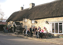
The 14th century,[18] red-tiled Grade II* listed Church of St Hilary is a substantial structure in the later English style, consisting of a nave, south aisle, and chancel, with an embattled tower at the west end. The nave is 45 feet (14m) long and 33 feet (10m) broad including the aisle. The chancel 22 feet (6.7m) long and 15 feet (4.6m) wide. The eastern window of the south aisle is elegantly design, and that of the chancel is ornamented with stained glass, representing the arms of the Traherne family.[11]
Mast
St. Hilary mast
On the high ground to the north of the village (and just north of the A48) stands the 229m (750ft)St. Hilary mast, built in 1957 for transmitting the now-defunct 405-line/Channel 7 TV system to South Wales and the West of England.[19][20]
Notable people
Richard Bassett, (fl. 15th century), lord of the manor of Old Beau Pre
↑ Stanton, Richard. A Menology of England and Wales: Or, Brief Memorials of the Ancient British and English Saints Arranged According to the Calendar, Together with the Martyrs of the 16th and 17th Centuries, p.703. Burns & Oates, 1892.
This page is based on this Wikipedia article Text is available under the CC BY-SA 4.0 license; additional terms may apply. Images, videos and audio are available under their respective licenses.