Eglwys Brewis

Last updated

Eglwys Brewis
Elm Grove, Eglwys Brewis - near St Athan - geograph.org.uk - 1431840.jpg
Elm Grove, Eglwys Brewis
Vale of Glamorgan UK location map.svg
Red pog.svg
Eglwys Brewis
Location within the Vale of Glamorgan
OS grid reference ST006961
Principal area
Preserved county
Country Wales
Sovereign state United Kingdom
Post town Barry
Postcode district CF62
Dialling code 01446
Police South Wales
Fire South Wales
Ambulance Welsh
UK Parliament
Senedd Cymru – Welsh Parliament
List of places
UK
Wales
Vale of Glamorgan
51°24′49″N3°25′45″W / 51.413635°N 3.429112°W / 51.413635; -3.429112

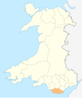
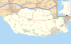
Eglwys Brewis (Welsh : Eglwys Brewys) is a village in the Vale of Glamorgan in south Wales. It is located just to the north of the village of St Athan, south of Flemingston and northeast of Llantwit Major. [1] Greenlands and St Mary Church lie to the north by road from Eglwys Brewis. The village consists primarily of residential estates which were originally built in the mid-20th century for service families stationed at nearby RAF St Athan. The estates are regularly used by driving instructors in the Vale of Glamorgan [ citation needed ]. Nant y Stepsau flows in the vicinity.
Contents

History

A Topographical Dictionary of The Dominion of Wales (1811) by Nicholas Carlisle said:

"EGLWYS BREWIS, in the Cwmwd of Maenor Glynn Ogwr, Cantref of Cron Nedd (now called the Hundred of Ogmore), County of GLAMORGAN, South Wales: a discharged Rectory, valued in the King's Books at £3..18..6 1/2: Patron, The Rev. Mr. Rickards: Church dedicated to St. Brise. The Resident Population of this Parish, in 1801, was 33. The Money raised by the Parish Rates, in 1803, was £37..19..0, at 2s. in the pound. It is 4 m. S. b. E. from Cowbridge. This Parish is all inclosed. According to the Diocesan Report, in 1809, the yearly value of this Benefice, arising from Tythes, was £73..16..4." [2]

A Topographical Dictionary of Great Britain (1833) by John Gorton said:

"The EGLWYS BREWIS, co. Glamorgan, S.W. P. T. Cowbridge (173) 4 m. S E. Pop. 20. A very small parish in the Hundred of Cowbridge, situated upon the Bristol Channel; living, a dis. rectory in the diocese of St. David's and province of Canterbury; valued in P. R. 37/. 1!)*.; church ded.' to St. Bride; patron, — Rickards, Esq." [3]

Only a hamlet still in the early 20th century, Eglwys Brewis developed into a dormitory village with housing estates in the mid-20th century to accommodate service families stationed at nearby RAF St Athan. Most of the houses on the estates surrounding the base were sold off.

Politics and administration

Eglwys Brewis lies within the Flemingston & Eglwys Brewis community electoral ward, being allocated three councillor seats to sit on the St Athan Community Council.

However, only half of Eglwys Brewis is within the St Athan ward as part of the Vale of Glamorgan county council.

Notable landmarks

Eglwys Brewis contains the St Brise Parish Church of St. Brewis and Bethesda'r Fro Congregational Church. It contains one pub, the Moonshine, formerly the Carpenter's Arms. The parish church, which became a Grade II listed building on May 18, 2002, is a small stone church dating to the 12th–13th century with 16th-century windows. [4] It contains a square stone castellated bell-cot at the western end of the nave and a Norman tub font and inscriptions. [4] To the east is RAF St Athan Golf Club.

The Carpenter's Arms The Carpenter's Arms, Eglwys Brewis, Nr Llantwit Major - geograph.org.uk - 856711.jpg
The Carpenter's Arms

Related Research Articles

<span class="mw-page-title-main">Vale of Glamorgan</span> County borough in Wales

The Vale of Glamorgan, locally referred to as The Vale, is a county borough in the south-east of Wales. It borders Bridgend County Borough to the west, Cardiff to the east, Rhondda Cynon Taf to the north, and the Bristol Channel to the south. With an economy based largely on agriculture and chemicals, it is the southernmost unitary authority in Wales. Attractions include Barry Island Pleasure Park, the Barry Tourist Railway, Medieval wall paintings in St Cadoc's Church, Llancarfan, Porthkerry Park, St Donat's Castle, Cosmeston Lakes Country Park and Cosmeston Medieval Village. The largest town is Barry. Other towns include Penarth, Llantwit Major, and Cowbridge. There are many villages in the county borough.

<span class="mw-page-title-main">Llantwit Major</span> Human settlement in Wales

Llantwit Major is a town and community in Wales on the Bristol Channel coast. It is one of four towns in the Vale of Glamorgan, with the third largest population after Barry and Penarth, and ahead of Cowbridge. It is 4+12 miles (7.2 km) from Cowbridge, 9 miles (14 km) from Bridgend, 10 miles (16 km) from Barry, and 15 miles (24 km) from Cardiff. It had a population of 9,530 in 2021.

<span class="mw-page-title-main">Colwinston</span> Village and community in Wales

Colwinston is both a village and a community in the Vale of Glamorgan, Wales, approximately 4 miles (6.4 km) southeast of the centre of Bridgend and 21 miles (34 km) west of the centre of Cardiff. The village is located within 12 mile (0.80 km) of the A48. The population in 2005 was approximately 400 but with recent building development, the population is now estimated at over 600 people.

<span class="mw-page-title-main">St Athan</span> Human settlement in Wales

St Athan is a village and community in the Vale of Glamorgan in South Wales. The village and its parish church are dedicated to Saint Tathan. The church dates to the 13th–14th century, though an earlier church was dated to the Norman period. The village and the adjacent dormitory village of Eglwys Brewis are known primarily for the MOD St Athan RAF base. There are two pubs in the village, as well as a football team at St Athan Football Club and the St Athan Golf Club. The community includes West Aberthaw.

<span class="mw-page-title-main">Bonvilston</span> Human settlement in Wales

Bonvilston is a village in the Vale of Glamorgan, Wales. The village is situated on the A48 about four miles east of Cowbridge and near the Welsh capital city of Cardiff. The population in 2011 was 392.

<span class="mw-page-title-main">Aberthaw</span> Human settlement in Wales

Aberthaw is an area containing the villages of East Aberthaw and West Aberthaw, on the coast of South Wales about 5 miles (8 km) west of Barry. It is home to Aberthaw Cement Works, Aberthaw Lime Works, and Aberthaw Power Station, a decommissioned coal power station that was linked to the South Wales Valleys via the Vale of Glamorgan Railway. The area is historically within the parish of Penmark in the Vale of Glamorgan. The two villages of West and East Aberthaw are separated by the River Thaw. The village of East Aberthaw, near Rhoose, has a 13th-century pub. The village Baptist Chapel and Mission Room no longer exist as such and have been converted for other uses.

<span class="mw-page-title-main">Llanmaes</span> Human settlement in Wales

Llanmaes is a small village and community in the Vale of Glamorgan near the market town of Llantwit Major. The population in 2011 was 403.

<span class="mw-page-title-main">St Hilary, Vale of Glamorgan</span> Human settlement in Wales

St Hilary is a village in the Vale of Glamorgan, Wales. It is located just south of the A48, about a mile southeast of the market town of Cowbridge. The village has a population of about 260, in approximately 80 houses. Notable landmarks in the vicinity include The Bush Inn, the Church of St Hilary, the Old Beaupre Castle, New Beaupre, Coed Hills and St. Hilary mast.

Richard Bassett was a Welsh cleric, thought to be the last Anglican clergyman in Wales to be associated with the Methodists.

<span class="mw-page-title-main">St Lythans</span> Human settlement in Wales

St Lythans is an affluent hamlet and former parish in the Vale of Glamorgan, southeast Wales, just outside western Cardiff. It lies southwest of Culverhouse Cross, west of Wenvoe and southwest of Twyn-yr-Odyn and is also connected by road from Dyffryn and the Five Mile Lane in the west. It is one of the wealthiest communities in the Vale of Glamorgan, containing some notable mansions and cottages, valued on average at over £500,000 as of 2011. The megalithic St Lythans burial chamber, over 6000 years old, lies 1 km to the west of the village and the hamlet also contains the St.Lythans Parish Church or Church of St Bleddian, a Grade II* listed building.

<span class="mw-page-title-main">River Thaw</span> River in United Kingdom, Wales

The River Thaw is a river in the Vale of Glamorgan, south Wales. At 20 kilometres/12.4 miles, it is the longest river entirely in the Vale of Glamorgan.

The Vale of Glamorgan has 740 listed buildings of which 4% are Grade I listed, 10% Grade II* listed and remainder Grade II listed.

<span class="mw-page-title-main">St Hilary's Church, St Hilary, Vale of Glamorgan</span> Church in Vale of Glamorgan, Wales

The Parish Church of St Hilary is a Grade II* listed Anglican church in the village of St Hilary in the Vale of Glamorgan, south Wales. It is one of 11 churches in the Parish of Cowbridge. It became a listed building on 22 February 1963.

<span class="mw-page-title-main">Flemingston</span> Human settlement in Wales

Flemingston is a small village in the Vale of Glamorgan in south Wales. It is located 8.5 miles (13.7 km) northwest by road from the town centre of Barry. It contains the Church of St. Michael the Archangel, the ruins of Flemingston Court, and Flemingston Manor or Grange, all of which are listed buildings. Historically, the parish of Flemingston was a sub-manor of Aberthaw or St Athan.

<span class="mw-page-title-main">St Mary Hill</span> Human settlement in Wales

St Mary Hill is a settlement in the Vale of Glamorgan, Wales. It is located approximately 4 miles (6.4 km) north west of the market town of Cowbridge. It is part of the community of Llangan along with Treoes and the village of Llangan itself.

St Athan Road railway station served the village of St Athan in the Vale of Glamorgan in South Wales.

<span class="mw-page-title-main">Gileston railway station</span> Former railway station in Wales

Gileston railway station served the village of Gileston in South Wales.

<span class="mw-page-title-main">East Camp</span> Human settlement in Wales

East Camp is an Ex-MOD housing estate opposite the MOD St Athan main east entrance within St Athan. The housing estate sits between the village of St Athan and Flemingston but does not constitute a village itself. It falls under the Flemingston & Eglwys Brewis electoral ward.

References

  1. Maps (Map). Google Maps.
  2. "Eglwys Brewis". GENUKI. Retrieved 12 May 2012.
  3. Gorton, John (1833). A topographical dictionary of Great Britain and Ireland: compiled from local information, and the most recent and official authorities. Chapman and Hall. p. 706. Retrieved 12 May 2012.
  4. 1 2 "Vale of Glamorgan County Treasures" (PDF). Vale of Glamorgan Council . Retrieved 12 May 2012.