
The Vale of Glamorgan, often referred to as The Vale, is a county borough in the south-east of Wales. It borders Bridgend County Borough to the west, Cardiff to the east, Rhondda Cynon Taf to the north, and the Bristol Channel to the south. With an economy based largely on agriculture and chemicals, it is the southernmost unitary authority in Wales. Attractions include Barry Island Pleasure Park, the Barry Tourist Railway, Medieval wall paintings in St Cadoc's Church, Llancarfan, Porthkerry Park, St Donat's Castle, Cosmeston Lakes Country Park and Cosmeston Medieval Village. The largest town is Barry. Other towns include Penarth, Llantwit Major, and Cowbridge. There are many villages in the county borough.

Glamorgan, or sometimes Glamorganshire, is one of the thirteen historic counties of Wales and a former administrative county of Wales. Originally an early medieval petty kingdom of varying boundaries known in Welsh as the Kingdom of Morgannwg, which was then invaded and taken over by the Normans as the Lordship of Glamorgan. The area that became known as Glamorgan was both a rural, pastoral area, and a conflict point between the Norman lords and the Welsh princes. It was defined by a large concentration of castles.

Gower or the Gower Peninsula in southwest Wales, projects towards the Bristol Channel. It is the most westerly part of the historic county of Glamorgan. In 1956, the majority of Gower became the first area in the United Kingdom to be designated an Area of Outstanding Natural Beauty.

Pembrokeshire Coast National Park is a national park along the Pembrokeshire coast in west Wales.

Llantwit Major is a town and community in Wales on the Bristol Channel coast. It is one of four towns in the Vale of Glamorgan, with the third largest population after Barry and Penarth, and ahead of Cowbridge. It is 4+1⁄2 miles (7.2 km) from Cowbridge, 9 miles (14 km) from Bridgend, 10 miles (16 km) from Barry, and 15 miles (24 km) from Cardiff. It had a population of 9,486 in 2011.

Sully Island is a small tidal island and Site of Special Scientific Interest at the hamlet of Swanbridge, Vale of Glamorgan, 400 m (440 yd) off the northern coast of the Bristol Channel, midway between the towns of Penarth and Barry and 10 km (6 mi) south of the Welsh capital city of Cardiff.

St Donat's Castle, St Donats, Wales, is a medieval castle in the Vale of Glamorgan, about 16 miles (26 km) to the west of Cardiff, and about 1+1⁄2 miles (2.4 km) to the west of Llantwit Major. Positioned on cliffs overlooking the Bristol Channel, the site has been occupied since the Iron Age, and was by tradition the home of the Celtic chieftain Caradog. The present castle's origins date from the 12th century when the de Haweys and later Peter de Stradling began its development. The Stradlings held the castle for four hundred years, until the death of Sir Thomas Stradling in a duel in 1738.
Ogmore-by-Sea is a seaside village in St Brides Major community in the Vale of Glamorgan, Wales. It lies on the western limit of the Glamorgan Heritage Coast of south Wales. The population in 2011 was 878.

The Vale of Glamorgan Line is a commuter railway line in Wales, running through the Vale of Glamorgan from Barry to Bridgend, via Rhoose and Llantwit Major.

Southerndown is a village in southern Wales to the southwest of Bridgend, in St Brides Major community, close to Llantwit Major and Ogmore-by-Sea. It is mostly known for its beach which backs Dunraven Bay, which is a popular tourist destination during the summer months and since 1972 has been part of a Heritage Coast and is part of the Southerndown Coast SSSI. When the tide is out there is an expanse of sand and pools. The cliffs are an obvious example of sedimentary rock.

The hamlet of Porthkerry lies on the Bristol Channel coast of South Wales within the community of Rhoose between that village and the town of Barry to the east. It is very close to the end of the runway of Cardiff International Airport. To the east of the hamlet is Porthkerry Country Park which occupies the valley leading down to the coast.

Aberthaw is an area containing the villages of East Aberthaw and West Aberthaw, on the coast of South Wales about 5 miles (8 km) west of Barry. It is home to Aberthaw Cement Works, Aberthaw Lime Works, and Aberthaw Power Station, a coal power station that is linked to the South Wales Valleys via the Vale of Glamorgan Railway. The area is historically within the parish of Penmark in the Vale of Glamorgan. The two villages of West and East Aberthaw are separated by the River Thaw. The village of East Aberthaw, near Rhoose, has a 13th-century pub. The village Baptist Chapel and Mission Room, no longer exist as such and have been converted for other uses.

Nash Point is a headland and beach in the Monknash Coast of the Vale of Glamorgan in south Wales, about a mile from Marcross. It is a popular location for ramblers and hiking along the cliffs to Llantwit Major beach. The lighthouse meadow is a Site of Special Scientific Interest, containing rare plants such as the tuberous thistle, and other wildlife such as choughs can be seen.

Southerndown Coast is a Site of Special Scientific Interest (SSSI) in St Brides Major community, in the Vale of Glamorgan, South Wales. It forms part of the Glamorgan Heritage Coast, bordered by the Monknash Coast to the southeast. The nearby villages are Southerndown and Ogmore-by-Sea. The SSSI extends over 5 kilometres of south-west facing coastline, with rocky limestone cliffs, broad beaches and deeply fissured wave-cut platforms.
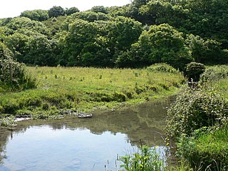
The Afon Col-huw is a very short river in Llantwit Major in the Vale of Glamorgan, south Wales. It is an exceptionally short river, with a length of only 1 mile/1.6 kilometres long. It is formed when two rivers, the Ogney Brook and the Hoddnant converge south of Llantwit Major. Its valley, the Cwm Col-huw, is a Scheduled Ancient Monument - it was used in the Dig for Victory campaign in World War II.

Dimlands was a small scale, gentry house on the north side of St Donats Road about 6 miles (9.7 km) southwest of Cowbridge in the Vale of Glamorgan, southeast Wales. Built like a small Tudor castle, it is situated about 1 kilometre (0.62 mi) back from the clifftops of the Bristol Channel between Llantwit Major and St Donats. The main house was demolished after a fire in 1948, but its lodge, in a similar castellated style, survives and became a Grade II listed building on 9 October 1982.
John Whitlock Nicholl Carne (1817–1887) FSA, JP, DCL, was a Welsh landowner, magistrate, and barrister. His seat was Dimlands.
A bibliography of books related to the Vale of Glamorgan, south Wales.

Portland Raised Beach refers to small raised beaches on each side of Portland Bill, on the Isle of Portland, part of the Jurassic Coast in Dorset, England. The main one is known as the West Pleistocene Raised Beach; nearby is the East Pleistocene Raised Beach.

Llantwit Major is the name of an electoral ward in the Vale of Glamorgan, Wales. It covers its namesake town of Llantwit Major and neighbouring village of Llanmaes. The ward elects four county councillors to the Vale of Glamorgan Council.


