St Donats

Last updated

St Donats
St.Donat's Village, Vale of Glamorgan.jpg
St Donats village
Vale of Glamorgan UK location map.svg
Red pog.svg
St Donats
Location within the Vale of Glamorgan
Population732 (2011) [1]
Principal area
Preserved county
Country Wales
Sovereign state United Kingdom
Post town Llantwit Major
Postcode district CF61
Dialling code 01446
Police South Wales
Fire South Wales
Ambulance Welsh
UK Parliament
Senedd Cymru – Welsh Parliament
List of places
UK
Wales
Vale of Glamorgan
51°24′21″N3°31′50″W / 51.4057°N 3.5306°W / 51.4057; -3.5306

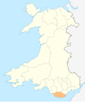
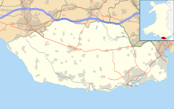
St Donats (Welsh : Sain Dunwyd) is a village and community in the Vale of Glamorgan in south Wales, located just west of the small town of Llantwit Major. The community includes the village of Marcross and the hamlets of Monknash and East and West Monkton. It is named after the 6th-century saint, Dunwyd, a friend of Saint Cadoc. It had a population of 732 in 2011. [2]

St Donat's church, dedicated to St Dunwyd, lies in a depression and is unremarkable from the exterior but contains Stradling family monuments in the Stradling chapel. It is a 12th-century Grade I listed building [3] with a Grade I listed medieval cross in the churchyard. [4]

St Donat's Castle, now occupied by Atlantic College Atlanticcollege11.jpg
St Donat's Castle, now occupied by Atlantic College

The village is primarily known as the location of the 12th century St Donat's Castle, which is now an international boarding school occupied by Atlantic College, the first of the United World Colleges. Within the castle grounds lies St Donats Arts Centre.

Sea views from the castle Atlanticcollege5.jpg
Sea views from the castle

Related Research Articles

<span class="mw-page-title-main">Llantwit Major</span> Human settlement in Wales

Llantwit Major is a town and community in Wales on the Bristol Channel coast. It is one of four towns in the Vale of Glamorgan, with the third largest population after Barry and Penarth, and ahead of Cowbridge. It is 4+12 miles (7.2 km) from Cowbridge, 9 miles (14 km) from Bridgend, 10 miles (16 km) from Barry, and 15 miles (24 km) from Cardiff. It had a population of 9,530 in 2021.

<span class="mw-page-title-main">Enford</span> Human settlement in England

Enford is a village and civil parish in Wiltshire, England, in the northeast of Salisbury Plain. The village lies 10 miles (16 km) southeast of Devizes and 14 miles (23 km) north of Salisbury. The parish includes nine small settlements along both banks of the headwaters of the River Avon. Besides Enford, these are Compton, Coombe, East Chisenbury, Fifield, Littlecott, Longstreet, New Town and West Chisenbury.

<span class="mw-page-title-main">St Donat's Castle</span> Castle in St Donats, Vale of Glamorgan, Wales

St Donat's Castle, St Donats, Wales, is a medieval castle in the Vale of Glamorgan, about 16 miles (26 km) to the west of Cardiff, and about 1+12 miles (2.4 km) to the west of Llantwit Major. Positioned on cliffs overlooking the Bristol Channel, the site has been occupied since the Iron Age, and was by tradition the home of the Celtic chieftain Caradog. The present castle's origins date from the 12th century when the de Haweys and later Peter de Stradling began its development. The Stradlings held the castle for four hundred years, until the death of Sir Thomas Stradling in a duel in 1738.

<span class="mw-page-title-main">Meifod</span> Human settlement in Wales

Meifod, formerly also written Meivod, is a small village, community and electoral ward 7 miles north-west of Welshpool in Montgomeryshire, Powys, Wales, on the A495 road and located in the valley of the River Vyrnwy. The River Banwy has a confluence with the Vyrnwy approximately two miles to the west of the village. The village itself had a population of 317. The community includes the village of Bwlch-y-cibau and the hamlet of Allt-y-Main.

<span class="mw-page-title-main">Bitterley</span> Human settlement in England

Bitterley is a village and civil parish in Shropshire, England. According to the 2001 census the parish had a population of 802, increasing to 902 at the 2011 Census. The village is about 4 miles (6.4 km) east of Ludlow on the western slopes of Titterstone Clee Hill. Bitterley is the location for Bitterley Court about 0.62 miles (1.00 km) east of the modern village. Nearby to the east, is the small hamlet of Bedlam.

<span class="mw-page-title-main">Bondleigh</span> Village in Devon, England

Bondleigh is a village and civil parish in the West Devon district of Devon, England, on the River Taw, north of North Tawton. According to the 2011 census it had a population of 167.

<span class="mw-page-title-main">Roughton, Lincolnshire</span> Village and civil parish in the East Lindsey district of Lincolnshire, England

Roughton is a village and civil parish in the East Lindsey district of Lincolnshire, England. The parish population was 644 in 2011.

<span class="mw-page-title-main">Beckermet</span> Village and civil parish in Cumbria, England

Beckermet is a village and civil parish in Cumbria, England, between Egremont and Seascale. The parish had a population of 1,619 in the 2011 census.

<span class="mw-page-title-main">Sibsey</span> Village, civil parish and electoral ward in the East Lindsey district of Lincolnshire, England

Sibsey is a village, civil parish and electoral ward in the East Lindsey district of Lincolnshire, England. It is situated at the junction of the A16 and B1184 roads, 4 miles (6.4 km) north from Boston. Sibsey Northlands is to the north of the village. The Prime Meridian passes just to the west of Sibsey, crossing the Stone Bridge Drain canal. At the 2001 census, Sibsey had a population of 1,996, reducing to 1,979 at the 2011 Census.

<span class="mw-page-title-main">Mareham le Fen</span> Village in Lincolnshire, England

Mareham le Fen is a village and civil parish about 6 miles (10 km) south from the town of Horncastle, Lincolnshire, England. The hamlet of Mareham Gate lies about 0.5 miles (0.8 km) south from the village, and it is believed that the deserted medieval village (DMV) of Birkwood is situated nearby.

<span class="mw-page-title-main">Nercwys</span> Village and community in Flintshire, Wales

Nercwys is a rural village and community in Flintshire, Wales, which is surrounded by open countryside. The community population taken at the 2011 census was 585. The older, Anglicised spelling of Nerquis can sometimes be found. It has a small school and a local bus service to Mold which is around 3 miles away.

<span class="mw-page-title-main">Llanmaes</span> Human settlement in Wales

Llanmaes is a small village and community in the Vale of Glamorgan near the market town of Llantwit Major. The population in 2011 was 403.

<span class="mw-page-title-main">Brinkhill</span> Village and civil parish in the East Lindsey district of Lincolnshire, England

Brinkhill is a village and civil parish in the East Lindsey district of Lincolnshire, England. It is situated approximately 5 miles (8 km) west from the market town of Alford and 7 miles (11 km) north-west from Spilsby, The village lies in the Lincolnshire Wolds, a designated Area of Outstanding Natural Beauty.

<span class="mw-page-title-main">Pennard</span> Human settlement in Wales

Pennard is a village and community on the south of the Gower Peninsula, about 7 miles south-west of Swansea city centre. It falls within the Pennard electoral ward of Swansea. The Pennard community includes the larger settlements of Southgate and Kittle. the population as of 2011 was 2,688.

<span class="mw-page-title-main">North Cotes</span> Village and civil parish in the East Lindsey district of Lincolnshire, England

North Cotes or North Coates is a village and civil parish in the East Lindsey district of Lincolnshire, England. It is situated close to the coast, 4 miles (6 km) to the east, and 10 miles (16 km) north-east from the town of Louth.

<span class="mw-page-title-main">Tydd St Mary</span> Village and civil parish in the South Holland district of Lincolnshire, England

Tydd St Mary is a village and civil parish in the South Holland district of Lincolnshire, England, about 9 miles (14 km) east of the town of Spalding and about 5 miles (8.0 km) north of Wisbech, Cambridgeshire. The Civil Parish includes the village of Tydd Gote which lies partly in Tydd St Mary and partly in Tydd St Giles, Cambridgeshire.

The Vale of Glamorgan has 740 listed buildings of which 4% are Grade I listed, 10% Grade II* listed and remainder Grade II listed.

<span class="mw-page-title-main">Grade I listed buildings in the Vale of Glamorgan</span>

There are 33 Grade I listed buildings in the Vale of Glamorgan all of which are churches and priory buildings, castles, country or manor houses and associated structures such as churchyard crosses and a dovecote.

<span class="mw-page-title-main">Welsh St Donats</span> Human settlement in Wales

Welsh St Donats is a village and a community in the Vale of Glamorgan, Wales. Consisting of 1207 hectares of mainly rural land, it is located north east of Cowbridge. The population of the community was 534 in the 2011 census. Welsh St Donats includes the villages of Maendy, Prisk and Tair Onen. A mile to the east from the village lies the Hensol Forest, while the remains of Talyfan Castle are to the north.

<span class="mw-page-title-main">St Donat's Church, St Donats</span> Church in Wales

St Donat's Church is a Grade I listed church in St Donats, in the Vale of Glamorgan, south Wales. It became a Grade I listed building on 22 February 1963.

References

  1. "Community population 2011" . Retrieved 10 April 2015.
  2. "Custom report - Nomis - Official Labour Market Statistics".
  3. "Church of St Donat, St Donats". British Listed buildings. Retrieved 22 July 2015.
  4. "Medieval Cross and associated Slab in the Churchyard of the Church of St Donat, St Donats". British Listed buildings. Retrieved 22 July 2015.

Commons-logo.svg Media related to St Donats at Wikimedia Commons