Welsh St Donats

Last updated

Welsh St Donats
Welsh St. Donats - panoramio.jpg
St Donat's (St Dunwyd's) church
Vale of Glamorgan UK location map.svg
Red pog.svg
Welsh St Donats
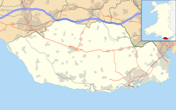
Location within the Vale of Glamorgan
Population534 
Principal area
Preserved county
Country Wales
Sovereign state United Kingdom
Post town Cowbridge
Postcode district CF71
Dialling code 01446
Police South Wales
Fire South Wales
Ambulance Welsh
UK Parliament
Senedd Cymru – Welsh Parliament
List of places
UK
Wales
Vale of Glamorgan
51°28′30″N3°24′04″W / 51.475088°N 3.401187°W / 51.475088; -3.401187

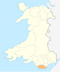
Welsh St Donats (Welsh : Llanddunwyd) is a village and a community in the Vale of Glamorgan, Wales. Consisting of 1207 hectares of mainly rural land, it is located north east of Cowbridge. The population of the community was 534 in the 2011 census. [1] Welsh St Donats includes the villages of Maendy, Prisk and Tair Onen. [2] A mile to the east from the village lies the Hensol Forest, while the remains of Talyfan Castle are to the north.

Contents

History

The village of St Donats takes its name from the late medieval church dedicated to St Dunwyd, which was first mentioned in 1173. [3] Set in mainly agricultural lands the compact village contains the 18th century Great House and a fine farm group. [4] Benjamin Heath Malkin mentions Welsh St Donats in his 1803 work The Scenery, Antiquities and Biography of South Wales, while passing along the 'great road' that ran north of the village, which linked England to the port of Milford Haven. He mentioned the varying style of genuine Welsh pigstye in the area and the fact that Welsh St Donats "... is perhaps scarcely a village in the principality, where less English is spoken." [5] As of 2019, spoken Welsh in the Vale is one of the lowest levels in Wales, with less than ten percent of adults identifying themselves as Welsh speakers. [6]

Buildings of note

St Donat's Church, Welsh St Donats, is a Grade I listed building. It was described by Nikolaus Pevsner as "a simple late mediaeval church" despite being mentioned in 1173. However there are no architectural remains in the present structure from that period. [7] [8] The 16th century arched brace truss roof timbers and other features, such as the 13th century font to the south door, are of interest and note and therefore contribute to it being a Grade I listed building. [9]

The church sits to the north end of a knot of houses, mostly recent, and within the middle of these lies the Great House. The Great House, is a two-storey 18th-century building of modest features consisting of three, three-bay units, the centre of which is higher than the sides. [9] Prisk Farm, which is situated about a mile to the west, once boasted an elaborate modelled plaster ceiling, of 17th- or 18th-century design. Unique amongst the farm houses of the area, the ceiling was lost when it collapsed c. 1989. [9]

To the north of Welsh St Donats lies the remains of Talyfan Castle (Welsh: Castell Tal-y-fan). Once serving as a caput for the Siwards and the St Quintins, Talyfan was one of several lordships within the Vale of Glamorgan during the 12th and 13th centuries. [10] There is some speculation that it was built to replace the motte castle at Ystradowen, but was never completed. [10] By the middle of the 13th century the castle had passed from the Siwards to the ownership of Richard de Clare, Lord of Glamorgan. The Lords of Glamorgan held onto the castle the late 15th century when it reverted to the monarchy after the death of Jasper Tudor. [10] It was bought by John Thomas Bassett of Llantrithyrd in 1545 and remained in private hands since. Today the remains of the castle stand on the lands of Talyfan Farm, though there is little left to see. [10] The original protective ditch can be observed along with a length of the outer embankment. A jumble of ruined walls mark the remains of the castle itself along with those of the farm house that superseded it. It is presently under the ownership of CADW. [10]

Notable people

See also

Related Research Articles

<span class="mw-page-title-main">Vale of Glamorgan</span> County borough in Wales

The Vale of Glamorgan, often referred to as The Vale, is a county borough in the south-east of Wales. It borders Bridgend County Borough to the west, Cardiff to the east, Rhondda Cynon Taf to the north, and the Bristol Channel to the south. With an economy based largely on agriculture and chemicals, it is the southernmost unitary authority in Wales. Attractions include Barry Island Pleasure Park, the Barry Tourist Railway, Medieval wall paintings in St Cadoc's Church, Llancarfan, Porthkerry Park, St Donat's Castle, Cosmeston Lakes Country Park and Cosmeston Medieval Village. The largest town is Barry. Other towns include Penarth, Llantwit Major, and Cowbridge. There are many villages in the county borough.

<span class="mw-page-title-main">Cowbridge</span> Human settlement in Wales

Cowbridge is a market town in the Vale of Glamorgan, Wales, approximately 12 miles (19 km) west of the centre of Cardiff.

<span class="mw-page-title-main">Llantwit Major</span> Human settlement in Wales

Llantwit Major is a town and community in Wales on the Bristol Channel coast. It is one of four towns in the Vale of Glamorgan, with the third largest population after Barry and Penarth, and ahead of Cowbridge. It is 4+12 miles (7.2 km) from Cowbridge, 9 miles (14 km) from Bridgend, 10 miles (16 km) from Barry, and 15 miles (24 km) from Cardiff. It had a population of 9,530 in 2021.

<span class="mw-page-title-main">Colwinston</span> Village and community in Wales

Colwinston is both a village and a community in the Vale of Glamorgan, Wales, approximately 4 miles (6.4 km) southeast of the centre of Bridgend and 21 miles (34 km) west of the centre of Cardiff. The village is located within 12 mile (0.80 km) of the A48. The population in 2005 was approximately 400 but with recent building development, the population is now estimated at over 600 people.

<span class="mw-page-title-main">Sully, Vale of Glamorgan</span> Human settlement in Wales

Sully is a village in the community of Sully and Lavernock, in the Vale of Glamorgan, Wales, lying on the northern coast of the Bristol Channel, midway between the towns of Penarth and Barry and 7 miles southwest of the Welsh capital city of Cardiff.

<span class="mw-page-title-main">St Athan</span> Human settlement in Wales

St Athan is a village and community in the Vale of Glamorgan in South Wales. The village and its parish church are dedicated to Saint Tathan. The church dates to the 13th–14th century, though an earlier church was dated to the Norman period. The village and the adjacent dormitory village of Eglwys Brewis are known primarily for the MOD St Athan RAF base. There are two pubs in the village, as well as a football team at St Athan Football Club and the St Athan Golf Club. The community includes West Aberthaw.

<span class="mw-page-title-main">Dinas Powys</span> Human settlement in Wales

Dinas Powys is a small town and community in the Vale of Glamorgan, South Wales. Its name means "fort of the provincial place" and refers to the Iron Age hillfort which overlooks the village. Dinas Powys is 5.6 miles (9.0 km) south-west of the centre of Cardiff and is situated on the A4055 road from Cardiff to Barry, making it a popular dormitory village for city commuters. It neighbours the larger town of Penarth.

<span class="mw-page-title-main">Llandough, Penarth</span> Village in Wales

Llandough is a village, community and electoral ward in the Vale of Glamorgan, Wales, approximately 2.3 miles (3.7 km) south west of Cardiff city centre, and approximately 1.3 miles (2 km) north west of Penarth.

<span class="mw-page-title-main">Llanblethian</span> Human settlement in Wales

Llanblethian is a village in the Vale of Glamorgan in Wales which sits upon the River Thaw. It makes up part of the community of Cowbridge with Llanblethian, which consists of the village itself, the larger market town of Cowbridge and Aberthin.

<span class="mw-page-title-main">St Donats</span> Human settlement in Wales

St Donats is a village and community in the Vale of Glamorgan in south Wales, located just west of the small town of Llantwit Major. The community includes the village of Marcross and the hamlets of Monknash and East and West Monkton. It is named after the 6th-century saint, Dunwyd, a friend of Saint Cadoc. It had a population of 732 in 2011.

<span class="mw-page-title-main">Fonmon Castle</span>

Fonmon Castle is a fortified medieval castle near the village of Fonmon in the Vale of Glamorgan and a Grade I listed building. The castle's gardens are designated Grade II on the Cadw/ICOMOS Register of Parks and Gardens of Special Historic Interest in Wales. With its origins rooted in the 12th century it is today seen as a great architectural rarity, as it is one of few buildings that was drastically remodelled in the 18th century, but not Gothicized. The castle is believed to have remained under the ownership of just two families throughout its history; from Norman times, it was owned by the St Johns, and from 1656, by the descendants of Colonel Philip Jones.

<span class="mw-page-title-main">St Hilary, Vale of Glamorgan</span> Human settlement in Wales

St Hilary is a village in the Vale of Glamorgan, Wales. It is located just south of the A48, about a mile southeast of the market town of Cowbridge. The village has a population of about 260, in approximately 80 houses. Notable landmarks in the vicinity include The Bush Inn, the Church of St Hilary, the Old Beaupre Castle, New Beaupre, Coed Hills and St. Hilary mast.

<span class="mw-page-title-main">St Lythans</span> Human settlement in Wales

St Lythans is an affluent hamlet and former parish in the Vale of Glamorgan, southeast Wales, just outside western Cardiff. It lies southwest of Culverhouse Cross, west of Wenvoe and southwest of Twyn-yr-Odyn and is also connected by road from Dyffryn and the Five Mile Lane in the west. It is one of the wealthiest communities in the Vale of Glamorgan, containing some notable mansions and cottages, valued on average at over £500,000 as of 2011. The megalithic St Lythans burial chamber, over 6000 years old, lies 1 km to the west of the village and the hamlet also contains the St.Lythans Parish Church or Church of St Bleddian, a Grade II* listed building.

The Vale of Glamorgan has 740 listed buildings of which 4% are Grade I listed, 10% Grade II* listed and remainder Grade II listed.

<span class="mw-page-title-main">Flemingston</span> Human settlement in Wales

Flemingston is a small village in the Vale of Glamorgan in south Wales. It is located 8.5 miles (13.7 km) northwest by road from the town centre of Barry. It contains the Church of St. Michael the Archangel, the ruins of Flemingston Court, and Flemingston Manor or Grange, all of which are listed buildings. Historically, the parish of Flemingston was a sub-manor of Aberthaw or St Athan.

<span class="mw-page-title-main">Laleston</span> Human settlement in Wales

Laleston is a village and a community in Bridgend County Borough, south Wales, directly west of Bridgend town centre. The village takes its name from the Norman Lageles family who settled in the area. Buildings of note in the village include St David's Church, which still possesses features dating back to the 13th and 14th centuries, the Great House which was built in the early 16th century and Horeb Welsh Presbyterian Church (1831).

<span class="mw-page-title-main">Wrinstone</span> Building in Vale of Glamorgan, Wales

Wrinstone or Wrinston is a medieval hamlet, just east of Wenvoe, Vale of Glamorgan, south Wales. The Wrinstone estate was variously also known as Wrenston, Wrencheston or Wrenchester. The Barry Railway line ran past the hamlet and entered the Wenvoe Tunnel just to the north near Wenvoe Quarry. It closed after a fire in 1963.

<span class="mw-page-title-main">Llanilid</span> Human settlement in Wales

Llanilid is a small settlement of in the county borough of Rhondda Cynon Taf, Wales. It is in the historic county of Glamorgan. Llanilid is part of the community of Llanharan along with the villages of Bryncae, Brynna, Ynysmaerdy, Peterston-super-Montem and Llanharan itself.

<span class="mw-page-title-main">Tythegston</span> Human settlement in Wales

Tythegston is a conservation area village located close to Cardiff and Swansea on the south coast of Bridgend, Wales. It is home to Tythegston Court, a Grade II listed manor house at the centre of the 1,200 acre Tythegston Estate which is designated at Grade II on the Cadw/ICOMOS Register of Parks and Gardens of Special Historic Interest in Wales. The estate has been owned by the Knight family for some 350 years and operates as a farming and property enterprise, with an industrial estate, as well as hosting green energy and food production. The seaside town of Porthcawl, with its numerous beaches is within 3 miles, as is Bridgend inter-city rail station. The village covers an area of 2,871 acres (1,162 ha). It is part of the community of Merthyr Mawr.

<span class="mw-page-title-main">St Georges super Ely</span> Human settlement in Wales

St Georges super Ely, also known as St Georges, is a small village and community in the western outskirts of Cardiff, in the Vale of Glamorgan, South Wales. Lying to the northwest of Culverhouse Cross, between Peterston-super-Ely and Michaelston-super-Ely, it contains a medieval church and ruined manor house dated to the fifteenth century. The community includes the settlements of Drope, Downs and Sant-y-Nyll.

References

  1. UK Census (2011). "Local Area Report – Welsh St. Donats Parish (W04000923)". Nomis. Office for National Statistics . Retrieved 6 May 2020.{{cite web}}: CS1 maint: date and year (link)
  2. http://www.welsh-st-donats-community.btck.co.uk/ Community website. Accessed 17 May 2014
  3. "Church of St Donat, Welsh St Donats". British Listed Buildings. Retrieved 21 March 2020.
  4. Davies, John; Jenkins, Nigel; Menna, Baines; Lynch, Peredur I., eds. (2008). The Welsh Academy Encyclopaedia of Wales. Cardiff: University of Wales Press. p. 943. ISBN   978-0-7083-1953-6.
  5. Prys Morgan, ed. (1988). Glamorgan County History. Cardiff: University of Wales Press. pp. 273–274. ISBN   978-0-904-730-05-0.
  6. "Percentage of adults who speak Welsh (including the percentage that cannot speak Welsh and have some Welsh speaking ability) by local authority". StatsWales. Retrieved 21 March 2020.
  7. http://www.eastvalechurches.org.uk /ChurchWelshStDonats.html East Vale Churches website. Accessed 17 May 2014.
  8. "Church of St Donat, Welsh St Donats". British Listed Buildings. Retrieved 22 July 2015.
  9. 1 2 3 Newman, John (1995). Glamorgan. London: Penguin Group. p. 644. ISBN   0140710566.
  10. 1 2 3 4 5 Hull, Lise (2007). The Castles of Glamorgan. Herefordshire: Logaston Press. pp. 223–225. ISBN   978-1904396-75-8.
  11. Jones, Sir Tom (2015). Over the Top and Back: The Autobiography. Penguin. ISBN   978-06984-0930-9.