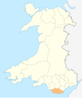
The Bendricks is a stretch of coastline and an important paleontological site in the Vale of Glamorgan in south Wales located along the northern coast of the Bristol Channel between Barry and Sully at 51°23′46″N3°14′50″W / 51.396117°N 3.2470861°W . It lies at the foreshore of the industrial port of Barry between the eastern breakwater of the Barry docks entrance on its western edge to Hayes Point on its eastern edge. This area of the coast is a Site of Special Scientific Interest.
A tidal promontory of Carboniferous Limestone known as Bendrick Rock (Welsh : Craig Bendrick) juts out from the mainland here. Only the highest part of the promontory at its seaward end normally remains visible at high tide, though the highest spring tides cover it entirely. The geology of the Bendricks consists primarily of mudstones, siltstones and conglomerates (Mercia Mudstone marginal facies) formed primarily by deposition of silt at the shoreline of a shallow muddy sea during the Early and Late epochs of the Triassic period.
The Cadoxton River now enters the Bristol Channel by a concrete channel at this point having been redirected during the construction of Barry Docks by the Barry Railway Company which began in 1884. Inland of the Bendricks are HMS Cambria [1] [2] and the former Sully Hospital [3]
The Bendricks is famous for the discovery of 220 million year old dinosaur footprints dating to the Late Triassic (Norian), some of which have been removed to the National Museum and Galleries of Wales in Cardiff. [4] [5] The BBC featured these footprints and the geology of the Bendricks in its TV series [6] about the Natural History of Wales. The footprints were first identified in 1974 and are deposited in the Triassic red beds and were made by the ichnospecies Anchisauripus , a small theropod, Grallator , also a small theropod, and Tetrasauripus , a sauropodomorph.
The Bendricks can be accessed via a path which follows the outside of the security fence round HMS Cambria at Hayes Point, Sully or by following the coastal path in a south-westerly direction from the public slipway at the Vale of Glamorgan recycling centre at Hayes Road, Sully.
The footprints can be difficult to see. Many are covered at high tide so it is easier to see them after high tide when the tracks may retain small puddles of water. It is also easier to spot the footprints when the sun is low in the sky as longer shadows will help throw the footprints into relief. [7]
There is a small residential street known as Bendrick Road, consisting of around 50 houses.
The Vale of Glamorgan, locally referred to as The Vale, is a county borough in the south-east of Wales. It borders Bridgend County Borough to the west, Cardiff to the east, Rhondda Cynon Taf to the north, and the Bristol Channel to the south. With an economy based largely on agriculture and chemicals, it is the southernmost unitary authority in Wales. Attractions include Barry Island Pleasure Park, the Barry Tourist Railway, Medieval wall paintings in St Cadoc's Church, Llancarfan, Porthkerry Park, St Donat's Castle, Cosmeston Lakes Country Park and Cosmeston Medieval Village. The largest town is Barry. Other towns include Penarth, Llantwit Major, and Cowbridge. There are many villages in the county borough.
Until 1974, Glamorgan, or sometimes Glamorganshire, was an administrative county in the south of Wales, and later classed as one of the thirteen historic counties of Wales. Originally an early medieval petty kingdom of varying boundaries known in Welsh as Morgannwg, which was then invaded and taken over by the Normans as the Lordship of Glamorgan. The area that became known as Glamorgan was both a rural, pastoral area, and a conflict point between the Norman lords and the Welsh princes. It was defined by a large concentration of castles.
Penarth is a town and community in the Vale of Glamorgan, Wales, approximately 3 miles (4.8 km) south of Cardiff city centre on the west shore of the Severn Estuary at the southern end of Cardiff Bay.
Sully Island is a small tidal island of 14.5 acres (5.9 ha) by the hamlet of Swanbridge in the Vale of Glamorgan. It is located 400 m (440 yd) off the northern coast of the Bristol Channel, midway between the towns of Penarth and Barry and 10 km (6 mi) south of the Welsh capital city of Cardiff. It is part of the parish of Sully, after which it is named, and is registered as a Site of Special Scientific Interest. Sully island is one of 43 (unbridged) tidal islands that can be reached on foot from the mainland of Great Britain.
Sully is a village in the community of Sully and Lavernock, in the Vale of Glamorgan, Wales, lying on the northern coast of the Bristol Channel, midway between the towns of Penarth and Barry and 7 miles southwest of the Welsh capital city of Cardiff.
Lavernock is a hamlet in the Vale of Glamorgan in Wales, lying on the coast 7 miles (11 km) south of Cardiff between Penarth and Sully, and overlooking the Bristol Channel.
Barry is a town and community in the Vale of Glamorgan, Wales. It is on the north coast of the Bristol Channel approximately 9 miles (14 km) south-southwest of Cardiff. Barry is a seaside resort, with attractions including several beaches and the resurrected Barry Island Pleasure Park. According to Office for National Statistics 2021 estimate data, the population of Barry was 56,605.
The Early Jurassic Epoch is the earliest of three epochs of the Jurassic Period. The Early Jurassic starts immediately after the Triassic–Jurassic extinction event, 201.3 Ma, and ends at the start of the Middle Jurassic 174.7 ±0.8 Ma.
Barry Docks Railway Station is one of three railway stations serving the town of Barry, South Wales. Rail passenger services are operated by Transport for Wales as part of the Valley Lines network.
Grallator ["GRA-luh-tor"] is an ichnogenus which covers a common type of small, three-toed print made by a variety of bipedal theropod dinosaurs. Grallator-type footprints have been found in formations dating from the Early Triassic through to the early Cretaceous periods. They are found in the United States, Canada, Europe, Australia, Brazil and China, but are most abundant on the east coast of North America, especially the Triassic and Early Jurassic formations of the northern part of the Newark Supergroup. The name Grallator translates into "stilt walker", although the actual length and form of the trackmaking legs varied by species, usually unidentified. The related term "Grallae" is an ancient name for the presumed group of long-legged wading birds, such as storks and herons. These footprints were given this name by their discoverer, Edward Hitchcock, in 1858.
Palmerstown is a south-eastern suburb of Barry in the Vale of Glamorgan south-west of Dinas Powys and 7 miles south-west of Cardiff in Wales. It is immediately north of chemical and plastics industries such as Dow Chemicals, and Barry No.2 dock and the Atlantic Trading Estate lie south-east of No.2 dock. Its south end is separated from the A4055 Cardiff-Barry main road via Palmerston Road, (sic) a tee junction with the A4055 and access to the original part of Palmerstown's housing is via a narrow railway bridge over the Barry-Cardiff railway line and lies north-west of the former Biglis Junction which was a short distance from the so-called "Palmerston Bridge" which separates Palmerston Road from Dobbins Road.
Barry Docks is a port facility in the town of Barry, Vale of Glamorgan, Wales, a few miles southwest of Cardiff on the north shore of the Bristol Channel. The docks were opened in 1889 by David Davies and John Cory as an alternative to the congested and expensive Cardiff Docks to ship coal carried by rail from the South Wales Coalfield. The principal engineer was John Wolfe Barry, assisted by Thomas Forster Brown and Henry Marc Brunel, son of the famous engineer Isambard Kingdom Brunel.
Rail transport in Cardiff has developed to provide connections to many other major cities in the United Kingdom, and to provide an urban rail network for the city and its commuter towns in southeast Wales. Today, there are three train operating companies in Cardiff: Great Western Railway, CrossCountry and Transport for Wales.
HMS Cambria is the lead Royal Naval Reserve unit in Wales. HMS Cambria's present headquarters is located on Cargo Road in Cardiff Bay.
The Cadoxton River is a short river in the Vale of Glamorgan, South Wales and with a length of about 5 miles/8 kilometres it is one of Wales's shortest rivers.
A bibliography of books related to the Vale of Glamorgan, south Wales.
The Atlantic Trading Estate is an industrial estate in Barry, Vale of Glamorgan, south Wales, UK. It is situated near the mouth of the Cadoxton River which flows into the Bristol Channel at the Bendricks to the south-east of Barry Docks. It is accessed via the Associated British Port-owned Wimbourne Road from Ffordd-y-Mileniwm near Weston Square, Cadoxton or from the public Hayes Road from the Main B4267 Sully Moors Road, south-west of the village of Sully. It is sometimes considered to be in Sully. It covers an area of 9.22 acres (3.73 ha). It covers an area of 9.22 acres (3.73 ha).
Wenvoe Quarry is a quarry located on the eastern edge of the Vale of Glamorgan, south Wales, approximately 5 km southwest of Cardiff city centre. It is situated on Alps Quarry Road, in an area known as "The Alps", between Wenvoe, Culverhouse Cross and Caerau. The quarry is accessed from the A4050 road.
HMS Cambria is the lead Royal Naval Reserve unit in Wales. It is based in the docks of the Welsh capital, Cardiff.