The Vale of Glamorgan, locally referred to as The Vale, is a county borough in the south-east of Wales. It borders Bridgend County Borough to the west, Cardiff to the east, Rhondda Cynon Taf to the north, and the Bristol Channel to the south. With an economy based largely on agriculture and chemicals, it is the southernmost unitary authority in Wales. Attractions include Barry Island Pleasure Park, the Barry Tourist Railway, Medieval wall paintings in St Cadoc's Church, Llancarfan, Porthkerry Park, St Donat's Castle, Cosmeston Lakes Country Park and Cosmeston Medieval Village. The largest town is Barry. Other towns include Penarth, Llantwit Major, and Cowbridge. There are many villages in the county borough.

The A48 is a trunk road in Great Britain running from the A40 at Highnam, 3 miles (4.8 km) west of Gloucester, England, to the A40 at Carmarthen, Wales. Before the Severn Bridge opened on 8 September 1966, it was a major route between England and South Wales. For most of its route, it runs almost parallel to the M4 motorway. During times of high winds at the Severn Bridge, the A48 is used as part of the diversion route and is still marked as a Holiday Route.

The Taff Trail is a walking and cycle path that runs for 55 miles (89 km) between Cardiff Bay and Brecon in Wales. It is so named because it follows the course of the River Taff. Along much of its length, it follows the National Cycle Network Route 8 that continues to Holyhead, and is substantially off-road.
The Rhymney Railway (RR) was a railway company in South Wales, founded to transport minerals and materials to and from collieries and ironworks in the Rhymney Valley of South Wales, and to docks in Cardiff. It opened a main line in 1858, and a limited passenger service was operated in addition.

Cardiff Airport is an airport in Rhoose, Wales. It is the only airport offering commercial passenger services in Wales. The airport is owned by the Welsh Government, operating it at arm's length as a commercial business.

Ely is a district and community in Cardiff, Wales. It is to the north of Cowbridge Road West. Caerau defines the boundary to the south as does River Ely to the east and in part to the north.

Pengam railway station is situated in Pengam on the Rhymney Line of the Valley Lines network in South Wales. It is also the nearest station to the town of Blackwood and is the 2nd busiest station on the Rhymney Line, after Caerphilly.

Rhymney railway station serves the town of Rhymney in Wales. Situated on the Valley Lines network 23 miles (37 km) north of Cardiff Central, it is the terminus of the Rhymney Line. The station has sidings to the west of its single platform which are used for the overnight stabling of the diesel multiple unit trains

Culverhouse Cross is a district straddling the boundary between Cardiff and the Vale of Glamorgan, Wales, in the community of Wenvoe.
Pontprennau is a ward and community in the north of the city of Cardiff, Wales, lying north of Pentwyn and Cyncoed, between the village of Old St Mellons and the farmlands east of Lisvane. The community had a population of 7,353 in 2011.

Cowbridge Road West is a major road in western Cardiff, the capital of Wales and forms part of the A48 road.
Penpedairheol is a village situated in the Rhymney Valleys, South Wales. It is located between Pengam, Gelligaer, Bargoed, Hengoed and Cefn Hengoed in the centre of Caerphilly borough, in the historic boundaries of Glamorgan. The translation of its names means the head of four roads.
Transport in Cardiff, capital and most populous city in Wales involves road, rail, bus, water and air. It is a major city of the United Kingdom and a centre of employment, government, retail, business, culture, media, sport and higher education.

The A4232, which is also known either as the Peripheral Distributor Road (PDR) (Welsh: Ffordd Ddosbarthu Ymylol) or the Cardiff Link Road (Welsh: Ffordd Gyswllt Caerdydd), is a distributor road in Cardiff, the capital of Wales.

The A4119 links Tonypandy with Cardiff in South Wales.

The A4161 is a main road in Cardiff, Wales, United Kingdom. The main purpose of the road is to link the city centre with the M4 motorway in the west at junction 33, and in the east with the A48(M) motorway at St Mellons.

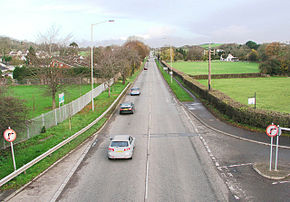
St Nicholas is a small village in the Vale of Glamorgan, South Wales. It lies 2 miles west of the capital city, Cardiff and 6 miles from its city centre. The population was 417 in 2011. It is in the community of St Nicholas and Bonvilston.
Rail transport in Cardiff has developed to provide connections to many other major cities in the United Kingdom, and to provide an urban rail network for the city and its commuter towns in southeast Wales. Today, there are three train operating companies in Cardiff: Great Western Railway, CrossCountry and Transport for Wales.

Wenvoe Tunnel is a disused tunnel on the defunct Barry Railway that runs under Culverhouse Cross in the Vale of Glamorgan in south Wales, on the western outskirts of Cardiff. It was opened in 1889 on a line used to carry coal to Barry Docks. The line also had a sparse passenger service and closed after March 1963.