
The A41 is a trunk road between London and Birkenhead, England. Now in parts replaced by motorways, it passes through or near Watford, Kings Langley, Hemel Hempstead, Aylesbury, Bicester, Solihull, Birmingham, West Bromwich, Wolverhampton, Newport, Whitchurch, Chester and Ellesmere Port.
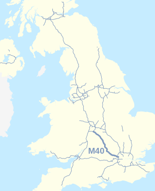
The M40 motorway links London, Oxford, and Birmingham in England, a distance of approximately 89 miles (143 km).

The A40 is a trunk road which runs between London and Goodwick (Fishguard), Wales, and officially called The London to Fishguard Trunk Road (A40) in all legal documents and Acts. Much of its length within England has been superseded by motorways, such as the M40, and has lost its trunk road status, though it retains it west of Gloucester, including its length within Wales. It is approximately 260 miles (420 km) long. The eastern section from Denham, Buckinghamshire to Wheatley, Oxfordshire is better served by the M40 and its former function of linking London with Cheltenham and Gloucester has been taken by the M4, A419 and A417 via Swindon.

Haddenham is a village and civil parish in west Buckinghamshire, England. It is about 5 miles (8 km) south-west of Aylesbury and 4 miles (6 km) north-east of Thame in neighbouring Oxfordshire. At the 2011 Census, the population of the civil parish was 4,502.
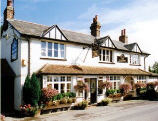
Bishopstone is a small, rural village in the civil parish of Stone with Bishopstone and Hartwell in Aylesbury Vale, Buckinghamshire, England.

Thame is a market town and civil parish in Oxfordshire, about 13 miles (21 km) east of the city of Oxford and 10 miles (16 km) southwest of Aylesbury. It derives its name from the River Thame which flows along the north side of the town and forms part of the county border with Buckinghamshire. The parish includes the hamlet of Moreton south of the town. The 2011 Census recorded the parish's population as 11,561. Thame was founded in the Anglo-Saxon era and was in the kingdom of Wessex.
The Oxford–Cambridge Arc is a notional arc of agricultural and urban land at about 80 kilometres radius of London, in south central England. It runs between the two English university cities of Oxford and Cambridge via Milton Keynes and other settlements in Bedfordshire, Buckinghamshire, Cambridgeshire, Northamptonshire, Oxfordshire at the northern rim of the London commuter belt. It is significant only in economic geography, with little physical geography in common.
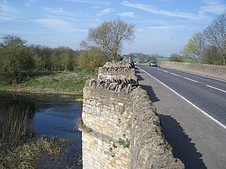
The A428 road is a major road in central and eastern England. It runs between the cities of Coventry and Cambridge by way of the county towns of Northampton and Bedford. Together with the A421,, the eastern section of the A428 forms the route between Cambridge and Oxford. The A428 was formerly part of the main route from Birmingham to Felixstowe before the A14 was fully opened in 1993.

The A421 is an important road for east/west journeys across south central England. Together with the A428, the A43 and A34, it forms the route from Cambridge through Milton Keynes to Oxford. The section between the A1 and the A5 is a national primary route.

Haddenham & Thame Parkway railway station is a station in Buckinghamshire serving the village of Haddenham and town of Thame in the neighbouring county of Oxfordshire, England. The station is on the western edge of Haddenham, about 2 miles (3 km) north east of Thame, and is served by Chiltern Railways.

The A4146 is an A-class road in England running from (near) M1 junction 14 at Milton Keynes, around Linslade and Leighton Buzzard as far as the A505 to Dunstable.

The A505 is a road in the East of England. It follows part of the route of the Icknield Way and the corresponding Icknield Way Path and runs from Leighton Buzzard in Bedfordshire to the A11 Abington Interchange North in Cambridgeshire.
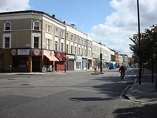
The A404 is a road in the United Kingdom that starts at Paddington in London and terminates near Maidenhead in Berkshire. It is 44.6 miles (71.8 km) long.

The A329 is an east–west road in Southern England that runs from Wentworth in Surrey to Thame in Oxfordshire.
The Oxfordshire Way is a long-distance walk in Oxfordshire, England, with 6 miles in Gloucestershire and very short sections in Buckinghamshire. The path links with the Heart of England Way and the Thames Path.

The A4010 is an important primary north–south road in Buckinghamshire, Southern England. It runs from High Wycombe at Junction 4 of the M40 motorway to Stoke Mandeville, near Aylesbury on the A413.

Transport in Buckinghamshire has been shaped by its position within the United Kingdom. Most routes between the UK's two largest cities, London and Birmingham, pass through this county. The county's growing industry first brought canals to the area, then railways and then motorways.
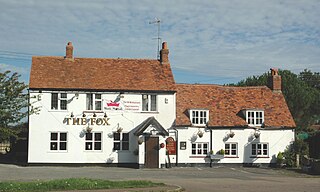
Tiddington is a village in the civil parish of Tiddington-with-Albury, about 3+1⁄2 miles (5.6 km) west of Thame in Oxfordshire, England. It is on the A418 road between Thame and Oxford. The 2011 Census recorded Tiddington-with-Albury's population as 683. Tiddington is on the county boundary with Buckinghamshire. It was a manor and hamlet of the parish of Albury, although for most of its history it has been a larger place than Albury. In 1866 Tiddington became a separate civil parish, but in 1932 the two parishes were reunited.
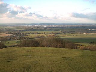
The Aylesbury Vale is a geographical region in Buckinghamshire, England, which is bounded by the City of Milton Keynes and West Northamptonshire to the north, Central Bedfordshire and the Borough of Dacorum (Hertfordshire) to the east, the Chiltern Hills to the south and South Oxfordshire to the west. It is named after Aylesbury, the county town of Buckinghamshire. Winslow and Buckingham are among the larger towns in the vale.
The Oxford to Cambridge Expressway was a proposed grade-separated dual carriageway between the A34 near Oxford and the A14 near Cambridge, via Milton Keynes. The road would have provided an outer orbital route around London, as well as connecting major growth areas in the region.


