The A1 is the longest numbered road in the United Kingdom, at 397 miles (639 km). It connects London, the capital of England, with Edinburgh, the capital of Scotland. It passes through or near North London, Hatfield, Welwyn Garden City, Stevenage, Baldock, Letchworth Garden City, Biggleswade, St Neots, Huntingdon, Peterborough, Stamford, Grantham, Newark-on-Trent, Retford, Doncaster, York, Pontefract, Wetherby, Ripon, Darlington, Durham, Sunderland, Gateshead, Newcastle upon Tyne, Morpeth, Alnwick and Berwick-upon-Tweed.

The M40 motorway links London, Oxford, and Birmingham in England, a distance of approximately 89 miles (143 km).

The A40 is a trunk road which runs between London and Goodwick (Fishguard), Wales, and officially called The London to Fishguard Trunk Road (A40) in all legal documents and Acts. Much of its length within England has been superseded by motorways, such as the M40, and has lost its trunk road status, though it retains it west of Gloucester, including its length within Wales. It is approximately 260 miles (420 km) long. The eastern section from Denham, Buckinghamshire to Wheatley, Oxfordshire is better served by the M40 and its former function of linking London with Cheltenham and Gloucester has been taken by the M4, A419 and A417 via Swindon.

The A38, parts of which are known as Devon Expressway, Bristol Road and Gloucester Road, is a major A-class trunk road in England.

The M5 is a motorway in England linking the Midlands with the South West. It runs from junction 8 of the M6 at West Bromwich near Birmingham to Exeter in Devon. Heading south-west, the M5 runs east of West Bromwich and west of Birmingham through Sandwell Valley. It continues past Bromsgrove, Droitwich Spa, Worcester, Tewkesbury, Cheltenham, Gloucester, Bristol, Clevedon, Weston-super-Mare, Bridgwater, Taunton, terminating at junction 31 for Exeter. Congestion on the section south of the M4 is common during the summer holidays, on Friday afternoons and bank holidays.
The N7 road is a national primary road in Ireland, connecting Limerick and Dublin. The majority of the route is motorway standard and is designated as the M7 motorway. At the Rosbrien interchange in Limerick the route continues as the N18 dual carriageway to Shannon and Ennis. The road passes through the midlands of Ireland, and acts as a trunk route out of Dublin for the N8 and N9 national primary routes to Cork and Waterford respectively. It forms part of European route E20.

The N11 road is a national primary road in Ireland, running for 129 km (80 mi) along the east side of Ireland from Dublin to Wexford. It passes close to Bray, Greystones, Wicklow, Arklow, Gorey, and Enniscorthy. Beyond Wexford, the route continues to Rosslare as the N25. The road forms part of European route E01. As of July 2019 the N11/M11 is of dual carriageway or motorway standard from Dublin as far as Oilgate in County Wexford.

The A46 is a major A road in England. It starts east of Bath, Somerset and ends in Cleethorpes, Lincolnshire, but it does not form a continuous route. Large portions of the old road have been lost, bypassed, or replaced by motorway development. Between Leicester and Lincoln the road follows the course of the Roman Fosse Way, but between Bath and Leicester, two cities also linked by the Fosse Way, it follows a more westerly course.
The A36 is a trunk road and primary route in southwest England that links the port city of Southampton to the city of Bath. At Bath, the A36 connects with the A4 to Bristol, thus providing a road link between the major ports of Southampton and Bristol. It also provides a link between Bristol and London via the A303.

The A48 is a trunk road in Great Britain running from the A40 at Highnam, 3 miles (4.8 km) west of Gloucester, England, to the A40 at Carmarthen, Wales. Before the Severn Bridge opened on 8 September 1966, it was a major route between England and South Wales. For most of its route, it runs almost parallel to the M4 motorway. During times of high winds at the Severn Bridge, the A48 is used as part of the diversion route and is still marked as a Holiday Route.
The A361 is an A class road in southern England, which at 195 miles (314 km) is the longest three-digit A road in the UK.

A dual carriageway (BrE) or a divided highway (AmE) is a class of highway with carriageways for traffic travelling in opposite directions separated by a central reservation (BrE) or median (AmE). Roads with two or more carriageways which are designed to higher standards with controlled access are generally classed as motorways, freeways, etc., rather than dual carriageways.

Blunsdon is a civil parish in the Borough of Swindon, in Wiltshire, England, about 4 miles (6 km) north of the centre of Swindon, with the A419 forming its southern boundary. Its main settlement is the village of Broad Blunsdon, with Lower Blunsdon nearby; the hamlet of Broadbush is now contiguous with Broad Blunsdon.

The A417 is a main road in England running from Streatley, Berkshire to Hope under Dinmore, Herefordshire. It is best known for its section between Cirencester and Gloucester where it has primary status and forms part of the link between the major settlements of Swindon and Gloucester.
The A420 is a road between Bristol and Oxford in England. Between Swindon and Oxford it is a primary route.

The A6 road in Northern Ireland runs for 71.4 miles (114.9 km) from Belfast to Derry, via County Antrim and County Londonderry. From Belfast to Randalstown the route has been superseded by a motorway. Mostly single carriageway, there are sections of dual carriageway in Antrim town centre and from Randalstown to Toome, including the Toome bypass. In urban and suburban districts of Belfast and Derry the route is single carriageway with 4 lanes. In rural parts, there are numerous climbing lanes along the route. The A6 is one of Northern Ireland's most important arterial routes, as the road runs between its two largest cities and urban areas. Between Randalstown and Derry the road forms part of European route E16. There is a new dual carriageway between Drumahoe and Dungiven, which will finish probably before 2023.

The A556 is a road in England which extends from the village of Delamere in Cheshire West and Chester to the Bowdon Interchange in Cheshire East, bordering Greater Manchester. The road contains a mixture of single and dual carriageway sections and forms a large part of the route between Manchester and Chester. It also acts as a major access route to Chester/North Wales to the west and to Manchester to the east for the conurbation of towns and villages around the Dane Valley centering on Winsford and Northwich. The central part, which forms the Northwich Bypass between Davenham and Lostock Gralam, suffers because of the amount of commuter traffic from this area. The part of the route between the M6 motorway Junction 19 and the M56 motorway Junction 7 is a major route into Manchester and has been recently upgraded to a four-lane dual carriageway.
Transport in Swindon, England, and the surroundings has directly contributed to the town's growth and the ingress of businesses and industries.

The A345 is a secondary A road in Wiltshire, England running from Salisbury to Marlborough and the A4. The road is a main south–north link across Salisbury Plain, which is renowned for its rich archaeology, and passes many ancient points of interest along its way.
B4008 is a B road in Gloucestershire, England, which starts in Quedgeley and ends in Stroud. The road goes south from Quedgeley, passes near Hardwicke, intersects the M5 motorway at Junction 12, passes through Stonehouse, then turns east through the Ebley area before ending in Cainscross, Stroud. The road is 9.1 miles in length.
 A419 Ebley bypass, looking towards Stroud
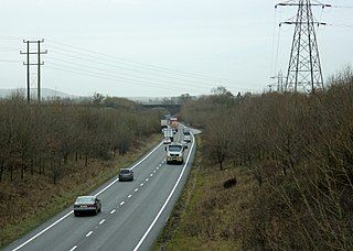
 Looking north towards Common Head, Swindon before the opening of a new flyover


