A36 | ||||
---|---|---|---|---|
Route information | ||||
Length | 63.7 mi [1] (102.5 km) | |||
Major junctions | ||||
North end | A4 near Bath | |||
A361 near Beckington A350 near Warminster ContentsM27 near Totton | ||||
South end | A35 in Totton | |||
Location | ||||
Country | United Kingdom | |||
Primary destinations | Warminster Salisbury Southampton Bath | |||
Road network | ||||
|
The A36 is a trunk road and primary route in southwest England that links the port city of Southampton to the city of Bath. At Bath, the A36 connects with the A4 to Bristol, thus providing a road link between the major ports of Southampton and Bristol. It also provides a link between Bristol and London via the A303.
Originally, the A36 continued to Avonmouth, beyond Bristol, but this section was renumbered to the A4.
Within Bath the A36 acts as a ring road on the southern side of the river, from the junction with the A4 at Newbridge to the west of the city. From here traffic can continue to Bristol on the A4 or to Wells and Weston-super-Mare via the A39 and A368 roads. Another link to the A4 on the eastern side at Cleveland Bridge, which provides a route to the M4 motorway via the A46, is highly congested.
The A36 leaves Bath in an easterly direction towards Bathampton, then turns south to follow the Avon through its steep-sided valley, climbing out of the valley beyond Limpley Stoke. The road passes near a number of towns and a city, including Frome, Warminster, Wilton and Salisbury in Wiltshire, and Totton in Hampshire, on the western outskirts of Southampton, where it meets the M27 motorway and the A35.
The majority of the A36 is built to single carriageway standard, but parts of it have been upgraded to dual carriageway. The A36 is dual carriageway for its 1 mile (1.6 km) bypass of the village of Beckington, 3 miles (5 km), briefly combined with the A361 north of Frome. It shares part of Warminster bypass with the A350. It is also dualled for approximately 1 mile (1.6 km) near its grade separated junction with the A303 road, 8 miles (13 km) north-west of Wilton.
The A36 in Salisbury acts as the city's ring road, bypassing the city centre to dual carriageway standard. Just south-east of Salisbury the largest dualled section runs for about 4 miles (6 km), bypassing the village of Alderbury. Then, the road is briefly dualled from its roundabout with the A3090 to the M27 motorway (junction 2) – this part of the road is erroneously thought by some to have been previously known as the A36(M); prior to the opening of the Totton Western Bypass on the other side of the junction, it was named as a spur of the M27, and hence is built to motorway standards. The A36 reverts to single carriageway standard through Totton until it terminates.
County | Location | mi [1] | km | Destinations | Notes |
---|---|---|---|---|---|
Somerset | Newton St Loe | 0.0 | 0.0 | A4 (Bristol Road / Newbridge Road) to A39 – Bristol, Wells, Corston, Newbridge, Weston | Northern terminus |
Bath | 1.6 | 2.6 | Windsor Bridge Road (A3604 north) / Brook Road to A431 – Bitton, Weston, Newbridge | Weston and Newbridge signed westbound only; southern terminus of A3604 | |
2.6 | 4.2 | A367 (Broad Quay / Wells Road) to A37 – City centre, Radstock, Shepton Mallet | City centre signed eastbound only | ||
2.8– 3.0 | 4.5– 4.8 | Claverton Street (A3062 south) – Claverton Down, Combe Down | Northern terminus of A3062 | ||
3.6 | 5.8 | Bathwick Street to A4 / A46 / M4 – Chippenham, Stroud | |||
Norton St Philip | 11.4 | 18.3 | A366 east – Trowbridge, Farleigh Hungerford | Northern terminus of A366 concurrency | |
11.6 | 18.7 | A366 west (Farleigh Road) to A362 – Norton St Philip, Radstock | Southern terminus of A366 concurrency | ||
Beckington | 14.5 | 23.3 | A361 north-east / to Bath Road – Trowbridge, Beckington, Southwick, Rudge, Rode | Northern terminus of A361 concurrency | |
15.2 | 24.5 | A361 / Warminster Road / Old Warminster Road – Taunton, Frome, Beckington | Southern terminus of A361 concurrency | ||
Wiltshire | Chapmanslade | 18.0– 18.2 | 29.0– 29.3 | A3098 – Westbury, Chapmanslade, Dilton Marsh | Grade–separated junction |
Warminster | 19.8 | 31.9 | A350 north / B3414 (Bath Road) to A363 – Chippenham, Trowbridge, Warminster, Westbury | Northern terminus of A350 concurrency | |
21.4 | 34.4 | A362 west / Victoria Road – Frome, Corsley Heath, Warminster | Eastern terminus of A362 | ||
22.7 | 36.5 | A350 south / Deverill Road – Poole, Blandford, Shaftesbury, Longbridge Deverill, Crockerton, Warminster | Poole and Shaftesbury signed southbound only; southern terminus of A350 concurrency | ||
Deptford | 32.7– 33.1 | 52.6– 53.3 | A303 – Andover, Winterbourne Stoke, Honiton, Exeter, Wylye, Mere, London, Amesbury | London and Amesbury signed southbound only; junction on A303 | |
Wilton | 41.0 | 66.0 | A30 west (Minster Street) / The Avenue to A360 – Wilton, Devizes, Shaftesbury | A30 and Shaftesbury signed westbound only; western terminus of A30 concurrency | |
Wilton–Quidhampton boundary | 41.4 | 66.6 | A3094 east (Netherhampton Road) to A338 – Bournemouth, Ringwood | Only route signed westbound; western terminus of A3094 | |
Salisbury | 43.3 | 69.7 | A360 north-west (Devizes Road) / Fisherton Street – Devizes | South-eastern terminus of A360 | |
43.6– 43.7 | 70.2– 70.3 | Central Salisbury | Grade–separated junction | ||
43.8 | 70.5 | A345 north (Castle Road) / Castle Street – Amesbury | Western terminus of A345 concurrency | ||
44.3 | 71.3 | A30 east / A338 north to St Mark's Avenue / Wain-a-Long Road / Estcourt Road / A343 – London, Marlborough, Andover, Laverstock | Eastern terminus of A30 concurrency; western terminus of A338 concurrency | ||
44.6 | 71.8 | Bourne Hill / Estcourt Road | Grade–separated junction; westbound exit only | ||
44.6 | 71.8 | Kelsey Road / Rampart Road | Grade–separated junction; eastbound exit only | ||
44.8– 44.9 | 72.1– 72.3 | Multistorey car park | Grade–separated junction | ||
45.1 | 72.6 | A338 south / A354 south (Churchill Way South) – Bournemouth, Blandford | Eastern terminus of A338 / A354 concurrency | ||
Alderbury | 48.9– 49.4 | 78.7– 79.5 | West Dean, Farley, Grimstead, Alderbury, Whaddon | ||
Whiteparish | 51.5 | 82.9 | A27 east (Brickworth Road) – Romsey, Whiteparish | Western terminus of A27 | |
Hampshire | Copythorne–Netley Marsh–Romsey Extra boundary | 59.3 | 95.4 | M27 / A3090 north-east to A326 – Southampton, Portsmouth, Ringwood, Fawley, Romsey, Totton, Bournemouth | Bournemouth signed northbound only; south-western terminus of A3090 |
Netley Marsh | 60.2 | 96.9 | A31 south-west (Romsey Road) to A337 – Copythorne, Cadnam, Lyndhurst | North-eastern terminus of A31 | |
60.6– 60.8 | 97.5– 97.8 | A326 to M27 / A3090 – Salisbury, Romsey, Fawley, Totton (west & south) | |||
Totton | 63.1 | 101.5 | A336 west (Ringwood Road) – Cadnam, Eling, Netley Marsh, Totton (west) | Netley Marsh and Totton signed northbound only; eastern terminus of A336 | |
63.7 | 102.5 | A33 east to M271 / M27 – Southampton | Eastern terminus; no access to A33 west or from A33 east | ||
1.000 mi = 1.609 km; 1.000 km = 0.621 mi
|
Point | Coordinates (Links to map resources) | OS Grid Ref | Notes |
---|---|---|---|
Bath | 51°23′21″N2°23′50″W / 51.3892°N 2.3971°W | ST724656 | Bath, Somerset |
Southampton | 50°55′20″N1°28′13″W / 50.9221°N 1.4703°W | SU373137 | Southampton |
The A30 is a major road in England, running 284 miles (457 km) WSW from London to Land's End.
The M3 is a motorway in England, from Sunbury-on-Thames, Surrey, to Eastleigh, Hampshire; a distance of approximately 59 miles (95 km). The route includes the Aldershot Urban Area, Basingstoke, Winchester, and Southampton.
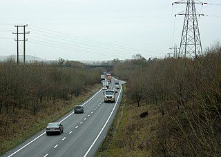
The A303 is a trunk road in southern England, running between Basingstoke in Hampshire and Honiton in Devon via Stonehenge. Connecting the M3 and the A30, it is part of one of the main routes from London to Devon and Cornwall. It is a primary A road throughout its length, passing through five counties.
The A4 is a major road in England from Central London to Avonmouth via Heathrow Airport, Reading, Bath and Bristol. It is historically known as the Bath Road with newer sections including the Great West Road and Portway. The road was once the main route from London to Bath, Bristol and the west of England and formed, after the A40, the second main western artery from London.
The M27 is a motorway in Hampshire, England. It is 27.9 miles (44.9 km) long and runs between Cadnam and Portsmouth. It was opened in stages between 1975 and 1983, providing the largest two urban areas in Hampshire with a direct motorway link. An extension into the county of West Sussex was planned but never constructed. A number of smaller motorways were proposed, connecting the city centres of Southampton and Portsmouth to the motorway; of these only the M271 and M275 were built. Three sections of the M27 have since been widened to four lanes each way, the first between junctions 7 and 8, the second between junctions 3 and 4, and the third begins at the slip road where junction 11 joins until mid-way to junction 12.
The N7 road is a national primary road in Ireland, connecting Limerick and Dublin. The majority of the route is motorway standard and is designated as the M7 motorway. At the Rosbrien interchange in Limerick the route continues as the N18 dual carriageway to Galway, Shannon and Ennis. The road passes through the midlands of Ireland, and acts as a trunk route out of Dublin for the N8 and N9 national primary routes to Cork and Waterford respectively. It forms part of European route E20.
The A46 is a major A road in England. It starts east of Bath, Somerset and ends in Cleethorpes, Lincolnshire, but it does not form a continuous route. Large portions of the old road have been lost, bypassed, or replaced by motorway development. Between Leicester and Lincoln the road follows the course of the Roman Fosse Way, but between Bath and Leicester, two cities also linked by the Fosse Way, it follows a more westerly course.
The A27 is a major road in England. It runs from its junction with the A36 at Whiteparish in the county of Wiltshire, follows the south coast of Hampshire and West Sussex, and terminates at Pevensey in East Sussex.
The A35 is a major road in southern England, connecting Honiton in Devon and Southampton in Hampshire. It is a trunk road for some of its length. Most of its route passes through Dorset and the New Forest. It originally connected Exeter and Southampton, the original A35 ran along what is now the A3052 joining the present road at Charmouth.
The A361 is an A class road in southern England, which at 195 miles (314 km) is the longest three-digit A road in the UK.
The M271 is a 3-mile (4.8 km) long motorway near Southampton in Hampshire, England. Construction began in 1973 and it opened in 1975. It provides part of the route to Southampton Docks from the M27, which in turn makes up another part of the route to the docks from the nearby M3 Motorway.
The A350 is a north–south primary route in southern England, that runs from the M4 motorway in Wiltshire to Poole in Dorset.
The Wessex Main Line is the railway line from Bristol Temple Meads to Southampton Central. Diverging from this route is the Heart of Wessex Line from Westbury to Weymouth. The Wessex Main Line intersects the Reading to Taunton Line at Westbury and the West of England Main Line at Salisbury.
The N9 road is a national primary road in Ireland running from Junction 11 on the M7, located near Kilcullen, County Kildare, to Waterford city. The route connects Dublin and Waterford. The section of the route from junction 11 on the M7 at Kilcullen to the intersection with the N24 road outside Waterford is motorway standard since 2010 and is designated as the M9 motorway. In line with Irish practice, all sections previously designated N9 were renumbered at that time. Only a short (550-metre) section of the route is still designated as N9 between the Quarry roundabout junction with the N24 and the N25 Grannagh Roundabout junction. This section is dual carriageway.
Wylye is a village and civil parish on the River Wylye in Wiltshire, England. The village is about 9+1⁄2 miles (15 km) northwest of Salisbury and a similar distance southeast of Warminster.
The A4174 is a major ring road in England which runs around the northern and eastern edge of Bristol, mainly in South Gloucestershire, and through the southern suburbs of the city. When it was first conceived it was planned to circle the whole of Bristol, and is commonly referred to as the "Avon Ring Road", or less accurately the "Bristol Ring Road", on road signs. The road does not circle the whole city, instead covering roughly half of the route. It is broken in part where it is concurrent with the A4.
The A338 is a major primary route in southern England, that runs from the junction with the A35 at Poole in Dorset to the junction with the A420 at Besselsleigh in Oxfordshire, a distance of 84 miles (135 km).
The Wilts, Somerset and Weymouth Railway (WS&WR) was an early railway company in south-western England. It obtained Parliamentary powers in 1845 to build a railway from near Chippenham in Wiltshire, southward to Salisbury and Weymouth in Dorset. It opened the first part of the network but found it impossible to raise further money and sold its line to the Great Western Railway (GWR) in 1850.
Road building was central to planning policy for much of the 20th century in Bristol, England. The planned road network evolved over time but at its core was a network of concentric ring roads and high-capacity radial roads.