
Kingston upon Thames is a town in the Royal Borough of Kingston upon Thames, southwest London, England. It is situated on the River Thames and 10 miles (16 km) southwest of Charing Cross. It is notable as the ancient market town in which Saxon kings were crowned and today is the administrative centre of the Royal Borough of Kingston upon Thames.
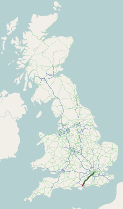
The A3, known as the Portsmouth Road or London Road in sections, is a major road connecting the City of London and Portsmouth passing close to Kingston upon Thames, Guildford, Haslemere and Petersfield. For much of its 67-mile (108 km) length, it is classified as a trunk road and therefore managed by National Highways. Almost all of the road has been built to dual carriageway standards or wider. Apart from bypass sections in London, the road travels in a southwest direction and, after Liss, south-southwest.

Esher is a town in Surrey, England, to the east of the River Mole.
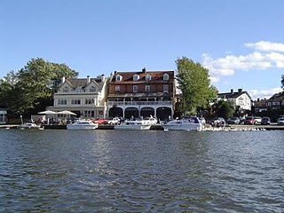
Elmbridge is a local government district with borough status in Surrey, England. Its council is based in Esher, and other notable towns and villages include Cobham, Walton-on-Thames, Weybridge and Molesey. The borough lies just outside the administrative boundary of Greater London, but is mostly within the M25 motorway which encircles London. Many of the borough's urban areas form part of the wider Greater London Built-up Area.

Kingston Vale with Kingston Hill is a district in the Royal Borough of Kingston upon Thames in south-west London. It is a residential area between Richmond Park, the much smaller Putney Vale, Wimbledon Common, Coombe/Coombe Hill and the Norbiton part of the very old borough. The main road is the A308 which is a through route for traffic passing to and from Kingston Hill to the A3 trunk road. Many of the branch roads are cul-de-sacs. It includes, toward the east and in the Vale, the only part of Kingston which drains eastward, that is, into Beverley Brook. The hill expanse, shared with Coombe and a golf course, has a hotel, some tall blocks overlooking Kingston, the edge of Kingston Hospital, the main campus of Kingston University London and faint remnants of dense woodland.

Thames Ditton is a suburban village on the River Thames, in the Elmbridge borough of Surrey, England. Apart from a large inhabited island in the river, it lies on the southern bank, centred 12.2 miles (19.6 km) southwest of Charing Cross in central London. Thames Ditton is just outside Greater London but within the Greater London Urban Area as defined by the Office for National Statistics. Its clustered village centre and shopping area on a winding High Street is surrounded by housing, schools and sports areas. Its riverside faces the Thames Path and Hampton Court Palace Gardens and golf course in the London Borough of Richmond upon Thames. Its most commercial area is spread throughout its conservation area and contains restaurants, cafés, shops and businesses.

Richmond Park is a constituency in Greater London represented in the House of Commons of the UK Parliament. Since 2019, its Member of Parliament (MP) has been Sarah Olney of the Liberal Democrats.

The Scilly Isles is a double roundabout in Hinchley Wood, Surrey, between the English towns of Esher and Kingston upon Thames on the traditional route of the Portsmouth Road. The name is a corruption of "silly islands", a nickname given to the road system when it was built in the 1930s.

Claygate is an affluent suburban village in Surrey, England, 14 miles southwest of central London. It is the only civil parish in the borough of Elmbridge. Adjoining Esher and Hinchley Wood to the west and north respectively, and bordered by green belt land to the south and east, Claygate lies within the Greater London Built-up Area.

The A316, known in parts as the Great Chertsey Road, is a major road in England, which runs from the A315 Chiswick High Road, Turnham Green, Chiswick to join head-on the M3 motorway at Sunbury-on-Thames. Its initial London section Chiswick Lane heads south – following this it is a mostly straight dual carriageway aligned WSW.

The A308 is a road in England in two parts. The first part runs from Central London to Putney Bridge. The second part runs from just beyond Putney Heath to Bisham, Berkshire. It traces four, roughly straight lines, to stay no more than 3 miles (4.8 km) from the Thames. It is a dual carriageway where it is furthest from that river, in Spelthorne, Surrey and forms one of the motorway spurs to the large town of Maidenhead. Other key settlements served are Fulham, Kingston (London), Staines upon Thames, Windsor and a minor approach to Marlow
Esher was a borough constituency represented in the House of Commons of the Parliament of the United Kingdom. It elected one Member of Parliament (MP) by the first past the post system of election. In the general elections during its 47-year lifetime it was won by three Conservatives successively. In area it shrank in 1974, then regrew in 1983 taking in four sparsely inhabited wards which proved to be temporary, as omitted from the successor seat, Esher and Walton.

The A240 is a partially primary status A road in Surrey and Greater London that connects the A217 with the A3 and continues beyond through Surbiton to Kingston upon Thames. The road is 8.5 miles (13.7 km) long and is dualled as the Ewell bypass and thereafter to Tolworth Broadway. In conjunction with the A3 it provides an alternative to the congested A24 corridor through Morden and Merton.
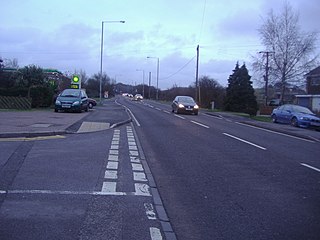
The A243 road in England is a partially primary status A-road that runs from Leatherhead in Surrey to Surbiton in the Royal Borough of Kingston Upon Thames, Greater London. It is primary for most of its length, from Leatherhead to Hook Junction with the A3 before running as a non-primary A-road through Surbiton to its terminus at the A307. Although comparatively short it is a busy road connecting a number of other A roads with the M25 motorway.

The A309 is a mostly primary status A-road that runs in two sections, a short section in Twickenham and Teddington as a non-primary status A-road, as well as the much longer primary A- Road section that runs from Hampton Court to Hook.

The Hundred of Kingston or Kingston Hundred was an ancient hundred in the north east of the county of Surrey, England. Its area has been mostly absorbed by the growth of London; with its name currently referring to both the suburban town of Kingston upon Thames and the larger Royal Borough of Kingston upon Thames. Its former area now corresponds to that borough and part of the London Borough of Richmond upon Thames in Greater London and part of the borough of Elmbridge in Surrey. It bordered the Hundred of Brixton to the east, the Hundred of Elmbridge to the south, and to the west and north by the River Thames.
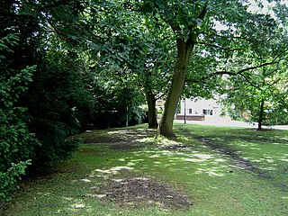
The Rythe is a tributary of the River Thames in north Surrey, England. It runs through woodland for approximately half of its course, but is also culverted and passes through suburban gardens. It joins the Thames between Thames Ditton and Long Ditton. Its longest branch is the Arbrook which drains Arbrook Common, a woodland area of Esher Commons.
The Petersham Hole was a sink hole caused by subsidence of a sewer which forced the total closure of the A307 road in Petersham in the London Borough of Richmond upon Thames in 1979–80. It caused long-term disruption to traffic in the surrounding area and significant direct and indirect costs.
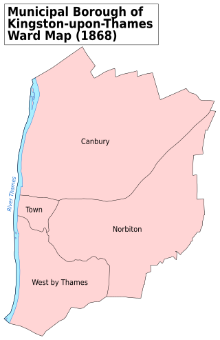
Kingston upon Thames was an ancient parish in the county of Surrey, England. By 1839 it contained these chapelries, curacies or ecclesiastical parishes which eventually became civil parishes in their own right:

Sudbrook and its tributary, the Latchmere stream, are north-flowing streams in London, England, that drain northern Kingston upon Thames and the eastern extreme of Ham following a meander scar in a terrace; the upper part of the Sudbrook drains a narrow vale in Richmond Park's southern corner into the tidal Thames.


