
Wiltshire is a ceremonial county in South West England. It borders Gloucestershire to the north and the north-west, Oxfordshire to the north-east, Berkshire to the east, Hampshire to the south-east, Dorset to the south, and Somerset to the west and the south-west. The largest settlement is Swindon, and Trowbridge is the county town.

Trowbridge is the county town of Wiltshire, England; situated on the River Biss in the west of the county, close to the border with Somerset. The town lies 8 miles (13 km) south-east of Bath, 31 miles (50 km) south-west of Swindon and 20 miles (32 km) south-east of Bristol. The parish had a population of 37,169 in 2021.

Chippenham is a market town in north-west Wiltshire, England. It lies 13 miles (21 km) north-east of Bath, 86 miles (138 km) west of London and is near the Cotswolds Area of Outstanding Natural Beauty. The town was established on a crossing of the River Avon, where some form of settlement is believed to have existed since before Roman times. It was a royal vill and probably a royal hunting lodge, under Alfred the Great. The town continued to grow when the Great Western Railway arrived in 1841. It had a population of 36,548 in 2021.

The A4 is a major road in England from Central London to Avonmouth via Heathrow Airport, Reading, Bath and Bristol. It is historically known as the Bath Road with newer sections including the Great West Road and Portway. The road was once the main route from London to Bath, Bristol and the west of England and formed, after the A40, the second main western artery from London.

Bradford-on-Avon is a town and civil parish in west Wiltshire, England, near the border with Somerset, which had a population of 10,405 at the 2021 census. The town's canal, historic buildings, shops, pubs and restaurants make it popular with tourists.

West Wiltshire was a local government district in Wiltshire, England, between 1974 and 2009, when it was superseded by Wiltshire Council.
The A361 is an A class road in southern England, which at 195 miles (314 km) is the longest three-digit A road in the UK.

Melksham Without is a civil parish in the county of Wiltshire, England. It surrounds, but does not include, the town of Melksham and is the largest rural parish in Wiltshire, with a population of 7,230 and an area of 29 square kilometres.

The A350 is a north–south primary route in southern England, that runs from the M4 motorway in Wiltshire to Poole in Dorset.

Wiltshire is a historic county located in the South West England region. Wiltshire is landlocked and is in the east of the region.

Bathford is a village and civil parish 3 miles (4.8 km) east of Bath, England. The parish, which includes Warleigh, has a population of 1,759 and extends over 1,800 acres (7.3 km2).

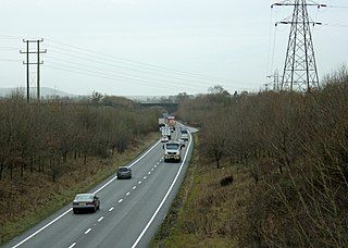
Yarnbrook is a large hamlet in Wiltshire, England, between the towns of Westbury and Trowbridge. Most of the settlement lies in the civil parish of North Bradley, the rest in West Ashton. Most of Yarnbrook's houses line the A350 road, running between the M4 motorway near Chippenham and the south coast of England at Poole, Dorset.

Monkton Farleigh is a village and civil parish in west Wiltshire, England, on high ground 3 miles (5 km) northwest of Bradford-on-Avon, and a similar distance east of the city of Bath. The parish includes the hamlets of Farleigh Wick and Pinckney Green. In the west and northwest the parish is bounded by Somerset.
The Wilts, Somerset and Weymouth Railway (WS&WR) was an early railway company in south-western England. It obtained Parliamentary powers in 1845 to build a railway from near Chippenham in Wiltshire, southward to Salisbury and Weymouth in Dorset. It opened the first part of the network but found it impossible to raise further money and sold its line to the Great Western Railway (GWR) in 1850.
Wingfield is a small village and civil parish in the county of Wiltshire, England, about 2.5 miles (4.0 km) south of Bradford-on-Avon and 2.2 miles (3.5 km) west of Trowbridge.
South Wraxall is a village and a civil parish in Wiltshire, England, 2.5 miles (4.0 km) north of Bradford on Avon. The village is to the east of the B3109 road from Bradford on Avon to Corsham.

Winsley is a large village and civil parish about 2 miles (3 km) west of Bradford on Avon in Wiltshire, England.
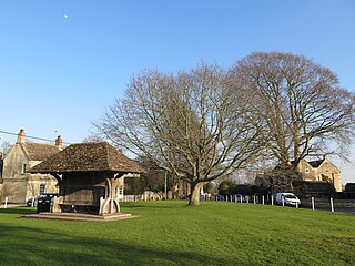
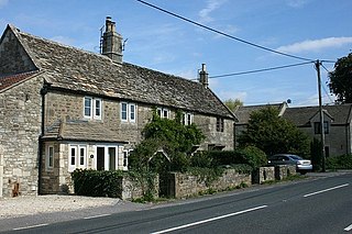
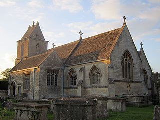
Holt is a village and civil parish in the west of Wiltshire, England, about 2.5 miles (4 km) north-east of Bradford-on-Avon and 3 miles (5 km) south-west of Melksham.
