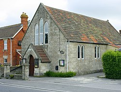
Edington is a village and civil parish in Wiltshire, England, about 4 miles (6 km) east-northeast of Westbury. The village lies under the north slope of Salisbury Plain and the parish extends south onto the Plain. Its Grade I listed parish church was built for Edington Priory in the 14th century.

Bromham is a village and civil parish in Wiltshire, England. The village is 3+1⁄2 miles (6 km) northwest of Devizes and the same distance east of Melksham.

Great Cheverell is a village and civil parish in Wiltshire, England, 5 miles (8.0 km) south of Devizes. In some sources the Latinized name of Cheverell Magna is used, especially when referring to the ecclesiastical parish.

Etchilhampton is a small village and civil parish in Wiltshire, England, in the Vale of Pewsey 3 miles (4.8 km) east of Devizes.

Westbury is a market town and civil parish in west Wiltshire, England. The town lies below the northwestern edge of Salisbury Plain, about 4 miles (6 km) south of Trowbridge and a similar distance north of Warminster.

Dilton Marsh is a village and civil parish in the far west of the county of Wiltshire, in the southwest of England. The village is about 1.5 miles (2.4 km) southwest of the centre of the town of Westbury; Dilton Marsh remains a distinct settlement with its own character and community, bounded and separated from Westbury Leigh by the Biss Brook.

Barford St Martin is a village and civil parish in Wiltshire, England, about 2.5 miles (4 km) west of Wilton, around the junction of the A30 and the B3089. Barford is known as one of the Nadder Valley villages, named for the River Nadder which flows through the parish.

West Lavington is a village and civil parish in Wiltshire, England, on the north edge of Salisbury Plain, on the A360 road between Devizes and Salisbury, about 5 miles (8 km) south of Devizes. The parish includes the hamlet of Littleton Panell.
Southwick is a semi-rural village and civil parish 3 miles (4.8 km) south-west of the county town of Trowbridge, Wiltshire, England. It is separated from the south-west fringe of Trowbridge only by the Southwick Country Park, which consists of 380 acres (150 ha) of open fields. The majority of the village lies south of the A361, which runs through the village, linking Trowbridge with Frome.

Bowerchalke is a village and civil parish in Wiltshire, England, about 9 miles (14 km) southwest of Salisbury. It is in the south of the county, about 1 mile (1.6 km) from the boundary with Dorset and 2 miles (3.2 km) from that with Hampshire. The parish includes the hamlets of Mead End, Misselfore and Woodminton.
Lyneham is a large village in north Wiltshire, England, within the civil parish of Lyneham and Bradenstoke, and situated 4 miles (6.4 km) southwest of Royal Wootton Bassett, 5.5 miles (8.9 km) north of Calne and 11 miles (18 km) southwest of Swindon. The village is on the A3102 road between Calne and Wootton Bassett.

North Bradley is a village and civil parish in Wiltshire, England, between Trowbridge and Westbury. The village is about 1.75 miles (2.8 km) south of Trowbridge town centre. The parish includes most of the village of Yarnbrook, and the hamlets of Brokerswood, Cutteridge and Drynham.

Horningsham is a small village and civil parish in Wiltshire, England, on the county border with Somerset. The village lies about 4 miles (6 km) southwest of the town of Warminster and 4+1⁄2 miles (7 km) southeast of Frome, Somerset.
Maiden Bradley is a village in south-west Wiltshire, England, about 6 miles (10 km) south-west of Warminster and bordering the county of Somerset. The B3092 road between Frome and Mere forms the village street. Bradley House, the seat of the Duke of Somerset, is adjacent to the village.

Market Lavington is a civil parish and large village with a population of about 2,200 on the northern edge of Salisbury Plain in Wiltshire, England, 5 miles (8.0 km) south of the market town of Devizes. The village lies on the B3098 Westbury–Urchfont road which skirts the edge of the Plain. The parish includes the hamlets of Northbrook, Lavington Sands and Fiddington Sands.

Beanacre is a small village in Wiltshire, England, about 1.5 miles (2.4 km) north of Melksham on the A350 towards Chippenham. It is in the civil parish of Melksham Without. The Bristol Avon passes to the east of the village where a stream from Sandridge joins it.

Manningford is a civil parish in Wiltshire, England. The parish includes the villages of Manningford Abbots, Manningford Bohune and Manningford Bruce, and the hamlet of Manningford Bohune Common, together known as the Manningfords.
The Wiltshire Record Society is a text publication society in Wiltshire, England, which edits and publishes historic documents concerned with the history of Wiltshire.

Stert is a village and civil parish in Wiltshire, England. Its nearest town is Devizes, about 2 miles (3.2 km) away to the northwest.

North Newnton is a civil parish in Wiltshire, England, 2.5 miles (4.0 km) southwest of Pewsey. The parish is in the Vale of Pewsey which carries the upper section of the Salisbury Avon.