
North East Lincolnshire is a unitary authority area with borough status in Lincolnshire, England. It borders the borough of North Lincolnshire and districts of West Lindsey and East Lindsey. The population of the district in the 2011 Census was 159,616. The administrative centre and largest settlement is Grimsby and the borough includes the towns of Cleethorpes and Immingham as well as the villages of New Waltham, Waltham, Humberston, Healing and Great Coates. The borough is also home to the Port of Grimsby and Port of Immingham as well as Cleethorpes beach.

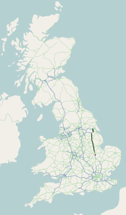
The M180 is a 25.5-mile (41 km) motorway in eastern England, starting at junction 5 on the M18 motorway in Hatfield, within the Metropolitan Borough of Doncaster, South Yorkshire, and terminating at Barnetby, Lincolnshire, some 10 miles (16 km) from the port of Immingham and 14 miles (23 km) from the port of Grimsby. The A180 road continues to the east for Grimsby, Cleethorpes and Immingham. Scunthorpe, Lincoln, Hull, Brigg, Bawtry and the Isle of Axholme can be accessed using the motorway. Humberside Airport, the now-closed Doncaster Sheffield Airport, and the Killingholme, Humber and Lindsey oil refineries are close to the motorway. The road forms part of the unsigned Euroroute E22 and is the main route along the south bank of the Humber Estuary.

The A46 is a major A road in England. It starts east of Bath, Somerset and ends in Cleethorpes, Lincolnshire, but it does not form a continuous route. Large portions of the old road have been lost, bypassed, or replaced by motorway development. Between Leicester and Lincoln the road follows the course of the Roman Fosse Way, but between Bath and Leicester, two cities also linked by the Fosse Way, it follows a more westerly course.

West Lindsey is a local government district in Lincolnshire, England. Its council is based in Gainsborough and covers the towns of Market Rasen and Caistor, as well as the villages of Bardney, Saxilby, Morton, Hemswell Cliff, Scampton, Torksey, Cherry Willingham, Nettleham and Dunholme.
The A15 is a major road in England. It runs north from Peterborough via Market Deeping, Bourne, Sleaford and Lincoln along a variety of ancient, Roman, and Turnpike alignments before it is interrupted at its junction with the M180 near Scawby. The road restarts 10 miles (16 km) east, and then continues north past Barton-upon-Humber, crossing the Humber on the Humber Bridge before terminating at Hessle near Kingston upon Hull.
The M181 is a motorway that links the town of Scunthorpe, England, to the M180 motorway. A spur of the M180, the road is virtually straight through its entire 2-mile (3.2 km) length. It was opened in December 1978, at the same time as the section of M180 from junction 3 (A15) to the east side of the River Trent.

The A16 road is a principal road of Lincolnshire in the East Midlands region of England, connecting the port of Grimsby and Peterborough, where it meets the A1175, A47 & A1139 then on to the A1 and the A605; the latter, in turn, giving a through route to Northampton and the west, and south west of England. Its length is 78 miles (126 km). The road was "de-trunked", with responsibility largely returned to Lincolnshire County Council from the Highways Agency in 2002.
South Killingholme is a village and civil parish in North Lincolnshire, England. The population of the civil parish at the 2011 census was 1,108.
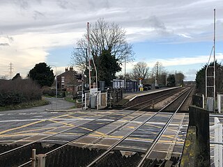
Habrough railway station serves the village of Habrough and the town of Immingham in North East Lincolnshire, England. It was built by the Great Grimsby and Sheffield Junction Railway in 1848. Up until 1988 there was a signal box at the station on the south side of the track and east side of the road with manually-operated gates. It was of typical Great Central Railway signal box design. The main buildings were located on the eastbound platform and were linked to the westbound one via a footbridge, but both have also been demolished and the level crossing was converted to an AHB crossing. In 2015/2016, it was converted to a full-barrier level crossing with Obstacle Detection (MCB-OD).

The Barton line is a railway line in North and North East Lincolnshire, England. It runs from Barton-upon-Humber south east to Cleethorpes and was designated by the Department for Transport as a community rail line in February 2007. Barton station is near to the Humber Bridge. It is situated on the south bank of the Humber Estuary.
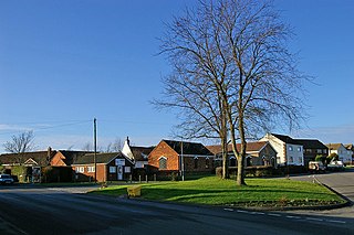
Barnetby le Wold is a village and civil parish in North Lincolnshire, Lincolnshire, England, located between Brigg and Immingham. The village is also near Barton-upon-Humber. The population of the parish in the 2001 census was 1,593. This increased by 148 to 1,741 in the 2011 census.

The A18 is a road in England that links Doncaster in South Yorkshire with Ludborough in Lincolnshire, via Scunthorpe and Grimsby. Much of its route has been superseded by the M180 motorway.

Barton-on-Humber railway station serves the town of Barton-upon-Humber in North Lincolnshire, England.

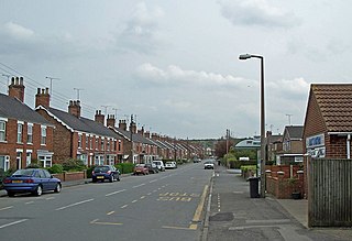
Ulceby railway station serves the village of Ulceby in North East Lincolnshire, England. It was built by the Great Grimsby and Sheffield Junction Railway in 1848 and is located at Ulceby Skitter.

The coast of Lincolnshire runs for more than 50 miles (80 km) down the North Sea coast of eastern England, from the estuary of the Humber to the marshlands of the Wash, where it meets Norfolk. This stretch of coastline has long been associated with tourism, fishing and trade.

The A160 is a short road in North Lincolnshire, England. It connects the A180 to Immingham docks. It is a dual carriageway for part of its length through the village of South Killingholme. Plans have been approved to entirely dual the road, and work started in spring 2015.
The A1077 road runs through North Lincolnshire, England, between Scunthorpe and South Killingholme.
The Great Grimsby and Sheffield Junction Railway was an early British railway company which existed between 1845 and 1847 with the intention of providing rail services between Grimsby, New Holland and Gainsborough in the county of Lincolnshire. It amalgamated with the Sheffield, Ashton-Under-Lyne and Manchester Railway and the Sheffield and Lincolnshire Junction Railway, the three being renamed the Manchester, Sheffield and Lincolnshire Railway in 1847.

The South Humberside Main Line runs from Doncaster on the East Coast Main Line to Thorne where it diverges from the Sheffield to Hull Line. It then runs eastwards to Scunthorpe and the Humber ports of Immingham and Grimsby, with the coastal resort of Cleethorpes as terminus.
A.F. Budge was a British civil engineering and construction company based in Nottinghamshire. It built many sections of motorway in Yorkshire and the north Midlands.
