A1198 road

Last updated

UK road A1198.svg
A1198
A bend in the A1198 (Old Great North Road, Ermine Street). - geograph.org.uk - 475795.jpg
A bend in the A1198 (Old Great North Road, Ermine Street).
Major junctions
South end A505 road near Royston
Major intersectionsUK road A505.svg A505
UK road A603.svg A603
UK road A428.svg A428
UK road A14.svg A14
UK road A1307.svg A1307
North end Godmanchester, near Huntingdon
Location
Country United Kingdom
Constituent country England
Primary
destinations
Royston
Cambourne
Godmanchester
Road network

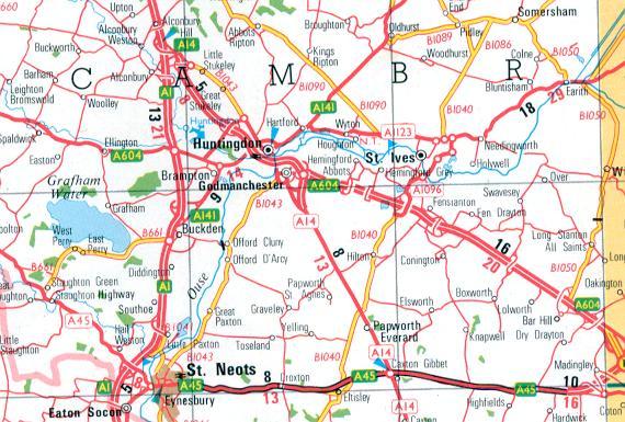
The A1198 is a road in Cambridgeshire, England, which runs between the A505 at Royston, and the A1307 on the outskirts of Huntingdon.

Contents

Settlements along route

History

Roman Road

The road follows the route of Ermine Street between the A505 at Royston, Hertfordshire and Godmanchester, near Huntingdon. [1]

20th century

This road was designated as a major road during road classification in 1922, and originally carried the number A14. [2] When the M11 motorway was completed in February 1980, and traffic was encouraged to follow the new motorway and the Via Devana (then the A604, now the A1307 and A14 roads) instead. [3] By 1991, most of the former A14 was renumbered as the A1198, with short section of the route from Huntingdon to Alconbury being renumbered as a spur of the A604. [4]

21st century

In August 2010, Cambridgeshire County Council announced the reduction of the road's speed limit from NSL (60 mph) to 50 mph in areas where concern was raised over the safety of traffic. [1] By 2020 some residential and industrial developments had urbanised sections of the road.

Related Research Articles

<span class="mw-page-title-main">A3 road</span> London to Portsmouth road in England

The A3, known as the Portsmouth Road or London Road in sections, is a major road connecting the City of London and Portsmouth passing close to Kingston upon Thames, Guildford, Haslemere and Petersfield. For much of its 67-mile (108 km) length, it is classified as a trunk road and therefore managed by National Highways. Almost all of the road has been built to dual carriageway standards or wider. Apart from bypass sections in London, the road travels in a southwest direction and, after Liss, south-southwest.

<span class="mw-page-title-main">M1 motorway</span> First inter-urban motorway in the UK

The M1 motorway connects London to Leeds, where it joins the A1(M) near Aberford, to connect to Newcastle. It was the first inter-urban motorway to be completed in the UK; the first motorway in the country was the Preston Bypass, which later became part of the M6.

<span class="mw-page-title-main">Ermine Street</span> Roman road from London to York, England

Ermine Street is a major Roman road in England that ran from London (Londinium) to Lincoln and York (Eboracum). The Old English name was Earninga Strǣt (1012), named after a tribe called the Earningas, who inhabited a district later known as Armingford Hundred, around Arrington, Cambridgeshire, and Royston, Hertfordshire. "Armingford", and "Arrington" share the same Old English origin. The original Celtic and Roman names for the route remain unknown. It is also known as the Old North Road from London to where it joins the A1 Great North Road near Godmanchester.

<span class="mw-page-title-main">Huntingdon</span> Former county town of Huntingdonshire

Huntingdon is a market town in the Huntingdonshire district of Cambridgeshire, England. The town was given its town charter by King John in 1205. It was the county town of the historic county of Huntingdonshire. Oliver Cromwell was born there in 1599 and became one of its Members of Parliament (MP) in 1628. The former Conservative Prime Minister (1990–1997) John Major served as its MP from 1979 until his retirement in 2001.

<span class="mw-page-title-main">Godmanchester</span> Human settlement in England

Godmanchester is a town and civil parish in the Huntingdonshire district of Cambridgeshire, England. It is separated from Huntingdon, 1 mile (1.6 km) to the north, by the valley of the River Great Ouse. Being on the Roman road network, the town has a long history. It has a waterside location, surrounded by open countryside of high value for its biodiversity but it remains highly accessible, with a railway line to London, the A1 road and M11/A14 which run nearby.

<span class="mw-page-title-main">A34 road</span> Major road in England

The A34 is a major road in England. It runs from the A33 and M3 at Winchester in Hampshire, to the A6 and A6042 in Salford, close to Manchester City Centre. It forms a large part of the major trunk route from Southampton, via Oxford, to Birmingham, The Potteries and Manchester. For most of its length, it forms part of the former Winchester–Preston Trunk Road. Improvements to the section of road forming the Newbury Bypass around Newbury were the scene of significant direct action environmental protests in the 1990s. It is 151 miles (243 km) long.

<span class="mw-page-title-main">M23 motorway</span> Road in Surrey and Sussex, England

The M23 is a motorway in the United Kingdom, running from the south of Hooley in Surrey, where it splits from the A23, to Pease Pottage, south of Crawley in West Sussex where it rejoins the A23. The northern end of the motorway starts on what is effectively a 2-mile (3.2 km) spur north of junction 7 of the M25 motorway. From Hooley it runs for 17 miles (27 km) past Redhill, Gatwick Airport and Crawley. A spur runs from junction 9 to Gatwick Airport.

<span class="mw-page-title-main">A14 road (England)</span> Major road in England

The A14 is a major trunk road in England, running 127 miles (204 km) from Catthorpe Interchange, a major intersection at the southern end of the M6 and junction 19 of the M1 in Leicestershire to the Port of Felixstowe, Suffolk. The road forms part of the unsigned Euroroutes E24 and E30. It is the busiest shipping lane in East Anglia carrying anything from cars to large amounts of cargo between the UK and Mainland Europe.

<span class="mw-page-title-main">A12 road (England)</span> Road in England

The A12 is a major road in Eastern England. It runs north-east/south-west between London and the coastal town of Lowestoft in the north-eastern corner of Suffolk, following a similar route to the Great Eastern Main Line until Ipswich. A section of the road between Lowestoft and Great Yarmouth became part of the A47 in 2017. Between the junctions with the M25 and the A14, the A12 forms part of the unsigned Euroroute E30. Unlike most A roads, this section of the A12, together with the A14 and the A55, has junction numbers as if it were a motorway.

<span class="mw-page-title-main">M1 motorway (Republic of Ireland)</span> Motorway connecting Dublin and the Northern Ireland border

The M1 motorway is a motorway in Ireland. It forms the large majority of the N1 national primary road connecting Dublin towards Belfast along the east of the island of Ireland. The route heads north via Swords, Drogheda and Dundalk to the Northern Irish border just south of Newry in County Armagh, where it joins the A1 road and further on, the M1 motorway in Northern Ireland. It also forms a significant part of the road connection between Dublin and the Northern Irish cities of Newry, and Lisburn. The route is part of European route E01.

<span class="mw-page-title-main">A10 road (England)</span> Road in England

The A10 is a major road in England which runs between The City of London and King's Lynn in Norfolk.

<span class="mw-page-title-main">M32 motorway</span> Motorway in England

The M32 is a 4.42 miles (7.11 km) long motorway in South Gloucestershire and Bristol, England. It provides a link from the M4, a major motorway linking London and South Wales, to Bristol city centre and is maintained by National Highways, the national roads body.

<span class="mw-page-title-main">A1(M) motorway</span> 4 separate motorway sections in England

A1(M) is the designation given to a series of four separate motorway sections in England. Each section is an upgrade to a section of the A1, a major north–south road which connects London, the capital of England, with Edinburgh, the capital of Scotland. The first section, the Doncaster Bypass, opened in 1961 and is one of the oldest sections of motorway in Britain. Construction of a new section of A1(M) between Leeming and Barton was completed on 29 March 2018, a year later than the anticipated opening in 2017 due to extensive archaeological excavations. Its completion linked the Barton to Washington section with the Darrington to Leeming Bar section, forming the longest A1(M) section overall and reducing the number of sections from five to four.

<span class="mw-page-title-main">A601(M) motorway</span> Road in Lancashire, England

The A601(M) was a motorway in Carnforth, Lancashire, England. It was at its time of downgrade a 1.3 miles (2.1 km) long dual carriagway, meeting the M6 at Junction 35. It is no longer a motorway but remains open, as part of the B6601 and A6070.

<span class="mw-page-title-main">A428 road</span> Road in England

The A428 road is a major road in central and eastern England. It runs between the cities of Coventry and Cambridge by way of the county towns of Northampton and Bedford. Together with the A421,, the eastern section of the A428 forms the route between Cambridge and Oxford. The A428 was formerly part of the main route from Birmingham to Felixstowe before the A14 was fully opened in 1993.

<span class="mw-page-title-main">A505 road</span> Road in southern England

The A505 is a road in the East of England. It follows part of the route of the Icknield Way and the corresponding Icknield Way Path and runs from Leighton Buzzard in Bedfordshire to the A11 Abington Interchange North in Cambridgeshire.

<span class="mw-page-title-main">A605 road</span> Main road in the English counties of Northamptonshire and Cambridgeshire

The A605 road is a main road in the English counties of Northamptonshire and Cambridgeshire.

<span class="mw-page-title-main">A1307 road</span> Secondary class A road in Cambridgeshire and Suffolk, England

The A1307 is a secondary class A road in Cambridgeshire and Suffolk between the A1(M) near Alconbury and Haverhill, Suffolk. In 2020 the former A14 between North of Cambridge and Alconbury was reclassified as the A1307. Whilst it generally follows the route of the Roman Road Via Devana from Alconbury to Haverhill. As it becomes unroutable through Cambridge, and sections were developed in different decades, it has been delt with in three parts: Cambridge city, Eastern and Northern.

<span class="mw-page-title-main">Brampton Hut interchange</span> Road junction in Cambridgeshire, England

The Brampton Hut interchange west of Huntingdon links the A1 and A14 trunk roads, and the A141 road which takes traffic into Huntingdon or towards Norfolk.

<span class="mw-page-title-main">Flint Cross</span>

Flint Cross is a hamlet and crossroads in South Cambridgeshire, in the English county of Cambridgeshire. It is in the south of the district, where the east–west A505 road meets the B1368 road, which leads north to Fowlmere and south to Barley, Hertfordshire. In both main definitions of parish, in England, it is in Melbourn.

References

Template:Attached KML/A1198 road
KML is from Wikidata
  1. 1 2 Cambridgeshire County Council (13 March 2012). "A & B ROAD SPEED LIMIT REVIEW" . Retrieved 18 December 2012.
  2. "List of Class I and Class II roads and numbers". HMSO. 1923. Retrieved 18 December 2012.
  3. "Collins Road Atlas of Great Britain". 1982. Retrieved 18 December 2012.
  4. "1:250 000 Road Atlas". Ordnance Survey. 1991. Retrieved 18 December 2012.