This article is missing information about Missing junctions. Please expand the article to include this information. Further details may exist on the talk page.(September 2023)
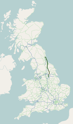
The A19 is a major road in England running approximately parallel to and east of the A1 road. Although the two roads meet at the northern end of the A19, the two roads originally met at the southern end of the A19 in Doncaster, but the old route of the A1 was changed to the A638. From Sunderland northwards, the route was formerly the A1018. In the past the route was known as the East of Snaith-York-Thirsk-Stockton-on-Tees-Sunderland Trunk Road. Most traffic joins the A19, heading for Teesside, from the A168 at Dishforth Interchange.
Eggborough power stationThe road just after St Mary's Roundabout
The southern end of the A19 starts at the St Mary's Roundabout with the A630 and A638 just to the north of Doncaster itself near to the parish church. It leaves the A638 at the next roundabout as Bentley Road, and then winds its way over the East Coast Main Line, which it follows through Selby and York, through the suburb of Bentley.
Much of the course of the southern section of the A19 runs through the old Yorkshirecoalfield. It meets the B1220 for Carcroft and goes through Owston. The surrounds are mostly flat as the road heads towards the M62. It enters North Yorkshire where it crosses the River Went near Walden Stubbs. It meets the M62 at junction 34.
From the M62, the village of Eggborough has been bypassed in recent years, with the new road travelling from this roundabout to near the site of Eggborough Power Station. Close by is Whitley Bridge and the A19 then meets the A645 at a roundabout and its previous alignment to the north of the village, before travelling through Chapel Haddlesey where it crosses the River Aire and the small village of Burn.
Selby–Thirsk
The £5million 5-mile (8km) Riccall and Barlby bypass opened in October 1987. This improved junctions with the A63 (Howden) and A163 (Holme-on-Spalding-Moor). The A63 and A19 meet at a roundabout near a large pickle factory. The A19 heads towards Riccall, following what was the East Coast Main Line before the Selby Diversion was built. Where the road leaves the old railway, the Trans Pennine Trail follows along the old track. At Escrick, the road enters the Vale of York, and passes the BPYork Road Garage, the Parsonage Hotel and St Helen's Church. Next is Deighton, passing the White Swan Inn, then it heads towards Crockey Hill. It meets the A64 near the headquarters of Persimmon plc.
The York Northern By-Pass (A1237) is a substitute[clarification needed] for the A19 through York. There road makes a left turn for Tollerton and goes through Tollerton Forest. Heading northward, the section between York and Thirsk was not helped much by the opening of the £5million 3-mile (5km)Easingwold Bypass in November 1994, as the road remained single carriageway, starting at a roundabout. There is a left turn for Raskelf. It meets the A168 from the south, and the old route through Thirsk is now the A170, then the A61. The bypass meets the A61 and A168 (for Northallerton) at a junction near South Kilvington.
Thirsk–Billingham
Leven Viaduct
North of Thirsk, the A19 takes over from the A168 as the link from the A1 to Teesside and becomes a fast dual carriageway with mostly grade separated interchanges. The five-mile £4.4million Thirsk bypass was opened on 5 September 1972 by Robin Turton, Baron Tranmire, the local MP (from 1929), with a flypast by four Royal Air ForceVickers Varsity aircraft – RAF Topcliffe is to the south-west of Thirsk. It passes North Kilvington, and the £0.3million South of Knayton (at Swan Lane) to north of Thirsk bypass section opened in the early 1970s. It climbs slightly past the junction at Knayton near Borrowby and skirting the western edge of the North York Moors, meeting the A684 (for Northallerton) at Clack Lane End after passing through Leake and by the Haynes Arms. The Borrowby diversion opened in the late 1960s. The £1.1million south of Clack Lane End to north end of Borrowby diversion opened in the early 1970s, built by A.F. Budge.[1][2] The Cleveland Tontine to Clack Lane End improvement opened in the early 1970s. It drops towards the Cleveland Tontine at the junction with the A172 (for Stokesley and Guisborough). 1 mile (1.6km) later, it passes the BP Exelby Services on both sides of the road. Eventually after passing the Crathorne/Yarm exit the road passes over the Leven viaduct towards Teesside. From the Crathorne bypass, the road leaves the old route to the east, with the old route now being the A67 then the A135 through Stockton.
The Tees Viaduct was opened on 17 November 1975 by John Gilbert. The Teesside Diversion was built by Cementation Construction, from April 1972, costing £10,239,606.[3] The 6,350 ft bridge, had a dual carriageway with three lanes, built by Cleveland Bridge. This was stage 1 of the Teesside Diversion. Stage 2 was south to Crathorne.[4]
About 2 miles (3.2km) from the Parkway Turn (A174) in Middlesbrough the road is raised slightly, overlooking Thornaby industrial estate and the town of Ingleby Barwick, giving clues that Teesside is imminent.
Billingham–Seaton Burn
Past Teesside the A19 enters rural landscape, meeting the former route through Billingham, where it enters the borough of Hartlepool. There is a right turn for Dalton Piercy at the Windmill Motel, and two link roads into Elwick, to the east, only accessible from the southbound carriageway. At Sheraton with Hulam, there is an intersection for the B1280 (for Wingate to the west), and the A179 (for Hartlepool, to the east). At this intersection the road enters County Durham. The route over Sedgewick Hill has been improved to the east. There is staggered crossroads, for Hutton Henry, to the left. There used to be a right turn for Castle Eden, now accessible only from the southbound carriageway. North of here, the Castle Eden Diversion opened in the early 1970s. It crosses a former railway (now NCN1 and 14), and meets the A181 (for Wheatley Hill and Durham), and the B1281 (for Hesleden) at an intersection, and passes west of Shotton, where it joins the former route. There is a large intersection at Burnhope Way Roundabout for Shotton Colliery and a large industrial estate, to the west, and the B1320 for the new town of Peterlee, to the east. A flyover was constructed in the early 1990s to replace the previous roundabout, known locally as the Turnpike.[5]
The 3.5-mile Easington and Cold Hesledon Diversion opened in the early 1970s. There is an access road to the south from Easington and the A1086 (for Peterlee and Hartlepool) has limited access to the northbound and from the southbound routes. There is an intersection for the A182 (for Hetton-le-Hole), and limited access from the B1283 (for Easington Village), with no access from the southbound route. The former route north of Easington is the B1432 (to the east). At Cold Hesledon, there is an intersection for the A182 (to Seaham, to the east) and the B1285 (for Murton, to the west). The three-mile New Seaham and Seaton Diversion opened in the early 1970s, with the former route now the B1285 through Dalton-le-Dale. The eight miles of sections from Easington to Seaham were built by A. R. Carmichael in late 1971, and made the A19 from Thirsk to Sunderland completely dual-carriageway, with the contract awarded in October 1969. At Seaton with Slingley, there is a limited-access (to and from the south) intersection for the A1018, for Sunderland and Ryhope. At the same point there is a limited-access intersection (to and from the north) for the B1404 for Seaton and Houghton-le-Spring. The former route through the south of Sunderland is now the B1522. At the point where a former railway crosses (now NCN Route 1) the road enters the City of Sunderland.
At this point, the A19 makes a large deviation from its former route, by bypassing Sunderland from the west. Its former route went near the coast. The 8.75-mile Sunderland Bypass opened as the A108, and was built by W.C. French, with fourteen bridges and five underpasses, with the contract awarded in February 1970. The A108 was also previously the number of an A road in north London, for a re-routed A10 to Hoddesdon. At Herrington the A19 meets the A690 (for Houghton-le-Spring) and the B1286 at an interchange. It is crossed by the B1286. At Offerton and Hastings Hill there is an interchange with the A183 road (for Penshaw and Pennywell). The road crosses the River Wear on the Hylton Bridge, which was built as the A108 in 1975 by W.C. French (Construction) Ltd. At North Hylton, there is an interchange with the A1231 (for Washington and Castletown).
At Testo's Roundabout with the A184 (for Gateshead and The Boldons), the A19 originally ended as the A1 took over to run through the Tyne Tunnel, before that classification became assigned to the Newcastle Western Bypass from the Angel of the North to Kingston Park. To the east the A19 now approaches the Tyne Tunnel, where a second tunnel opened in 2011 to relieve traffic congestion. There is a limited access junction (from the north) for Hedworth, and the road is crossed by the Green Line of the Tyne and Wear Metro. It meets the A194 (for South Shields) at an interchange. At the Jarrow Interchange, there is a roundabout for the A185 (for Hebburn) and the B1297 at the start of the single-carriageway £13million Tyne Tunnel, opened in October 1967 as the A108.
The A19 continues in a north-westerly direction through North Tyneside past Killingworth and Cramlington, rejoining the current A1, just north of Newcastle at Seaton Burn.
Trucks over 7.5 tonnes prohibited from Elwick; No access to Coal Lane heading southbound towards Stockton; No access to Elwick heading northbound towards Sunderland
89.9
144.7
(North Lane) - Elwick
Trucks over 7.5 tonnes prohibited from Elwick; No access to North Lane heading northbound towards Sunderland
In 2024, the A19 topped a survey of road users by Transport Focus, with an 85% satisfaction rating, up from 6th place with 77% in 2023.[6]
Incidents
In November 1986 a tanker loaded with toluene overturned and caught fire near Brookfield. The driver and the occupants of three cars were injured. The fire burned for eight hours and led to residents being warned by Cleveland Police of potentially toxic fumes. The fire service later criticised the police response as a "massive overreaction".[7]
In 1988 a stretch of the road in Teesside was notoriously accident prone. In a now famous interview, then local councillor Mr Davidson appeared on TV to declare the road safe. During the interview, a car lost control and veered off the road while another car was rear-ended directly behind him.[8]
In June 2008 a fuel tanker began leaking oil from its engine covering a mile-long stretch, including a bend, before stopping near Hartlepool. A small fire broke out and cars began sliding, although none crashed. The fire service shut down the road to clean it.[9]
This page is based on this Wikipedia article Text is available under the CC BY-SA 4.0 license; additional terms may apply. Images, videos and audio are available under their respective licenses.